James S. and Susan E.W. Aber
Saskatchewan, Canada (2024) |
Saskatchewan, Canada (2024) |
Early aerial view of Rome, Italy.
Beyond the United States, we have acquired kite aerial photography in Saskatchewan, Canada as
Map composed with source code by Ben Markowitz at Stately
The Great Plains aerial photography is presented for general public enjoyment by James S. and Susan E.W. Aber.
This webpage was established in 1996 andIntroduction to Kite Aerial Photography
Kite aerial photography (KAP) is a form of remote sensing—collecting information about an object from a distance. Aerial photography from kites is, in fact, one of the oldest forms of remote sensing of the Earth's surface. Kites were utilized to take aerial photographs in the late 19th and early 20th centuries for many purposes—military reconnaissance, disaster assessment, scientific surveys, etc. KAP images from above the surface gave new perspectives for how people visualized the world, both from practical as well as aesthetic points of view. The development of powered flight gradually put an end to the golden age of kite aerial photography by the 1930s.
More on KAP history.
![]()
![]() Selected kite aerial photographs
Selected kite aerial photographs
View over the city of Skagen, northern Denmark. The historical lighthouse, "Hvide Fyr" (white light), appears in lower right corner. Note typical red tile roofs of Danish buildings.
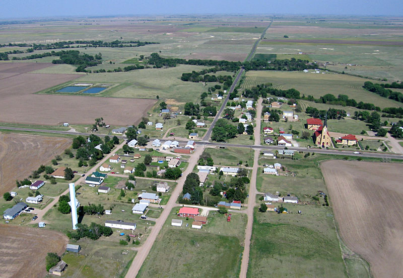
Small town of Liebenthal in the prairie of west-central Kansas. St. Joseph's Church (right) is built of native chalk stone. Water supply tower to lower left; sewage treatment ponds upper left. Trees in the background follow Big Timber Creek, a tributary of the Smoky Hills River.
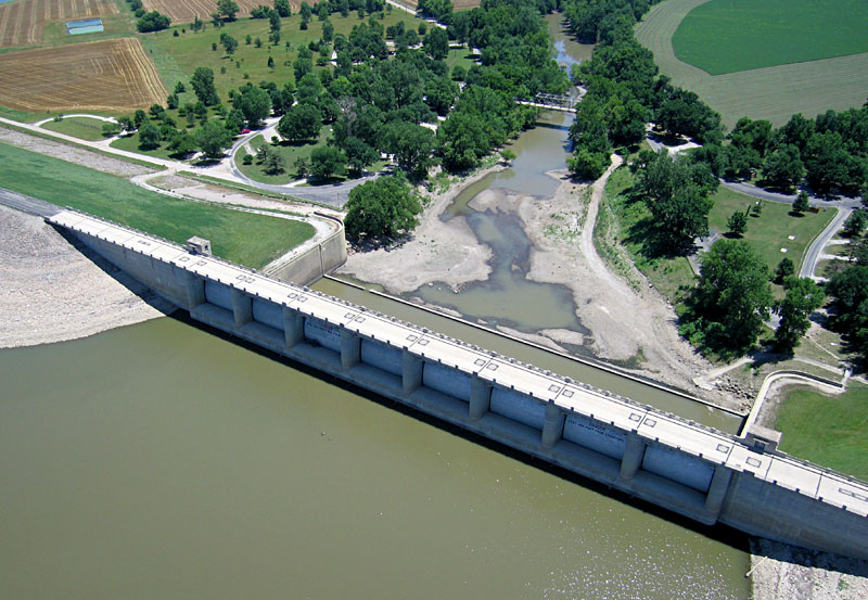
Closeup view of the dam, outlet gates, and spillway at Fall River Reservoir, southeastern Kansas. Constructed and operated by the U.S. Army Corps of Engineers for flood control and recreational purposes.
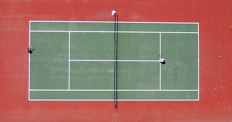
Vertical shot of tennis players, Loose Park, Kansas City, Missouri. Numerous tennis balls are scattered about the court.
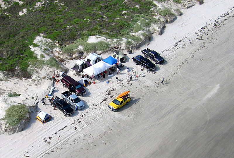
Fishing camp set up on the beach of Padre Island, South Texas. Various tents, vehicles, small boats, and fishing equipment. Preparing for a major fishing tournament.
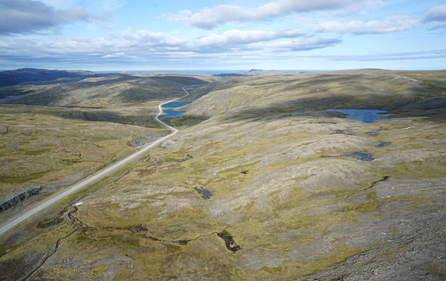
Tundra landscape and one-lane road meandering over the island of Magerřya, northernmost Norway. The farthest north place we've done KAP at approximately 71° N latitude.
![]()
![]() Home states in which we do most of our aerial photography.
Home states in which we do most of our aerial photography.
![]() Other states where we have conducted aerial photography.
Other states where we have conducted aerial photography.
well as in Europe—Denmark, Estonia, Finland, Hungary, Norway, Poland, Slovakia, and Sweden.
with assistance from Jeremy Aber at MTSU. ![]()
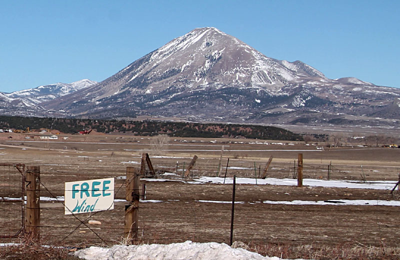
Free Wind, as the sign says, whether for flying kites to take aerial photographs or for spinning turbines to generate electricity. Mount Maestas in the background, on the western edge of the High Plains near La Veta, Colorado.
All rights reserved; text and images © by the authors (1996-2024). For more information, contact J.S. Aber.![]() Return to beginning.
Return to beginning.
moved to its present URL in March 2002.
Last update: June 2025.