 J.S. and S.W. Aber |
| Introduction | Equipment |
| Sweden | Mager°ya |
| Varanger | Finland |
| Lessons | Related |
J.S. and S.W. Aber |
| Introduction | Equipment |
| Sweden | Mager°ya |
| Varanger | Finland |
| Lessons | Related |
Norway is an intensely beautiful country, as are its neighbors. Thus, the attraction for landscape photography from kites. For this trip, we planned to spend considerable time in the far north in late August and early September 2019. In particular, we wanted to visit Nordkapp (North Cape), Norway, the farthest north point that can be reached by driving in Europe at 71░ 10' 21" N latitude.
The trip began with picking up a new car at the Volvo factory delivery center in G°teborg on the southwestern coast of Sweden. From there we headed north and east. We made a preliminary stop and conducted an initial KAP session on the Baltic coast of eastern Sweden, then continued northward across the Arctic Circle into Norway and Finland.
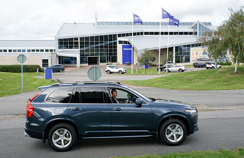
| Taking delivery of a new Volvo (left) in G°teborg, and crossing the Arctic Circle (right) on the border between Sweden and Finland. The flags represent the eight countries on the Arctic Circle (~66.55░ N latitude). | 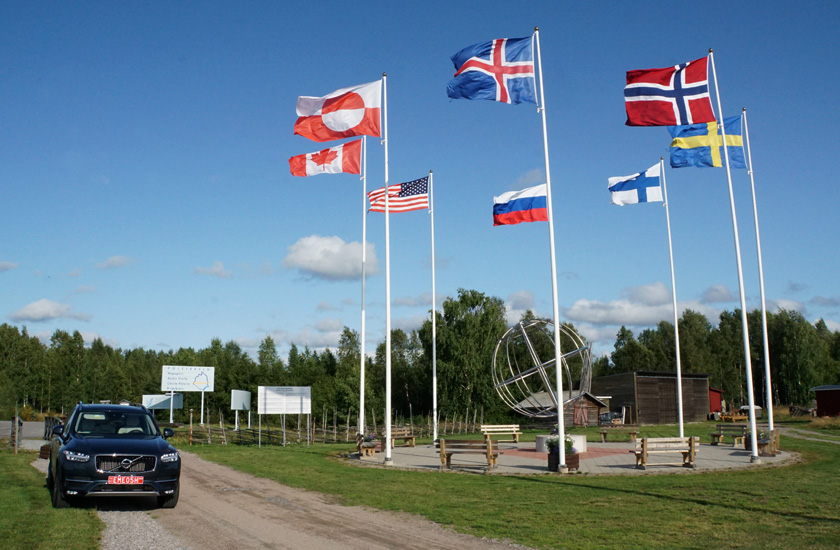
|
Equipment
Overseas travel for KAP is complicated by several factors beginning with airline baggage limits and restrictions for certain items such as lithium batteries. Beforehand, we reduced equipment to the minimum necessary for successful KAP. Kites, reel, RC radio, tools, and accessories were packed in a single cargo box for checked luggage. Two complete KAP rigs went into a camera case for carry-on luggage.
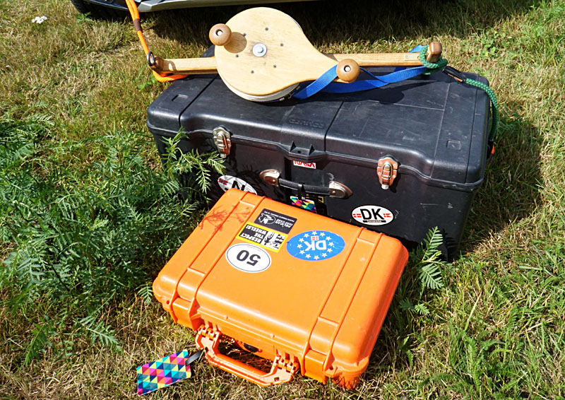
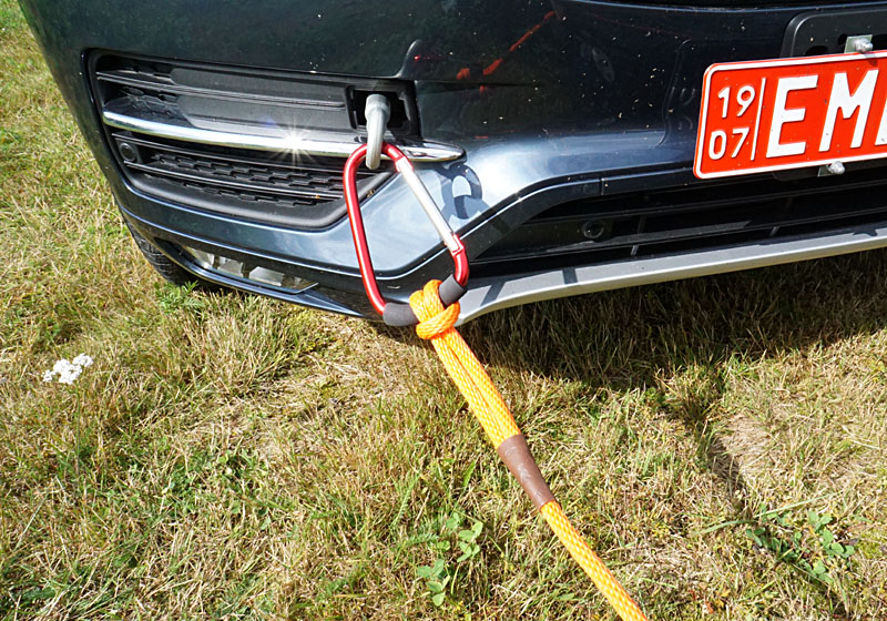
Left: cargo box is checked luggage at maximum weight and dimensions to avoid an oversize fee. The reel was disassembled to pack in the cargo box. Orange camera case is carry-on luggage. Right: reel is anchored to the car's towing ring for kite flying.
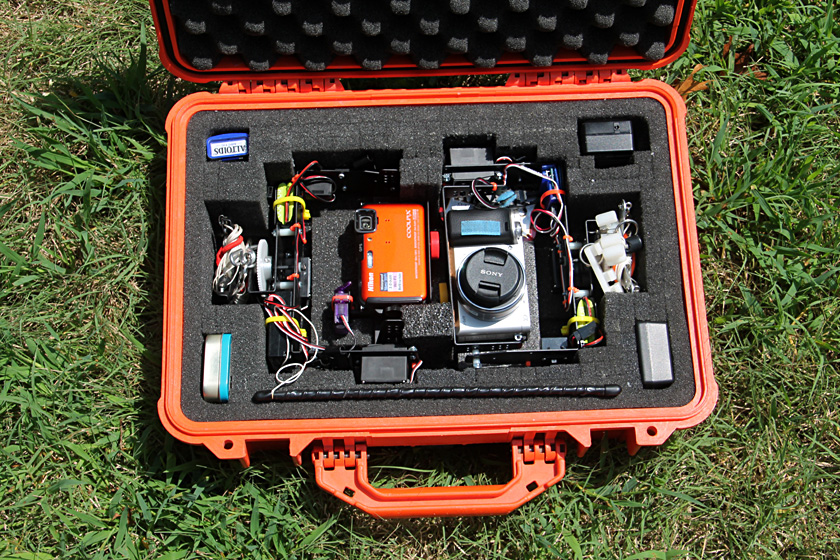
Two complete KAP rigs. The Sony autoKAP rig (right) was our primary setup for this tour. The Nikon (left) is a radio-controlled rig that we took for backup purposes.
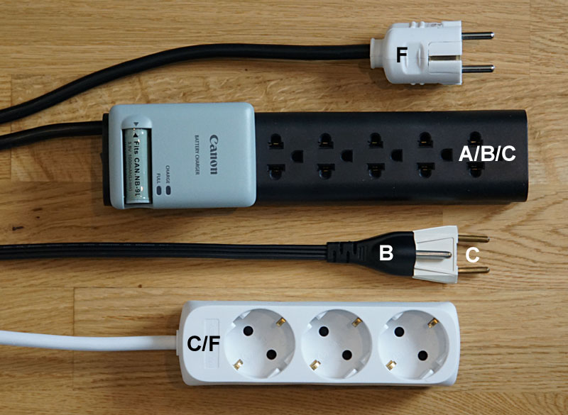
| Typical European plug and sockets at top and bottom (types C & F). Black power strip accepts either American or European plugs (types A, B & C). Below it is an American plug (type B) with European adapter (type C). For further explanation, see plugs and sockets. |
Return to top.

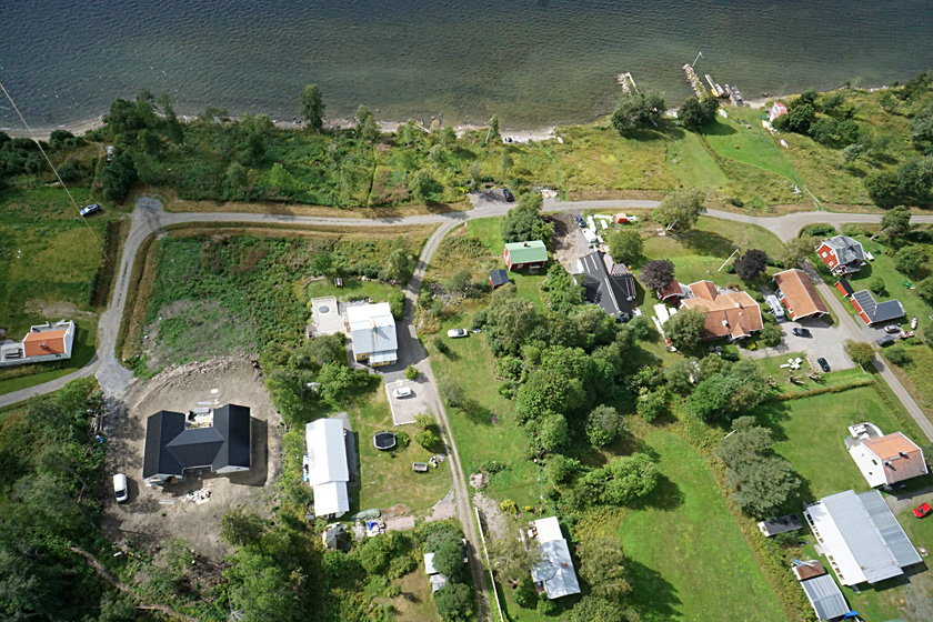
| Overview of coast (left) where we stayed. Our cottage on far left and kite flyers are upper left. Closer view (right) of our cottage at bottom center of scene. | 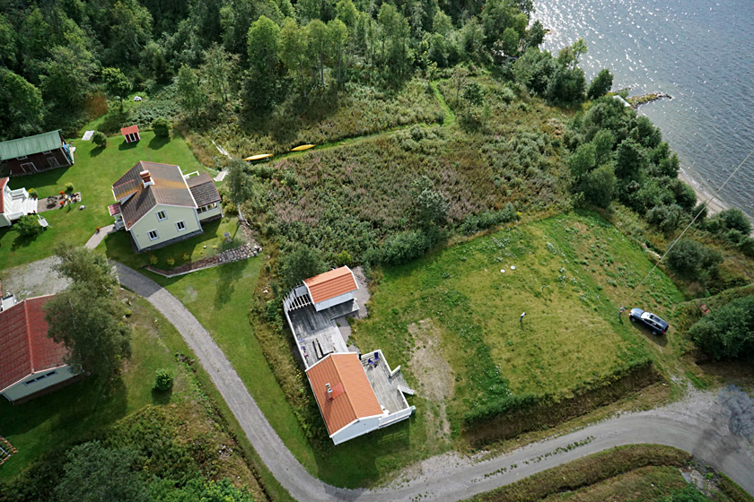 |
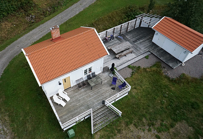
| Close-up shot of our cottage (left). The bathhouse is a separate building on right side of deck. New house under construction (right) with more traditional houses in the background. | 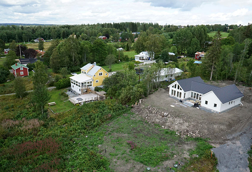 |
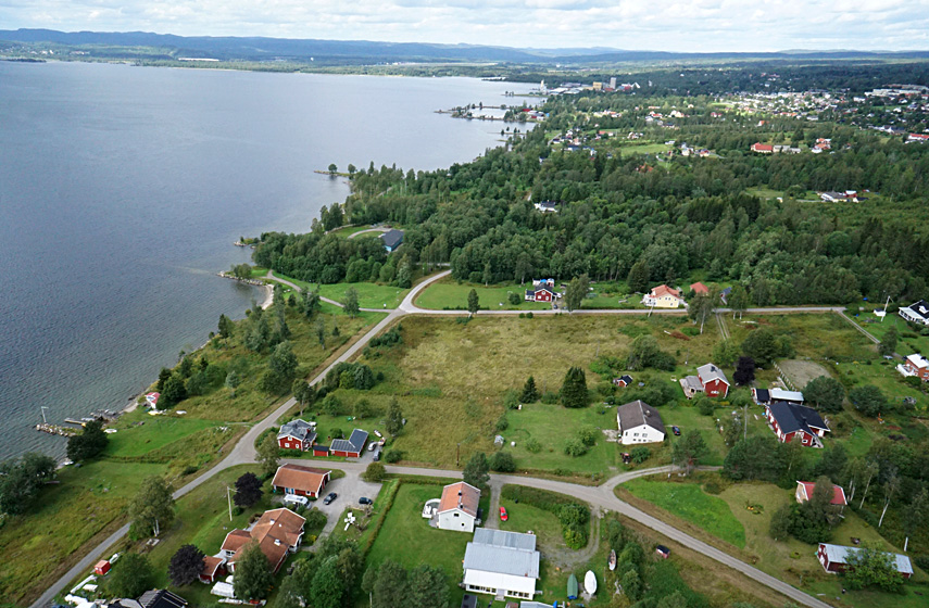
| Overview (left) looking along the coast toward the northwest. Closer shot (right) showing details of houses, roads, and other structures. | 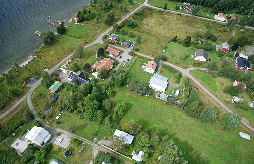 |
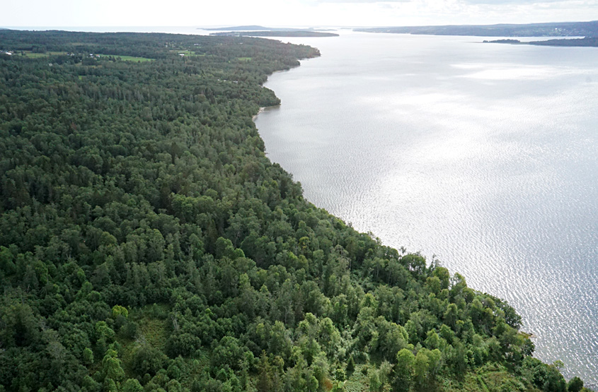
| Overview toward southeast (left). Cloud shadows and sun glint highlight waves on sea surface. Overview of forest to east (right) with mixed conifer and deciduous trees. | 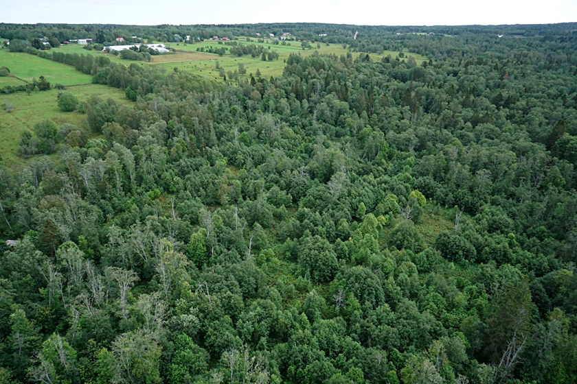 |
Return to top.

The climate of Mager°ya is exceptionally warm for so far north. Coastal temperatures average 20 ░C higher than anywhere else in the world at this latitude (Schmutterer 2016). Flowing from the Caribbean, the Gulf Stream crosses the Atlantic, warms Iceland and Ireland, and then continues along the Norwegian coast all the way to Murmansk, Russia. The mixing of warm water with the cold Barents Sea leads to rich fishing, which is a major part of the local economy.
We spent a week on Mager°ya with the intention of conducting kite aerial photography. As expected, the weather was typically terribleŚfog, clouds, rain, and cold most days in late August. In fact, the summer of 2019 was unusually cold, cloudy and rainy. We had only half a day with mostly sunny sky and moderate wind suitable for KAP. Temperature was in the upper 40s ░F. We dressed in multiple layers to protect against wind chill. For example, at 46 ░F (~8 ░C) and wind speed of 20 mph (17 knots), wind chill is 38 ░F (3 ░C).
During our early days on the island, we drove the few roads and identified several potential KAP sites. So when a good weather window came, we were able to move quickly and conduct KAP at three sites, all in upland interior portions of the island. Wind speed varied from about 10 to 25 mph depending on local topographic conditions. We used our large rokkaku for light wind and a smaller delta for stronger wind in order to lift the Sony autoKAP rig.
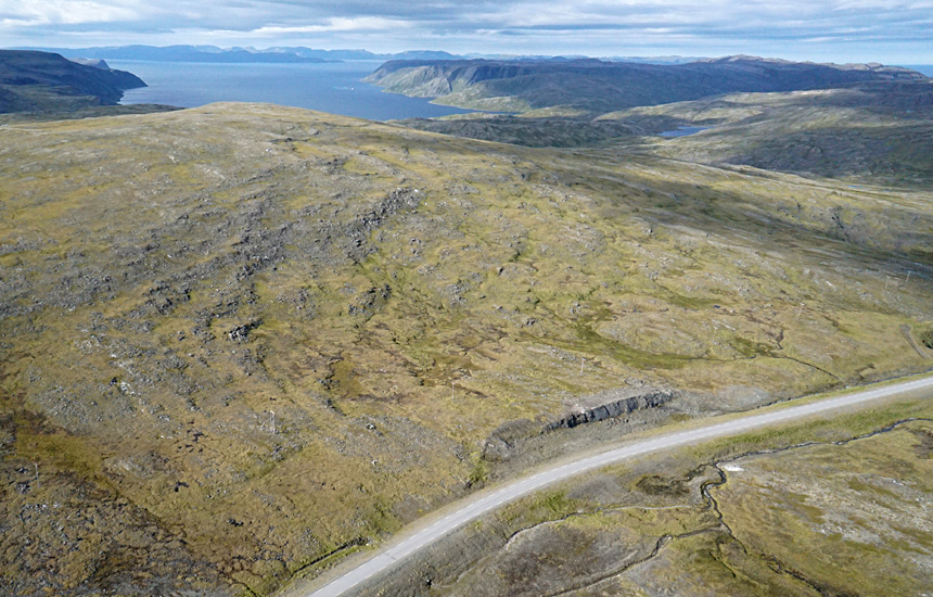
| View toward Vannfjorden to the southwest (left), and looking to the northwest (right). Highway Fv156 appears in both scenes. | 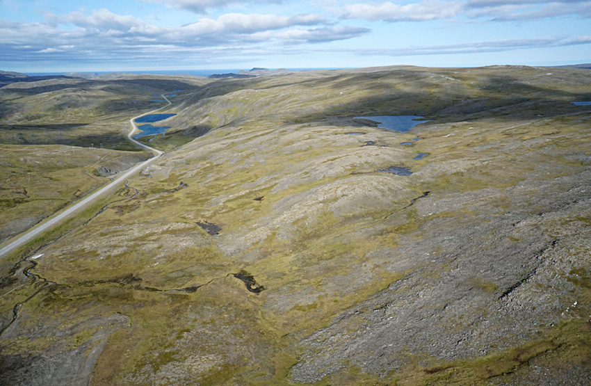 |
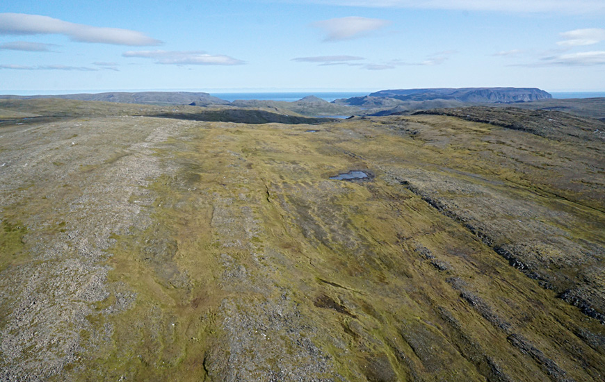
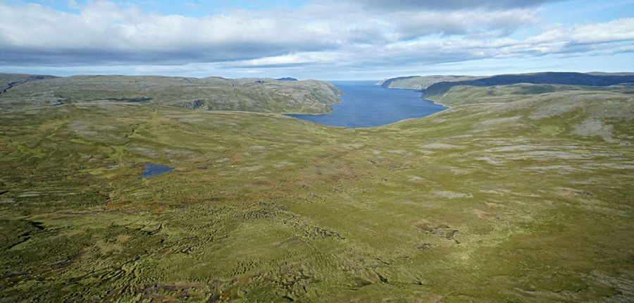
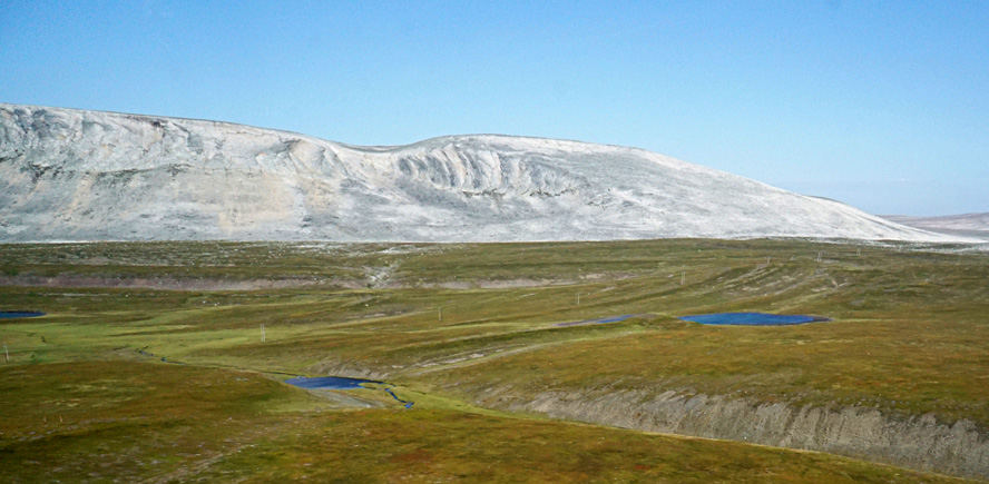
| View toward the northeast (left). Nordkapp is the plateau in the far right background. Closer look (right) at outcropping bedrock strata that form bands in the tundra landscape. | 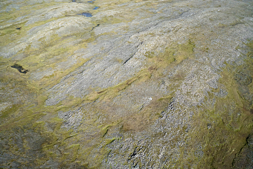 |
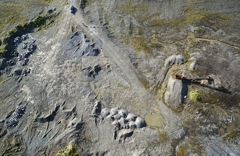
| Small gravel pit in which we conducted KAP (left); kite flyers at upper left. Close-up shot of the gravel-sorting machine. Material from this pit was used presumably to build the adjacent highway Fv156. | 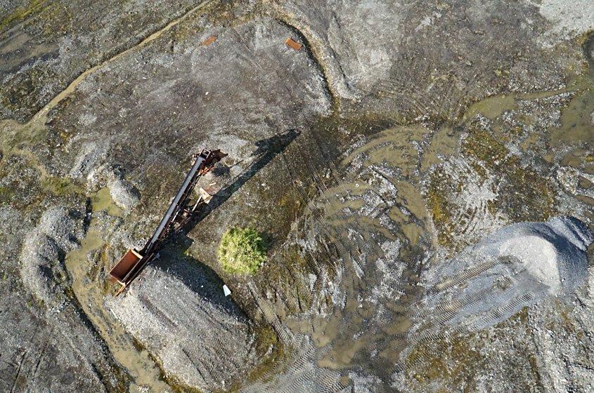
|
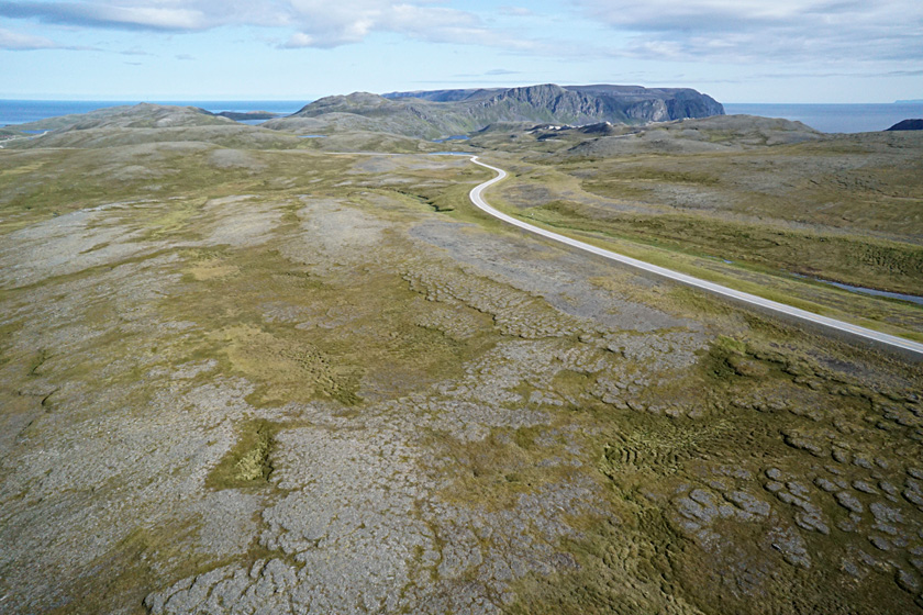
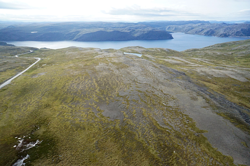
| Looking toward the northeast (left). Highway E69 leads to Nordkapp, the plateau on the horizon. Terraces are prominent on slopes (right); kite flyers at upper left. These terraces are constructed of peat-rich soil and rock debris. | 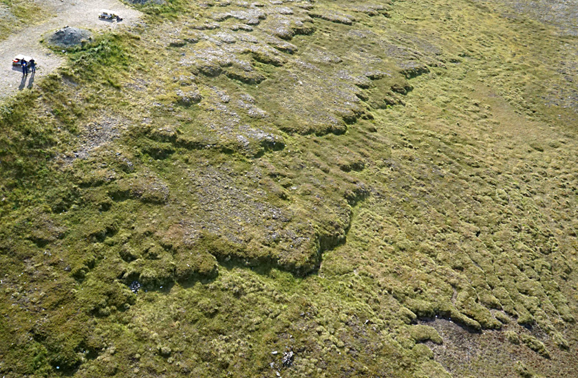 |
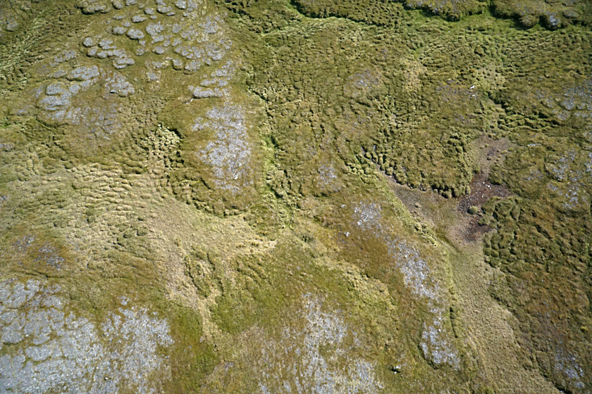
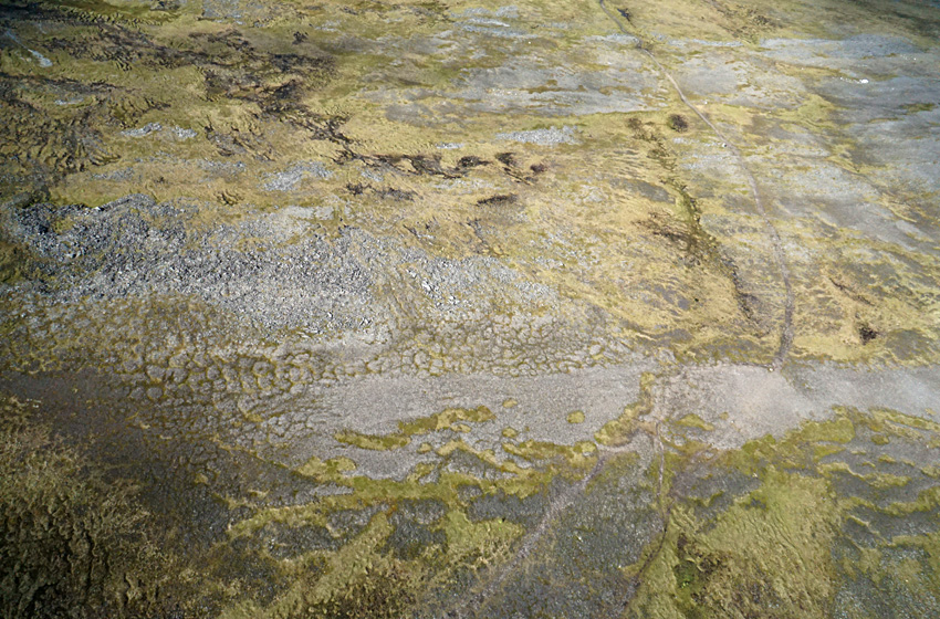
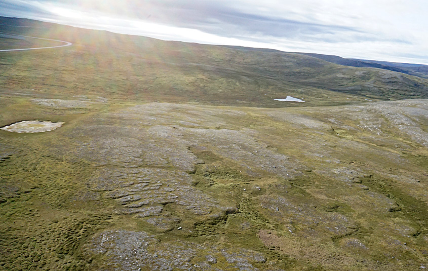
| The landscape has a distinctly patterned appearance. Lumpy (left) and deeply furrowed in places (right). These patterns reflect the accumulation of peaty soil and deep ground freezing (periglacial) conditions. | 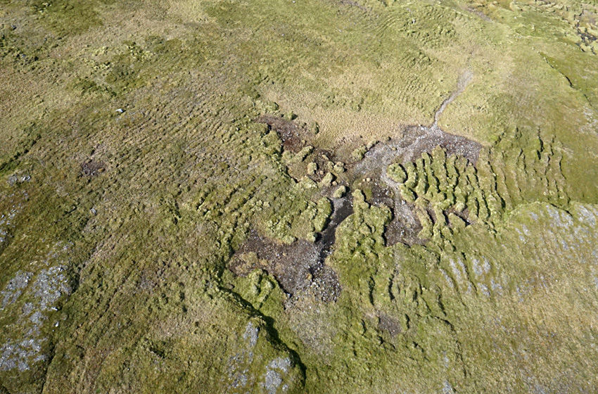 |
Panorama constructed of two overlapping images.
Looking north over tundra toward Tufjorden.
| Looking toward Tufjorden to the west (left) and northwest (right). The bleakly beautiful character of the upland tundra is evident. | 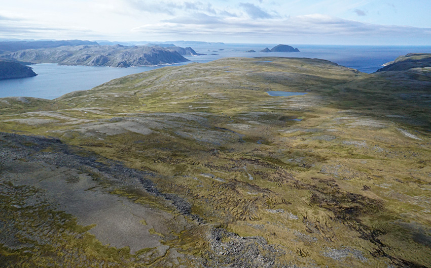 |
| Knivskjellodden, the northernmost point on Mager°ya, is reached by a long hiking trail. Left: trail visible on right side of image. Note the white spot in upper right corner; it's a mass of quartz (see below). Right: view of parking area and beginning of the trail. Kite flyers at lower right corner of parking lot. | 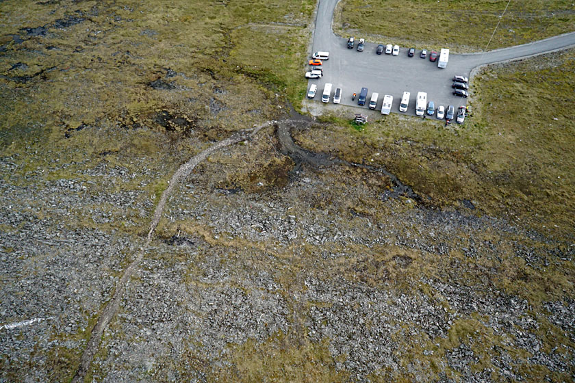 |
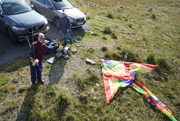
| The authors (left) conducting KAP at Knivskjellodden trail parking area. SWA at the large mass of quartz (right) that we dubbed "dronningenstolen" (the queen's throne). | 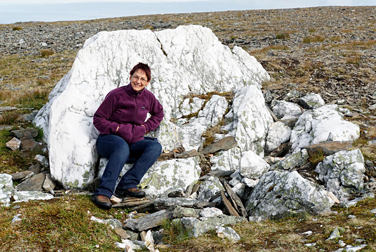
|
Return to top.
On two days with good weather, we drove on Vegen til Ishavet, the highway to the Barents Sea (890). We crossed the peninsula and found sites of opportunity to conduct kite aerial photography. Two were located in the central plateau region, and two were on the north coast in fjord settings.
| Two views of the upland tundra plateau with a bare quartzite mountain in the distance. On the left, a small gravel pit is visible in the foreground and highway 890 appears to far left. | 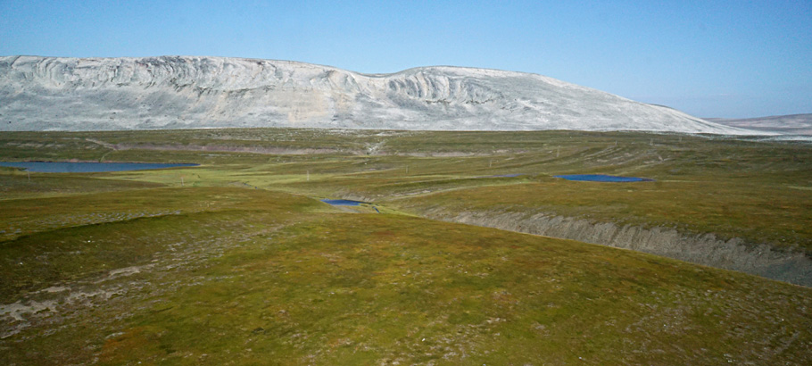 |
| Closer view of the quartzite mountain (left) displays folded strata and distinctive gray-pink colors. Close-up shot of a reindeer fence (right). The poles show marked relief displacementŚthey lean away from the image center, but their shadows remain consistent on the ground. | 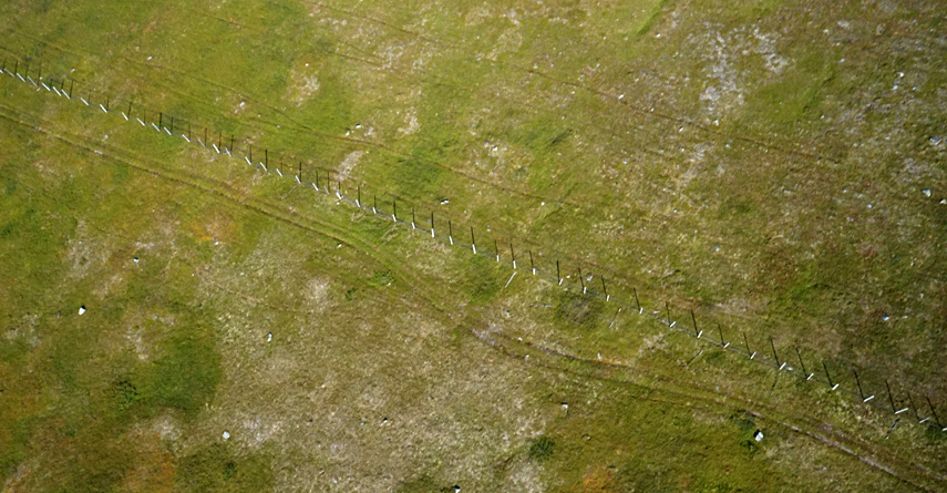
|
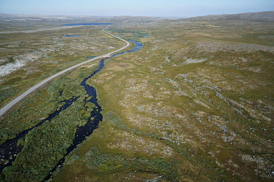
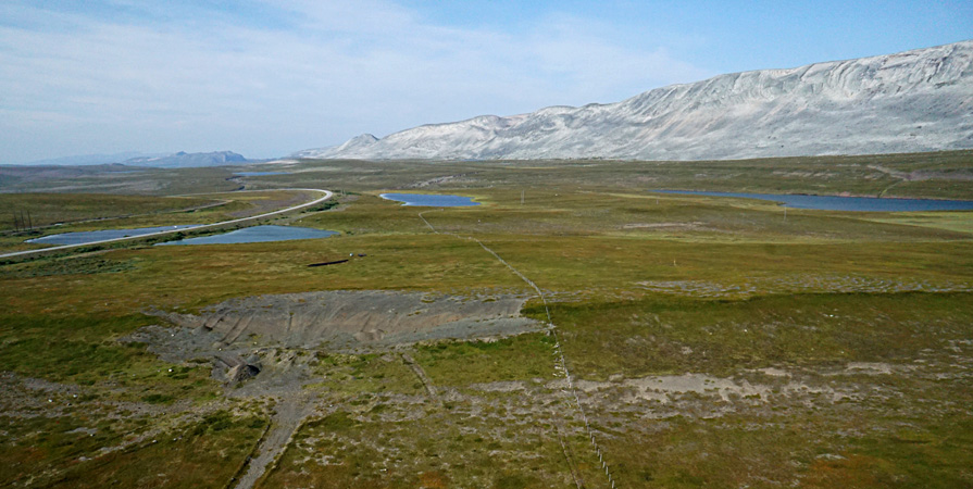
| This river begins in the central plateau area of tundra vegetation and flows northward to Kongsfjord. Two views looking downstreamŚoverview (left) and close-up shot of island (right) beside highway 890. | 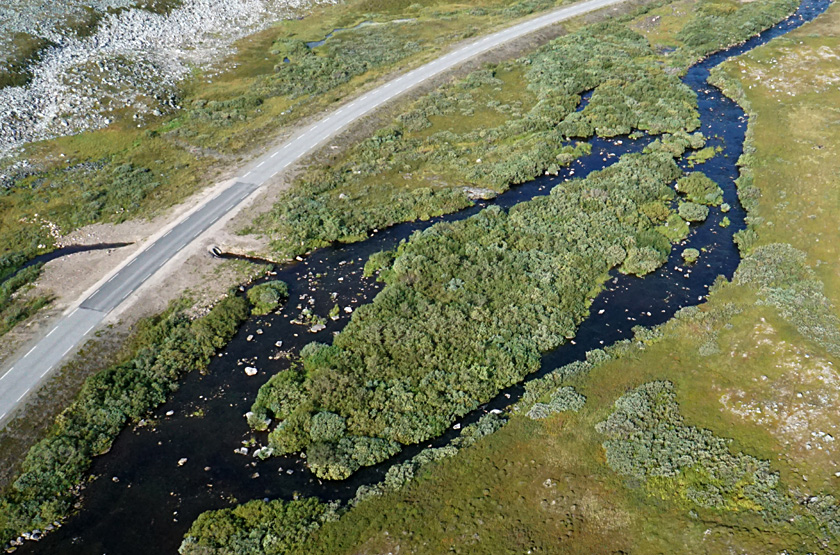 |
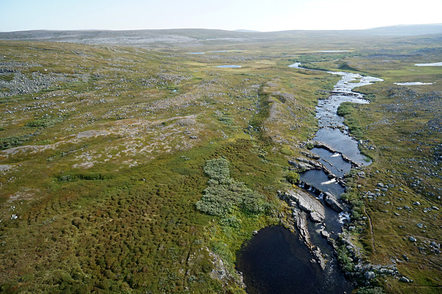
| Two views looking upstreamŚoverview (left) and close-up shot of cascades (right) over resistant rock layers. This river is well-known for salmon fishing, although we visited after fishing season had ended. | 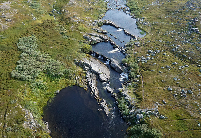
|

| Two views looking seaward and showing steep side cliffs. Wind blowing offshore carried the kite and camera rig far out over the water. Vegen til Ishavet (highway 890) appears on the right side. | 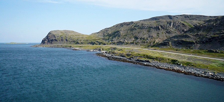 |
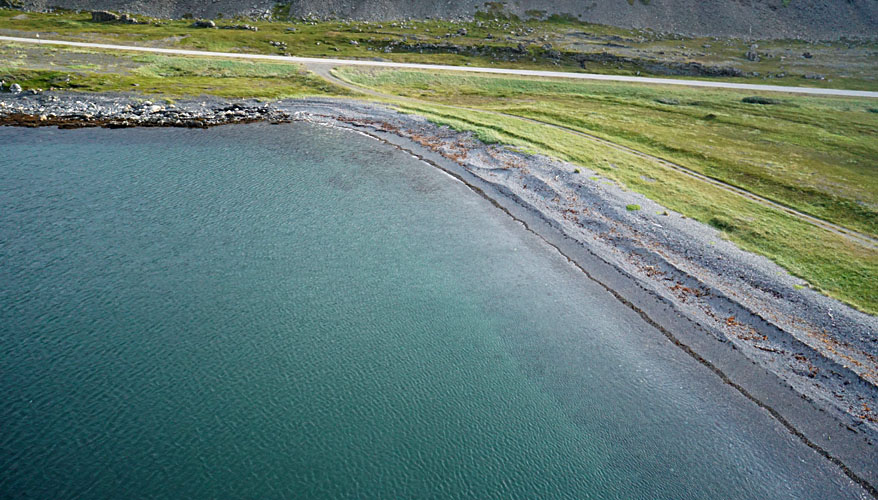
| Ridges of beach gravel mark the landward end of the fjord. Note a series of older and higher grass-covered ridges toward the right. Kite flyers on far right side. | 
|
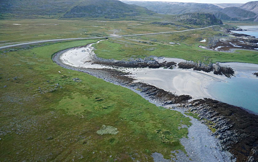
| Left: overview of small inlet with sandy beach between rocky outcrops. Right: closer view displays a series of foundation ruins (*) that represent former structures, presumably fishing cabins, along the shore (see below). | 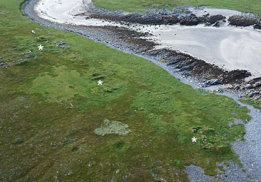 |
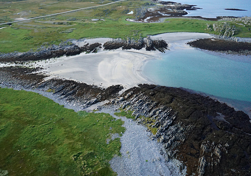
| Left: small sandy beach bounded by bedrock layers standing in vertical position. Highway 890 in the background. Right: close-up view of seaweed-covered sawtooth rocks and slope covered with cobble gravel at low tide. | 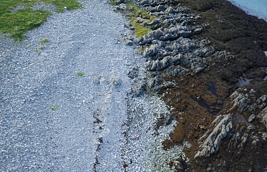 |
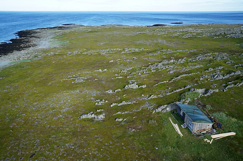
| Two views of a small fisherman's cabin. This cabin was originally used to store salmon; it was moved up from the shore and converted for family living during World War II, when it supported Norwegian partisans. It is reconstructed and currently undergoing a renovation, as shown by the new lumber. | 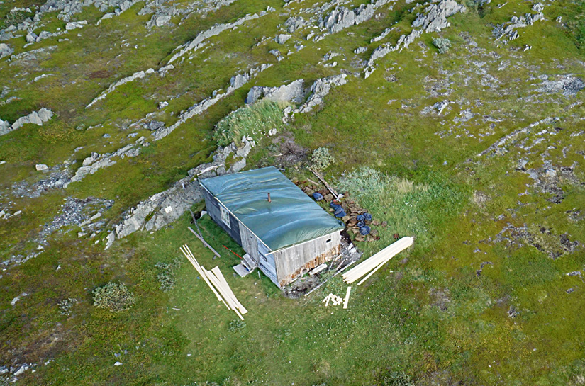
|
Return to top.

 View to northwest 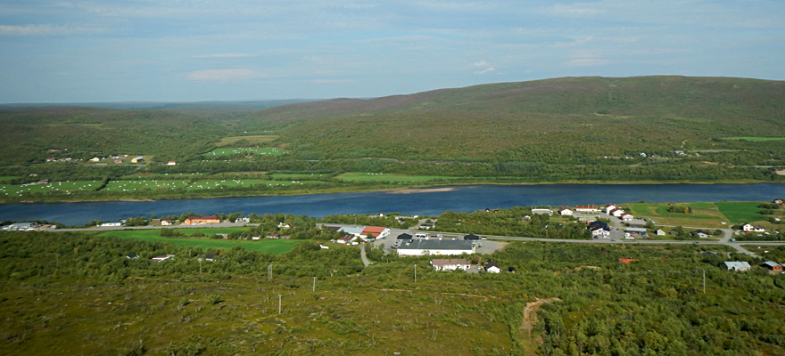 View northward 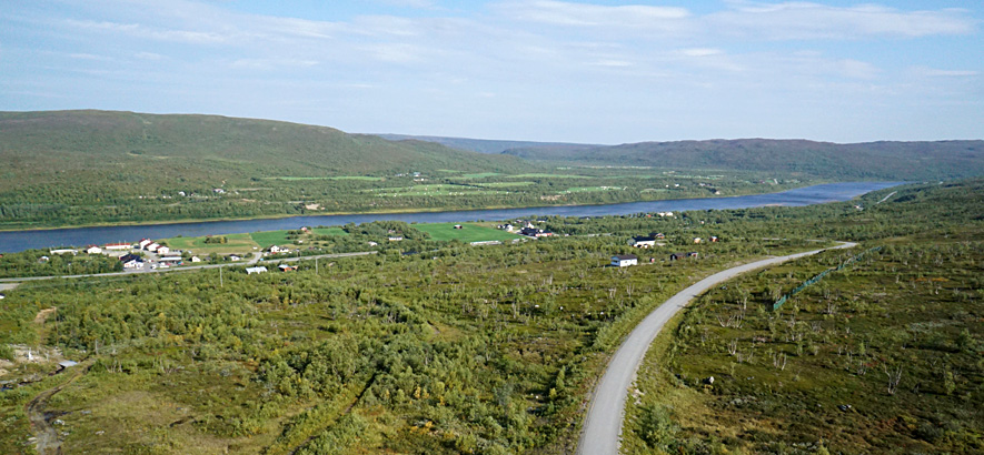 View to northeast |
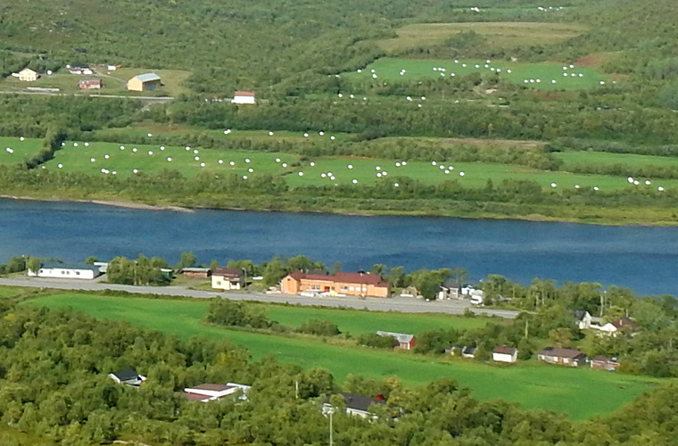
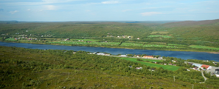
| Closer view of Nuorgam (left) in the foreground with farms and hay fields beyond the Tana River in Norway. The white dots are hay bales bagged in plastic, as shown in the ground view (right). Hay is essential for dairy cows during the winter. | 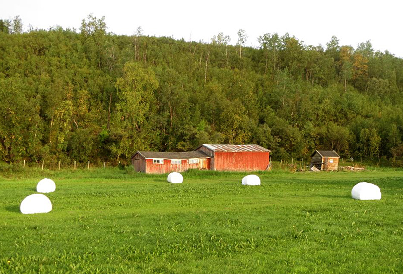
|
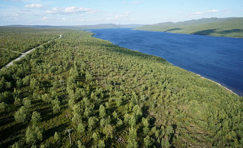
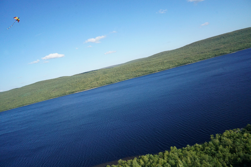
| Views toward the north (left) and southeast (right) showing the long, narrow character of the lake with steep, forested slopes on either side. Lake surface elevation is approximately 15 m (~50 ft); width is roughly 1 km, and length is about 7Į km. | 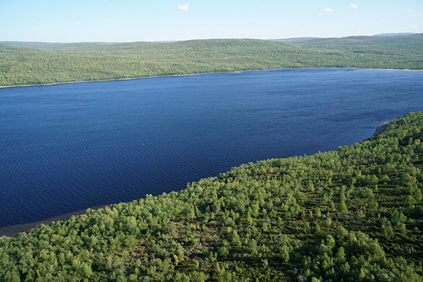 |
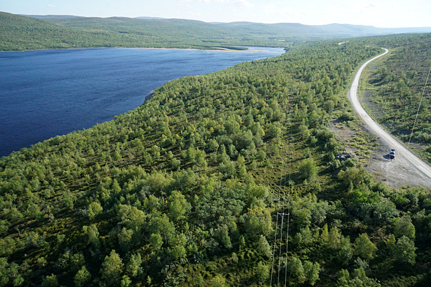
| Left: kite flyers in a small parking area on the west side of the lake. Right: view of birch forest and access road on the west side of the lake. Polmakvatn is quite similiar in size and glacial origin to Honeoye, one of the smaller Finger Lakes in western New York, which have been described as inland fjords. | 
|
Return to top.
| Owing to the low sun angle at this high latitude, we often had lens reflections that created colorful streaks in views looking toward the sun. High-oblique shot at mid-day on eastern Mager°ya (~71.1░ N). |
| Small delta kite turning into a steep dive. We let out the line quickly, the kite stablized, and then it returned to normal flight. We were lucky not to crash the camera rig into the forest here. Polmakvatn, Finland. |
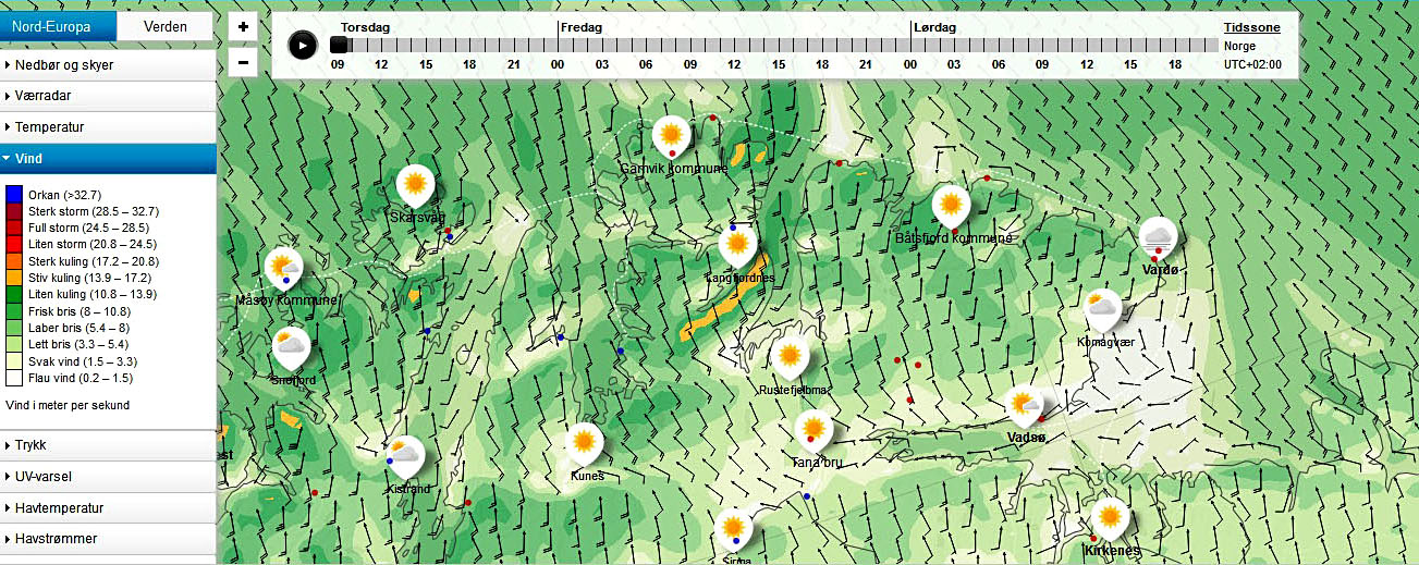
| Typical wind map for northern Norway showing consistent fresh breeze (frisk bris) from the S-SE over uplands and offshore. But in fjords wind is only weak (svak) or near calm (flau). Also notice radical changes in wind direction in some fjord areas. Wind speed given in meters per second; adapted from Norwegian weather forecasts. |
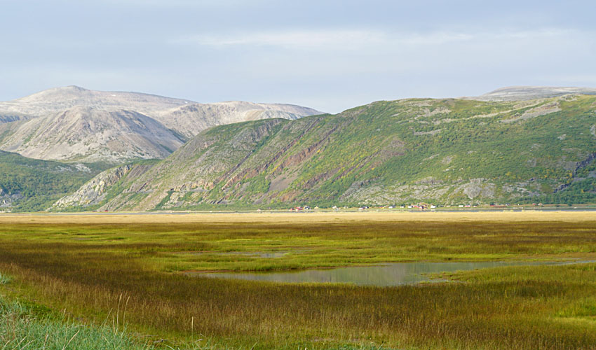
| Ground view of the Tanamunningen nature reserve in the foreground with coastal mountain cliffs in the background. The salt marsh hosts many species of seasonal and migrating birds as well as an endemic variety of harbor seal (Phoca vitulina). |

| Complete set of posted regulations. Our Norwegian is limited, but it was sufficient for us to realize that further investigation was necessary. Item 8 indicates that takeoff and landing of "luftfart°y" are not allowed. Luftfart°y is an general term for all types of flying devices, including tethered kites. Needless to say, we did not tempt fate and possible arrest by a local game warden or police. |
![]() Return to KAP gallery.
Return to KAP gallery.
Last update: October 2019.