|
J.S. and S.W. Aber
|

| Skagen peninsula | Mĺrup Kirke |
| Feggeklit, Mors | Hanklit, Mors |
| Bovbjerg Klit | Ramme Dige |
| Gammelsogn Kirke | Vinderupvold |
| Helgenćs peninsula | Jernhatten |
| Danish wind power | References |
|
|
J.S. and S.W. Aber
|
| Skagen peninsula | Mĺrup Kirke |
| Feggeklit, Mors | Hanklit, Mors |
| Bovbjerg Klit | Ramme Dige |
| Gammelsogn Kirke | Vinderupvold |
| Helgenćs peninsula | Jernhatten |
| Danish wind power | References |
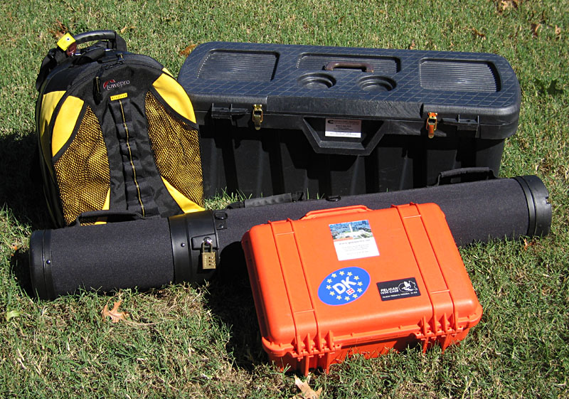
| Equipment packing for the trip from the U.S. to Denmark. Waterproof camera backpack (upper left), small cargo box, golf-club case, and waterproof camera case (lower right). |
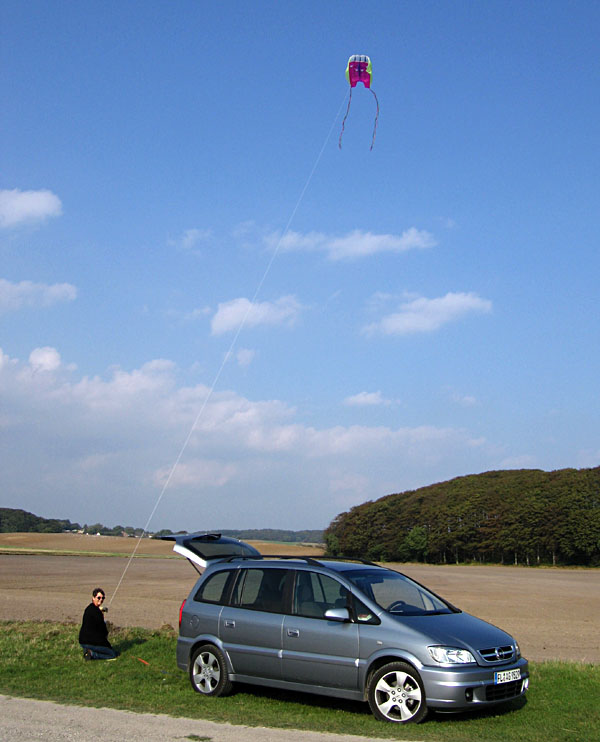
| Flying the Sutton Flowform 16 over a field next to Jernhatten with our rented Opel Zafira. |
During our stay, we encountered a wide variety of weather conditions ranging from clear sky and optimum KAP wind to cloudy, rainy days, intervals with no wind, and times with too much wind. For most sites, our large rokkaku was utilized, and we also employed a large delta and a smaller Sutton Flowform 16 a few times. Given its maritime setting, Danish wind is generally consistent in speed and direction with little gustiness.
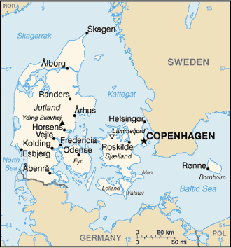
Map from CIA World Factbook.
We were joined for part of this venture by Irene Marzolff, our KAP colleague from the University of Frankfurt, Germany. Special thanks to Holger Lykke-Andersen, who made logistical arrangements for this trip. The following sites are arranged geographically, starting in the north and proceeding to the northwest, west, central, and finally eastern portions of northern Jutland.
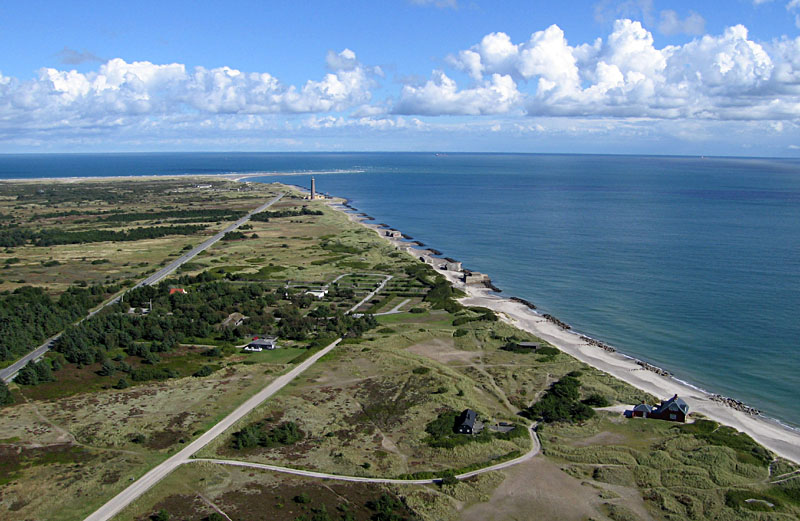
| View northeastward toward Grenen, the sandy tip of Skagen. The brick lighthouse just in front of Grenen is the "new" one built in 1858. It is still in operation today. Boulder barriers protect the coast from erosion during storms. |
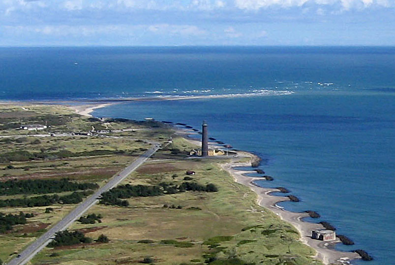
| Closeup view of the lighthouse and sandy tip at Grenen. Here the Skaggerak sea (left background) meets the Kattegat sea (right). |
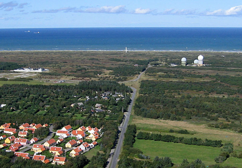
| View toward north showing a military radar station (domes). The white tower in center distance is a modern, automated lighthouse. Two ships are visible in the left background. |
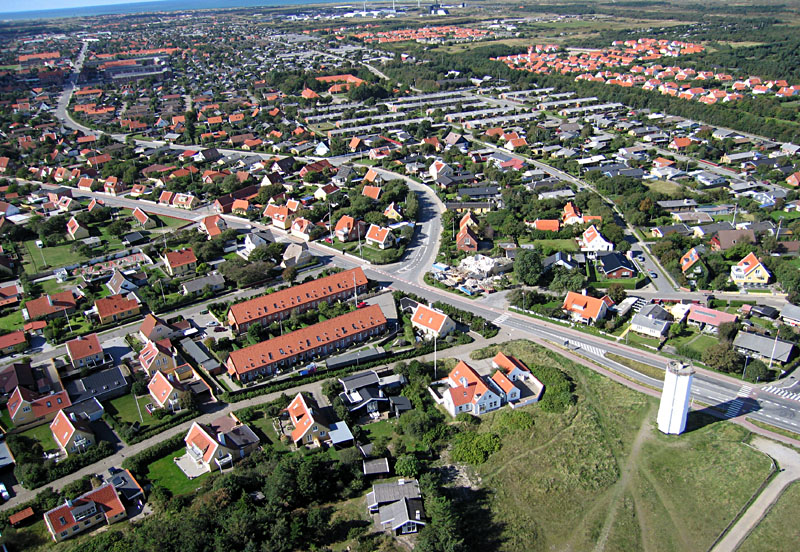
| View toward the southwest over the city of Skagen. Hvide Fyr (white lighthouse) is the tower in lower right corner. Red tile roofs are traditional in Denmark. |
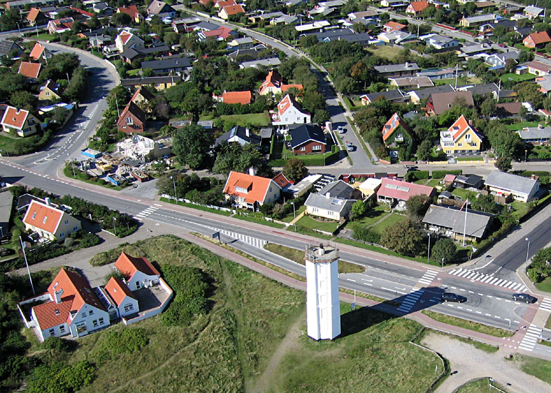
| Closeup view of Hvide Fyr, the white lighthouse. It was built in 1816 and is now a historical monument. |
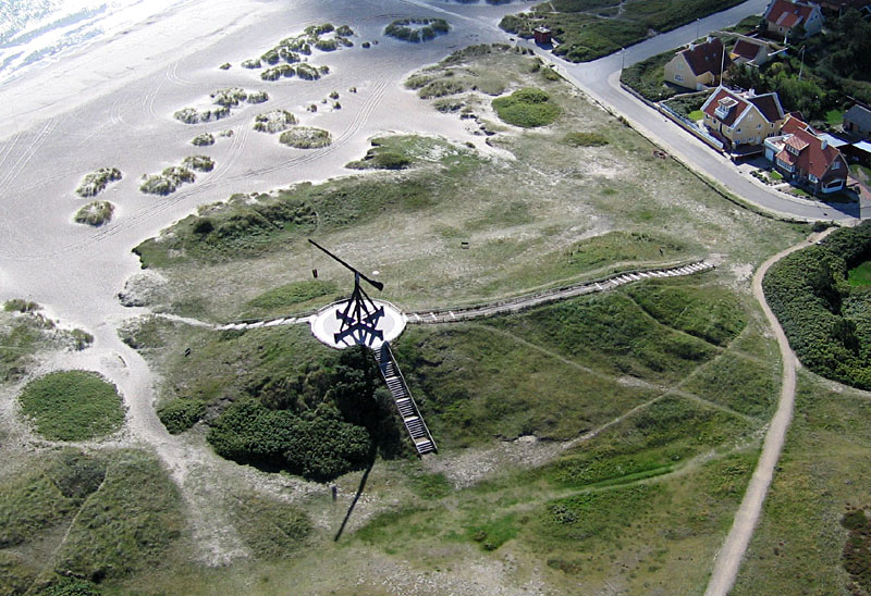
| Reconstruction of the original Skagen lighthouse dating from the late 1700s. A fire burned in the basket suspended on the boom. |
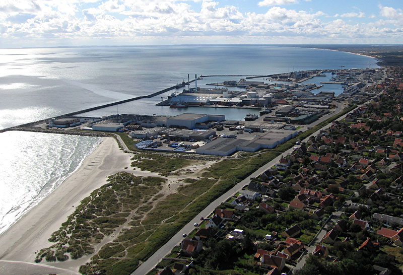
| View southward over the harbor and industrial sector of Skagen. |
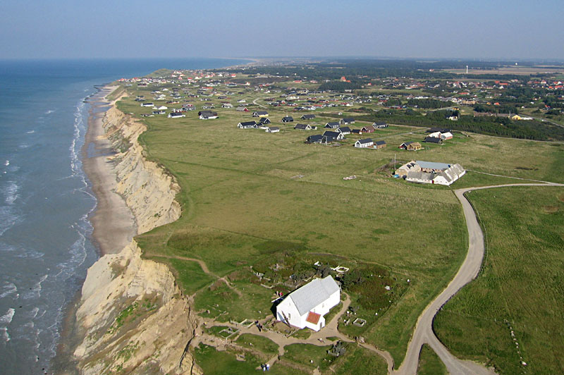
| Overview of Mĺrup Kirke in the foreground and Skallerup Strand community in the background. The cliff is composed entirely of unconsolidated sediments. It's retreating at an average rate of 1 m (3 feet) per year. |
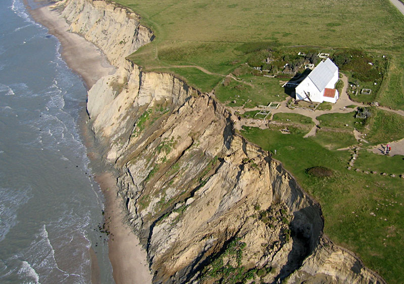
| Closer view of Mĺrup Kirke. Notice how the cliff has cut into the corner of the church yard at scene center. The large anchor in front of the church was recovered from a shipwreck in 1808, and dead sailors were buried in the church yard. |
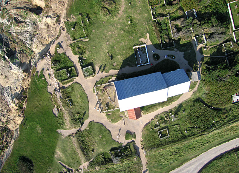
| Vertical view of Mĺrup Kirke. The anchor rests within the foundation of the former church tower. |
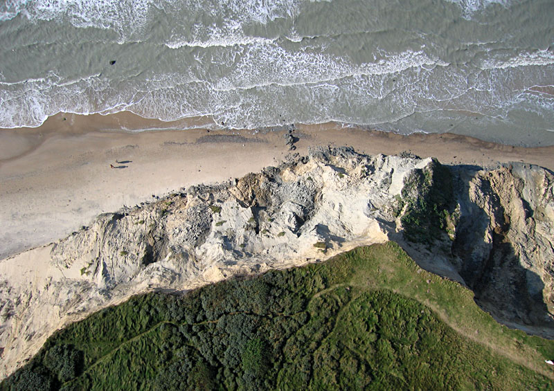
| Vertical view of the cliff and beach at Mĺrup Kirke. Notice two people (and their shadows) on the beach. |
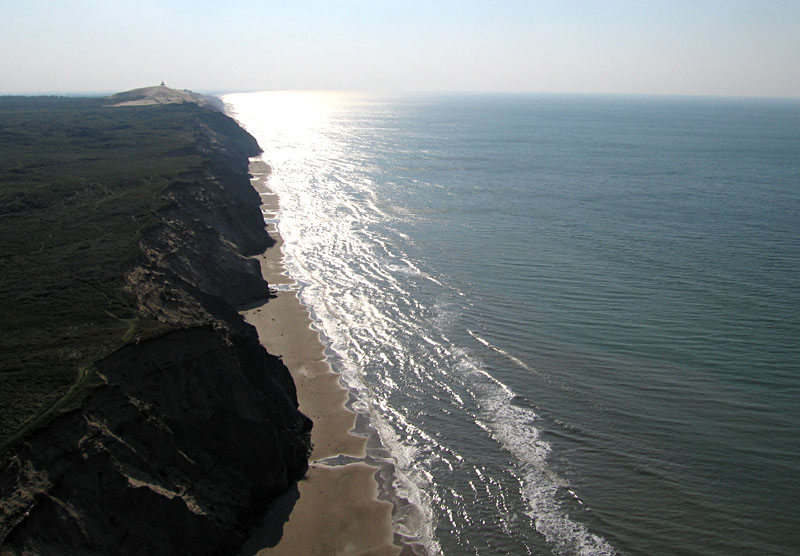
| Sun glint view along the coast toward the southwest. Sand dunes and the abandonned lighthouse at Rubjerg Knude are visible on the left horizon. |
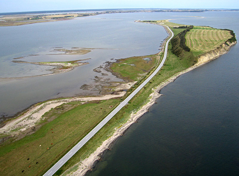
| Northward overview of Feggeklit, a cliff section on the east (right) side of scene, which is part of a long, narrow peninsula within the Limfjord estuary. Cattle are grazing on low, wet meadows in lower left corner of view. |
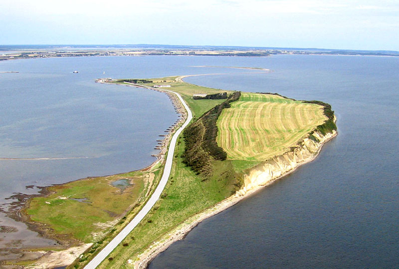
| Closeup view of Feggeklit. The coastal cliff is eroded on the side of a flat-topped butte of soft bedrock shoved up by glacier advance during the ice age. Notice the series of rock structures placed to control erosion on the west (left) side next to the highway. |
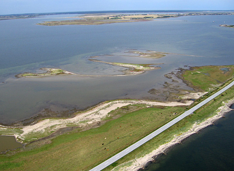
| Shallow Limfjord estuary and wetlands. The low-lying land has emerged from below the sea during the past few 1000 years, as the crust rebounded following the end of glaciation. |
| View toward southwest over the island of Mors and Limfjord. Factory in right background is a brickworks. Kite flyers are visible at bottom center of scene, along with the kite line. |
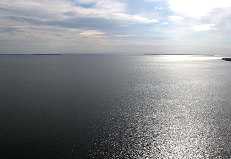
| Sun glint through partly cloudy sky highlights wave patterns on the Limfjord. |
| Northeastward overview of the Hanklit vinicity on the north side of the island of Mors. A patchwork of agricultural fields covers the land area, and a small gravel beach runs along the coast of the Limfjord. |
| Closeup view of Hanklit, a large coastal cliff (left of center) that exposes the internal structure of deformed bedrock and sediment in a large ice-shoved ridge. |
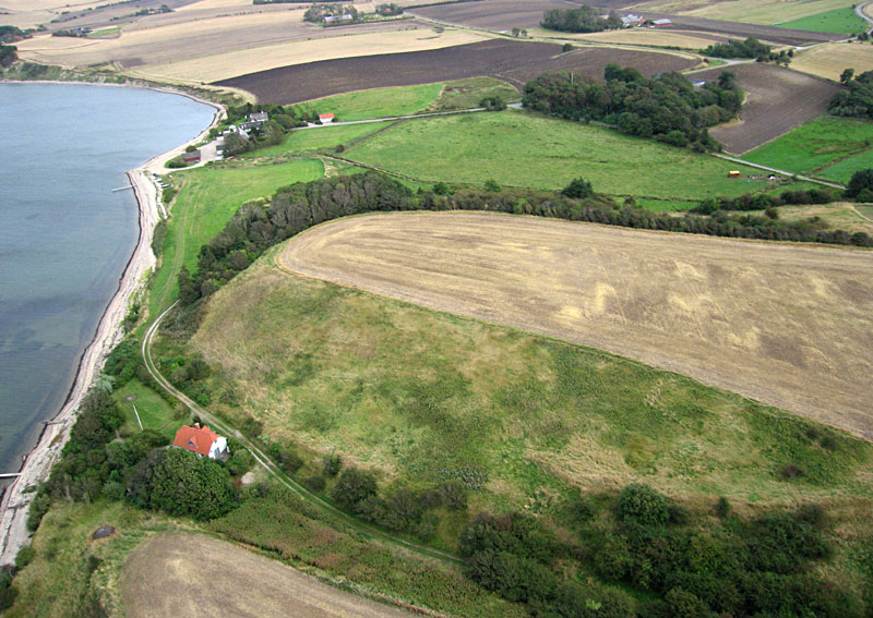
| Coastal and agricultural features in vicinity of Hanklit. This area is quite popular for summer tourism, and many recreational homes have been built or restored in the neighborhood in recent years. |
| View westward from Hanklit over harvested fields in the ice-thrust terrain of northwestern Mors. Wheat and barley are the main grain crops. |

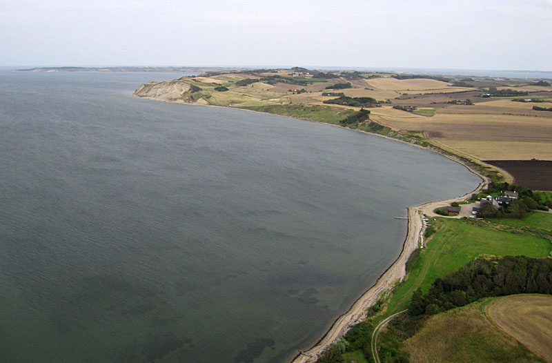
| Overview of Bovbjerg Klit, a coastal cliff section on the North Sea, with the village of Borup and Ferring Sř lagoon in the background. |
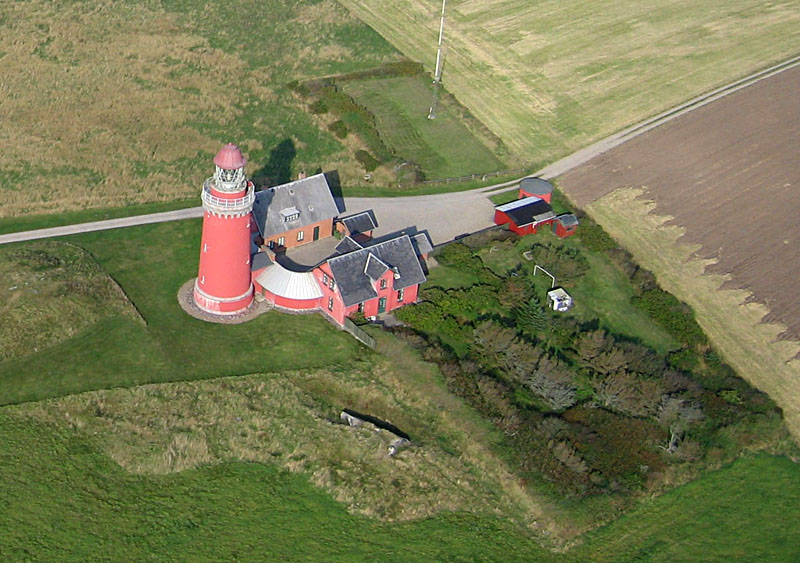
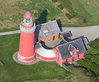
| Closeup view of Bovbjerg Klit lighthouse. This brick structure dates from 1877; however, due to rapid cliff erosion its life is now limited. |
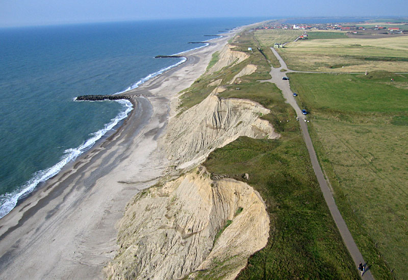
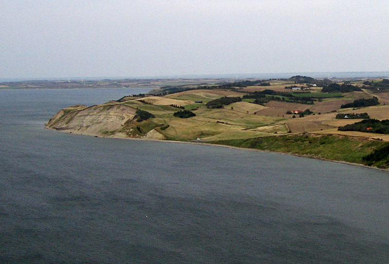
| Coastal erosion of the cliff at Bovbjerg Klit. The cliff stands 44 m (~150 feet) high and is composed entirely of unconsolidated glacial sediment. The boulder structures are designed to slow beach erosion. |
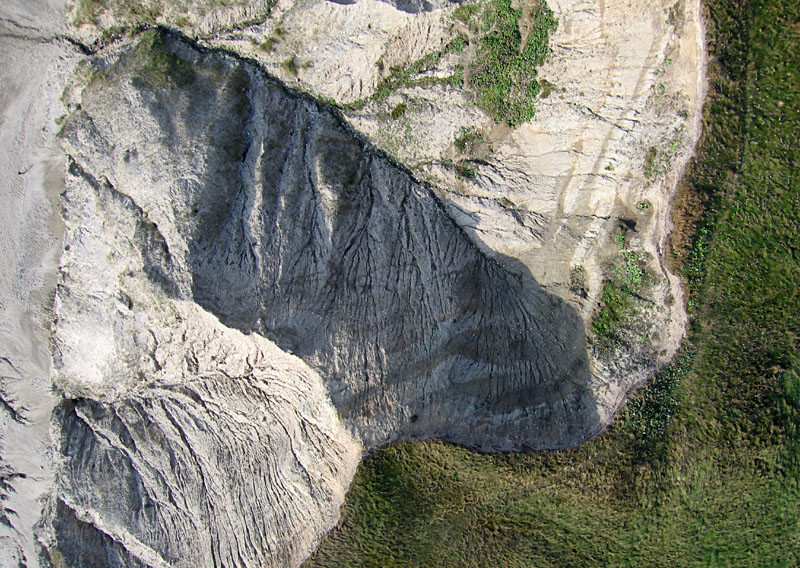
| Vertical view of gully erosion patterns on cliff; beach to left, cliff top to right. |
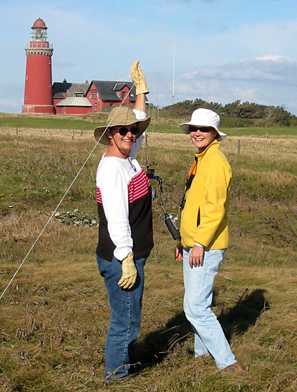
| Irene Marzolff (right) and S.W. Aber adjust the camera rig on the kite line near the lighthouse at Bovbjerg Klit. |
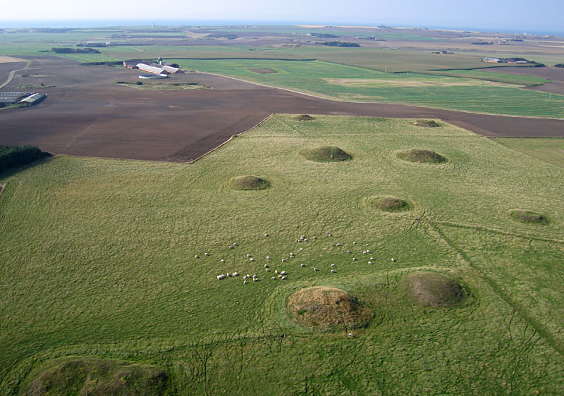
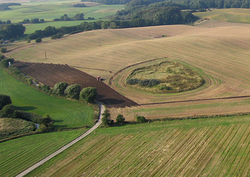
| Overview of burial mounds with sheep grazing between the mounds. Features at lower left and center appear to be "double mounds" with a surrounding edge. The others are single mounds. |
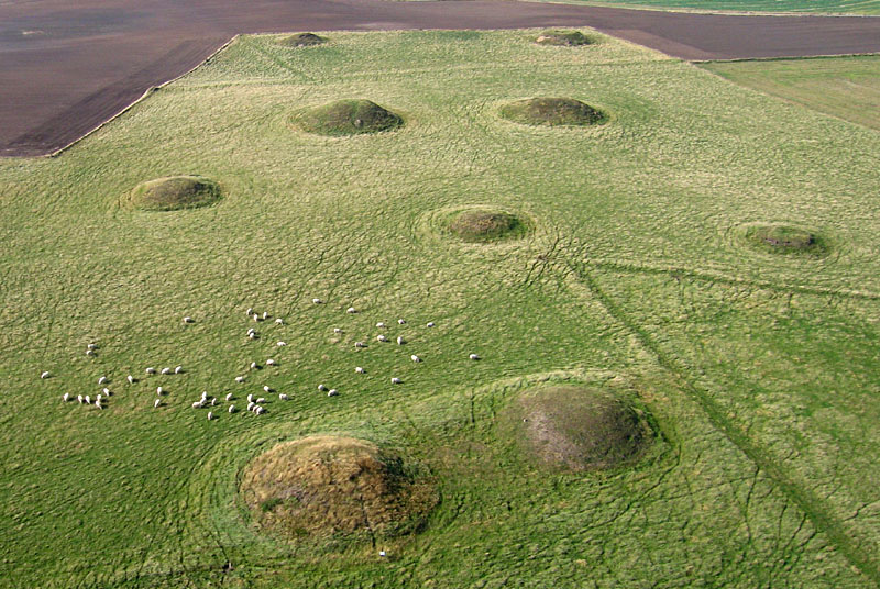
| Closer view of the main cluster of burial mounds. Sheep grazing inhibits growth of woody vegetation that would otherwise cover the protected site. Linear patterns are old field boundaries. |
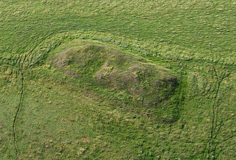
| Closeup detail of one of the "double mounds" in which the center of each mound appears to have collapsed or been removed. |
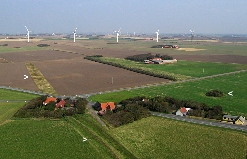
| View toward the east showing remains of a wall (>) to left and a single burial mound (<) to right. Numerous wind turbines are visible in the background. |
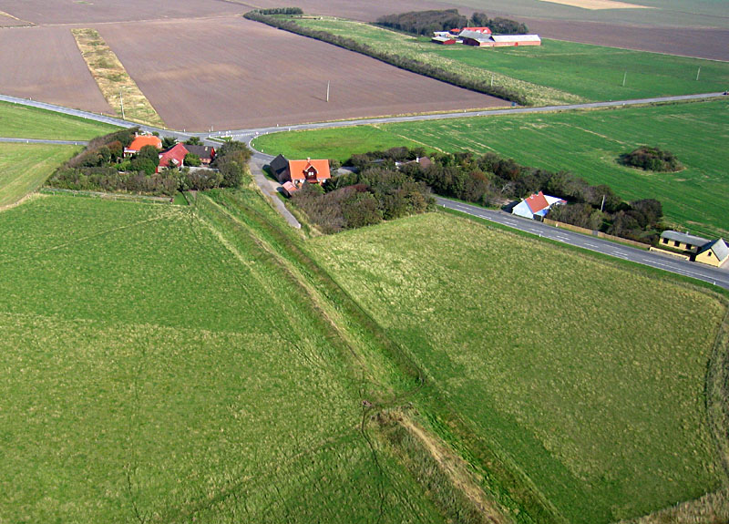
| Detailed view of the preserved wall and ditch in the foreground and its continuation as a grassy stripe across a field in the left background. |
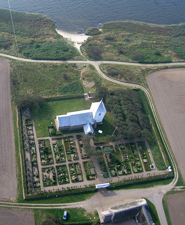
| Overview of Gammelsogn Kirke, the surrounding church yard with graves, and the tiny beach on Ringkřbing Fjord. Kite line and flyers are visible in the upper left corner. |
| Closeup oblique view of Gammelsogn Kirke and the surrounding church yard. |
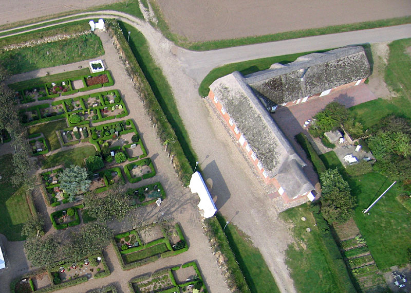
| Old parish school building (right) next to Gammelsogn Kirke. |
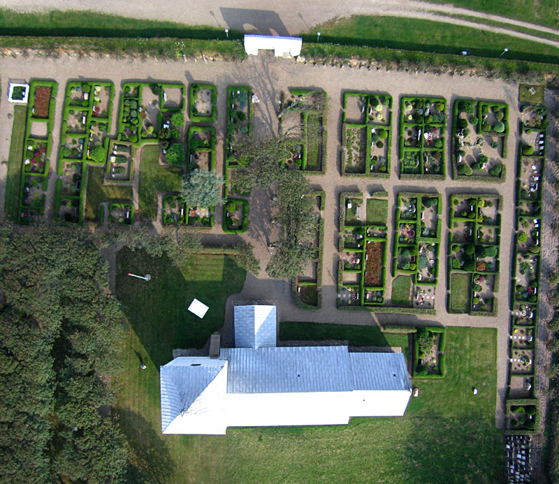
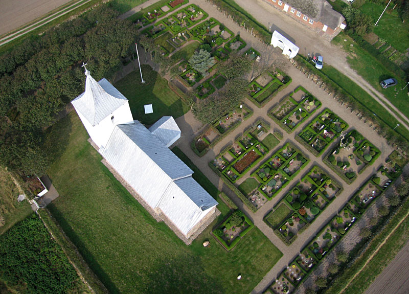
| Vertical view of Gammelsogn Kirke and the surrounding church yard. Notice the shadows cast by the church building and the gate (top of view). Also note the slight shift in alignment between the nave and choir of the church building. This was done on purpose to avoid perfection in the church structure. |
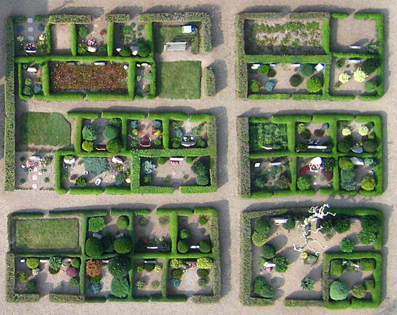
| Detailed vertical view of carefully groomed grave sites beside the church. Each family plot is surrounded by a hedge and decorated with ornamental shrubs and flowers. |
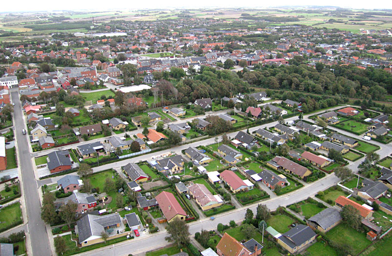
| Overview of the city of Vinderup looking toward the east. |
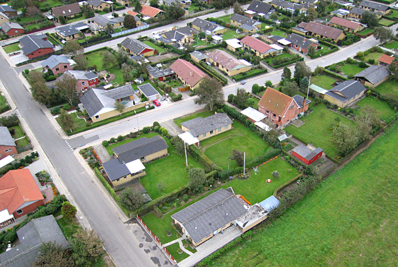
| Residential neighborhood on the western edge of Vinderup. |
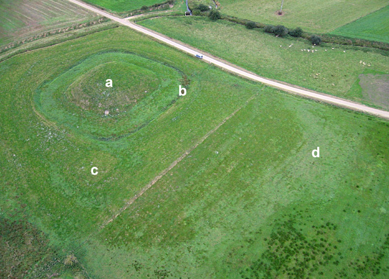
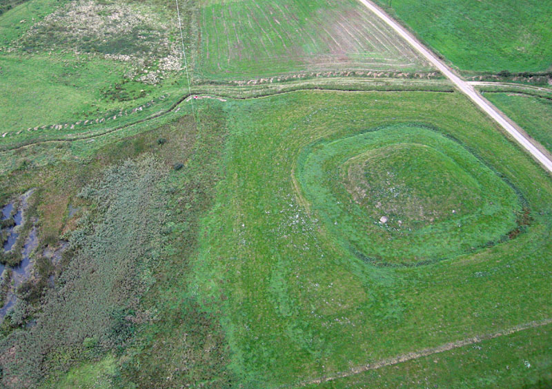
| Overview of Vinderupvold historical site. Features include: a) central mound, b) inner moat or ditch, c) smaller square outside the moat, and d) possible outer ring (former moat). Sheep are grazing in the right background. |
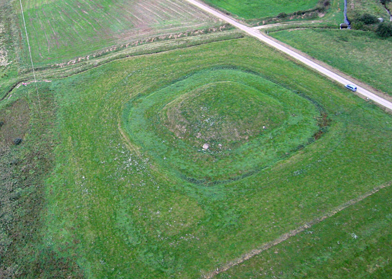
| Closer overview of Vinderupvold. Note the drainage ditch, Landting Ĺ, in the right background, which has lowered water level in this wetland site by at least 2 m (6 feet). Kite flyers standing in left background. |
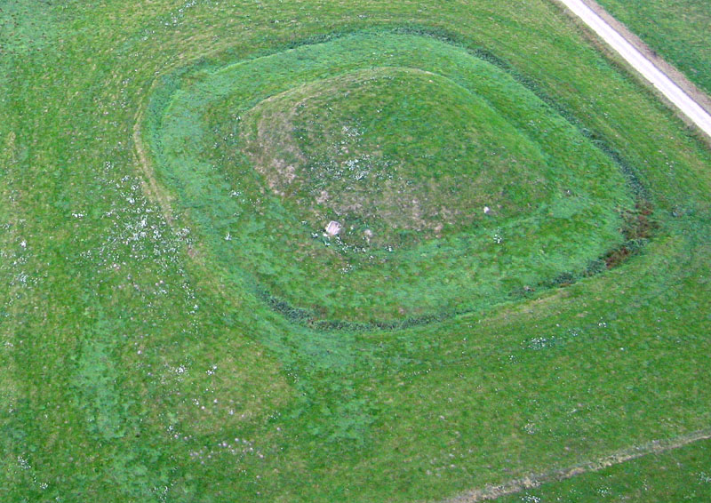
| Detailed view of Vinderupvold. The while speckles to left are patches of wildflowers. |
| Relationship of Vinderupvold to remaining wetland on left side of view. |
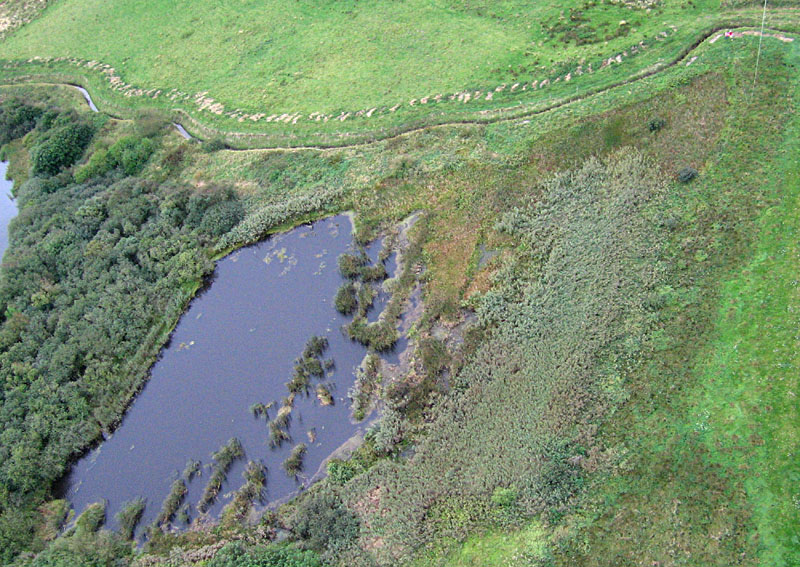
| Detailed view of ponds and wetland vegetation next to Vinderupvold. Notice the spoil piles next to the drainage ditch, Skćrbćk Ĺ, along top of view. Kite flyers standing at upper right. |
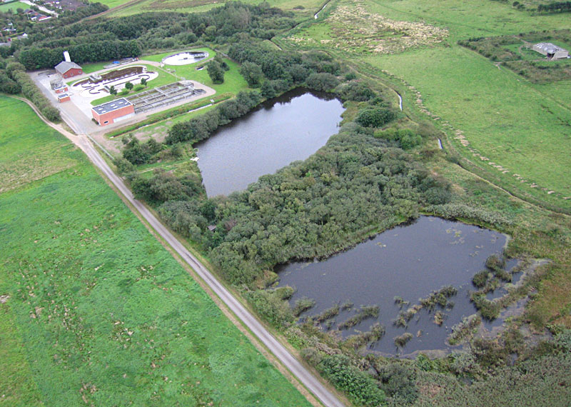
| Sewage treatment plant (upper left), ponds and wetland near Vinderupvold. |
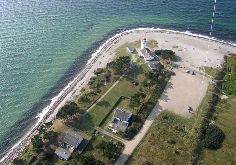
| Lighthouse at Sletterhage, southern tip of Helgenćs peninsula. The lighthouse dates from 1894. |
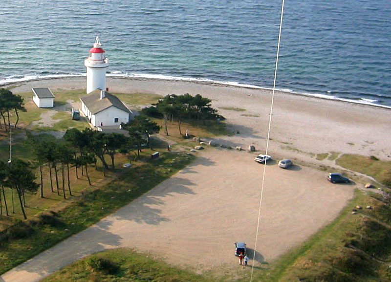
| Closeup, low-height view of lighthouse. Kite flyers are standing at bottom of scene. |
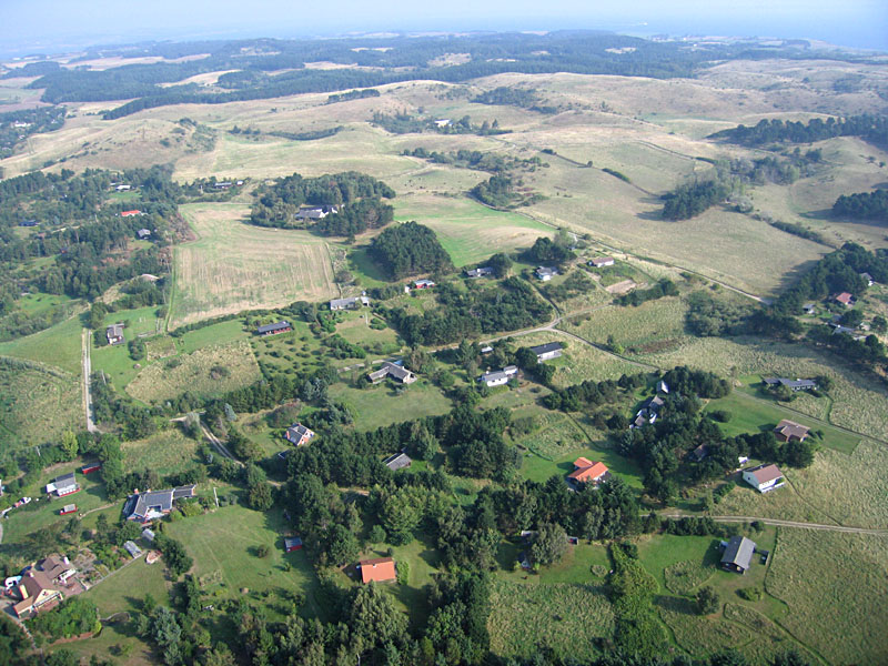
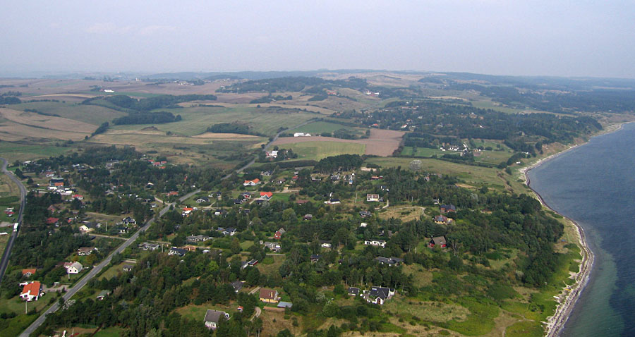
| View from Sletterhage northward over the hilly landscape of Helgenćs. Many summer and weekend homes are visible in the foreground. |
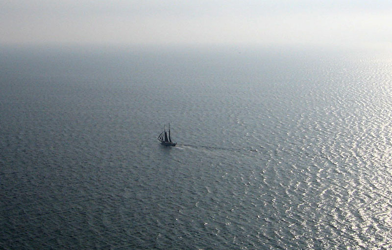
| Two-masted yacht sailing toward sunrise on the sea east of Helgenćs. |
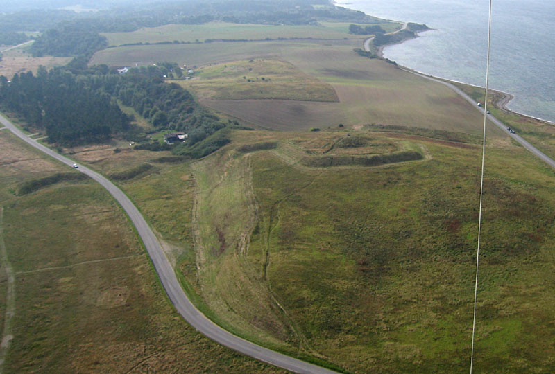
| Olaf Ryes Skanse, remains of a middle age wall and fortress on a hill, at the northern end of Helgenćs peninsula. View southward. |
| View northward to the hilly mainland of Mols Bjerge. This region is famous for its scenic beauty. |
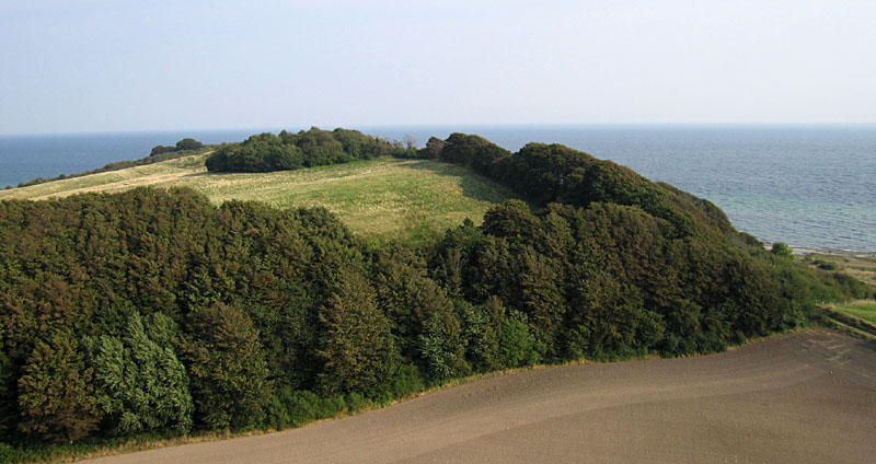
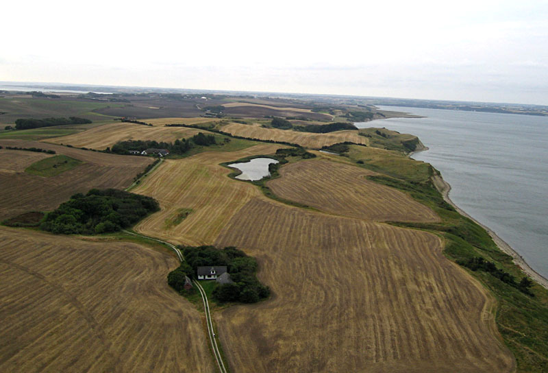
| View of Jernhatten hill top. The hill stands 49 m (~160 feet) above sealevel and provides an excellent view of the surrounding landscape and sea. |
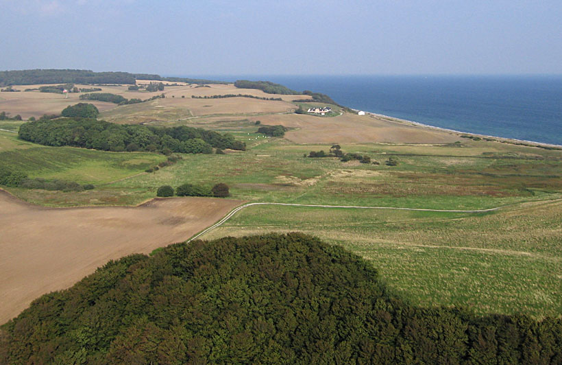
| View of the Kattegat coast and landscape north of Jernhatten. |
| September is the time for cultivating soil and planting winter crops. Here a tractor is working a field. |
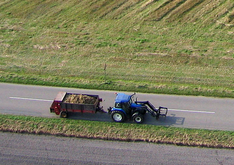
| Tractor and trailer on the road next to Jernhatten. |
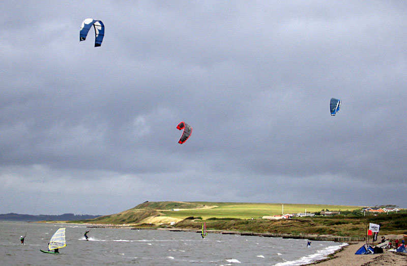
| Kite surfing competition on a windy, cool, cloudy day at Ejsing "surfcenter" on the southern margin of the Limfjord estuary. |
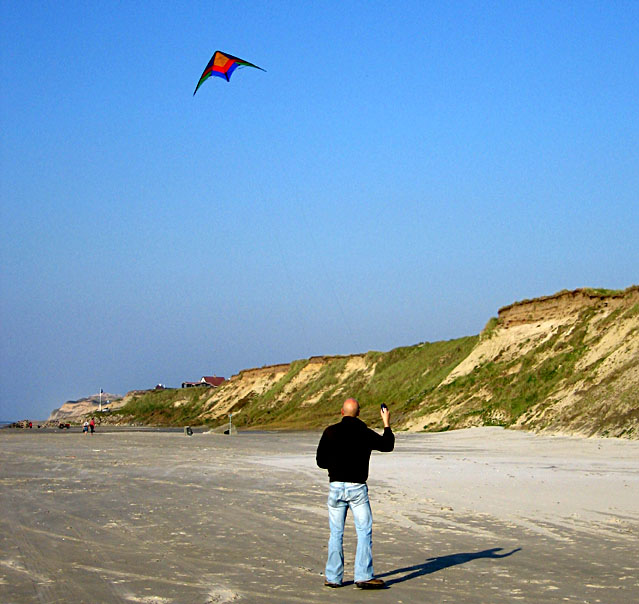
| Flying a small sport kite on the beach at Nřrre Lyngby on the Skaggerak coast of northwestern Denmark. |
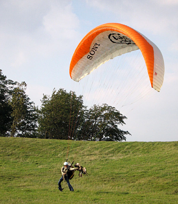
| Parasailing with a falcon. Note bird coming to the person's left arm. On Kattegat coast at Jernhatten east of Ĺrhus. |
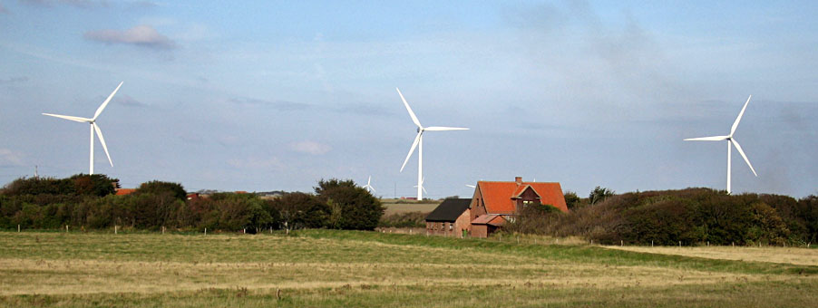
| Large wind turbines in western Jutland. Such turbines generate a significant portion of Denmark's electrical power. For more info, see turbine stamps. |
References
![]() Return to KAP gallery.
Return to KAP gallery.
Last update: Jan. 2007.