| Estonian Peat Bogs
James S. Aber
Sept. 2001 |
|
| Estonian Peat Bogs
James S. Aber
Sept. 2001 |
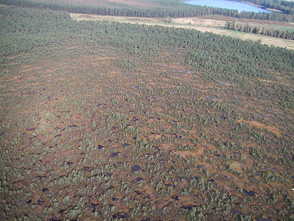
The main visual difference between a forest and a peat bog is that a forest may be viewed from the side; whereas, the nearly flat surface of a bog can be seen fully only from above. KAP provided an excellent means to capture bog colors from vantage points 50-100 m above the ground. Adequate sunlight is limited at this time of year by Estonia's relatively high latitude (58°N). At "high noon" on the autumnal equinox, the sun rises only 32° above the horizon, which makes for long shadows on the ground. For this reason, all KAP was conducted between the hours of 10 am and 3 pm. The following images were acquired with various radio-controlled digital and film cameras in both color-visible and color-infrared formats--see KAP equipment. The color-infrared pictures depict active vegetation in pink, red, and purple colors.
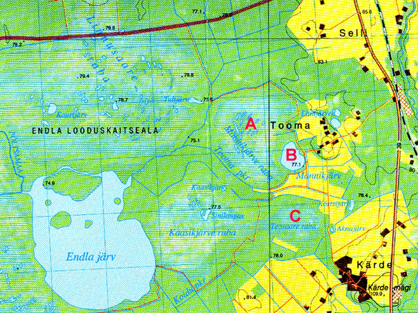
| Topographic map of the Endla Looduskaitseala (Nature Preserve), east-central Estonia. A = Männikjärve raba (bog), B = Männikjärv (lake), C = Teosaare raba (bog). KAP was conducted at both A and C. An environmental research station is located in the village of Tooma. Grid lines are spaced 1 km apart; map adapted from the Rakke 6414 1:50,000 satellite photo map (1998), Estonia base map. Click on the small map to see a full-sized version. |
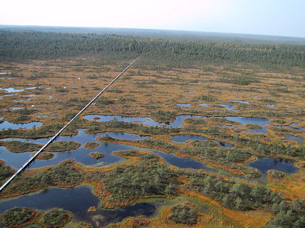
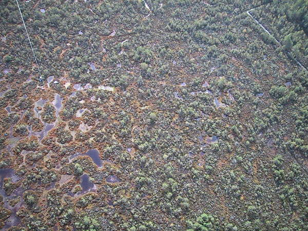
| View toward the west over the western portion of Männikjärve bog. The elevated boardwalk is visible along the left side. Notice the transition from water-filled pools in the foreground to marginal forest in the background. Digital image date 9/01; © J.S. Aber. |
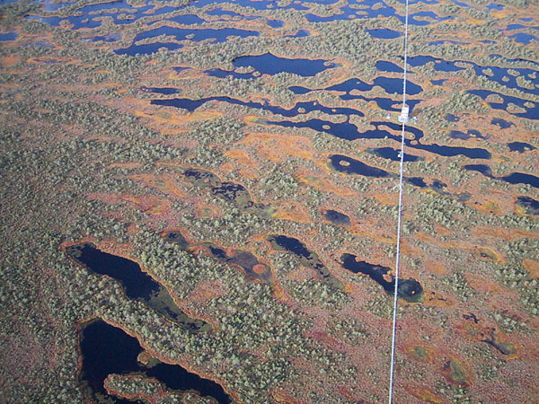
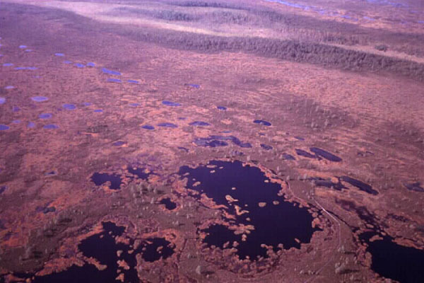
| Westward view from the eastern side of Männikjärve bog. The observation tower is located near the center of the bog. Color zones are apparent around the hollows and pools. Digital image date 9/01; © J.S. Aber. |
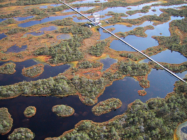
| Boardwalk and observation tower in the center of Männikjärve bog. This new tower was opened in 2001; it replaces an older, smaller tower. Notice the tiny "button" islands within the linear pools in the foreground. Digital image date 9/01; © J.S. Aber. |
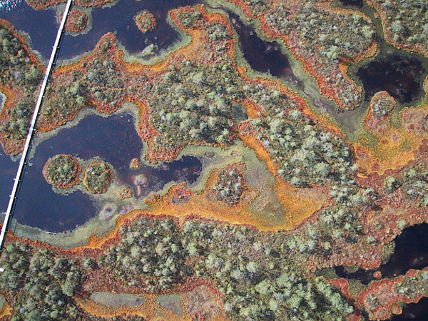
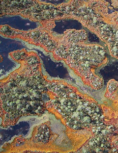
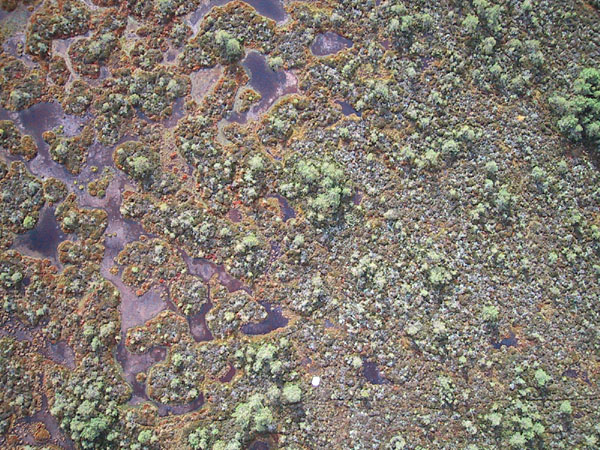
| Vertical picture of pools and hummocks near the center of Männikjärve bog. Notice the distinct vegetation color zones within and around the water-filled pools. The boardwalk is 60 cm (2 feet) wide. Digital image date 9/01; © J.S. Aber. |
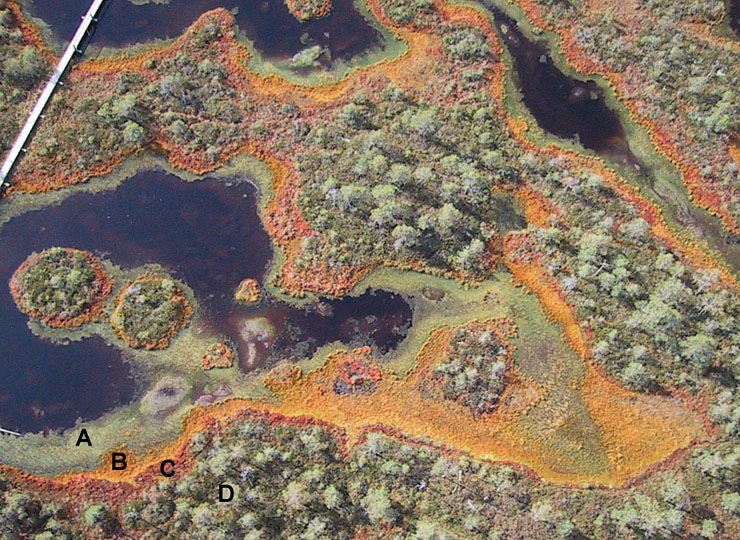
| Closeup vertical picture of pools and hummocks near the center of Männikjärve Bog. A = Sphagnum cuspidatum floating in water, B = Sphagnum cuspidatum around pool shore, C = Sphagnum rubellum above water, D = pine trees on hummocks along with dwarf shrubs--Empetrum nigrum, Chamaedaphne calyculata, Andromeda polifolia and Calluna vulgaris. Digital image date 9/01; © J.S. Aber. |
| View of the meteorological station, where the kite flyers are working, at the eastern edge of Männikjärve bog. Left: color-visible photograph. Right: color-infrared photograph. Date 9/01, © J.S. Aber. | 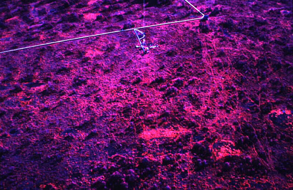 |
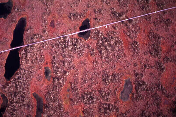
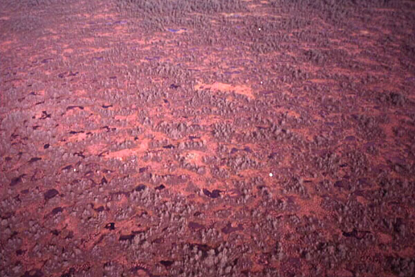
| Near-vertical shot in the eastern portion of Männikjärve bog. The markers are spaced 20 m (65 feet) apart on the boardwalk. Active peat moss is bright red and pink, whereas pine trees are dark violet in the color-infrared picture. Left: color-visible photograph. Right: color-infrared photograph. Date 9/01, © J.S. Aber. | 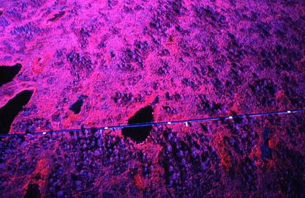 |
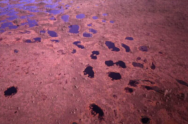
| Northward view over the central portion of Männikjärve bog. A distinct pattern is developed with small pines on linear ridges and pools in the intervening hollows. Left: color-visible photograph. Right: color-infrared photograph. Date 9/01, © J.S. Aber. | 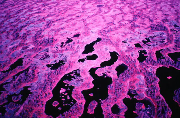 |
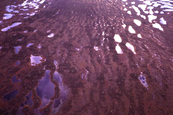
| Vertical views over the boardwalk in the western portion of Männikjärve bog. Active peat growth is concentrated around the margins of pools, as shown by bright pink-red in the color-infrared picture. Left: color-visible photograph. Right: color-infrared photograph. Date 9/01, © J.S. Aber. | 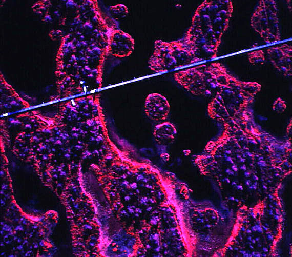 |
| View over Teosaare bog toward the north with Männikjärv (lake) visible in the upper right corner. Survey markers are visible along the right side of view. The bright zone in left center is an example of the "hot spot" or opposition effect, which is the point in direct alignment between the sun, camera, and ground. Digital image date 9/01; © J.S. Aber. |
| Oblique view toward the southern side of Teosaare bog. Marginal drainage ditches can be seen in the upper right, and kite flyers are to the left. Small, irregular pools are numerous toward the center of the bog (lower left). Digital image date 9/01; © J.S. Aber. |
| Vertical view near the center of Teosaare bog. Distinct color zones are visible within small pools and hummocks. A white survey marker (1 m²) appears in the lower center of view. Digital image date 9/01; © J.S. Aber. |
| View toward the north over the central portion of Teosaare bog. Survey markers can be seen to the right and across the center of the scene. This bog is relatively dark in the color-infrared picture, because it has numerous pine trees and water bodies. Peat growth is less extensive compared to Männikjärve bog. Left: color-visible photograph. Right: color-infrared photograph. Date 9/01, © J.S. Aber. | 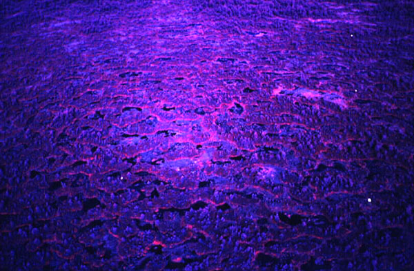 |
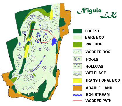
| Sketch map of the Nigula Looduskaitseala (Nature Preserve), southwestern Estonia. KAP was conducted at sites 1 (eastern) and 2 (western). A forested "island" runs through the middle of the bog between sites 1 and 2. Map adapted from Nigula Nature Reserve, Estonia. |
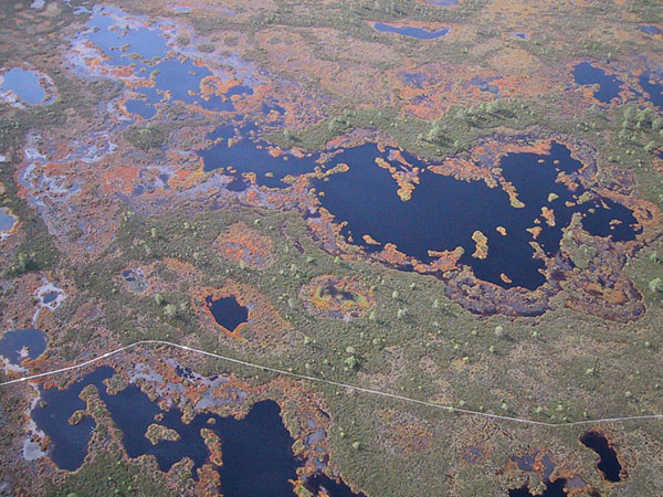
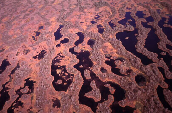
| View over the eastern portion of Nigula bog. Pools and hollows display intricate patterns of irregular size and shape, and many tiny islands are present within water-filled pools. White survey markers on the boardwalk are placed 25 m apart (to lower left). Digital image date 9/01; © J.S. Aber. |
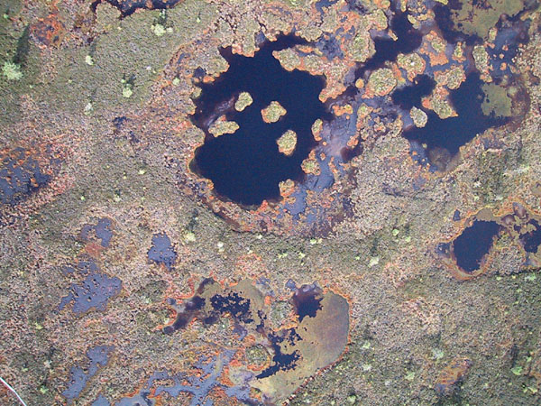
| Vertical view in eastern portion of Nigula bog. Sphagnum cuspidatum forms a silvery green "mat" floating in parts of some pools. The reddish-brown zones include Sphagnum magellanicum and Sphagnum rubellum. Heather covers much of the mottled green surface along with a few small pines (note shadows). A portion of the boardwalk is visible in lower left corner. Digital image date 9/01; © J.S. Aber. |
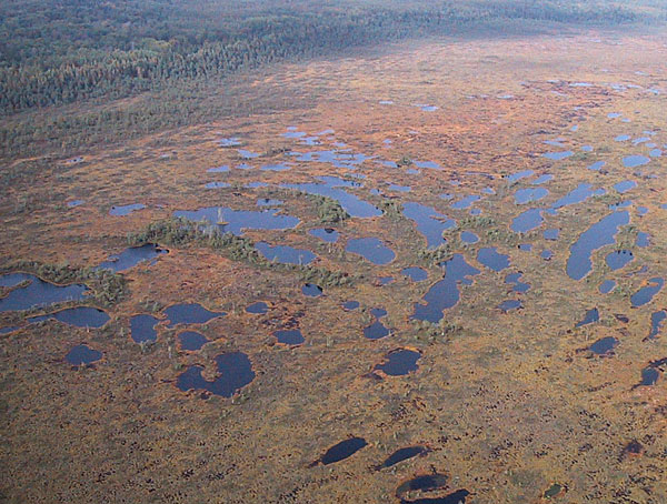
| View toward the northwest over the western portion of Nigula bog with a marginal forest in the background. Water color varies from light blue (background) to black (foreground), which depends on the amount of reflected sky light. Digital image date 9/01; © J.S. Aber. |
| View toward the southwest in the eastern portion of Nigula bog with a forested "island" near the top of the scene. The boardwalk meanders between the two larger ponds. Left: color-visible photograph. Right: color-infrared photograph. Date 9/01; © J.S. Aber. | 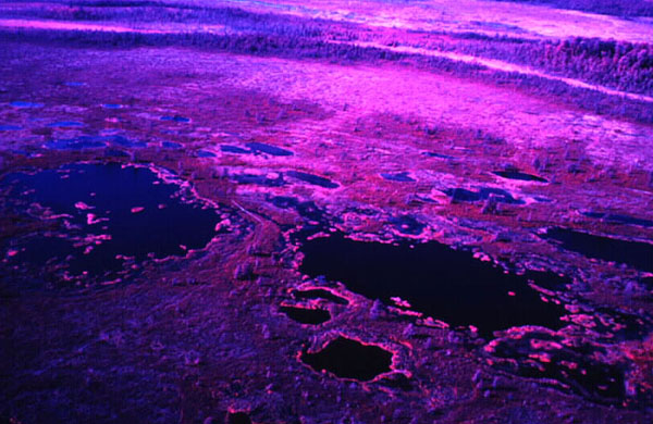 |
| Northward view over the eastern portion of Nigula bog with numerous pools toward the bog center. Left: color-visible photograph. Right: color-infrared photograph. Date 9/01; © J.S. Aber. | 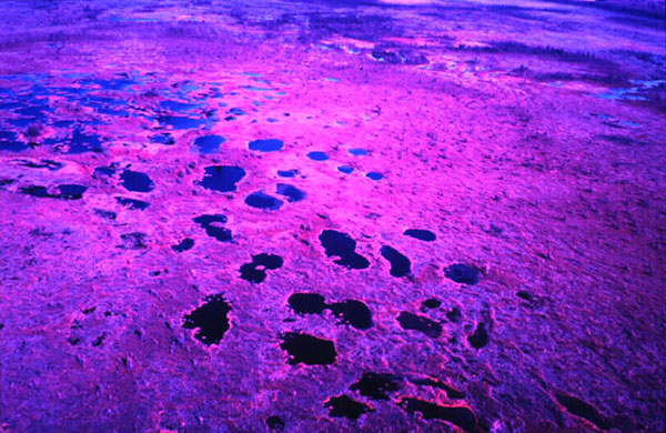 |
| Southward view toward the sun over the western portion of Nigula bog. Sun glint (mirror reflection) from water bodies creates dramatic lighting in both photographs. Left: color-visible photograph. Right: color-infrared photograph. Date 9/01; © J.S. Aber. | 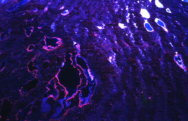 |
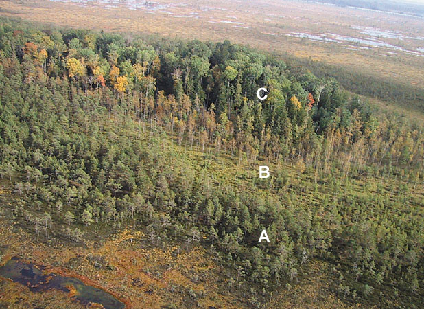
| Salupeaksi, a tree-covered "mineral" island (a drumlin) in the middle of Nigula bog. Notice the marked forest zones of the island. A = pine, B = birch (partly bare), C = ash, elm, maple and other deciduous hardwoods, some of which are displaying fall colors. Left: digital color image. Right: color-infrared photo. Date 9/01; © J.S. Aber. | 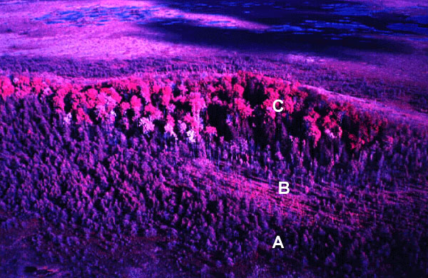 |
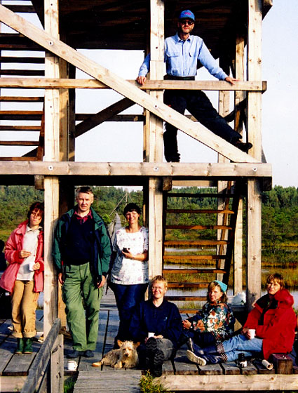
| Members of the field crew at the observation tower in Männikjärve bog; relaxing after a long day of kite aerial photography. From left to right: Karin Muru, Edgar Karofeld, Susie Aber, Kai Kimmel, Katrin Möllits, and Kiira Aaviksoo; Jim Aber at top. Not shown: Andres Kimmel and Meeli Vilbaste. |
All text and images © by the authors.
Last update 31 Oct. 2001.