Kite Aerial Photography
of Estonia

James S. and Susan W. Aber

Introduction

Estonia is a small country located at the eastern end of the Baltic Sea in northern Europe. Neighboring countries include Finland to the north, Russia to the east, Latvia on the south, and Sweden across the Baltic to the west.

Map of Estonia and surrounding countries.
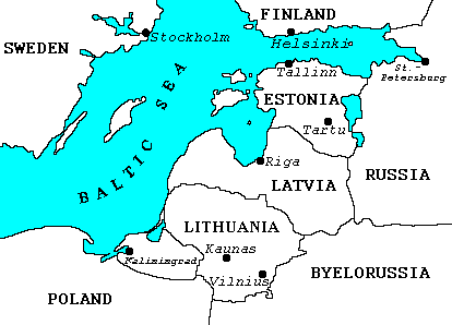
Taken from Estonia in the Baltics.

During the summer and autumn of 2000, we resided in Tartu on a faculty exchange between Emporia State University and the University of Tartu. This gave us ample opportunity to travel and conduct kite aerial photography at several sites. August and September are months with many cloud-free days. The maritime situation of Estonia gives rise to consistent wind on most days, which we took advantage of as often as possible. We visited again in September, 2001, for more KAP in eastern and southern Estonia. The map below indicates the places where we had successful KAP. Click on the marked sites to see selected kite aerial photographs.

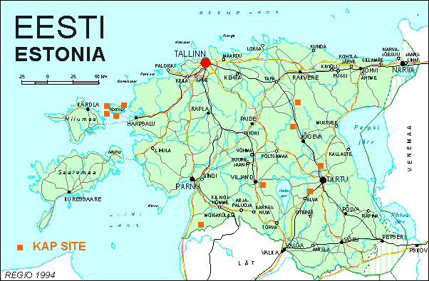
Map obtained from Estonia in the Baltics.

Tartu Observatory

The
Tartu Observatory maintains a long tradition of Estonian astronomy. Perhaps the most famous Estonian astronomer was Ernst Julius Öpik (1893-1985), who was among the foremost astrophysicists of the 20th century. Among many accomplishments, he was first to estimate the distance to an object outside our own galaxy--the Andromeda galaxy in 1922. In addition to astronomy, the observatory includes research groups working on atmospheric physics and remote sensing of vegetation. The observatory has at present two main telescopes in operation for research purposes.

  1. Large reflecting telescope of 1.5 m (4.9 feet) diameter. This is the largest telescope in the Baltic countries and Scandinavia. It is coupled with a spectrograph, which is utilized for long-time observations of the light spectrum emitted by variable stars.

  2. Small reflecting telescope of 60 cm (24 inches) diameter. This telescope is used together with a photometer to measure brightness of stars in three colors--ultraviolet, blue, and yellow.

Originally situated in the city of Tartu, the observatory was moved to its present location at Tõravere in the 1964. The observatory location was selected to provide a view to the horizon in all directions and to minimize potential atmospheric pollution from nearby power plants, etc. Estonia has a maritime climate with relatively high humidity and frequent clouds. On average, the observatory has 80 cloud-free nights per year with August, September and March being the best months for night sky viewing.

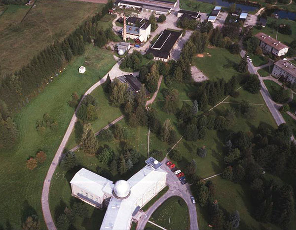
Main building of the observatory. This building houses administrative and research offices as well as rooms for conferences and meetings. Part of the village of Tõravere is visible in the background. Photo date 9/00, © J.S. Aber.
The large telescope is housed in the dome to the right. This telescope is used for spectrographic observations. Part of the ground meteorological station can be seen in the lower left corner. Photo date 9/00, © J.S. Aber.
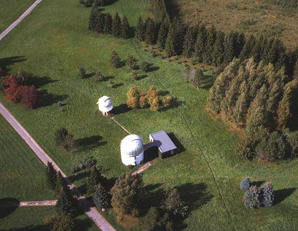
The smaller dome (upper left) in this view contains the small telescope used to measure star brightness. Photo date 9/00, © J.S. Aber.

Saadjärv vicinity

Saadjärv is one of several lakes located in the Vooremaa drumlin field north of Tartu. Drumlins are elongated hills that were molded by glaciation into smoothed, streamlined landforms. Long, narrow lakes occupy the troughs between drumlins. A substantial portion of the Saadjärv vicinity is included in a natural protection area. Because of its scenic beauty and proximity to Tartu, the region is utilized for recreation--sailing, hiking, horseback riding, and skiing. Many vacation and guest homes are located near the lakes.

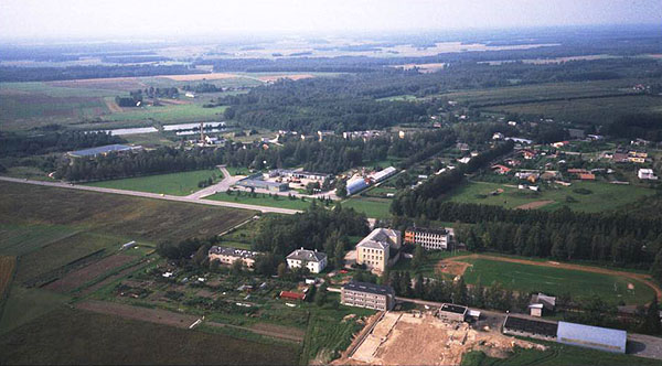
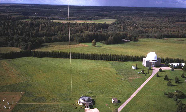
Village of Lähte, located at the southern end of the Saadjärv district. Highway 39 crosses the scene from left to right. Photo date 9/00, © J.S. Aber.
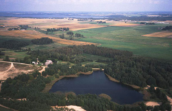
View toward the north with a small lake in foreground and Saadjärv visible on the distant horizon. Photo date 9/00, © J.S. Aber.
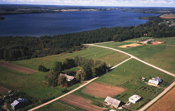
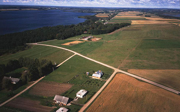
View toward the northwest over Saadjärv. The lake is roughly 2 km wide by 6 km long. It is often used for small-boat sailing and wind surfing, although the water is relatively cold. Photo date 9/00, © J.S. Aber.
Saadjärv is visible to the left, and a drumlin extends into the right distance. Another lake, Soitsjärv, can be seen in the upper right corner. Note the smooth shape of the drumlin ridge. Photo date 9/00, © J.S. Aber.
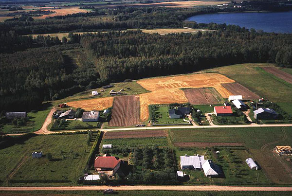
View of Salu, a small resort community, with Saadjärv visible in the upper right corner. New vacation homes intermingle with more traditional agricultural landuse. Photo date 9/00, © J.S. Aber.


Autumn color of Estonian peat bogs and Estonian agriculture.

Return to KAP gallery or Great Plains KAP homepage.
Last update 24 Oct. 2001.