| South Texas Coast J.S. and S.W. Aber |
| Atascosa NWR | South Padre |
| North Padre | Related sites |
|
| South Texas Coast J.S. and S.W. Aber |
| Atascosa NWR | South Padre |
| North Padre | Related sites |
Our main subjects included Padre Island and Laguna Madre (Weise and White 1991). Padre Island is a barrier island that extends more than 100 miles (>160 km) along the South Texas coast. It is the longest barrier island in the United States. It began forming only about 2800 years ago, when sea level rose close to its modern position following the melting of Ice Age glaciers (Brown and Huey 1991). Most of the island is less than 20 feet (6 m) above sea level, although a few dunes stand up to 50 feet (15 m) high. Much of the north half of the island is protected in the Padre Island National Seashore. The remainder is privately owned.
Laguna Madre is a shallow lagoon between Padre Island and the mainland. It has quite limited connections to the open sea and little influx of freshwater from the mainland. Given the high evaporation rates, its water is quite saline. Average water depth is only 3 feet (1 m). The lagoon is subject to wind action that drives water across tidal flats around its margins. Seagrass on the lagoon bottom is a rich and productive environment with high biodiversity, and emergent wetlands on islands and margins of the lagoon are famous for shore birds and wading birds, such as the roseate spoonbill.
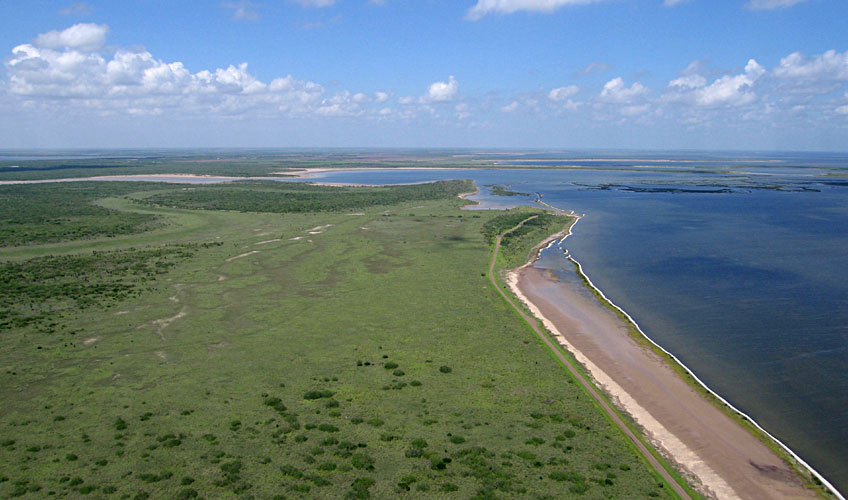
| Overview toward the north with Laguna Madre on the right and refuge wetlands on the left. The road leads toward Plover Point parking area in the distance (where the road appears to end on a small knob). |
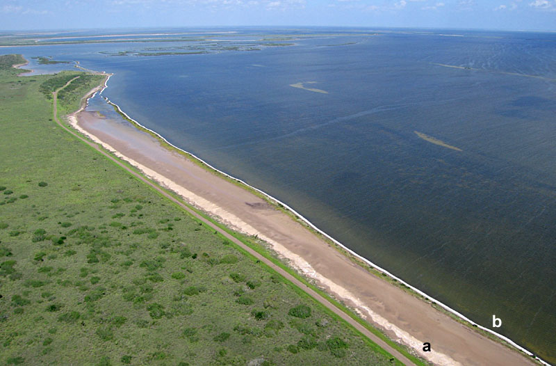
| Detail view of Laguna Madre shoreline. The bare strip is a wind-tidal flat marked by two bright zones: a) dead seagrass washed up during a storm and bleached in the sun, and b) foam on water margin. |
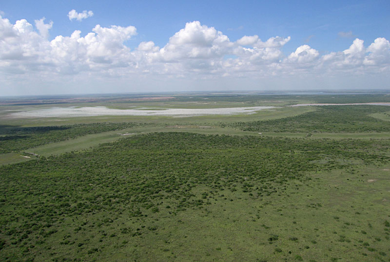
| Overview toward the northwest into the mainland of the refuge. The largely bare zone in the distance is Pelican Lake which has little water in late summer. |
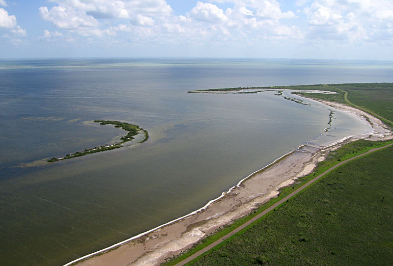
| View southward to Stover Point (peninsula). Note the delicate shoals and islands along the coast. |
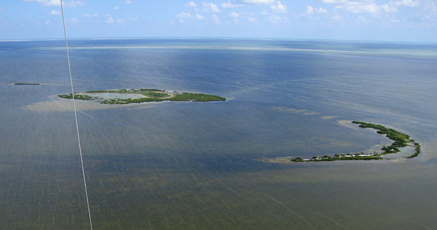
| View eastward showing small islands. These islands display natural crescentic outlines and enclose small lagoons. They presumably formed by wind and wave reworking of sediment from shoals and are now stabilized by vegetation. |
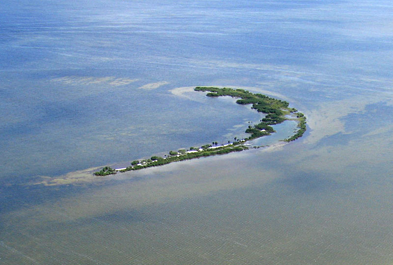
| Detail view of crescentic island and shallow shoals. Such islands are important bird santuaries, as predators cannot reach the islands. |
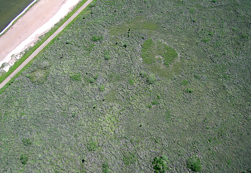
| Near vertical look at the mainland environment next to the shore. Numerous animal trails can be seen across the wetland vegetation. |
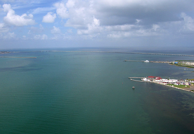
| View toward northwest including the Queen Isabella Causeway, which connects Port Isabel on the mainland (left) with South Padre Island (right). Laguna Madre in the background. |
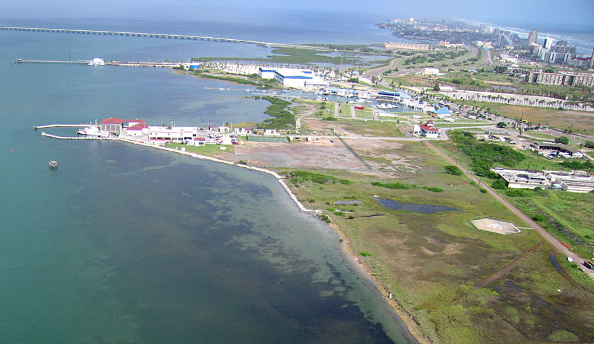
| View northward showing the Coast Guard station (left center) and "downtown" South Padre Island (upper right). |
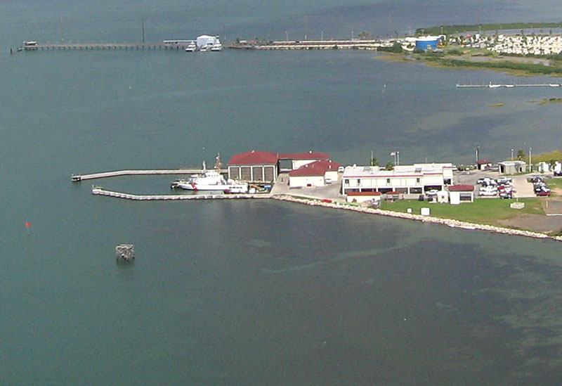
| Closeup view of the Coast Guard station on the Laguna Madre side of South Padre Island. |
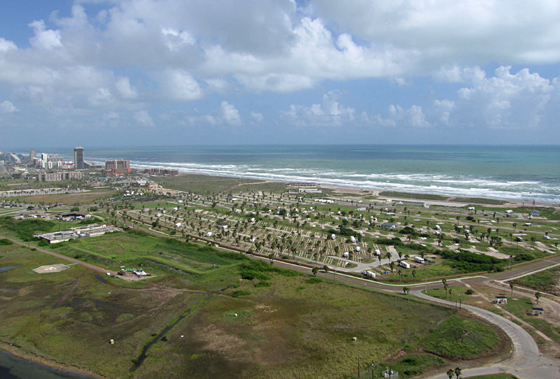
| View toward northeast with Isla Bianca Park in the foreground and Gulf of Mexico in the background. |
| View eastward including entrance of the shipping channel (upper right). Laguna Station (Boy Scout) camp is visible in the lower right. The closely spaced square objects are wooden frames for tents. |
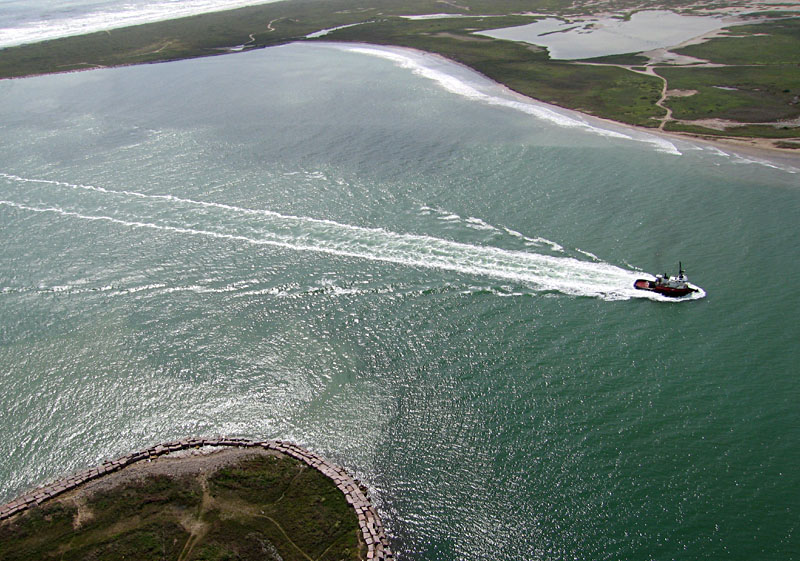
| Towboat coming through the Brazos-Santiago Pass between South Padre Island (bottom) and Brazos Island (top). |
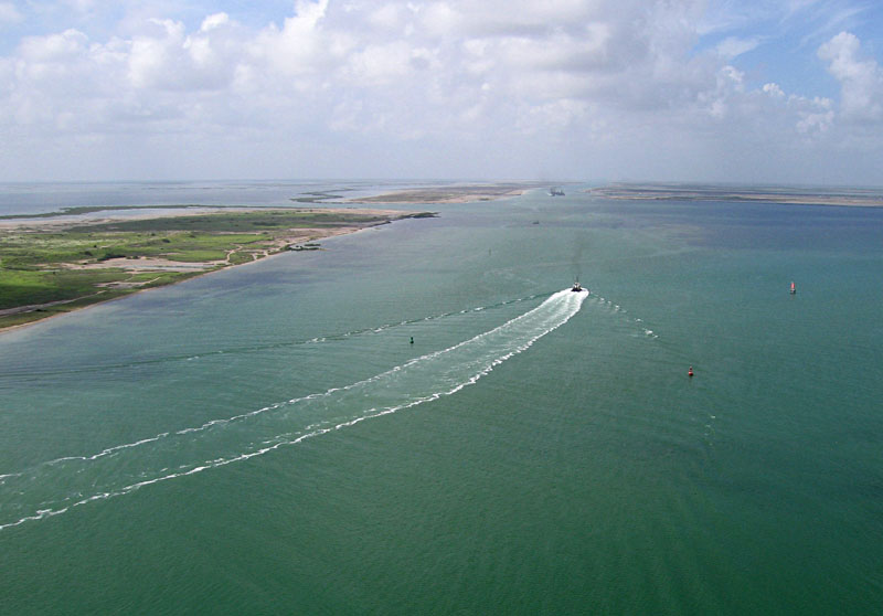
| Towboat heading toward the Brownsville Ship Channel in the background. Note the distinctive wake pattern behind the boat. |
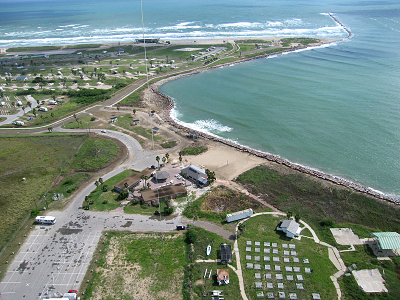
| Sun glint view of the south tip of South Padre Island with a navigation tower in lower right corner of scene. The shore along Brazos-Santiago Pass (top left) is protected by large granite blocks. |
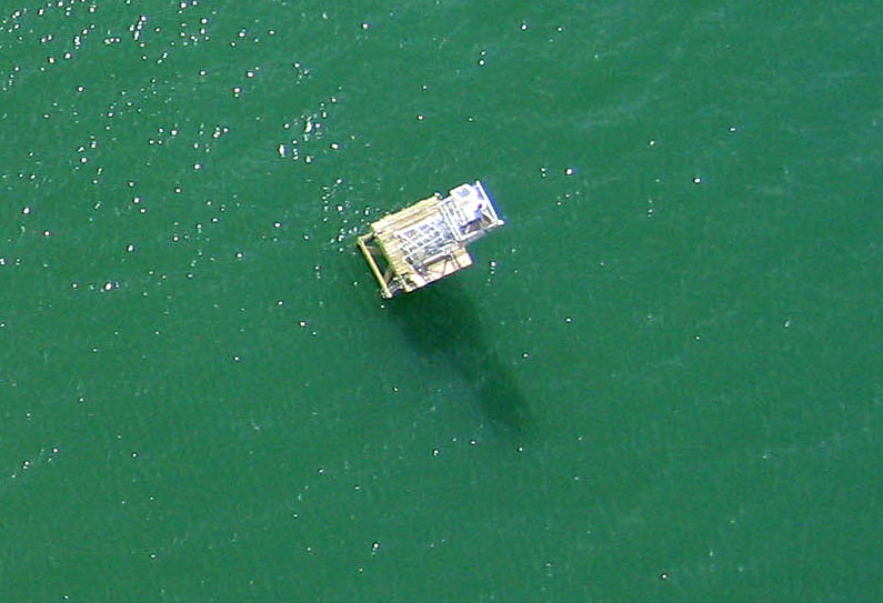
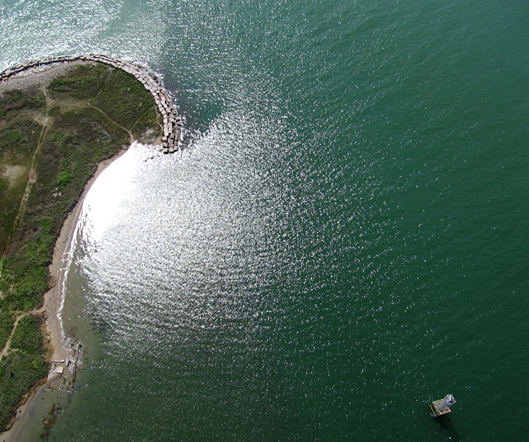
| Closeup, near-vertical view of navigation tower on Laguna Madre side of South Padre Island. Note tower shadow. |
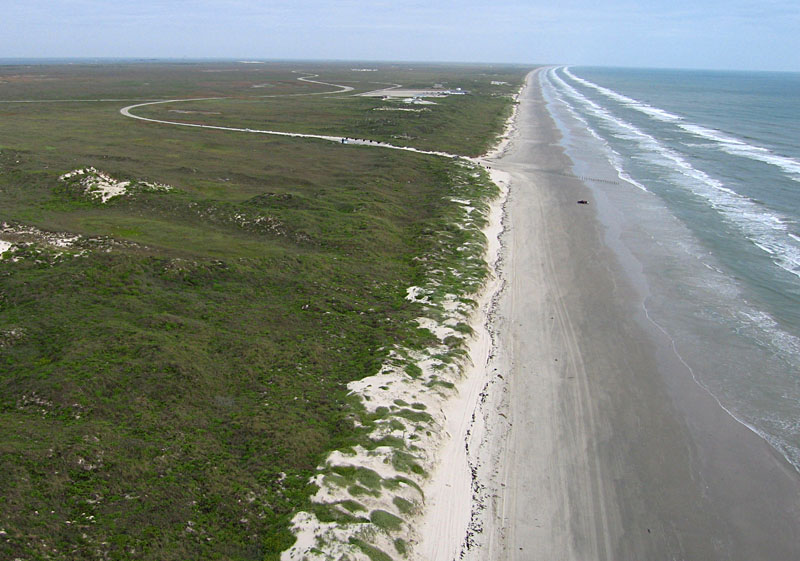
| View northward along the Padre Island seashore. The Malaquite Visitor Center is visible in the center background, along with the access road that leads to the beach. |
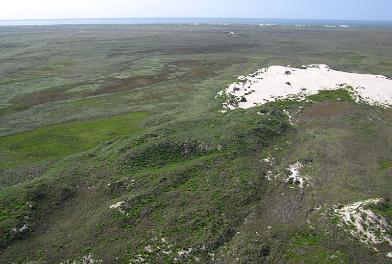
| View across the island toward Laguna Madre in the distant background. An active blow-out dune appears to right, and wetland vegetation fills hollows to left. |
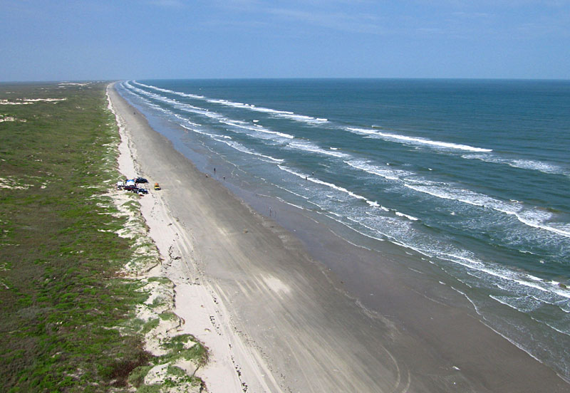
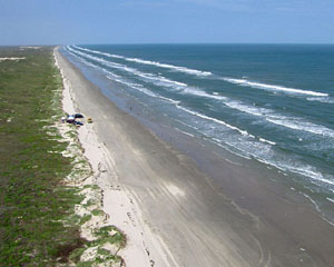
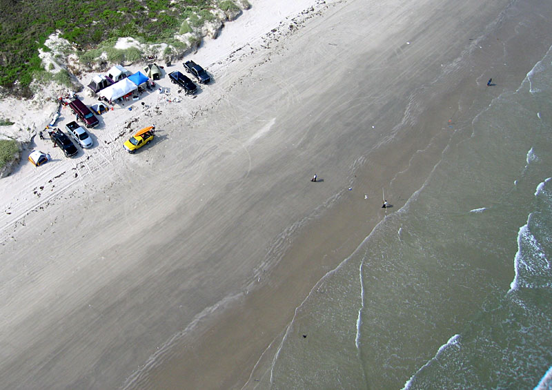
| Fishermen have set up a camp at the upper margin of the beach in preparation for a fishing tournament. |
| Low-oblique view of fishing camp as people begin to set up their fishing poles along the beach. |
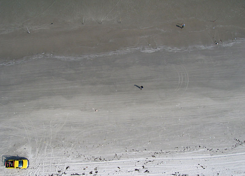
| Vertical shot of beach zone. Several fishing poles are visible along the top edge of the scene. |
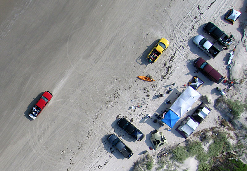
| Vertical view of the fishing campsite as a red truck loaded with gear drives by on the beach. |
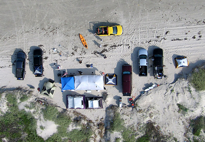
| Closeup vertical shot of the weekend fishing campsite with vehicles, tents, coolers, a small boat, and other equipment. |
![]() Related sites
Related sites
References
![]() Return to KAP gallery.
Return to KAP gallery.
Last update: Dec. 2007.