|
Slovakia & Poland J.S. and S.W. Aber |
| Introduction | KAP |
| Slovak Tatras | Polish Tatras |
| Other Slovak KAP | Other Polish KAP |
![]() More about life in Slovakia.
More about life in Slovakia.
|
|
Slovakia & Poland J.S. and S.W. Aber |
| Introduction | KAP |
| Slovak Tatras | Polish Tatras |
| Other Slovak KAP | Other Polish KAP |
![]() More about life in Slovakia.
More about life in Slovakia.
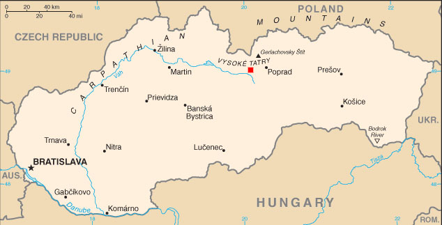 west of Poprad and south of the Tatra Mountains. Map adapted from CIA World Factbook. |
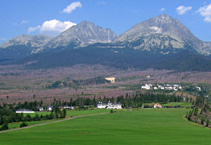
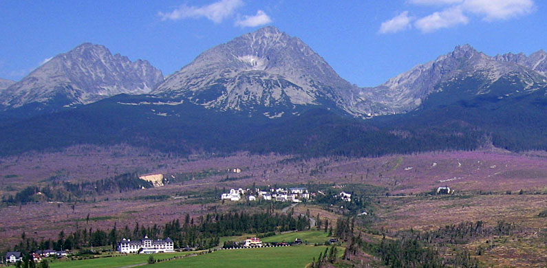
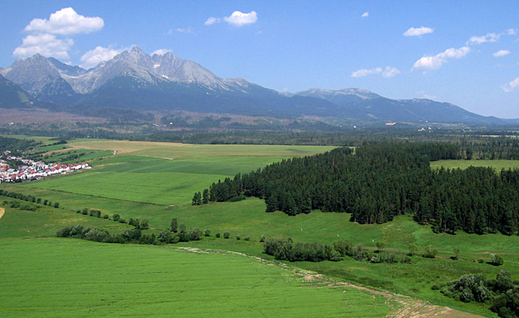
The Tatra Mountains are extremely popular for tourists both in the summer and winter. In summer, visitors enjoy the mountain scenary and relatively cool weather. In winter, skiing and ski jumping are primary activities. Both domestic and foreign tourism have grown rapidly since Poland and Slovakia gained independence and joined the European Union. A construction boom for hotels, highways, recreational facilities, and private housing is underway in the Tatra region. Nonetheless both countries are keenly aware of the need to balance economic development and environmental protection.
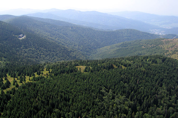
Mountains are risky places. In the spring of 2004, for example, a severe wind storm blew down a large portion of the conifer forest in the Tatranské Podhorie zone on the foreland of the Vysoké Tatry in Slovakia. After considerable debate, a decision was made to salvage the downed timber to minimize insect infestation of the damaged forest. Thus a broad zone along the southern flank of the Tatras is now open; fireweed has established quickly, and eventually the forest will regenerate. Such events happen every few decades. The opening of the forest is an opportunity for geologists to study the landforms better.
![]() Back to top.
Back to top.

| The authors with our Slovak colleagues, from left: Juraj Janocko, J.S. Aber, Branislav Fricovsky and S.W. Aber. |
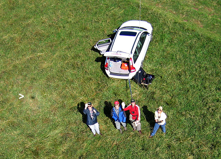
We conducted kite aerial photography under various wind and lighting conditions, revisiting some sites more than once to acquire pictures under different conditions or times of day. However, many days were cloudy, rainy, or lacked sufficient wind. So the number of good flying days was limited. All the following pictures were taken with Canon S70 and SD600 cameras--see camera rigs.
 Slovak Tatras

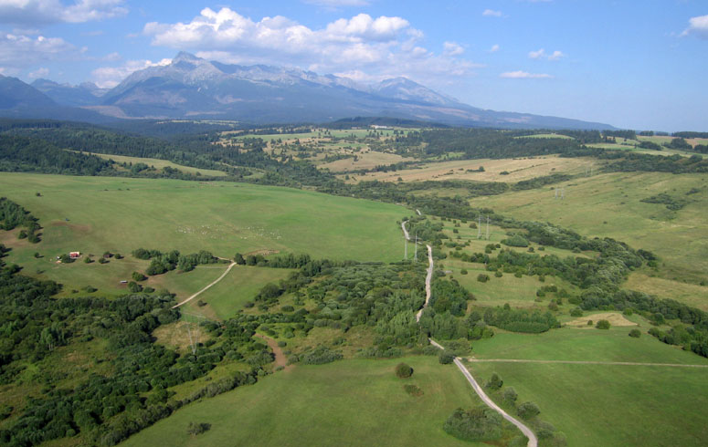
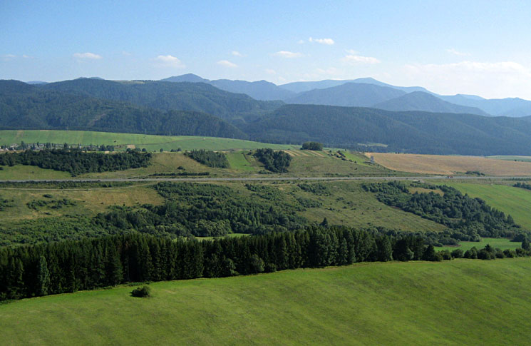
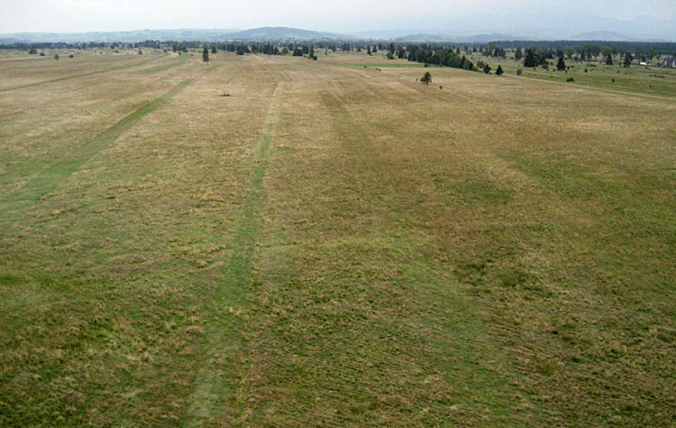
| This site is quite close to the mountain front. View toward the north showing mostly forested lower slopes of the Západné Tatry. |
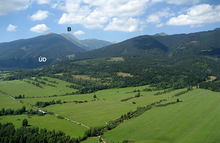
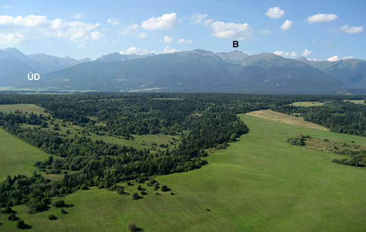
| View toward the northwest. ÚD = Úzka dolina (valley), and Baranec (B) peak (2185 m) is visible in the left background. |
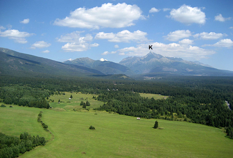
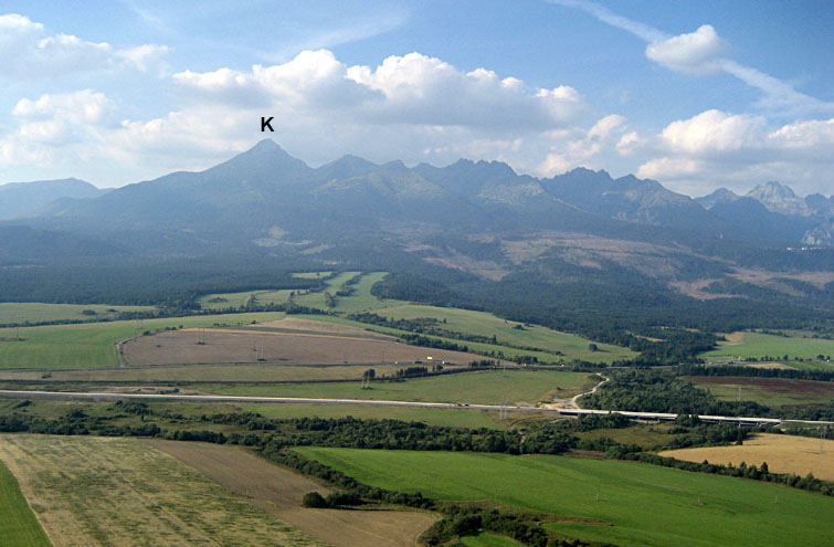
| Northeastern view showing the the High Tatras in the distance. K = Kriván peak (2495 m) at the western end of the High Tatras. |
| Wide-angle view toward the northeast with Vysoké Tatry in the background and foreland of the Západné Tatry in the near scene. |

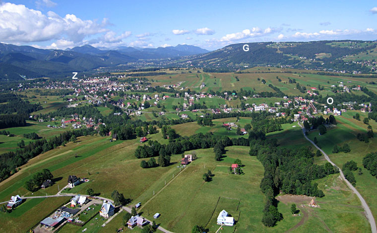
| Closer view toward northeast. K = Kriván peak (2495 m) and G = Gerlachovsky štit (2654 m). Notice the flock of sheep grazing in lower left pasture. |
| Northward view toward the Západné Tatry. ÚD = Úzka dolina (valley) and B = Bystra (2248 m), the highest peak in this sector of the Tatras, near the Slovak-Polish border. |
| Looking toward the southeast, the village of Východná is visible beyond national highway 1 (E50). |
| Southward view with Nízke (lower) Tatry ranges silhouetted on the horizon. |
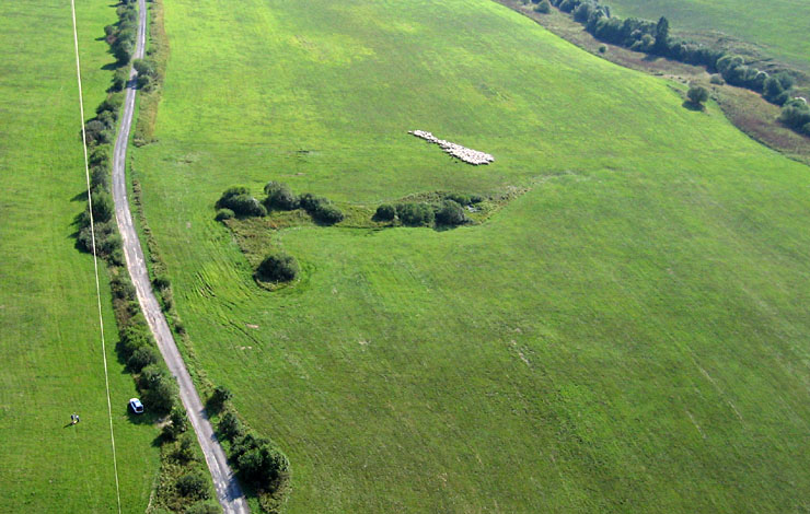
| Shepards direct a flock of sheep across a pasture. Numerous sheep bells made a delightful sound as the flock moved along. Kite flyers in lower left corner. |
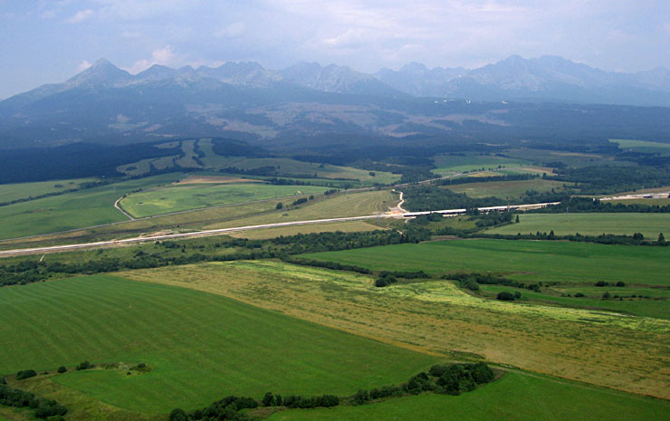
| View northeast toward the main mass of the High Tatra Mountains. Hazy conditions render the peaks barely visible in the distance. |

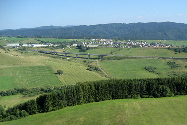
| View toward northwest showing new "autobahn" style highway (E50) under construction. The goal is to complete this highway in three years linking Košice in eastern Slovakia to Bratislava in the west. |
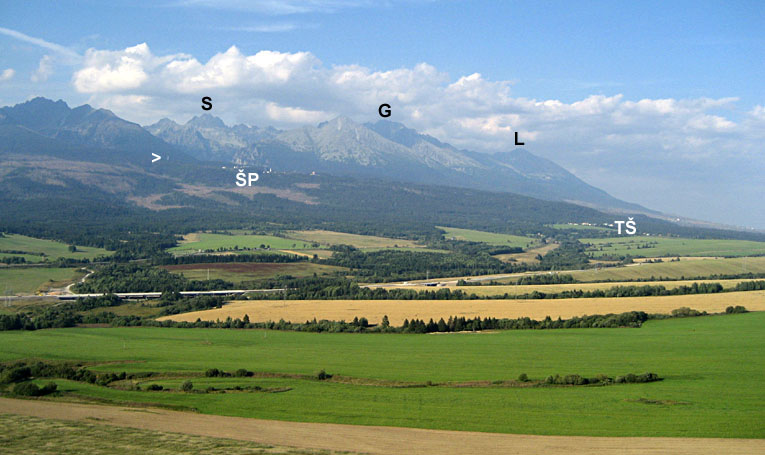
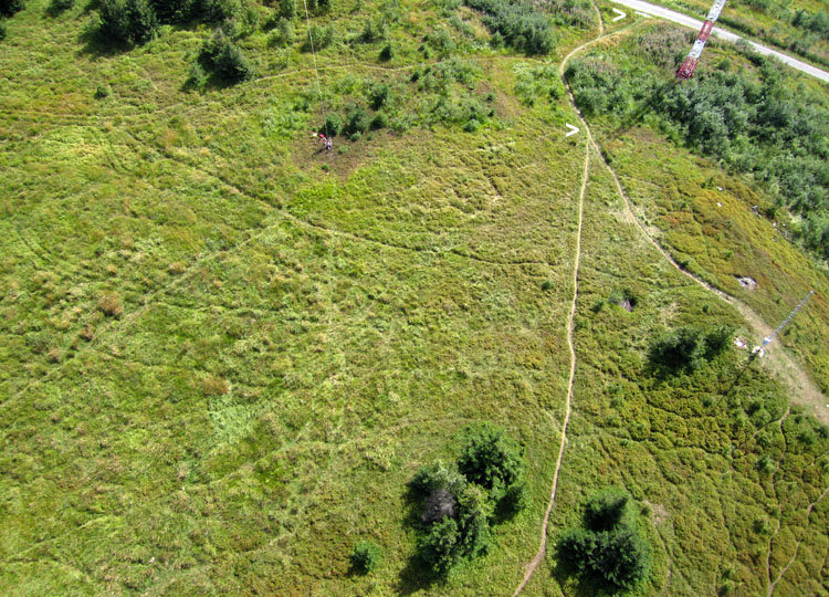
| View toward the northeast on a relatively clear day in the late afternoon. S = Satan peak (2422 m), G = Gerlachovsky štit (2654 m) and L = Lomnicky štit (2634 m). ŠP = Štrbské Pleso and TŠ = Tatranská Štrba. Arrow (>) indicates the ski jump at Štrbské Pleso. |
| Northward view showing the western end of the High Tatras. K = Kriván peak (2495 m), which marks the western summit of the High Tatras. |
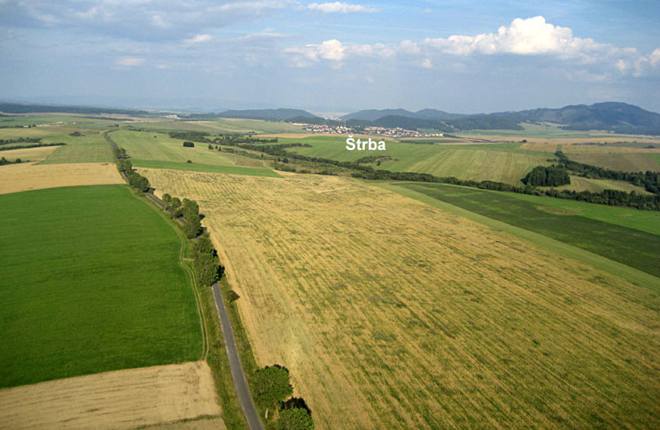
| Late afternoon view toward east along the Poprad depression. The village of Štrba appears in the middle distance (see map above). |
 |
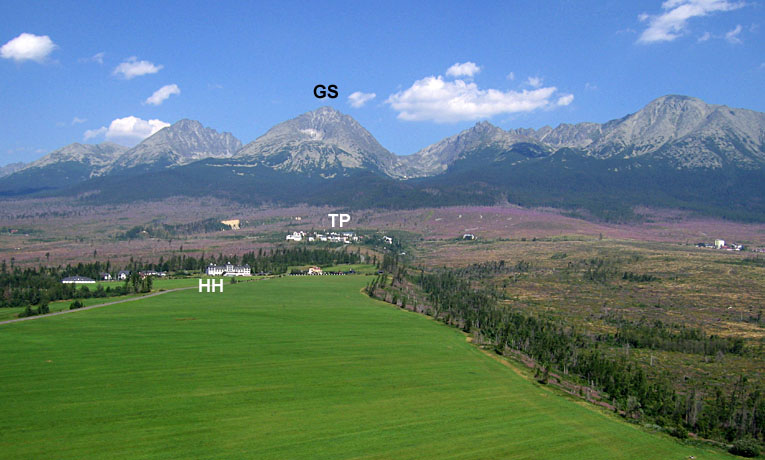
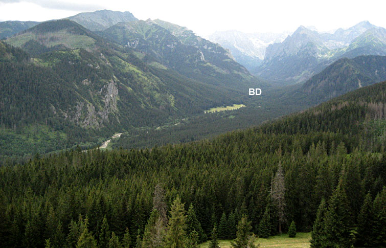
| Northward view to the central portion of the High Tatras. HH = Hotel Hubert, TP = Tatranská Polianka, and GS = Gerlachovsky štit (2654 m), the highest peak in the Tatras. |

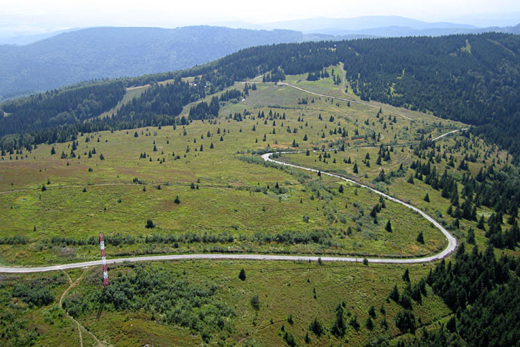
| Wide-angle view toward the west showing the broad foreland slope on the southern (left) side of the mountains. Notice the pinkish-purple zone in the middle distance. This is fireweed in the area of forest blow down. |
| Closer view of pink-purple fireweed blooming in the forest blow-down zone in the vicinity of Tatranská Polianka. Common Fireweed (Epilobium angustifolium) is among the first plants to become established in conifer forests damaged by fire, wind, or insects. |
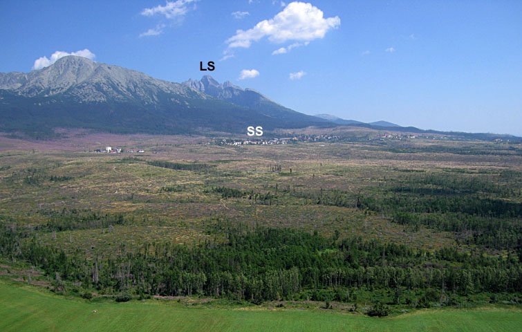
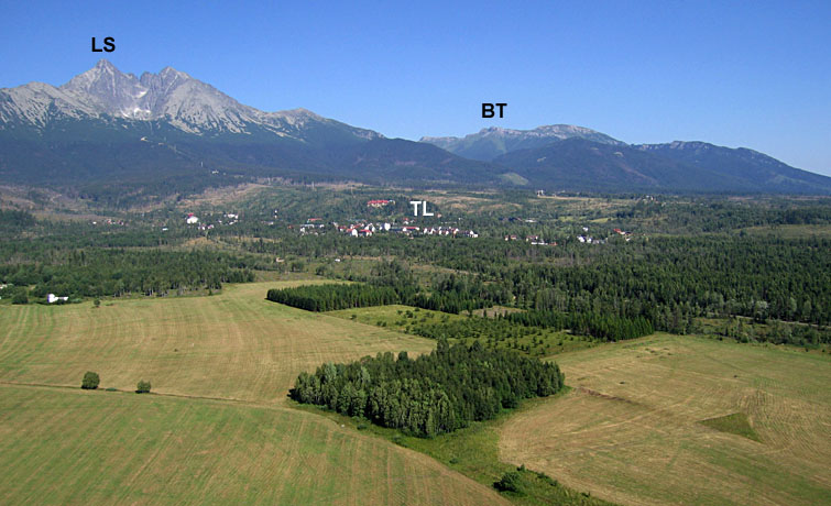
| Wide-angle view toward the northeast. SS = Starý Smokovec and LS = Lomnicky štit (2634 m), the second highest peak in the Tatras. |
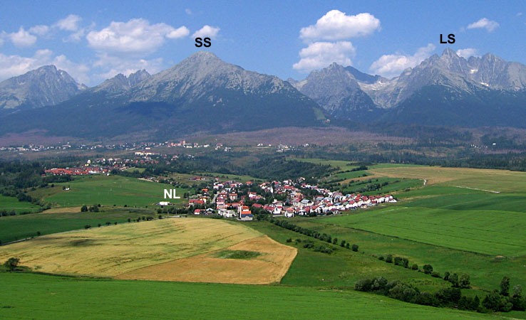
| Village of Nová Lesná (NL) in scene center with the High Tatras behind. SS = Slavkovsky štit (2452 m) and LS = Lomnicky štit. |
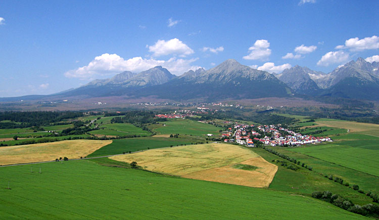
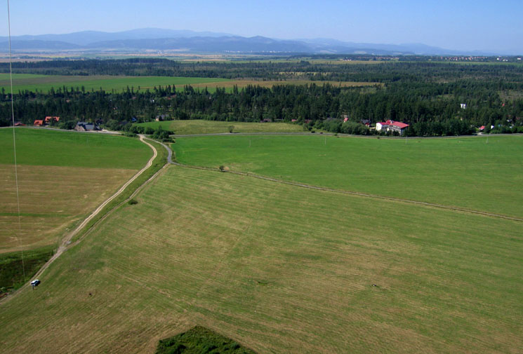
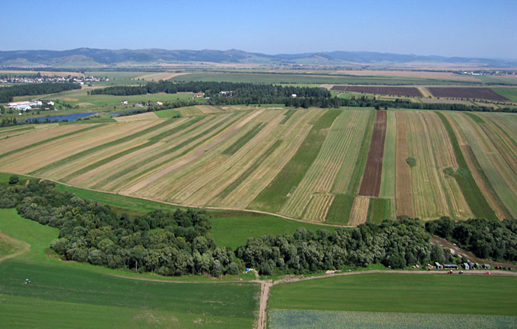
| Wide-angle view toward the west showing agricultural landuse on the lower foreland slope of the mountains. |
| Wide-angle view toward the northeast of Nová Lesná. |
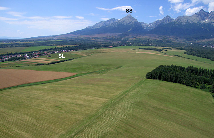
| Wide-angle view toward the west. Notice the broad terraces that slope downward from the mountains toward the south (left). SL = Stará Lesná and SS = Slavkovsky štit. |
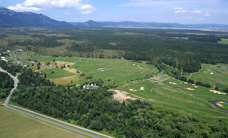
| View northeastward showing part of the International Golf Course along highway 540 near Vel'ká Lomnica. |
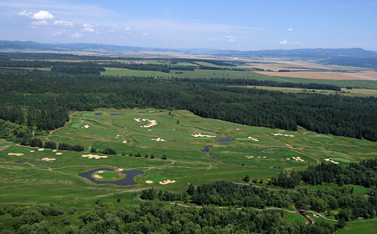
| Closeup showing part of the International Golf Course with numerous sand traps and water hazards. |
| View toward southwest with the Low Tatra Mountains, Nízke Tatry, visible on the distant horizon. Kite flyers in lower left corner of scene. |
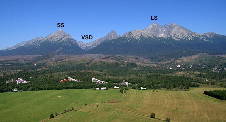
| Northward view toward High Tatras. SS = Slavkovsky štit, VSD = Vel'ká Studená dolina (valley) and LS = Lomnicky štit. |
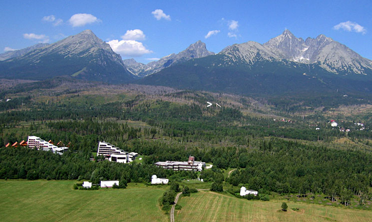
| Closeup view of hotels and observatories near Tatranská Lomnica. Notice the ski jump marked by arrow (>) just right of scene center. |
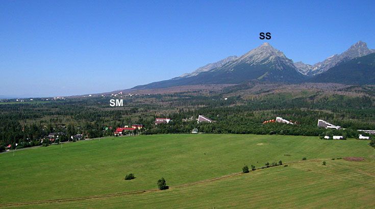
| View toward west, showing once again the long slope of the foreland toward the south (left) of mountains. SS = Slavkovsky štit and SM = Starý Smokovec. |
| Wide-angle view to the northeast. LS = Lomnicky štit, TL = Tatranská Lomnica and BL = Belianske Tatry, the White Tatras. |
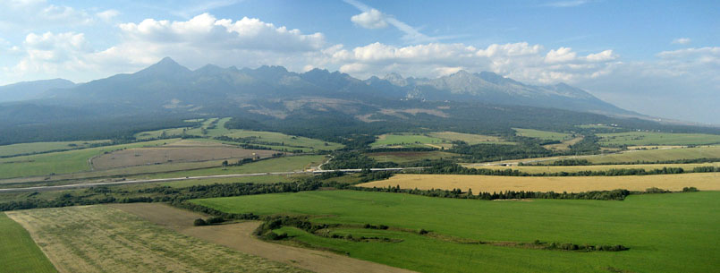
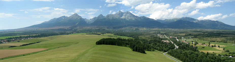 Panoramic view created by stitching together two Canon Elph images using D Joiner. Field of view spans ~140° from west (left) to northeast (right). Compare with single images above. | |
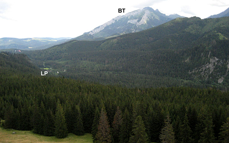
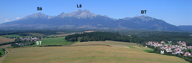 Wide-angle view looking toward the northwest. Sš = Slavkovsky štit (2452 m), Lš = Lomnicky štit (2634 m), and BT = Belianske Tatry, beyond which Ždiar is situated. Villages of Stráne pod Tatrami (ST) to left and Mlynceky (M) to right.
| |
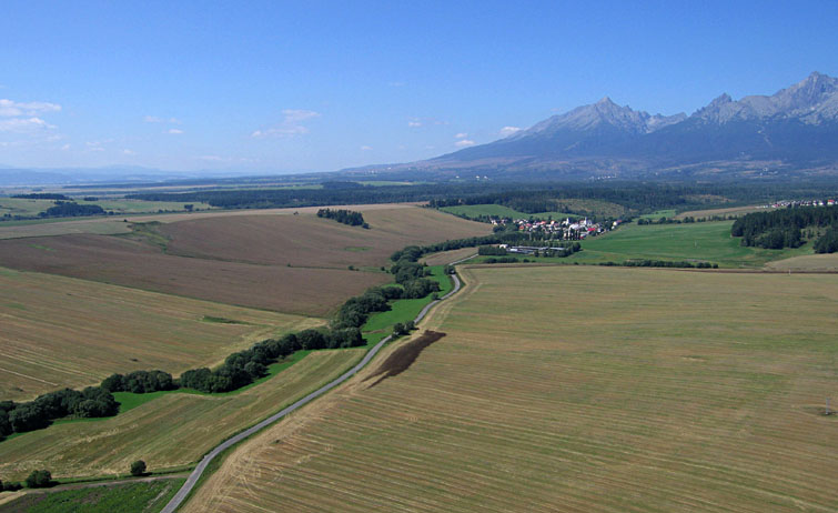
| View westward emphasizing the sloping foreland on the southern (left) side of the Vysoké Tatry. The dark brown patch just below scene center is manure that was spread on the field while we conducted KAP--the smell was unmistakable! |
| Meticulous agricultural land use is evident in this view toward the east. |
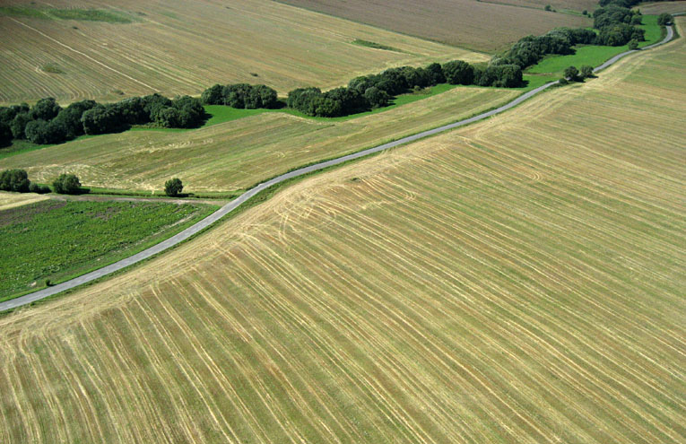
| Intricate agricultural landscape patterns near Stráne pod Tatrami. |

| View toward the east from the high end of the village looking down the valley. The village is long and narrow, following the valley bottom. |
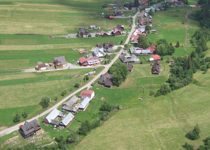
| Closeup view of houses and farms at the upper end of the village. |

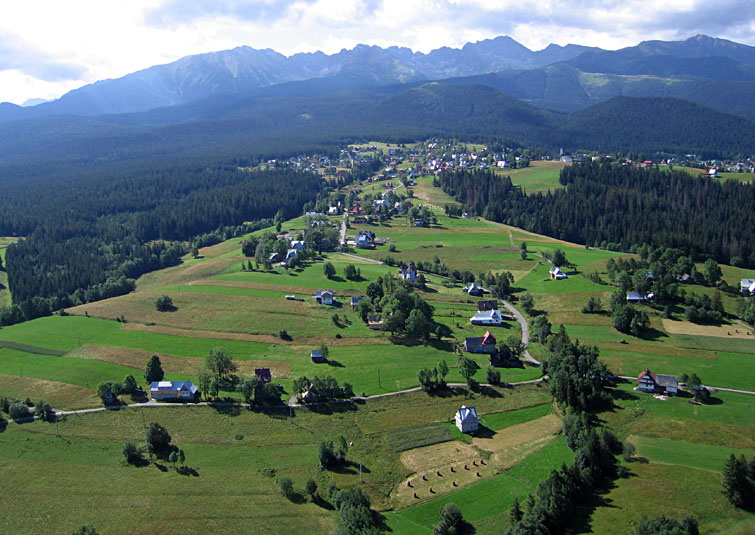
| Parking area for ski lifts at the upper end of the village. Belianske Tatry shadowed in background. This site is just above 1000 m (3300 feet) in elevation. Ždiar is favored especially by Polish and Hungarian tourists for relatively easy skiing. |
 Polish Tatras
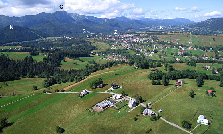
| Overview of Zakopane region looking toward the southwest. G = Giewont (1894 m), N = Nosal ski run, S = Skocznia ski jumps, Z = Zakopane centrum, K = Koscielisko. |
| Overview of Zakopane region looking toward the west. Z = Zakopane centrum, G = Gubalówka hill, O = village of Olcza. |
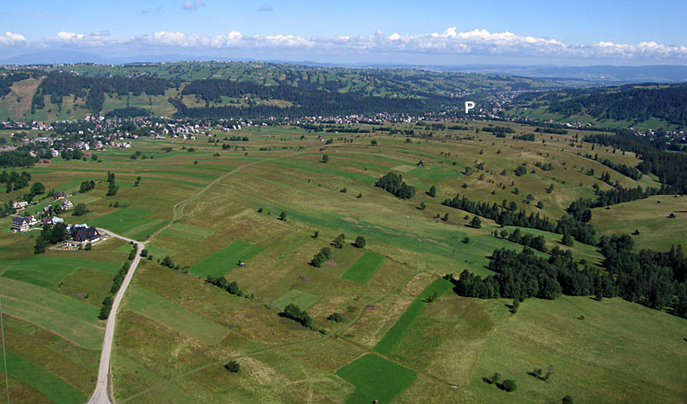
| View northward with agricultural landuse in the foreground and the Bialy (White) Dunajec River valley in the distance. P = Poronin. |
| View toward south with village of Toporowa Cyrhla in front of the forest in the center distance. |

| Near vertical view of landfill at Zoniówka, north of Cyrhla. An older, filled section to upper right; new portion under construction to lower left. Recycling of plastics, tires and other materials takes place here also. |
| The authors with our Polish colleagues, from left: Maria Górska-Zabielska, Ryszard Zabielski, J.S. Aber and S.W. Aber. Notice the hot spot (bright patch) to left indicated by arrow (>). The shadow of the camera rig appears at the center of the hot spot. For more explanation, see opposition effect. |
| View toward the south up the Bielovodska Dolina (BD) into Slovakia. This valley displays the classic features of a glaciated alpine valley--steep side walls and rounded valley floor. |
| Eastward view into Slovakia. LP =Lysa Polana and BT = Belianske Tatry. The Belianske Tatry are composed largely of limestone. |
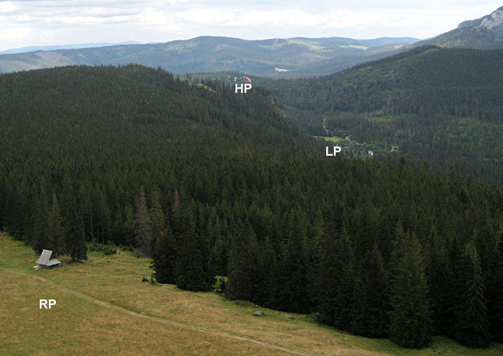
| Closeup view toward the east. The edge of Rusinowa Polana (RP) can be seen in the lower left corner. HP = Hotel Polana, LP =Lysa Polana. |
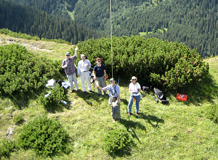
| The authors with Polish colleagues, from left: Maria Górska-Zabielska, Andrzej Iwanow, Ryszard Zabielski, J.S. Aber and S.W. Aber. We are flying from a narrow ridge next to a popular mountain trail (see next image). |
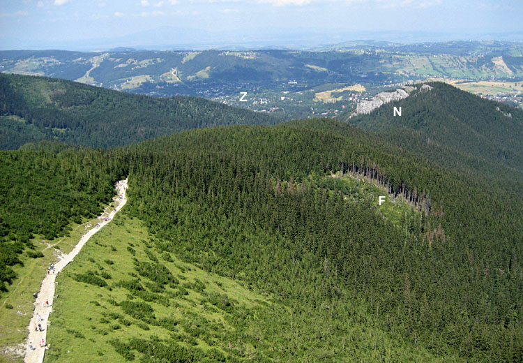
| Trail up the side of Skupniów Uplaz ridge. Z = Zakopane and N = Nosal. F indicates a forest zone damaged by a wind storm. |
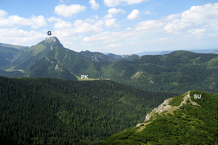
| View to northwest with Skupniów Uplaz (SU) ridge in the right foreground and Giewont (G) peak on the left horizon. PK = Polana Kalatówki. |
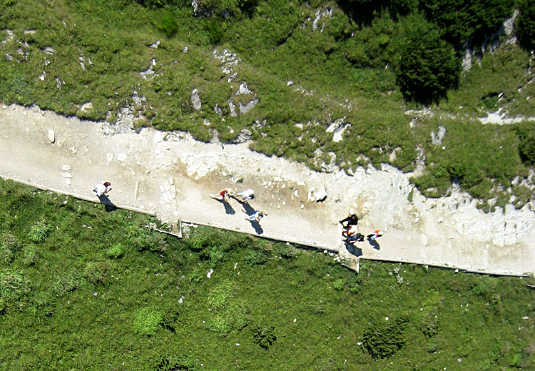
| Closeup view of people on the trail. |

| View toward northeast. KM = Kopieniec Maly, KW = Kopieniec Wielki, SW = Suchy Wierch and KP = Królowa Polana. This was our highest KAP site, just over 5000 feet elevation. |
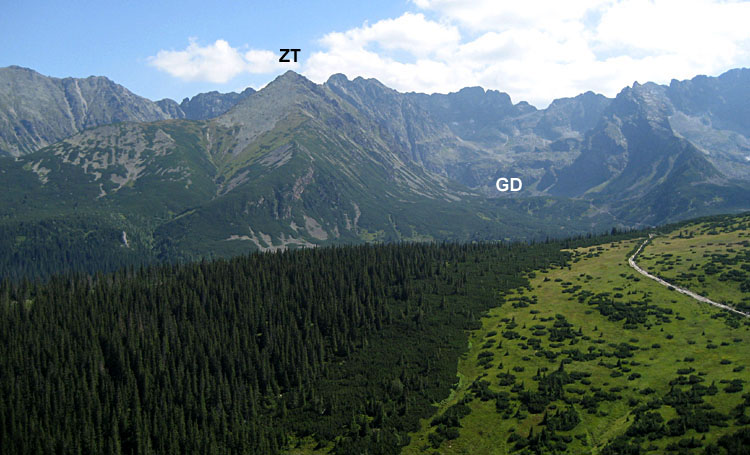
| View toward the southeast. Zólta Turnia (ZT) peak is 2087 m elevation, and to its right is the Gasienicowa Dolina (GD) valley. On far right can be seen the trail to Hala Gasienicowa. |
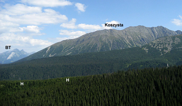
| Koszysta ridge exceeds 2100 m elevation, and the Belianske Tatry (BT) can be seen in the far left background. Herbik (H) is a lateral moraine formed by a glacier in Dolina Suchej Wody (valley), which is largely hidden just beyond Herbik. |
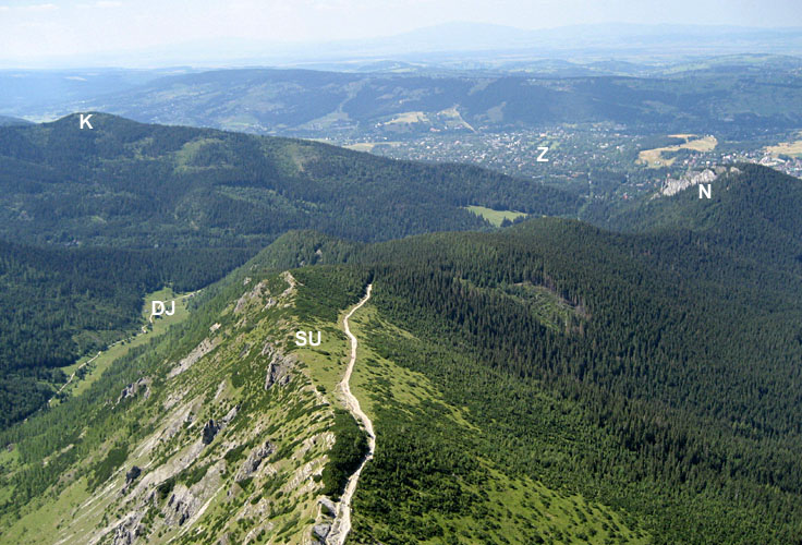
| View toward the northwest over Skupniów Uplaz (SU) ridge. The marked site was used for KAP (see above). K = Krokiew, DJ = Dolina Jaworzynka, Z = Zakopane, N = Nosal. |
 |
We conducted KAP on a day that was hot, hazy and windless in nearby lowlands. However, the mountain top had plenty of cool wind. The large rokkaku flew like a tiger, lifting the Canon S70 rig easily. We positioned ourselves immediately downwind from the observatory and away from numerous instrument towers that could pose a hazard to our kite.
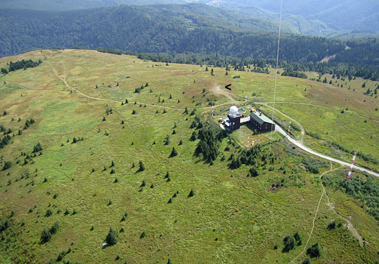
| Overview of the meteorological observatory and the bare top of Kojšovská hol'a. The point shown with arrow (<) is the high spot with markers and a hiker sign-in book. Kite flyers in lower right portion of view. |
| View toward south showing the access road to the observatory. This road is closed to vehicles, but is open for public walking and bicycling. The whole area is used for skiing in the winter. |
| Westward view over forested mountain ranges. On left is a hotel that is undergoing renovation; this is where we parked to walk up to the observatory. |
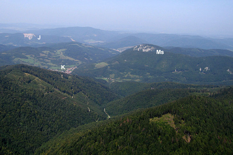
| View northward. J = active mines in the vicinity of Jaklovce, K = village of Kojšov, Ms = Murovana skala, a cliff of Mesozoic carbonate rocks. |
| Strong hot spot appears in the lower left corner of this view. This lighting condition is often quite remarkable over conifer forest. For more explanation, see opposition effect. |
| Kite flyers at top-center of scene next to a small alpine meadow. The path marked with arrows (>) is used for the Košice bicycle marathon. Numerous other trails and paths cross the meadow. |
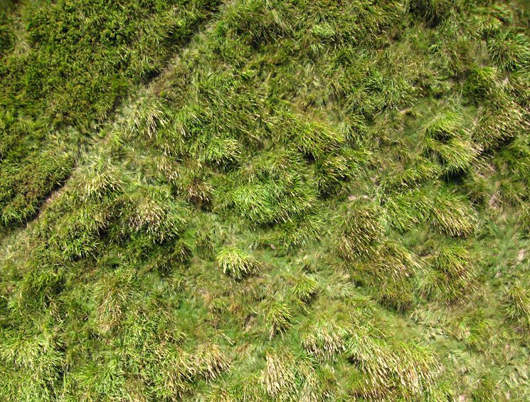
| Closeup, vertical view of vegetation in the meadow. Notice diagonal paths crossing at left side of scene. |
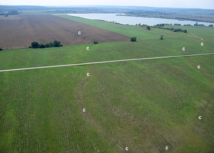
The floodplain is utilized in three ways: extracting of sand and gravel, pumping ground water, and growing crops. Of the latter we observed corn, sunflowers, and hay fields. However, all these enterprises are subject to damage during flooding.
| View toward the north showing the meander belt of the Hornád River. The river channel is marked by trees. Village of Valaliky in the center distance. |
| Looking over the Hornád River in foreground toward the southeast. All of the area beyond the river lies in Hungary. |
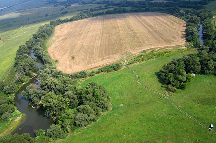
| Overview of a large meander loop of the Hornád River, which flows from left to right in this scene. Note agricultural land use within the loop. Kite flyers in lower right corner. |
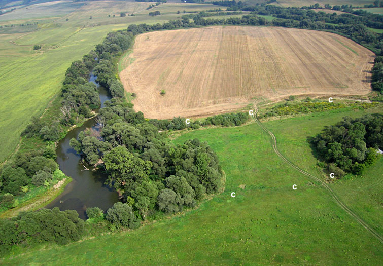
| Closer view of large meander loop. Overflow flood channels (c) cut across the narrow neck of the loop. |
| Northward view showing shallow channels (c) on the floodplain next to the Hornád River (under trees on the right side). These channels show obvious evidence of recent scouring and erosion during flood events. The white building is a water well. |
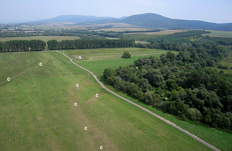
| View toward the southwest showing overflow channels (c) leading toward a large lake in the distance. This lake was created artifically by exploiting sand and gravel beneath the floodplain. |
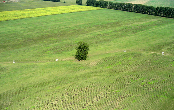
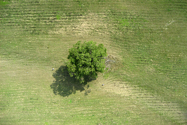
| Lone cottonwood tree stands beside a channel (c) across the floodplain study area. The dark stripes in the field are plant remains from hay mowing. |
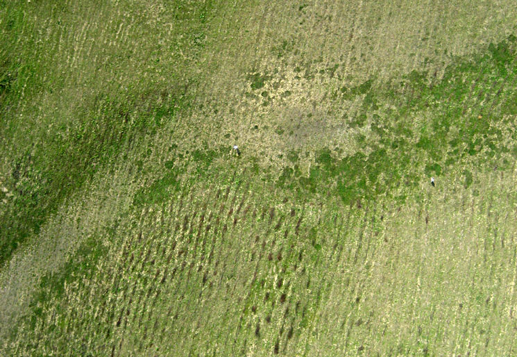
| Near-vertical view of overflow channel with a double bend on the floodplain. The channel is marked by differences in soil and vegetation cover. JJ standing near center, SWA to right side. |
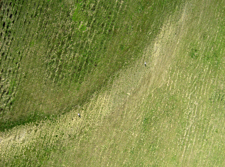
| Near-vertical view of overflow channel at the lone cottonwood tree. JJ standing to left, SWA to right side. |
| Near-vertical view of overflow channel curving across the floodplain. JJ standing to left, SWA to right side. |
| Near-vertical view of a water-well structure. The white well house stands on a raised mound to protect it from flooding. JJ and SWA at far left side of scene. |

| Closeup vertical view of tractors parked next to water well; the farmers are taking a lunch break. |
Kite aerial photography was accomplished on a hot day with extremely light southerly wind using a large rokkaku kite (without tail) and the Canon Elph camera rig. We flew from a small hill top southeast of the castle.
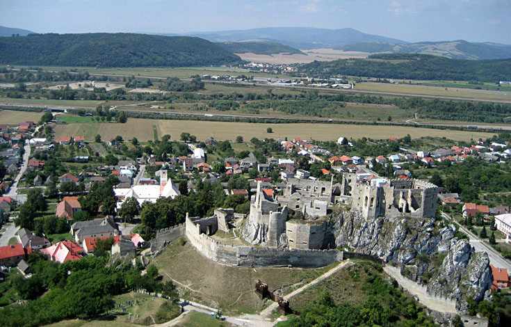
| Overview of Beckov castle, village, and the Váh River valley looking toward the west. |
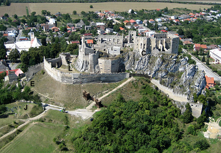
| Beckov Hrad details. E = entrance to the castle, L = lower courtyard, C = renaissance chapel, J = Jewish cemetery outside the castle. |
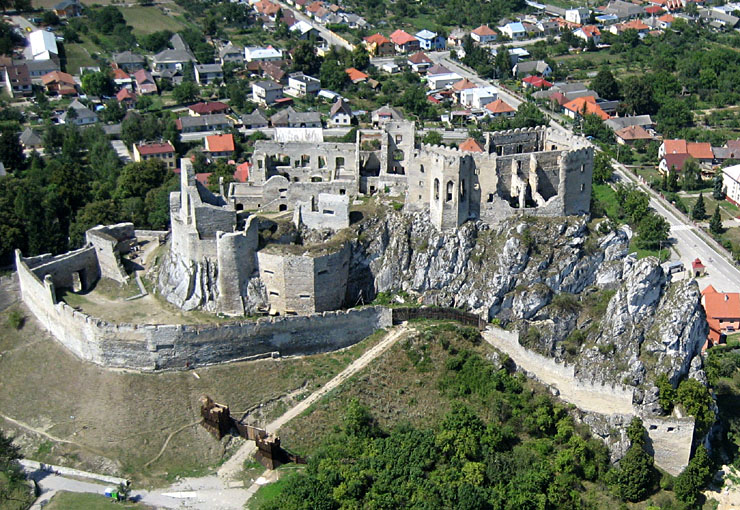
| Closeup view of Beckov Hrad built on a pinnacle of Triassic dolostone above the village. |
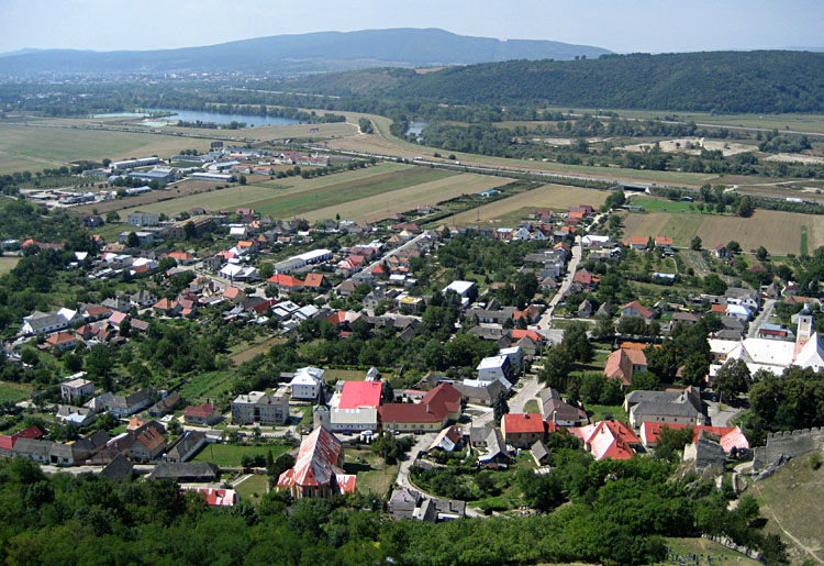
| View toward the southwest over the village of Beckov with the Váh River valley in the background. Entrance to the castle is visible in lower right corner. |
| Northward view along the eastern side of the Váh River valley. Summer cottages and gardens appear on the hill slope to right-center of scene. |
![]() Back to top.
Back to top.
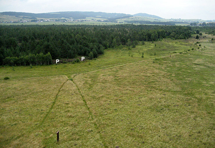
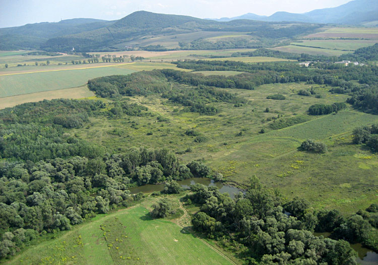
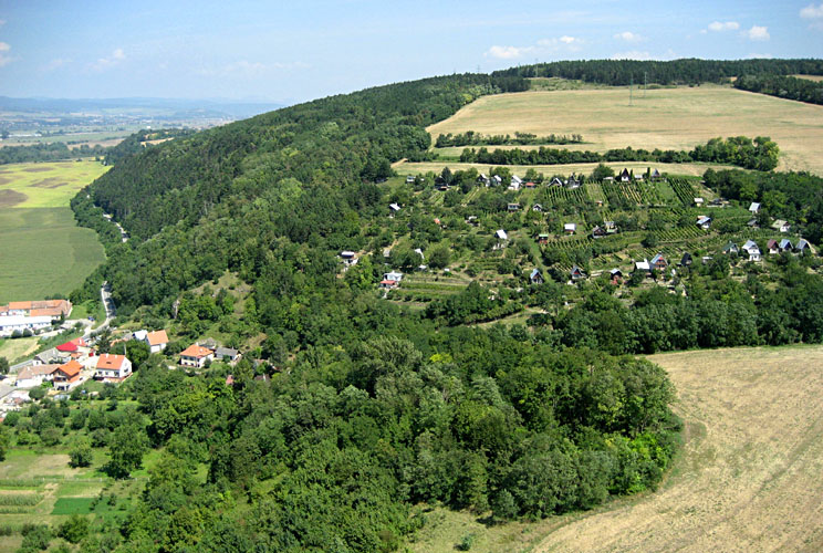
| Overview of public nature trail in a bog complex. In the foreground is a wet hollow covered with heather, blueberries, sedge, rush, and moss--typical bog vegetation. The forested background is a raised hummock with peat (P) exposed along the hummock edge. |
| Linear patterns reflect drainage and mowing in the wet hollow portion of the bog. |
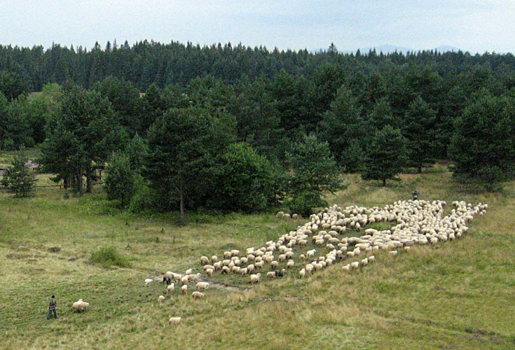
| Moving a herd of sheep from grazing in the bog to a corral for milking and shearing. Sheep cheese is produced in a smokehouse nearby. |
![]() Return to KAP gallery.
Return to KAP gallery.
Last update: Sept. 2007.