2007 Summer Slovakian AdventureS.W. and J.S. Aberwww.geospectra.net/slovakia/views3.htm |
|
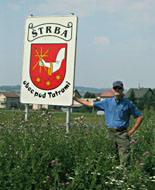
Poprad, Slovakia
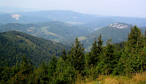
In addition to photographing the High Tatra Mountains we worked one site in the Low Tatras. That trip is documented below. On the way we drove by several caves in the karst region of Slovakia. If you do not have a good map and patience, the caves may be difficult to locate. It is important to realize entrance to caves may be seasonal and they are often closed on Mondays.
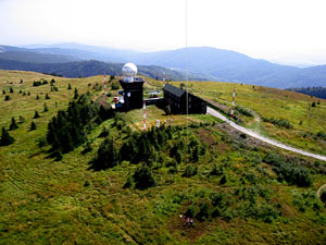
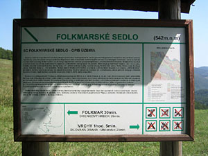
The poster explains the geology of this mountain pass located at 543 meters, which we photographed from the air. We were standing at an elevation of 1246 meters and the kite was even higher!
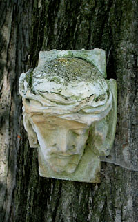
Also at this stop beside the road was a religious monument and this stone carving was attached to a tree providing cool shade.
Views from Slovakia Three
Beautiful scenes are numerous in Slovakia! Follow along on our adventures through the online kite aerial photographic images, www.geospectra.net/kite/tatra.htm, to ground images of the Vysoké Tatry or High Tatra Mountains, Lomnický Štít , Spiš Castle , and Ždiar at www.geospectra.net/slovakia/views.htm, Slovakia One. Additional pictures and text feature our USA visitors and areas we toured with them in Austria and Slovakia including Lomnický Štít, Beckov Castle, Liptovsky Castle, Betliar Manor, and others at www.geospectra.net/slovakia/views2.htm, Slovakia Two. Slovakia Four, www.geospectra.net/slovakia/views4.htm, features Štrba and Košice. This webpage includes Slovakian castles located at Kezmarok and Strecno
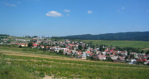
Poprad is a city of about 50,000 with convenient proximity to Vysoké Tatry. There is a narrow gauge train service from the city to the villages and services for high mountain excursions. It was also the nearest city to Štrba and we visited and shopped there often. General pictures of the area follow.
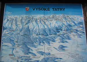
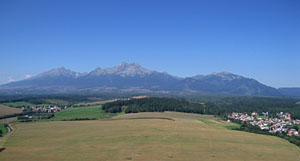
This poster of the High Tatra Mountains is located in Štrba, which is the village positioned in the left, lower portion of the map. Poprad is on the right, lower portion of this relief map of the area with snow!
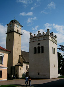

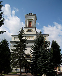
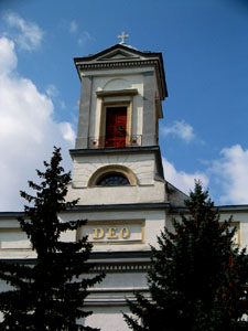
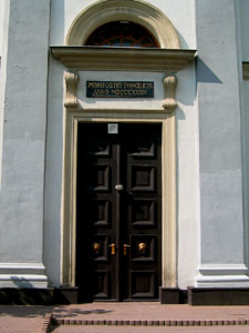
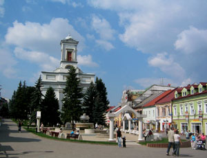
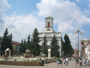
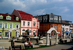
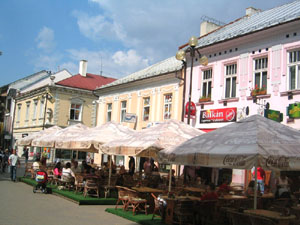
A pedestrian area is in the center of the city where businesses, churches, and a museum are all found. There are two churches Catholic and Evangelical. In many Slovakian cities we noticed the two churches are located in the center with roads or walkways for cars or pedestrians split around the two important cornestones of the community. This is the case in Poprad and Catholic Church is shown above and below.
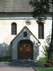
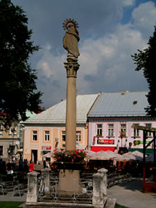
The statue, above and to the right, is located between the two churches. The church shown below is the Evangelical Church, which dates from 1834.
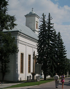
Below you can see the pedestrian way on both sides of the church. A fountain and park is in the foreground of the images, just north of the church.
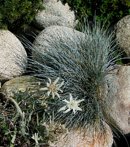
A reminder of the High Tatra Mountains can be seen in the planters by the fountain where edelweiss (Leontopodium alpinum)is growing. This plant is in the sunflower family (Asteraceae) and a well-known European mountain flower.
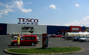
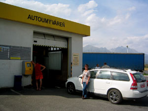
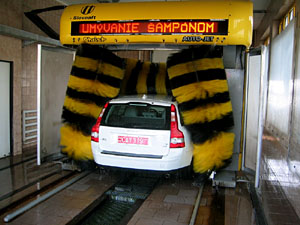
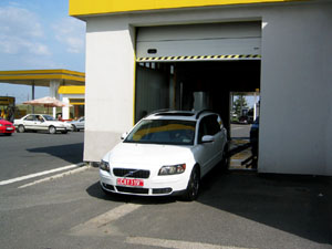
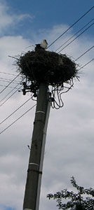
While there are many great shops in the downtown area, Poprad has a HyperNova mall and other stores around the city. One variety store we visited is called Tesco. It is conveniently located for us on the west edge of the city and open nonstop. Also located on the west edge is a Slovnaft gas station and car wash! Between Štrba and Poprad was good luck in the form of a stork nest.
Kezmarok Castle
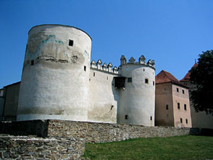
Kezmarok is located north of Poprad less than 20 kilometers on highway 67. It is a city with many historic buildings. Specifically, Catholic, Lutheran, and Protestant churches, as well as the 15th century castle shown below.
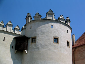
The wooden structure attached to the side of the castle seen in the images above is likely a WC (toilet) added sometime after the original building was erected. The inner courtyard has the water well visible, now with an iron grate covering.

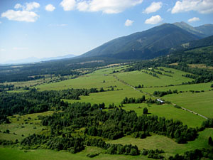
The Tatra Mountains can be seen when looking west from Kezmarok. This rural scene shows the villages of Stráne pod Tatrami, to the left, and Mlynceky, to the right, as well as forests and crops in an undulating landscape. Crops are divided into long narrow segments and carefully tended. This is true for most cropland in Slovakia and the primary rural life in small villages, each with Catholic and Protestant churches.
Several of the photos below were taken from a camera suspended from a kite line!

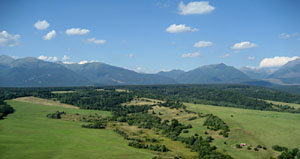
Poprad and Kezmarok are on the eastern side of the High Tatras. The next images are from the more westerly end of the high mountain range near Pribylina. These four photos are from the kite's eye view as well. The camera was about 100 to 150 meters (300-500 feet) above the ground.
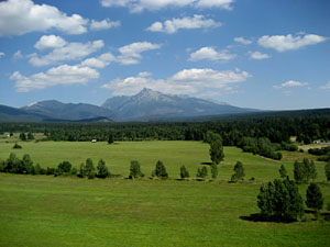
Another village that rings the High Tatra Mountains is Východná, which is shown from the ground in the image below. The image to the right is from the kite vantage.

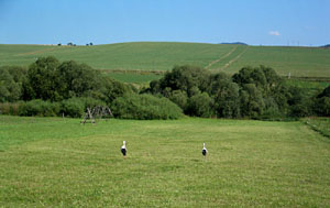

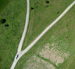
We see sheep and storks on the ground. As we conducted kite aerial photography, the sheep herder moved the herd together, which you can see from the air! Although the storks are too small to be seen, the view of the mountains is stunning.

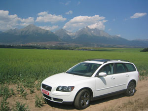
Our new field vehicle has been terrific as well. Comfortable travel, work, and pleasure on many kinds of roads.
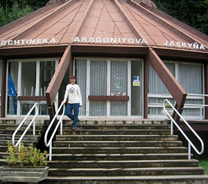
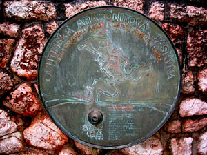
There are many mineral and ice caves in Slovakia. Entrance to an aragonite cave, Aragonitova Jaskyña, and a medallion with the known rooms and tunnels is shown here.
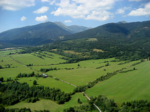
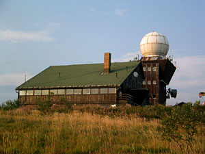
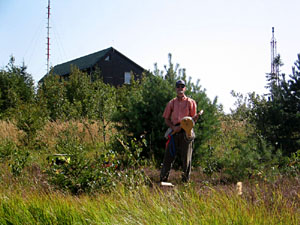
A meteorological station is located at 1246 meters in the lower Tatras near Košice.
We conducted kite aerial photography in a high mountain wetland with heather and mushrooms!

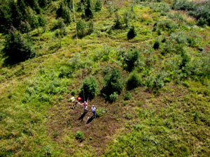


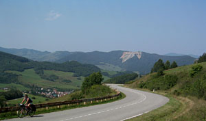
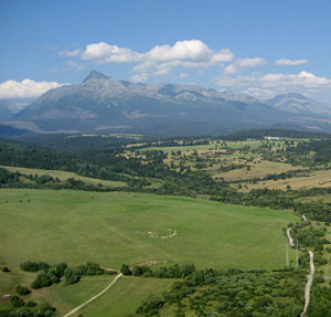
We drove in the direction of the kite views on our way back to Štrba and located some of the areas we photographed from the air. One site was Folkmarské Sedlo.
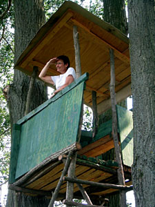
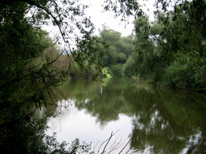
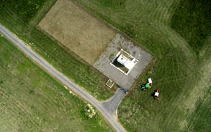
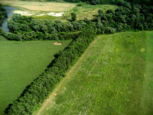
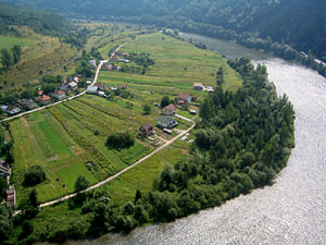
Another area of interest for kite photography was at the border of Slovakia and Hungary. This border is defined at this location by a meandering river with paths taken in times of flood visible from the air. The former border patrol tree house has been refurbished and provides a great view of the corn field and surroundings! We set up near a water well and the pictures can tell the story from here.
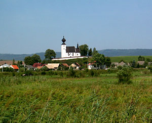
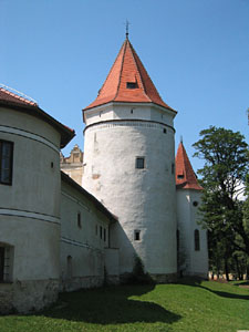
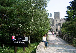
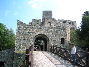
...but back on the ground and some distance away, is another pastoral view of a church at Zehra. which is followed by images of Strecno Castle below!
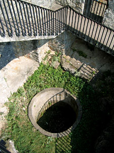
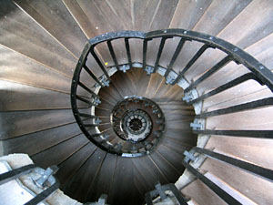
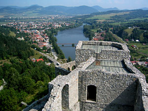
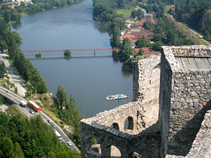
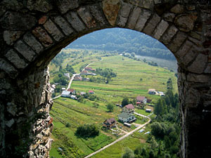
Finally, images from our visit to Strecno Castle. The castle is situated high above the Váh River. These pictures may look like kite aerial photography, but in fact are the super views from the castle itself. In one image you can see a car ferry crossing the river.
Return to the top.
For more information, visit
Copyright 2007. All rights reserved. For more information contact S. W. Aber, e-mail: saber@emporia.edu Thanks for visiting! Webpage created: August 2007; last update: August 28, 2007.