2007 Summer Slovakian AdventureS.W. and J.S. Aberwww.geospectra.net/slovakia/travel.htm |
|
Berchtesgaden was occupied during the Bronze Age as nearby Celts mined salt at Dürrnberg mountain in Germany, which is near present day Hallein in Austria. More on this below.
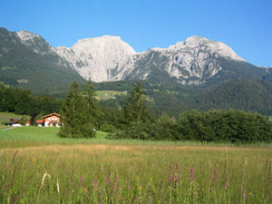
Roads were improved as early as the 1800s and this area of Central Europe became a Plant Protected Area in 1910, a Nature Preserve in 1921, and National Park in 1978. We stayed at this former hunting lodge and enjoyed nothing but beautiful views of the Alps in all directions.
Initially, underground mining of salt extracted the surrounding rock, but later a brine method was used. Evidence of the early mining is recorded in artifacts found that suggest salt was traded from the Baltic Sea to Italy, and from France to Hungary. However, with the rise of the Roman Empire, Romans were able to produce salt from oceans and salt mining at Dürrnberg mountain was halted for hundreds of years.
This salt mining process needed firewood for the tunnels and for heating the brine to evaporate for salt production. This resulted in leveling nearby the forests and a brine pipeline was constructed in the early 19th century to shifted the burden on cutting trees and allow some areas to regrow forests and improve hunting and the natural landscapes.
When mining tunnels moved across the Austrian border into Bavaria, a war ensued. Austria lost, Dietrich was removed from his position and died in prison some 5 years later.
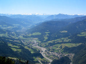
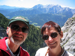
Views of Southern Germany and Austria
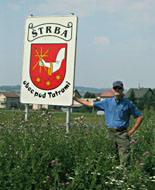
Greetings from Štrba, Slovakia! We are pleased to have an adventure overseas in the 2007 summer in which we will see some of Germany, Austria, and Poland, as well as Slovakia. The primary reason for our stay is to document landscapes in Slovakia through kite aerial photography (www.geospectra.net/kite/tatra/tatra.htm). However, this is not where our journey began. Our flight from the US landed in Munich, Germany, where we picked up a V50 Volvo at a dealership in a small town on the southern end of the greater Munich area.


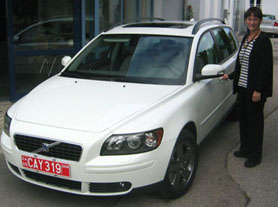
Jim received the keys from Florian Dull, and Susie prepares to get in the driving seat! The car purchase was made from Gorges Volvo in Wichita, Kansas before we left the US. Volvo registered the car with Swedish export license plates, and we took delivery in southern Germany. After our travels, we will return the vehicle to Germany where it will be shipped back to Gorges in Wichita and we will pick it up again. Great company, car dealerships, and people to work with, and we highly recommend this method for obtaining your next vehicle.
Views from Southern Germany
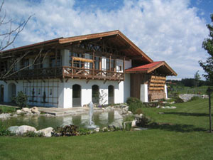
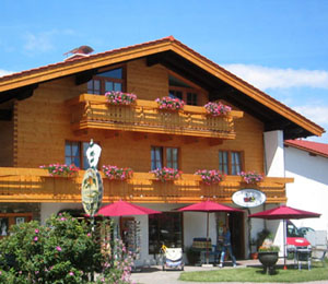
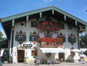
We left Munich and headed east. In order to account for jet lag and be fresh for driving, we took several days to reach our Slovakian destination and first toured some days in Germany and Austria. Below are images of homes, businesses, and folk cultural artifacts in and around Inzell, Germany. This is the Bayern region of southern Germany, also known as Bavaria.
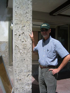
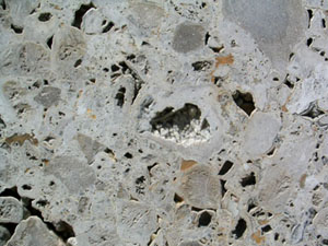
The two images above show the local conglomerate stone used as a facade, building stone. Later we found it used as headstones in cemetaries and paving stone as well. It is a naturally cemented, porous conglomerate with clasts that include geodes!
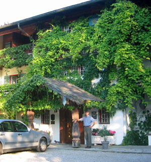
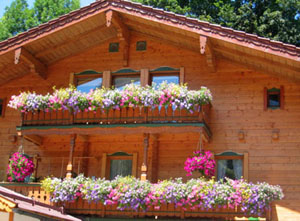
We reached our intended destination, the Berchtesgaden area, and checked in to Stoll's Alpina in Schönau. This area has a long history of pilgrimages, which later became known as tourism! Wooden wares, from toys to clock cases, were produced here and people came to ski, hike, and hunt.

Early postcards from the area pictured in a 1907 Berchtesgaden, a post vehicle to deliver mail and men and women skiers. The women were in floor length long dresses and coats. All were wearing stylish hats! The landscapes and sign posts have not changed but skiing attire is different today.
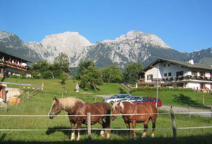
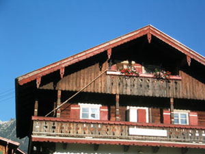
Cows and horses were in the fields, while the importance of the family cat is evident in the house on the right above. A staircase has been built for cats travel safely between the second floor balcony and the third level of the house.
Cats do seem to hold a special place in some homes. We found this cat sunning in the window as we wandered around Berchtesgaden.

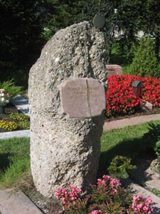
This headstone appears to be the same conglomerate we encountered in Inzell buildings. Individual landscaping for each burial plot was common. This cemetary between Berchtesgaden and and Schönau.
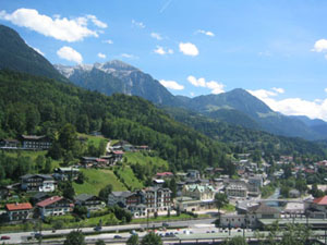
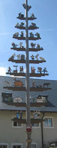
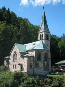
General scene of Berchtesgaden is above and one of the churches in th town is to the right.
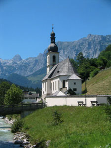
A nearby community, Ramsau, was documented as early as the 14th century. It is surrounded be mountains and moraines of the Alps. Today the old is near the new. Looking in one direction we see the 19th century Ramsau church and in the other direction, new home and business construction.
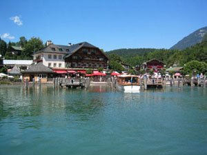
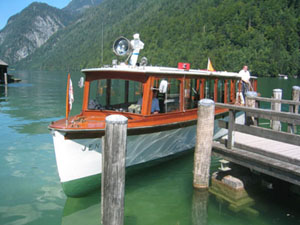
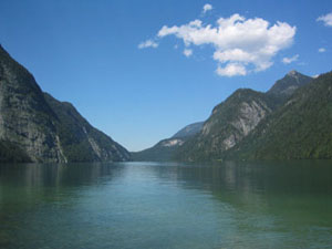
Below are scenes from Lake Königssee, King's Lake, which is advertized as the heart of Berchtesgaden National Park and the only fjord-like lake in Central Europe. The deep valley resulted from a graben structure that was downcut by a river; the valley was enlarged by glaciations to create the 200 meter deep trough shaped valley. The lake provides a lovely setting for summer swimming and boating. We took the tour on one of the electric boats, which date from the 1920s and 1950s. The first electric boat crossed the lake in 1909.
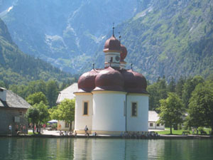
We stopped at the peninsula of St. Bartholomew, a delta built from weathering of Watzmann. St. Bartholomew was consecrated in 1134 at the first Basillica at Königssee. It was renovated in the late 17th and early 18th centuries. The pilgrimage church and former castle form a homogeneous structure. The single-nave design has three semi-domes that together form a clover-leaf. See image below to the right.
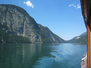
The lake is narrow and measures nearly 5 miles long and at the widest, three-fourths of a mile. The lake is free from pollution because the catchment basin consists of 64% plant coverings, 28%forest, and 8% alpine meadows.

Views from Austria
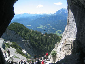
Two attractions we visited in Austria were an Ice Cave at Werfen and a Salt Mine near Hallein, in the region known as Salzberg.
The Ice Cave was cold! Filled with natural ice formations, the temperature was about 1�C (34�F). In winter, cold air rushes into the cave and lowers the ground temperature. During the spring melt, water percolates from the surface and freezes upon entering the cave. During summer and fall, the process is reversed. However, nowadays air flow is controlled by a door that is open in the winter and closed during summer, so the cave is actually gaining ice mass.
The pictures above and below show the situation and entrance to the ice cave. Photographs were not allowed inside.
Salzwelten in Salzburg/Bad Dürrnberg Region
The salt works and mine have a long history in this region of Austria. Athough salt extration is believed to date from the 5th and 4th centures B.C., mining has not been contiuous, and the mine was finally closed in 1989. Today it is a museum to honor historic miners and tell the story of the importance of salt to life and the regional economy.
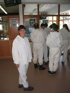
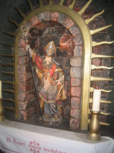
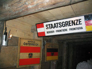
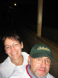
To tour the underground mine, first you must wear the clothing of miners past and pass by a religious alter of salt. We entered the mine on a small train that took us across the Austria-German border. After the train ride, we slid down two historical miners' slides, or Klaus-Rolle. The first slide was 27 meters long and second, 42 meters. Jim held the camera up for our picture in motion.
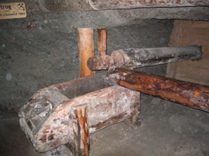
Salt is about 27% of the rock from which it is extracted, first by solid blocks of rock and later by boiling a brine. The earliest record of salt leaching, or mixing the rock with fresh water to dissolve the salt, was 1268. Dissolved salt forms a brine and rock settled to the bottom of mixture. The brine was transported and boiled to evaporate the water and leave crystalline salt, which was formed into pillars with the wooden molds.

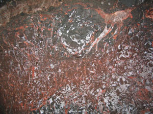
The salt is Permian in age but only some 27% of the surrounding rock, which is clay, annhydrite, and gypsum. Salt tectonics.... Solution mining on a greater scale began when a shaft was drilled into the mountain and a massive leaching chamber was created and repeated for 10-15 years. An enormous underground room was the result and the tour crossed the salt lake in an electric boat! This image shows the salt rock matrix in the ceiling of this rock salt cave.
Much of the tour concentrated on salt mining from the mid 16th century and the influence of Prince Archbishop Wolf Dietrich, who increased salt production to 36,000 tons per year which was not reproduced again until the 20th century mining!

For more information, visit
Copyright 2007. All rights reserved. For more information contact S. W. Aber, e-mail: saber@emporia.edu Thanks for visiting! Webpage created: July, 2007; last update: August 28, 2007.