Ross Natural History Reservation

Emporia State University, Kansas
James S. and Susan W. Aber


Overview of Ross Reservation

The ESU Ross Natural History Reservation was established in 1958. It consists of 200 acres in the Flint Hills upland in western Lyon County, Kansas--see ESU natural areas. The major habitats include grassland, aquatic sites, wooded tracts, and a central building complex. The grassland category can be subdivided into native-grass tracts and abandoned croplands. The major aquatic habitat is Gladfelter Pond, a 2½-acre farm pond that predates establishment of the natural area. Several other smaller ponds also are located on the reservation. The area is underlain by lower Permian shale and limestone of the Council Grove Group, including the Neva and Cottonwood limestones. A small perennial spring exists in the Neva Limestone.

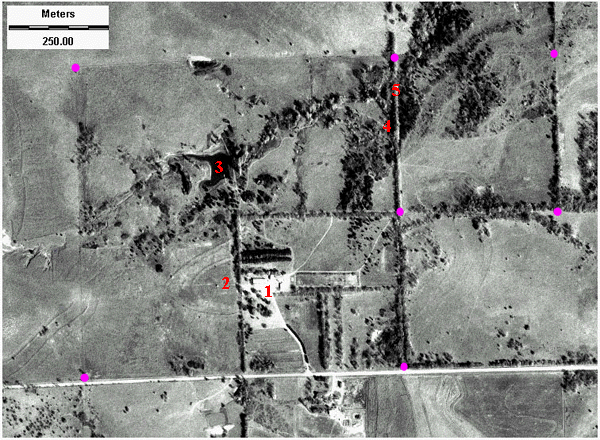
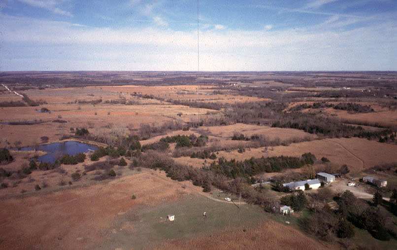
Kite aerial photograph of Ross Natural History Reservation. Building complex is visible in lower right corner, and Gladfelter Pond appears to the left. Photo date 11/98, © by J.S. Aber.
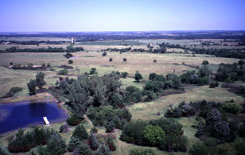
Closeup view of Gladfelter Pond in left foreground. The Neosho River valley can be seen in the background. Photo date 8/97, © by J.S. Aber.

Management practices on the reservation reflect the history of wildlife management in North America (Finck 1990). During the early to mid-1960s, the area was fenced to prevent grazing and prairie burning was not allowed. This policy led to an increase in woody vegetation (trees). In the late 1960s, the strategy was switched to management for wildlife with a major emphasis on game species. Growth of trees was controlled through burning and cutting. Current management emphasizes a "holistic approach" toward complex ecosystems that support game and non-game wildlife within a mix of prairie and woodland habitats. One-third of the reservation is burned each year on a 3-year rotation schedule in order to maintain a diversity of habitats. Beginning in 1997, KAP has been utilized to monitor changes in habitat conditions as results of management practices and natural variations.

KGS GeoKansas--Flint Hills.

Image map of Ross Reservation

Click on the image map below to see additional kite aerial photographs of the Ross Natural History Reservation vicinity. This image is a digital orthophotograph (DOQ) obtained from DASC at the Kansas Geological Survey. The original aerial photograph was taken on Oct. 14, 1991.

Purple dots indicate corner points of the reservation (owned by ESU). 1 = main building complex, 2 = mount for telescope, 3 = Gladfelter Pond, 4 = spring, 5 = old stone bridge on abandoned county road.

Special feature on Prairie burning.

Return to KAP gallery or homepage.
Text and images © J.S. and S.W. Aber (2006).