
| Susan W. and James S. Aber |
|
| Susan W. and James S. Aber |
The first railroad through the pass was completed in the 1870s. Later a new railroad route was built, and the original path was converted into U.S. highway 160. In the 1960s, the highway was rebuilt along yet another route, and the original path was turned into a county road. So, presently at least three routes lead across La Veta Pass--railroad, U.S. highway, and county road. A touristic steam-engine train traverses the pass between Alamosa and La Veta along with freight trains.
Our flying site was a clearing along a power-line right of way at the crest of the drainage divide marking the pass. As mid-day thunderstorms grew rapidly to the east, we flew on a brisk westerly wind that swirled across the ridge. We utilized a large rokkaku without a tail to lift our Canon S70 camera rig. At times the kite flew straight up, even over our heads, on updrafts, and more than once did complete loops. Controlling the kite and camera rig was a dicey situation. After two sessions of photography, the picavet suspension became tangled, and we had to bring the kite down.
| View northward at La Veta Pass. US highway 160 can be seen in right background. Crossing the Sangre de Cristo Mountains, it reaches a crest of 9413 feet near the center of view. |
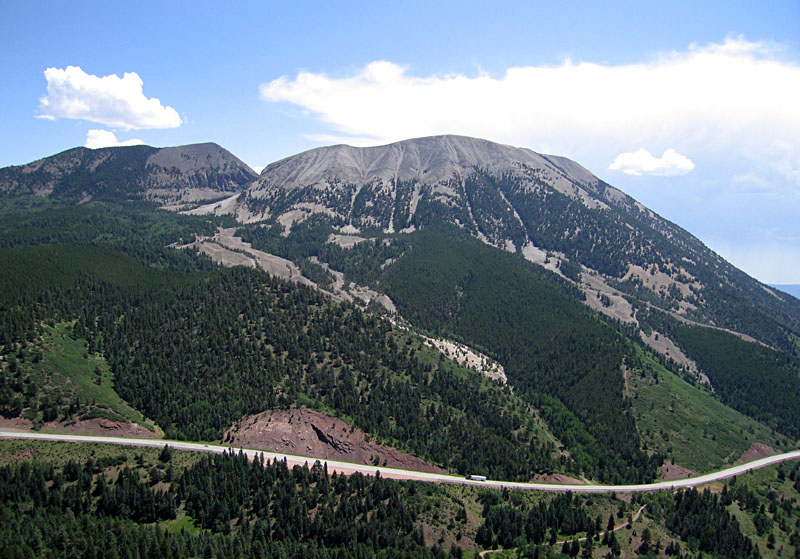
| Looking toward the east; Mount Maestas (right) and Rough Mountain (left) with US highway 160 crossing bottom of scene. Both these mountains are formed by igneous intrusions along the main front-range fault system. |
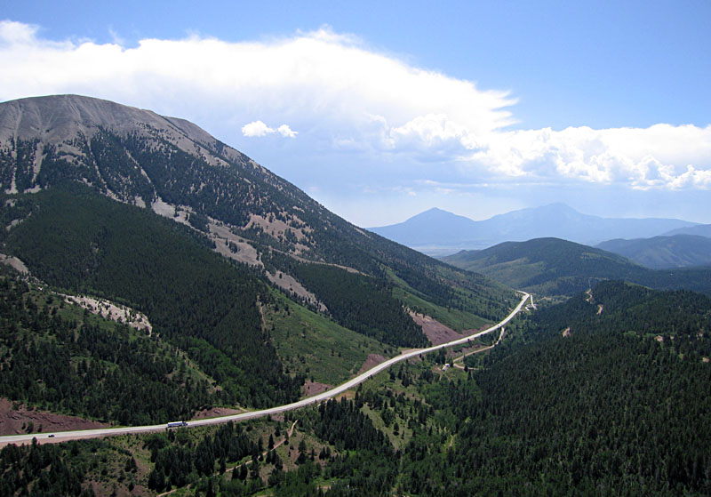
| View toward southeast. Mt. Maestas to left; Spanish Peaks form a silhouette behind a thunderstorm in the right distance. US highway 160 across the bottom of scene. |
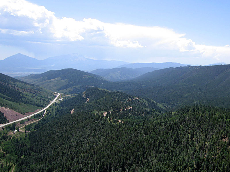
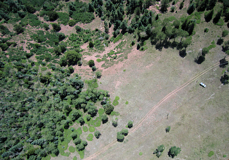
| The road snaking around the sides of the hill at scene center is the county road that follows the original railroad route across La Veta Pass. View toward south; U.S. highway 160 on left side of scene. |
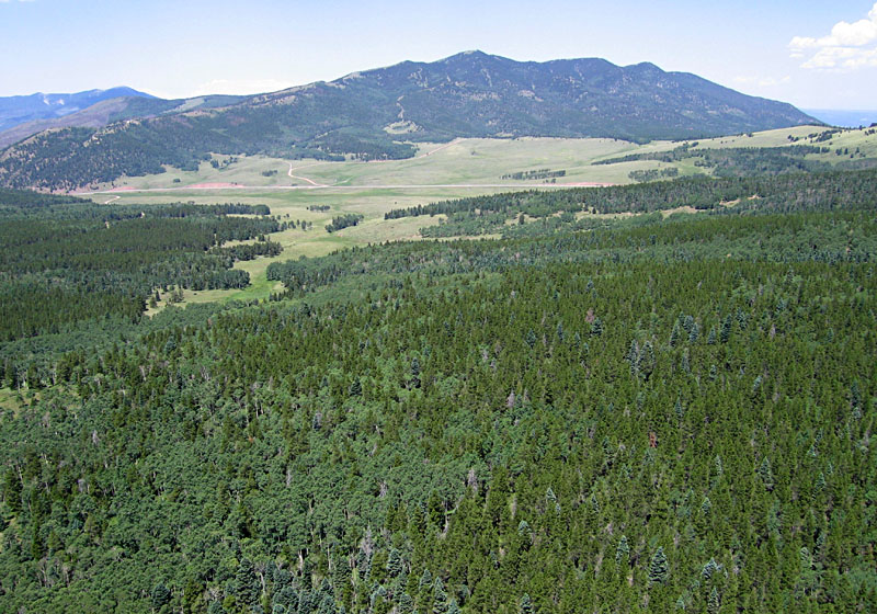
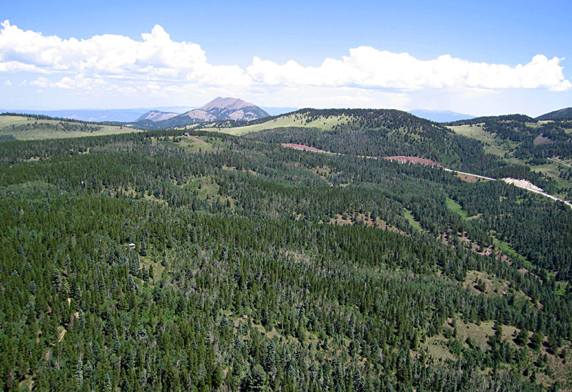
| View toward northwest. US highway 160 descends western side of La Veta Pass in the distance. The open meadow and forest are frequented by elk herds. |
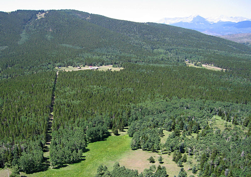
| Looking toward the southwest, the "ghost town" of Old La Veta Pass can be seen in the clearing to left center of scene. This was the original railroad crossing of the Sangre de Cristo Mountains in the late 1800s; depot elevation at the crest = 9382 feet. |
| Near-vertical view of KAP site; kite flyers to right side. Numerous trees, power lines, and turbulent updrafts made for difficult flying conditions in the thin air at this high altitude. |
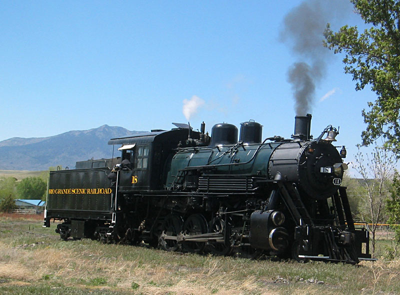
| Ground shot of Rio Grande Scenic Railroad steam locomotive in the switching yard at La Veta, Colorado. |
Acknowledgment: Thanks to Jack Estes for permission to conduct KAP on private land.
![]()
![]() Return to airphoto gallery
or Great Plains airphoto homepage.
Return to airphoto gallery
or Great Plains airphoto homepage.
All images © by the authors (2008).