|
J.S. and S.W. Aber |
| Introduction | Kansa Indians | |||
| Exoduster Cemetery | Exoduster update | Dunlap Cemetery
| Dunlap Bottoms | References & related | |
|
|
J.S. and S.W. Aber |
| Introduction | Kansa Indians | |||
| Exoduster Cemetery | Exoduster update | Dunlap Cemetery
| Dunlap Bottoms | References & related | |
Back to top.
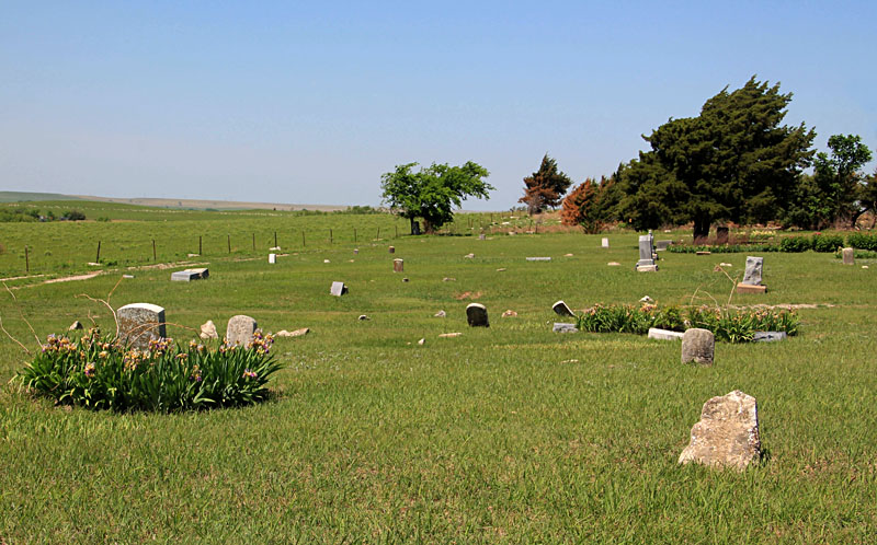
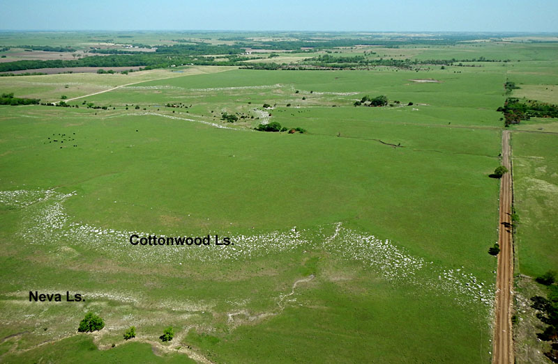
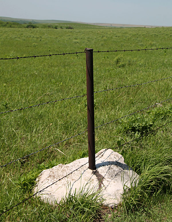
Iris and peonies were in full bloom, and the surrounding prairie was a carpet of green. The cemetery is located on a hill top next to an outcrop of the Cottonwood Limestone, which is prominent in this vicinity. Stone blocks quarried by exodusters in the late 19th century from the Cottonwood Limestone were used to manufacture distinctive stone fence posts that continue in use today throughout the region.
Back to top.
Back to top.
We began to conduct kite aerial photography in the spring of 2015, which turned out to be an unusually wet year (see NOAA). The winter and early spring of 2016, in contrast, were relatively dry. Late April rains dumped several inches (>10 cm) of rain in the vicinity, however, which filled the pools and triggered vegetation greenup. The site was quite muddy, for which the cargo dolly proved useful.
Introduction
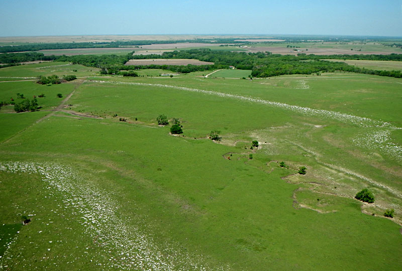
Dunlap is located in the Neosho River valley at the eastern edge of the Flint Hills, which includes the largest tract of tallgrass prairie that still exists in the United States. Owing to rocky soils and steep slopes, crop agriculture is limited mainly to bottomland soil in valleys. Cattle grazing is the primary land use, and ranchers employ controlled burning to maintain the prairie grasses (Hoy 1993). The Flint Hills embody the archetype of the American prairie, and as such the region has become a destination for ecotourism and scientific research (Aber and Aber 2009). The Dunlap vicinity witnessed two important chapters in the history of Kansas (Hickey 1990).
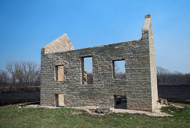
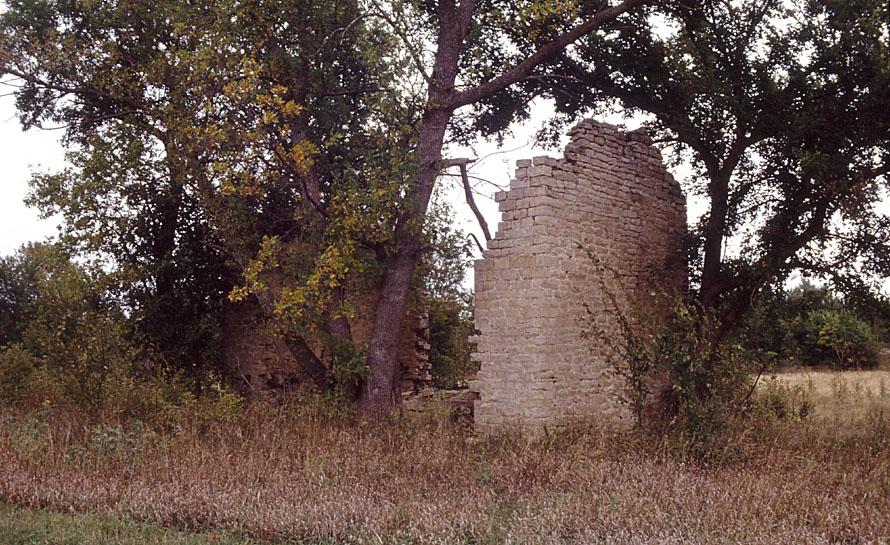
Diminished Kansa Reserve, about five miles northwest of Dunlap. Left: restored stone walls of the main building (2014). Right: prior to reconstruction only a couple walls remained standing amid large trees (1990).
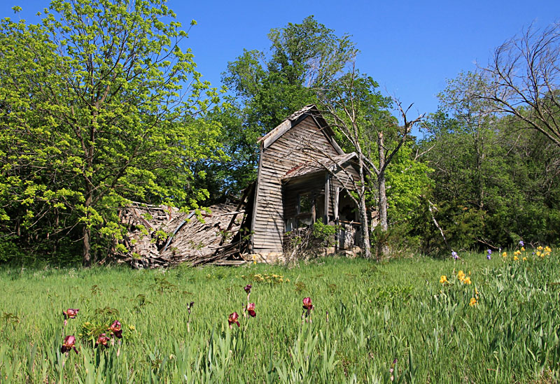
Left: remains of the African-American (exoduster) Baptist Church in Dunlap (2014). Church walls collapsed and were removed the following year. Right: Dunlap Colored Cemetery, established in 1880.
Diminished Kansa Reserve
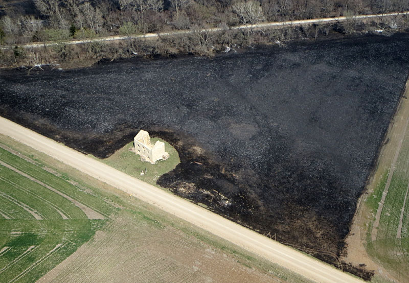
We (JSA & MS) undertook kite aerial photography at the Kansa Diminished Reserve site near Dunlap under light-wind conditions in mid-April 2014. We set up beside a county road. Spring burning was underway in many locations throughout the Flint Hills, which made for a smoky haze, and burning had been done within the past week in this vicinity. The charred prairie contrasted dramatically with green fields of winter wheat.
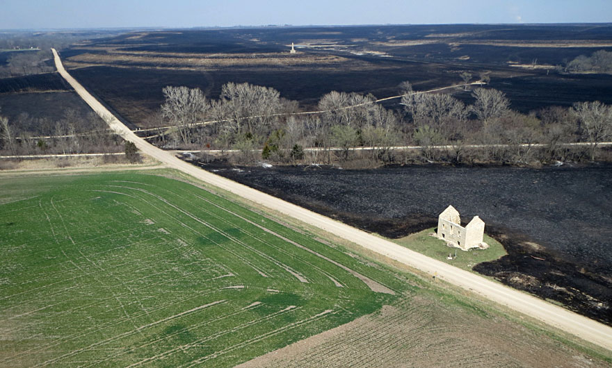
Left: overview of the main building and Kansa Indian monument in the background. The monument is situated in the Flint Hills upland, and the building is located in the Neosho River valley. Right: close-up shot of the partially reconstructed main building within a recently burned field.
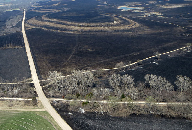
Left: Kansa Indian monument surrounded by recently burned prairie. Note the distinctive rock outcrop pattern. The Flint Hills Nature Trail (former railroad) crosses the lower portion of this scene. Right: kite aerial photographers and a field of winter wheat beginning to green up in the Neosho River valley.
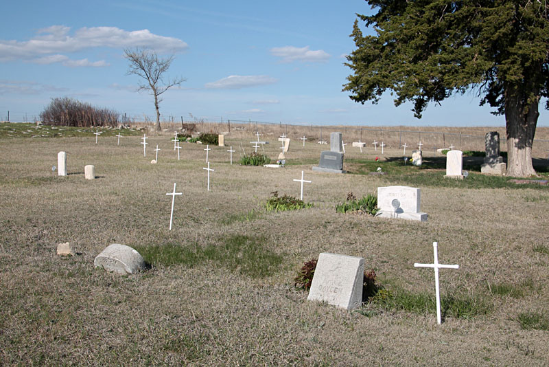
Dunlap Colored Cemetery
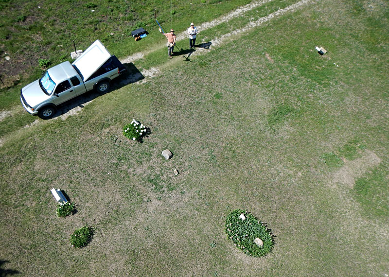
In mid-May 2014, we (JSA & JS) had the opportunity for KAP at the African-American (exoduster) cemetery, official known as the Dunlap Colored Cemetery, about one mile northeast of Dunlap and half a mile north of the city cemetery. A gusty south wind made for somewhat difficult kite handling, but our big rokkaku easily lifted the radio-controlled Nikon GPS camera rig.
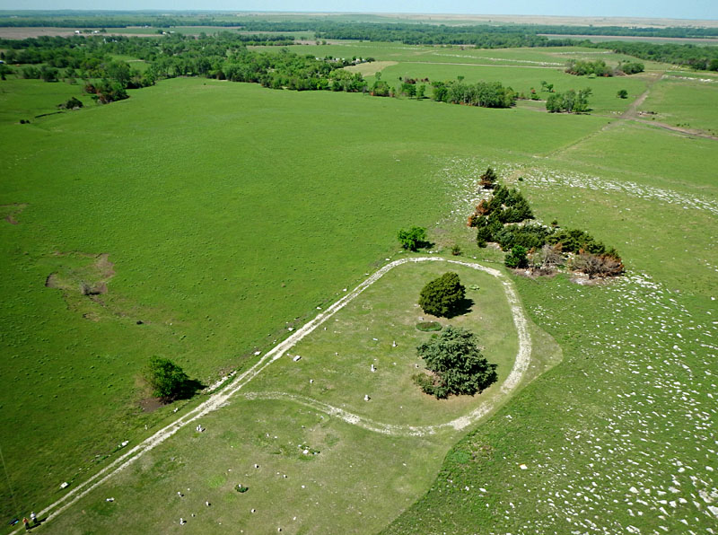
Left: overview looking toward the southwest showing part of the cemetery with the Neosho River valley in the background. Kite flyers in lower left corner. Right: closer view of the central and western portions of the cemetery.
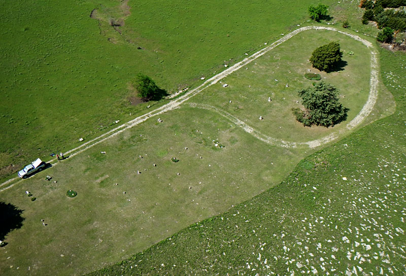
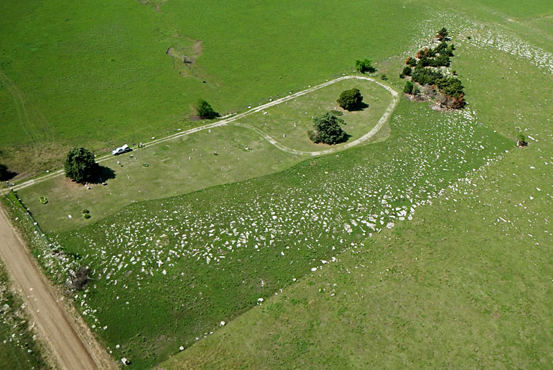
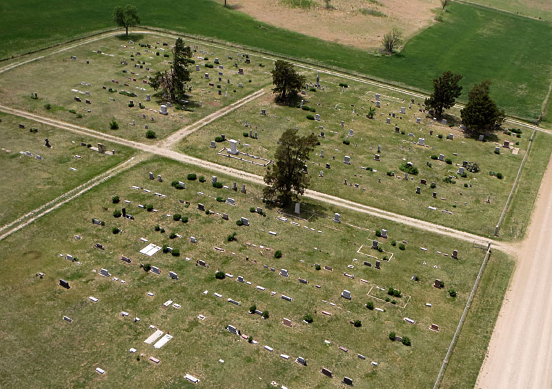
Left: all of the cemetery in a single scene. Cottonwood Limestone crops out as a stone line along the near side. Right: close-up shot of the kite aerial photographers. Note unmarked graves visible as green patches in the grass on right side.
Left: looking westward with conspicuous stone lines in the upland and the Neosho River valley in the background. Right: view northward. Prominent limestone layers are noted. The road on the right divides Morris County (left) from Lyon County (right).
Left: representative cemetery overview looking toward the southwest. Right: GPS map shows camera position over the county road and SSW look direction. Processed with Nikon software; base map adapted from Google.
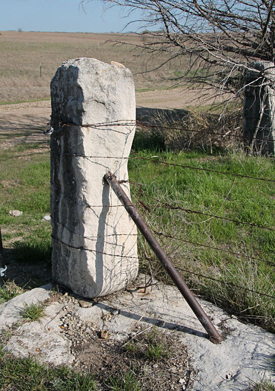
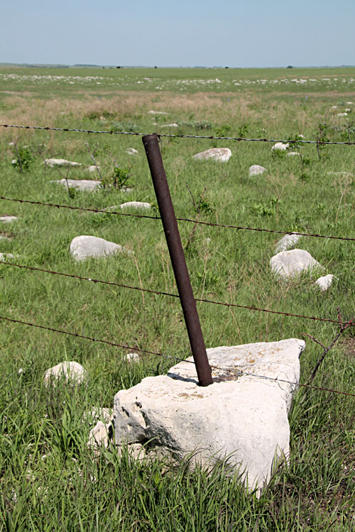
Right: limestone block with steel post set into the stone.
Dunlap Colored Cemetery – 2021 update
In late April 2021, we revisited the Dunlap Colored Cemetery for ground photos and noted several improvements. The cemetery was placed on the National Register of Historic Places in 2018. According to the registration summary, headstones are arranged in approximately 17 rows, although uneven rows and random headstones are found throughout the cemetery. An estimated total of 125-130 graves are present, but additional unmarked graves may exist. Many graves originally had stones without inscription or simple wooden crosses. The latter are long gone from rot, wind, and prairie fires.
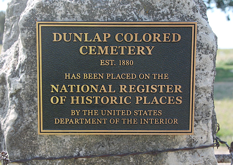
Plaque mounted on a stone gate post at the entrance to the Dunlap Colored Cemetery.
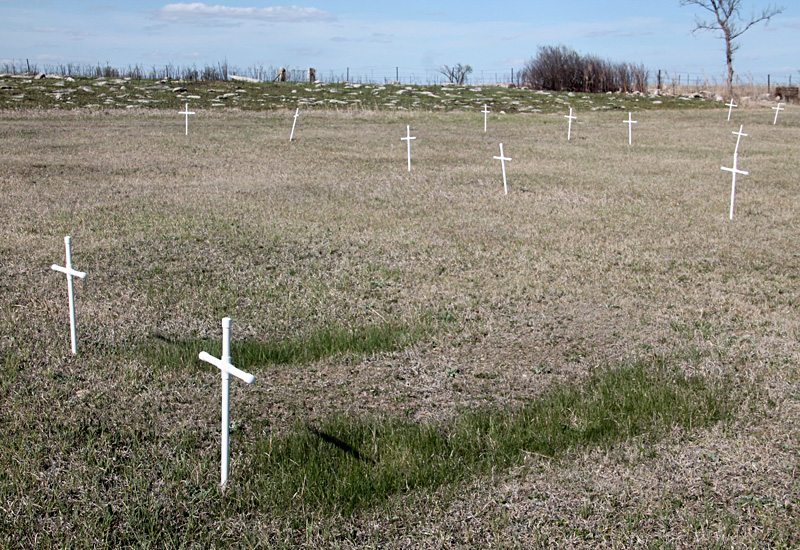
Small plastic crosses are placed at assumed unmarked graves, as shown by soil depressions and distinctive vegetation. These crosses were installed presumably sometime between 2017 and 2019. Compare with the following aerial image taken in 2014.
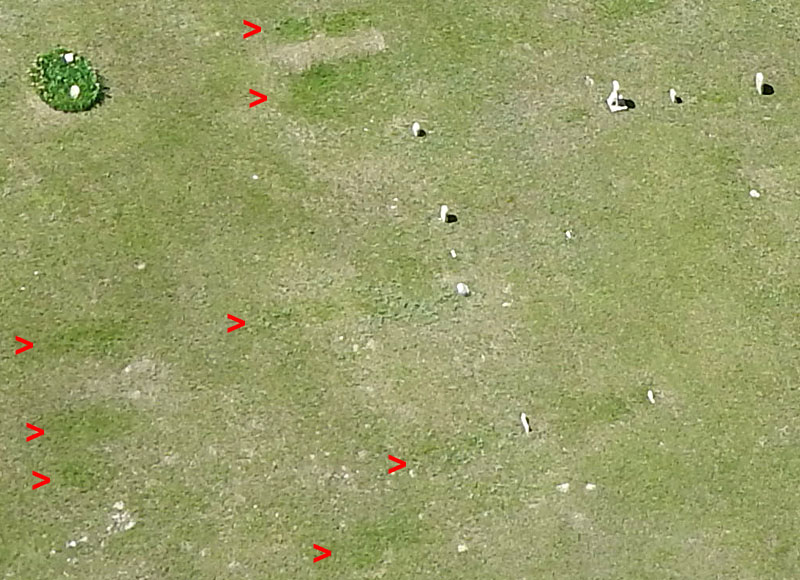
Detailed aerial image taken in 2014 showing probable unmarked graves (>), as indicated by greener grass in rectangular or oval shapes aligned with row pattern of the cemetery. Two near top center of view are particularly distinct. Larger patches are likely adults, and smaller patches may be children or infants.
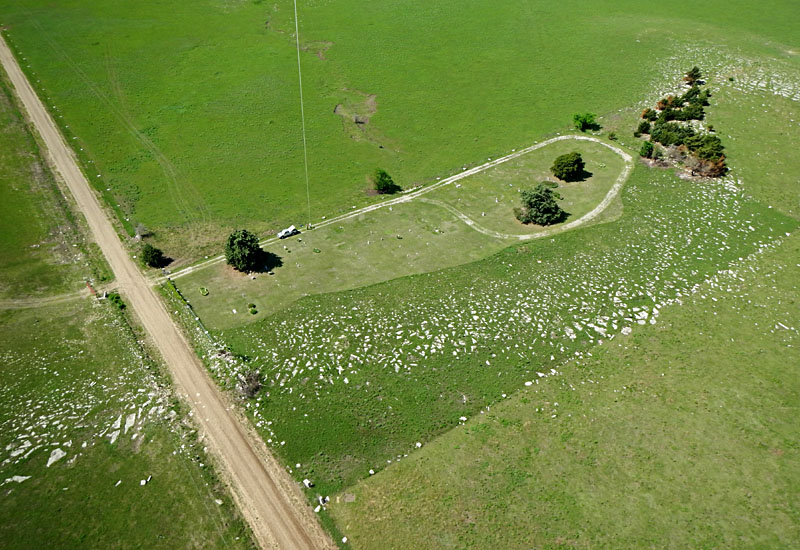
Dunlap Cemetery
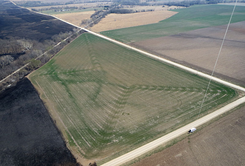
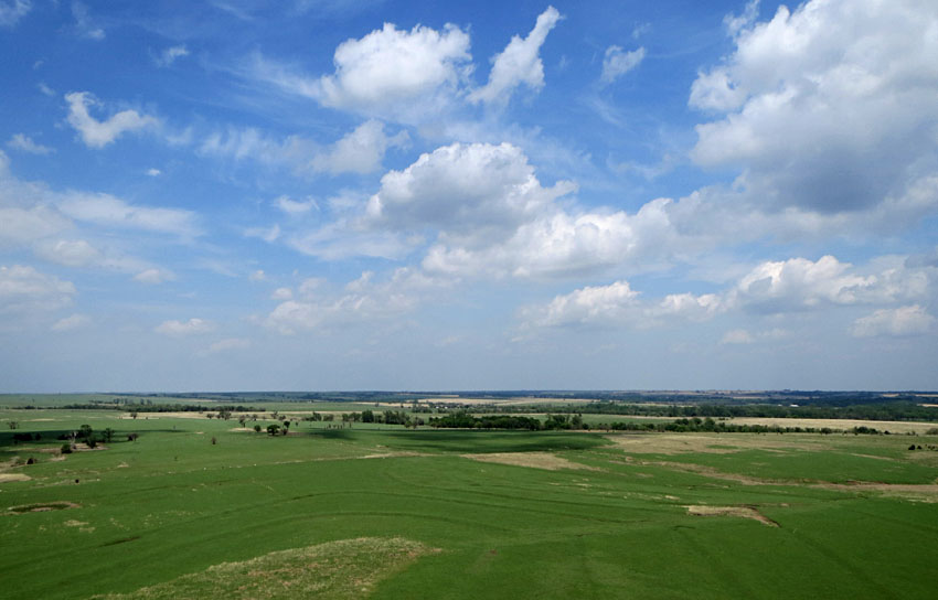
The Dunlap Cemetery is located on a hill top about one-half mile east of Dunlap. We (JSA & SWA) conducted KAP here in early May 2014 about a month after spring burning in the vicinity. Tallgrass prairie was greening up along with lush fields of winter wheat. Weather conditions were somewhat unsettled with a gusty south wind and variable cloud cover racing by. This made for some interesting sky and cloud views, but we had some equipment issues. We tried three kites, first a small rokkaku, and our large Strato-spool reel suffered a mechanical failure.
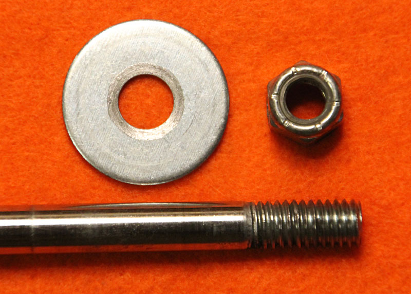
The worn threads on the reel axle (left) allowed the nut to slip when the brake was applied hard. Then no more braking, and the runaway rokkaku promptly crash-landed in the turbulent wind. Fortunately the kite was not damaged, and we had a spare axle for the reel. Then we put up a box kite (right) designed for wind up to 30 mph. The kite flew well on its own, but had minimal lifting capacity.
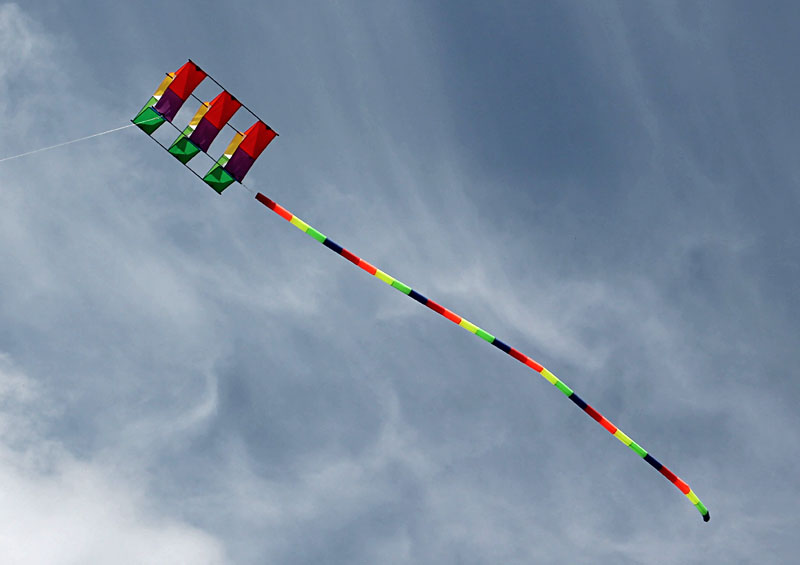

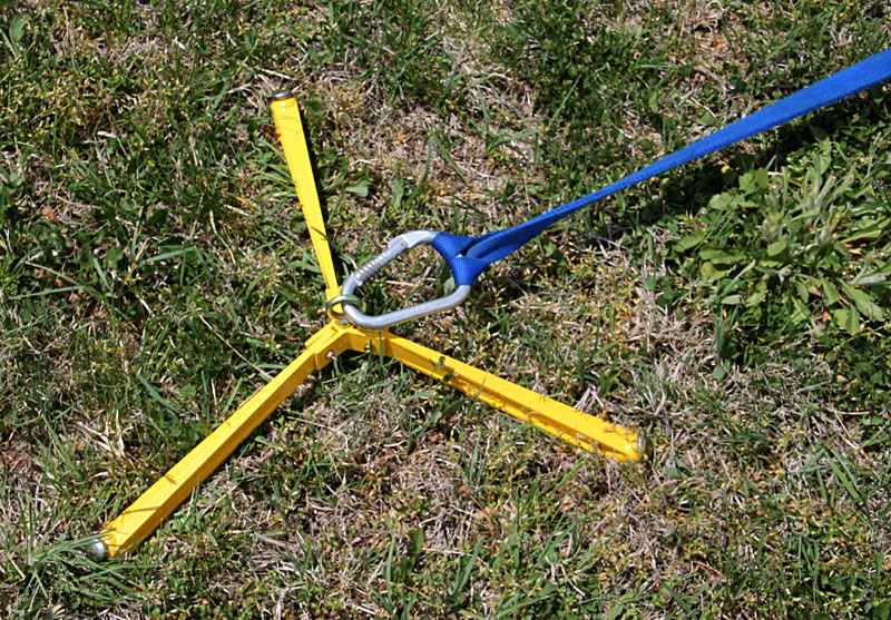
Finally we launched a dependable small delta on high-wind setting with a 20-foot tail (left). It flew well and lifted our Canon Elph camera rig. The Claw proved quite effective as a ground anchor (right).
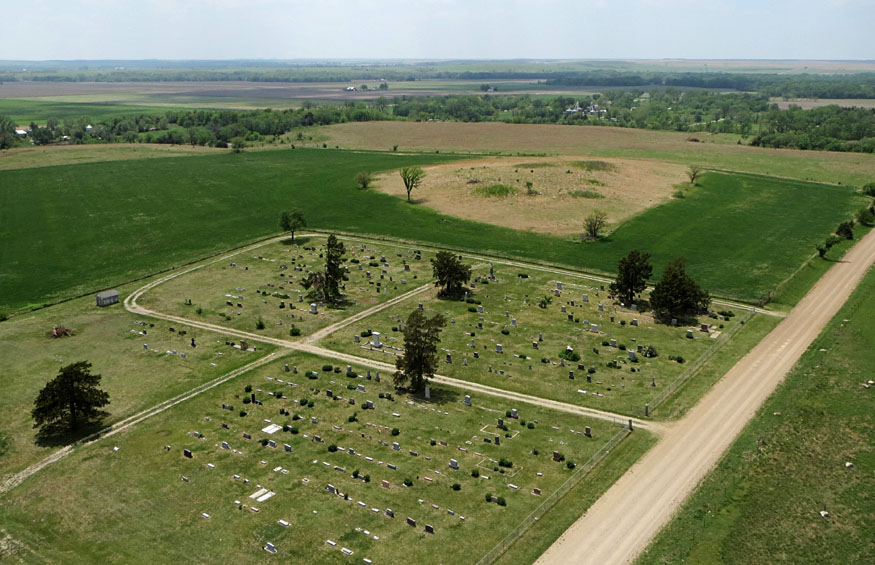
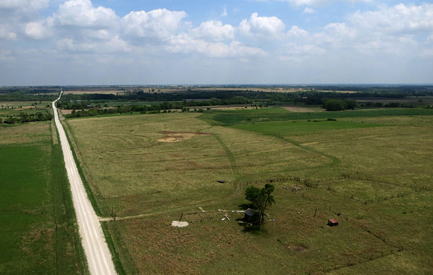
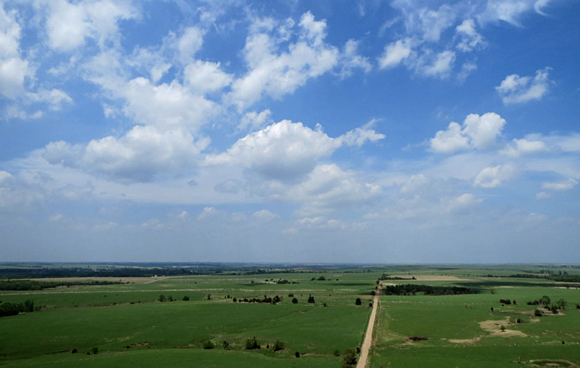
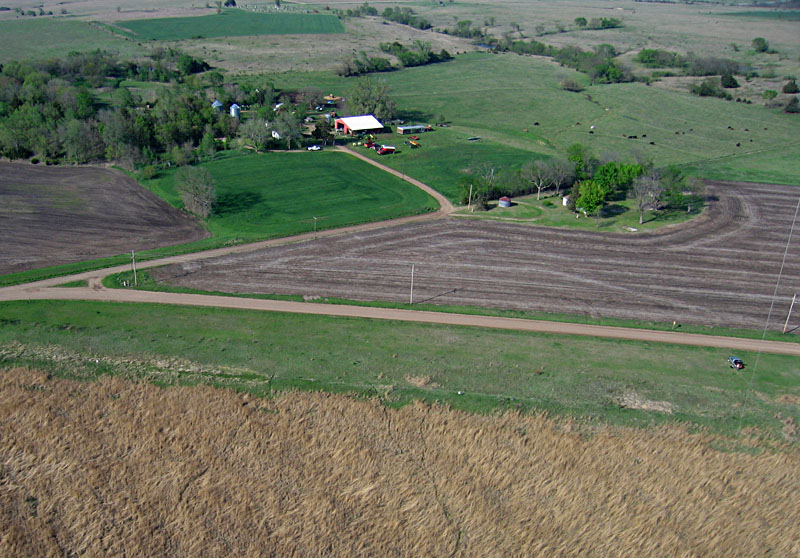
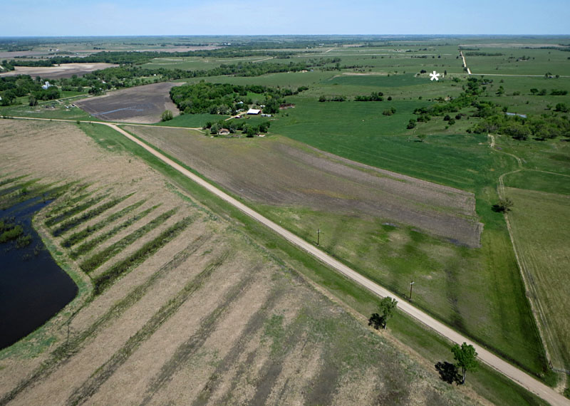
Left: Dunlap Cemetery in the foreground with the town of Dunlap in the Neosho River valley in the background. Right: Lyon-Morris county boundary is marked by the fence in foreground and road in left background. Asterisk (*) indicates the Dunlap Bottoms natural area in the Neosho River valley.
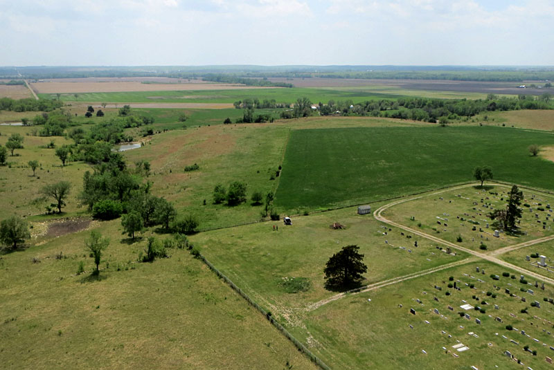
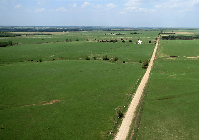
Left: view eastward into Lyon County. Right: looking northward with Lyon County to the right and Morris County to the left. Asterisk (*) marks the African-American (exoduster) Cemetery half a mile to the north.
Notice the distinctive stone fence posts (right).
Dunlap Bottoms
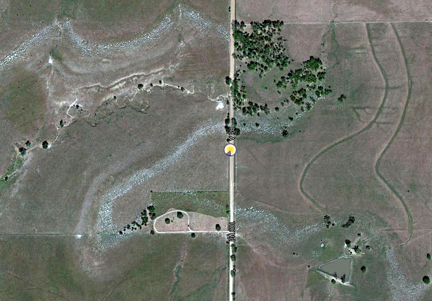
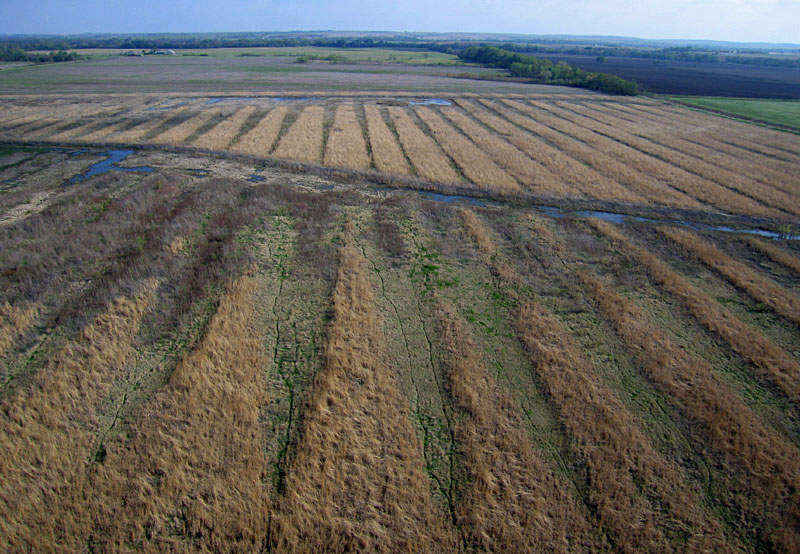
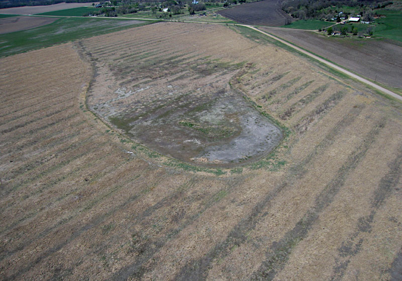
Dunlap Bottoms is one of several natural areas owned and maintained by Emporia State University. It is located immediatly southeast of the city of Dunlap. The natural area covers 128 acres (52 hectares) of former agricultural land in the Neosho River valley floodplain. The site is part of the USDA Wetland Reserve Program and has been partially restored for wetland habitat. An old and long-abandoned railroad right-of-way runs along one side; the other sides are bordered by county roads and agricultural fields.
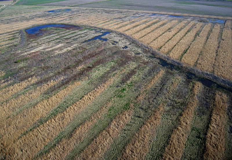
Views from the north end looking toward the southeast (left) and south (right). Parallel ridges and ditches date from earlier agricultural land use. Curved channels and pools mark the wetland restoration effort.
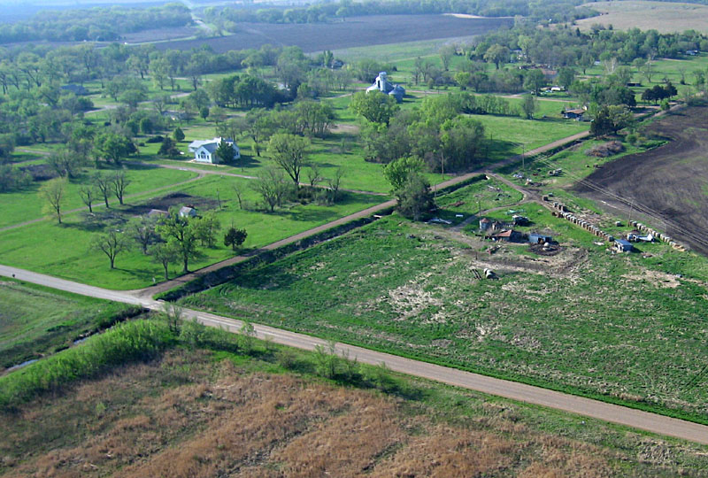
Left: well-tended farmsted on the valley side next to the bottoms. Kite flyer at lower right side. Right: view toward Dunlap looking to the northwest. A church and grain elevator are the only prominent structures. KAP by JSA.
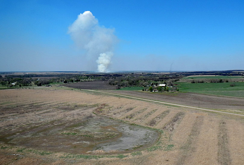
Left: plume of smoke from prairie burning rises in the upland behind dry Dunlap Bottoms in the foreground. Right: pools and ditches show no sign of surface water, and spring greenup had barely started in the wetland. KAP by JSA and JA.
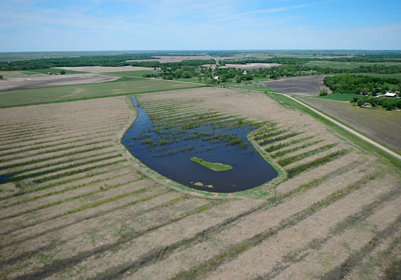
Overview looking toward the northwest (left) and close-up shot of the main pool (right). Water fills the pool and ditches. Young cottonwood trees are starting to grow up in the area. KAP by JSA.
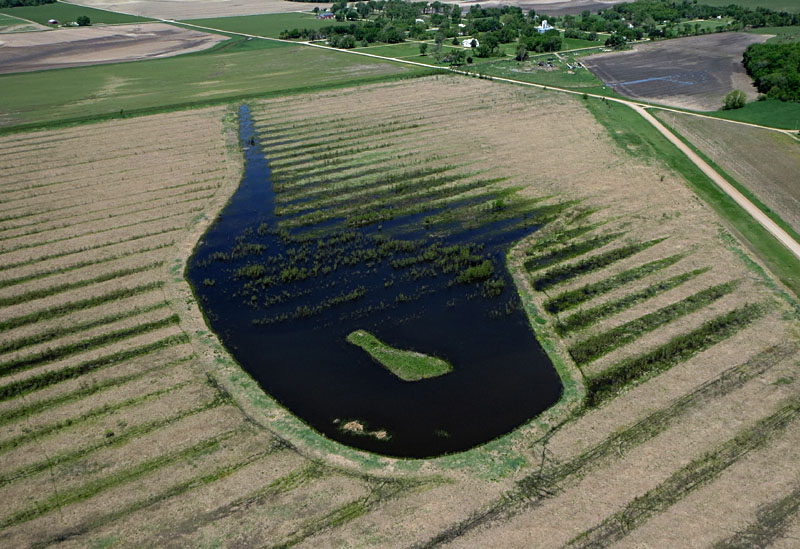
Left: looking westward. Small islands are bird nesting sites relatively protected from predators. Right: view to the north. Asterisk (*) marks the Dunlap Cemetery 1˝ miles to the north.
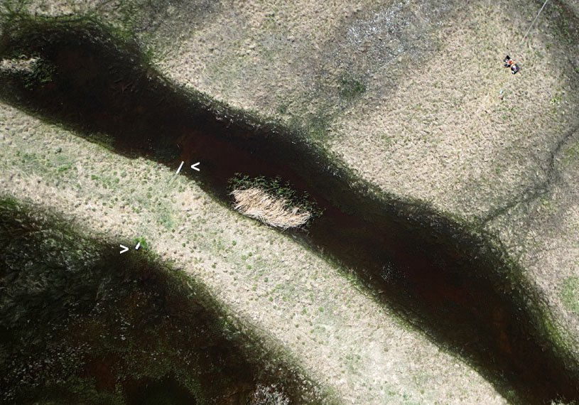
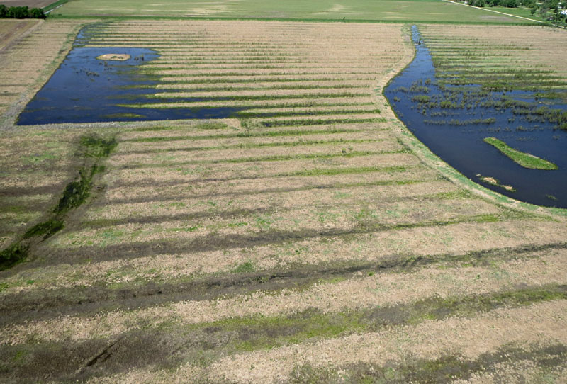
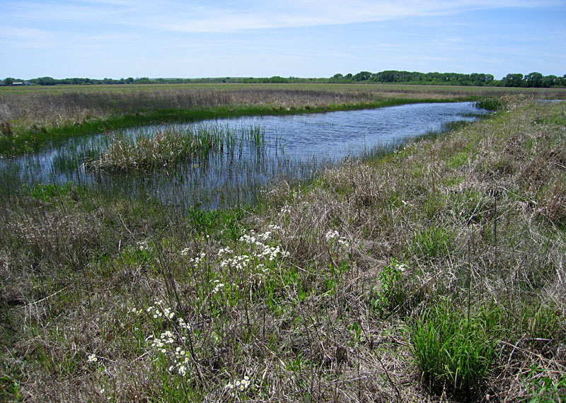
Left: vertical shot over the southeastern corner of the natural area; kite flyer at upper right corner. Notice culvert pipe (> <) that connects drainage between two wetland channels. Right: ground view of water in channel. Vegetation is beginning to green up following heavy rains and flooding of site.
![]()
References
![]() Related sites
Related sites
![]() Return to KAP home or gallery.
Return to KAP home or gallery.
All text and imagery © by J.S. and S.W. Aber.
Last update June 2021.