
J.S. and S.W. Aber |
| Introduction | High Tatrys |
| Liptov valley | Pieniny Klippen |
| Plavecsky Hrad | Tokaj wine |
| Silica karst | Hornád valley |
J.S. and S.W. Aber |
| Introduction | High Tatrys |
| Liptov valley | Pieniny Klippen |
| Plavecsky Hrad | Tokaj wine |
| Silica karst | Hornád valley |
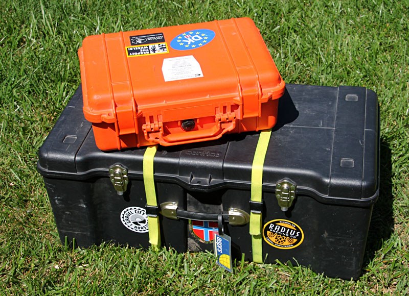
| KAP equipment for Slovak faculty exchange. Cargo box and camera case (left). The cargo box contains all kites and associated items, tools, and spare parts. It weighs about 48 pounds (~22 kg) for checked luggage. Camera case (right) has two complete KAP rigs and accessory equipment. This is carry-on luggage weighing only 9 pounds (~4 kg). | 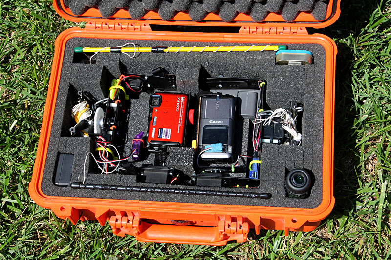
|

| Typical power-outlet sockets and plug for Slovakia along with some adapters for American plugs. American plugs include types A and B; most of Europe utilizes types C, E and F—see plug-and-socket types. |
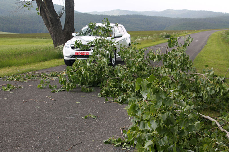
| Left: two large limbs fell across the road in front of our car during a wind storm. A smaller branch hit the car while driving on this same road, but did not cause any damage. Near the village of Vazec between the High and Low Tatry mountain ranges. Right: cleaning up shattered and uprooted trees in Warsaw, Poland a few days later. | 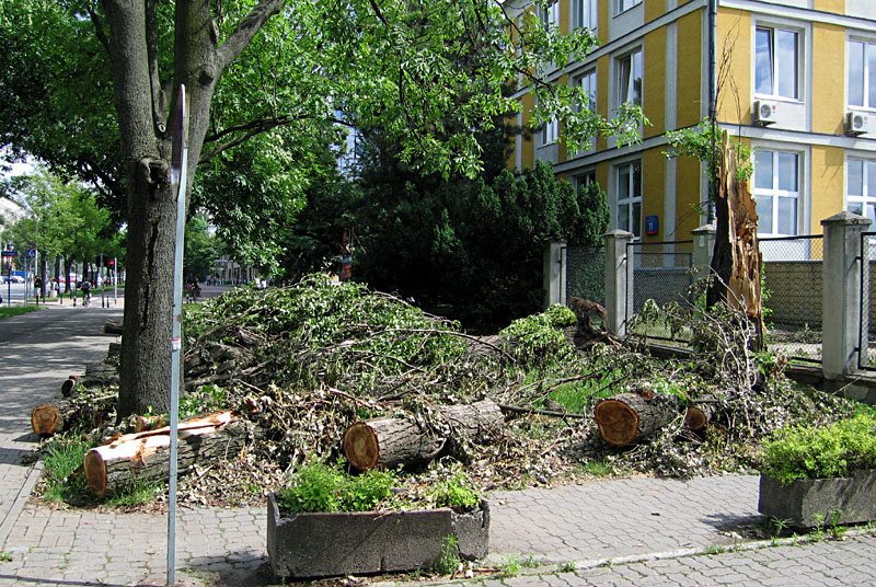
|
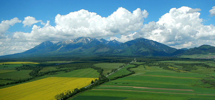
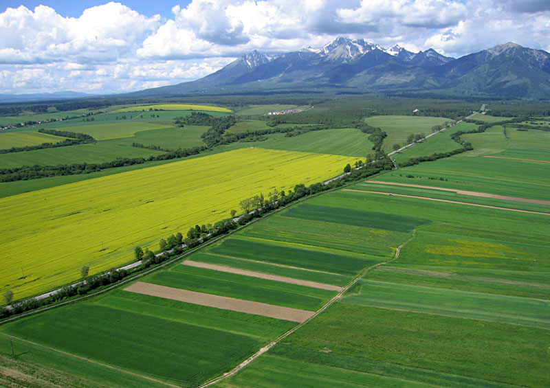
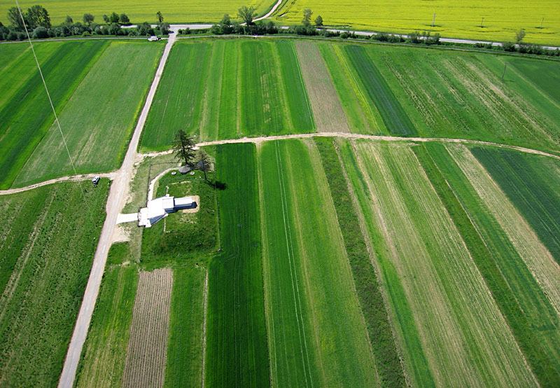
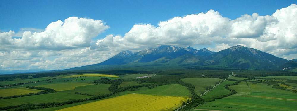
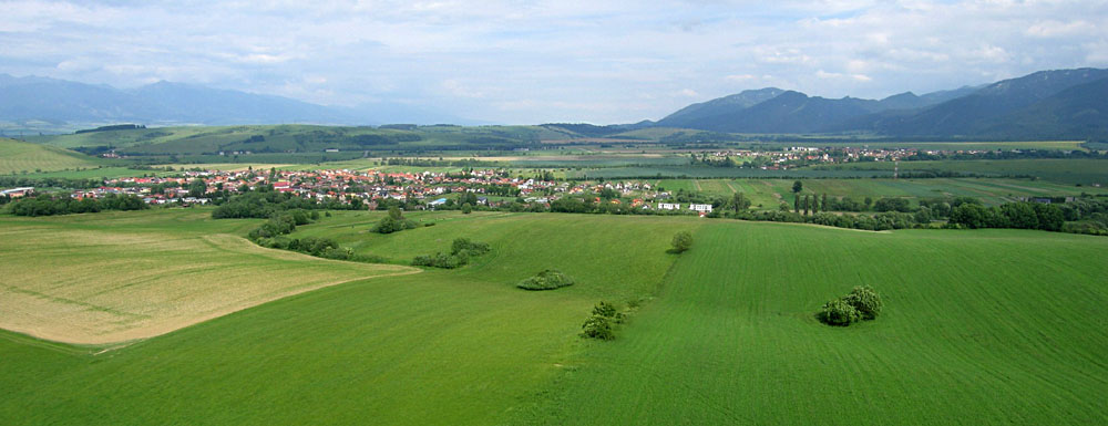
| Overviews looking toward the Tatry Mountains (left) and across agricultural fields (right). The mountains are part of the larger Carpathian Mountain system of central Europe. Highest peaks are in the clouds and exceed 2600 m (>8500 feet). Agricultural fields in the foreground are developed on fans of glacial outwash gravel. | 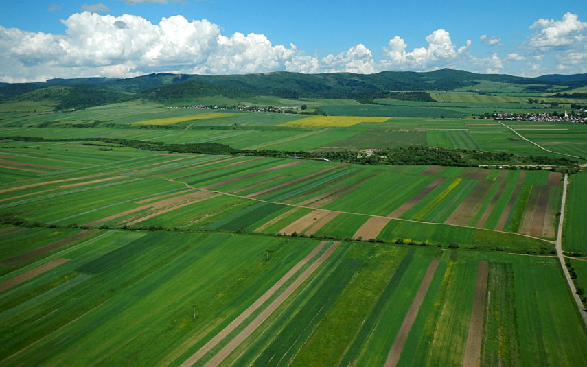 |
| Left: two types of agriculture. Large fields represent cooperative farms that date from communist times. Smaller fields are privately owned. Right: long narrow stripes, knowns as "noodles," are each owned and farmed separately. A single noodle may have 16 or more owners. This pattern of farming is a legacy of the Austro-Hungarian Empire. | 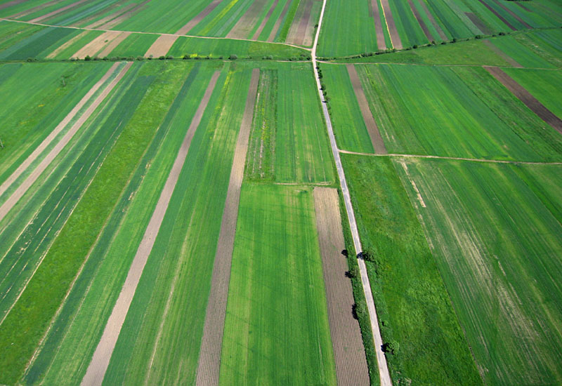 |
| KAP conducted from a fallow and weedy field next to a water-treatment plant (left), and close-up shot of KAP team bringing the camera down (right). The kite-line reel is secured to the car's towing ring in the bumper. | 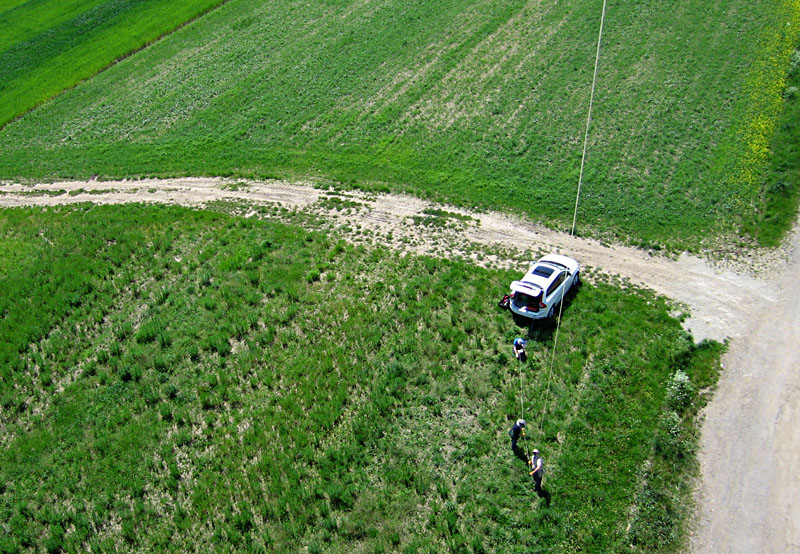
|
 Near Poprad; assembled from two wide-angle shots. |
 Near Poprad; assembled from two wide-angle shots. |
![]() Back to top.
Back to top.
Our kite launching site was on the side of one such limestone hogback, which created a strong local updraft. Under partly cloudy conditions, our pictures are mosaicks of sunlit and cloud-shadowed patches on the ground. Beside the village of Kamenica, near Prešov.
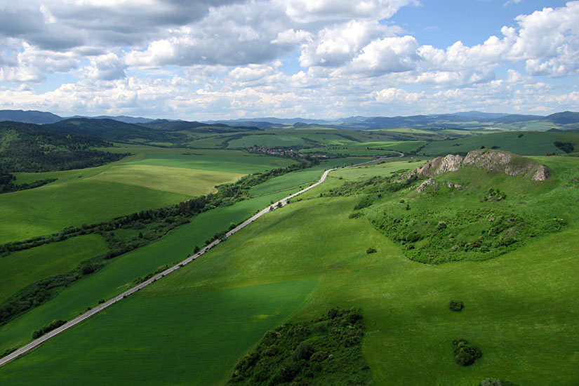
| Overview of the Pieniny Klippen Belt (left) and close-up shot of limestone hogback within the klippen belt (right) near the village of Kamenica. The limestone ridge stands conspicuously above the adjacent valley. | 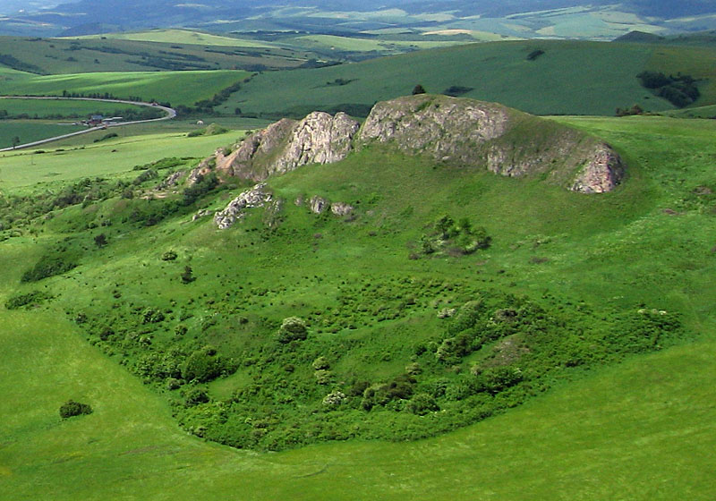 |
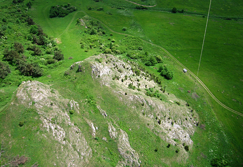
| Left: kite flyers operating from the steep side of a limestone ridge. Note small boxes in upper left corner. Right: close-up shot of bee hive boxes on top of the ridge. | 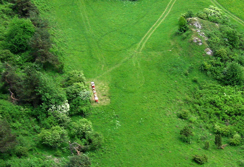 |
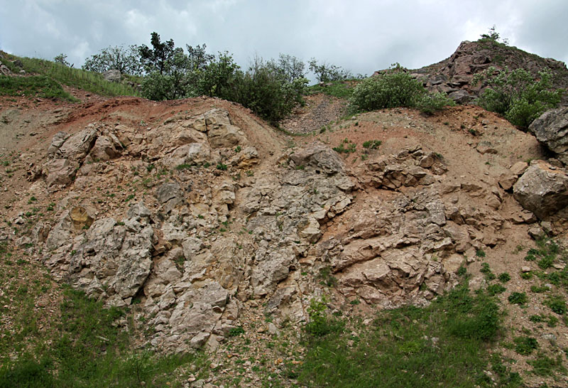
| Ground views of bedrock deformation. Limestone breccia mixed with red shale (left) exposed in a quarry and strongly folded limestone (right) revealed in a cliff. | 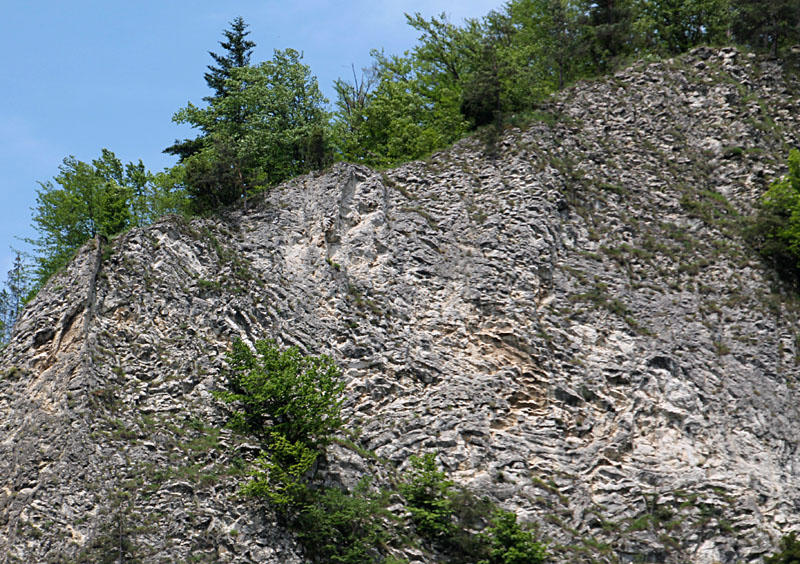
|
The castle is currently undergoing partial reconstruction, and we were invited to conduct KAP. We set up on a nearby hill next to a small chapel. Wind was somewhat erratic, and our KAP session was cut short when clouds moved over the site. Close to the town of Plavec, near Prešov.
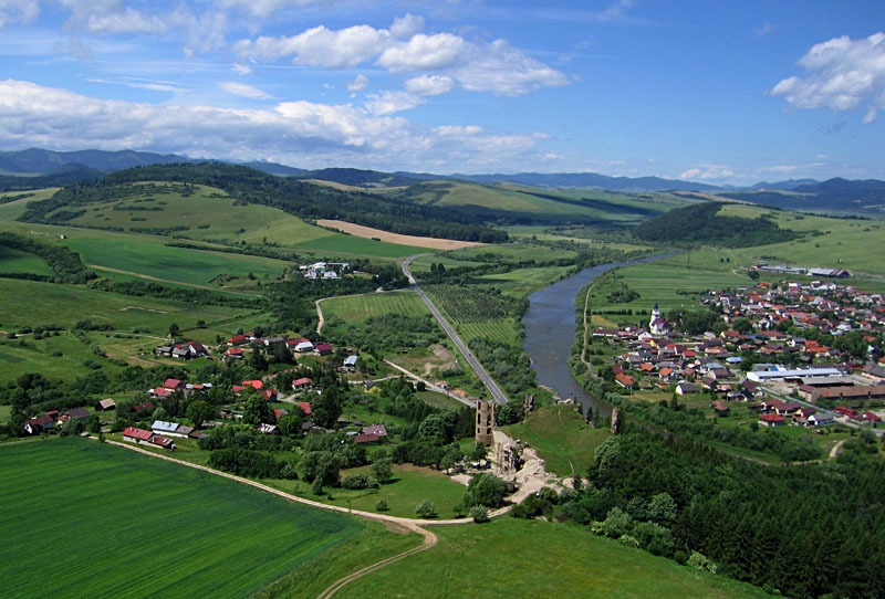
| Left: overview of Plavecsky Hrad at lower center. Small village of Podzámok on left and larger town of Plavec in right background beyond the Poprad River. Right: close-up shot of the castle ruin which is undergoing partial reconstruction. | 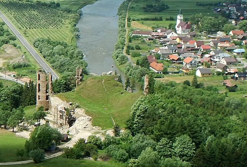 |

| Left: overview of the town of Plavec, which is located inside a large meander loop of the Poprad River. Castle ruin on left side. Right: large sand-and-gravel pit filled with water on the floodplain of the Poprad River valley. | 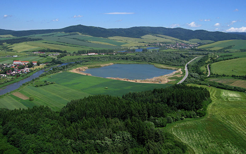 |
| Left: kite flyers beside the ruin of a small chapel on the hill above the castle. Right: close-up shot of the chapel ruin which contains the grave of the person who owned the castle. |  |
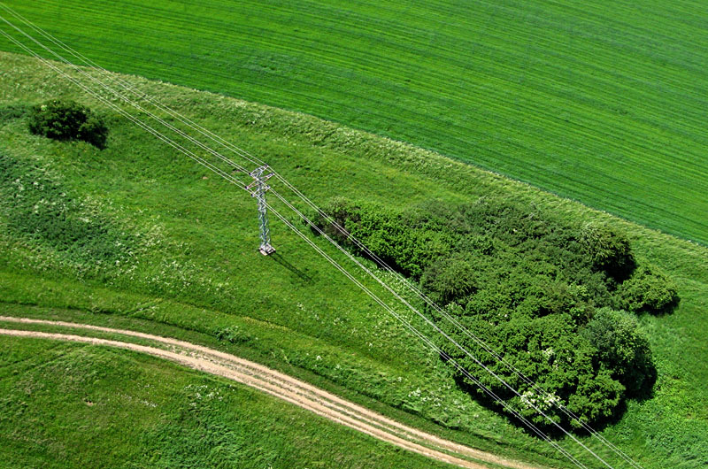
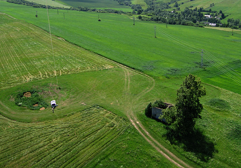
| Flying over high-voltage transmission lines is always risky (left) and requires good wind, skill, and close attention to the kite at all times. Small tractor cutting hay (right) beneath the transmission lines. | 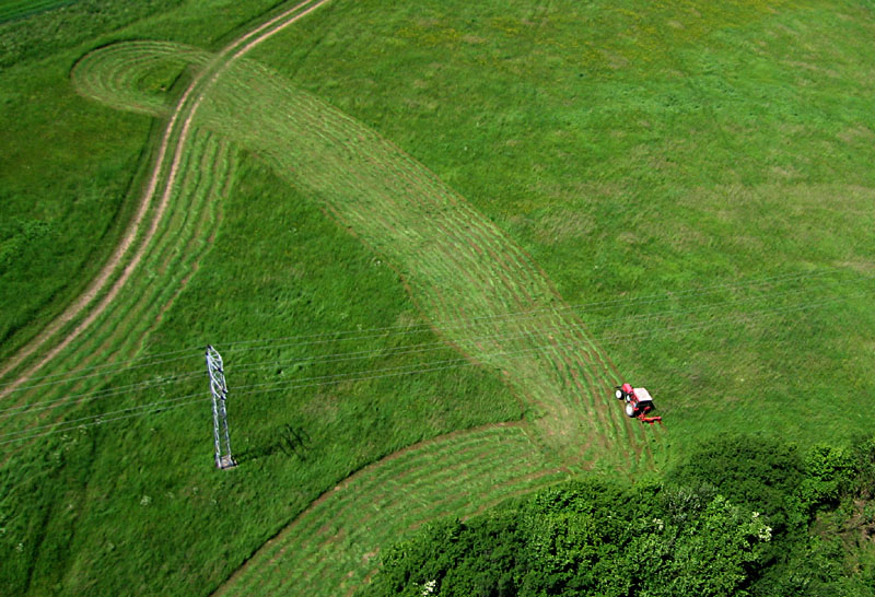 |
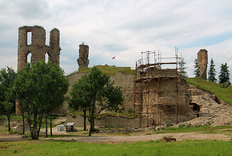
| Ground views of castle undergoing partial reconstruction (left) and interior of the tower (right). Thanks to Martin Sárossy for invitation and permission to conduct kite aerial photography at this site. | 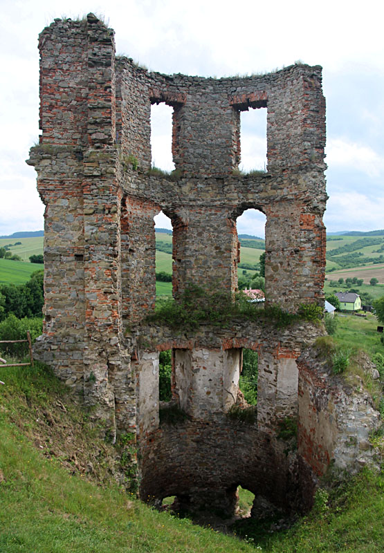
|
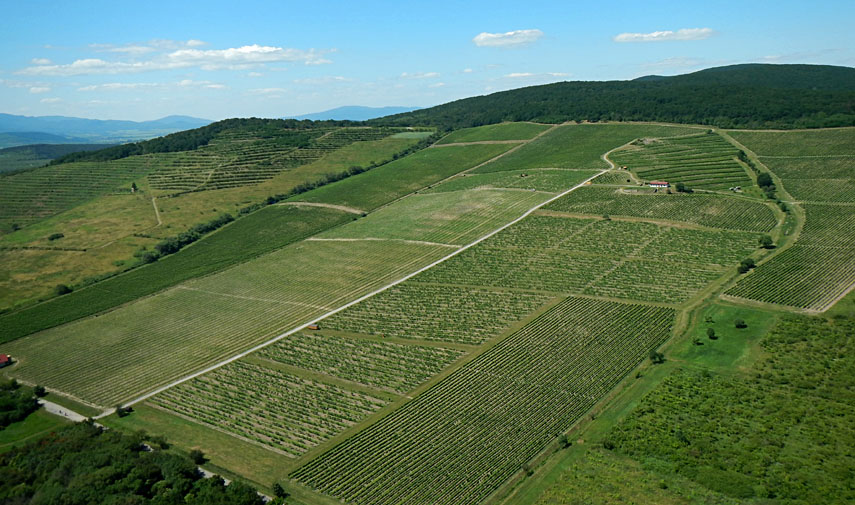
| Vineyards extend across southern slopes of the Zemplinske hills (left) near the border with Hungary. Individual fields form intricate patterns on the landscape (right). Note small tractor in lower right corner; it is pulling a sprayer between rows of grape vines. | 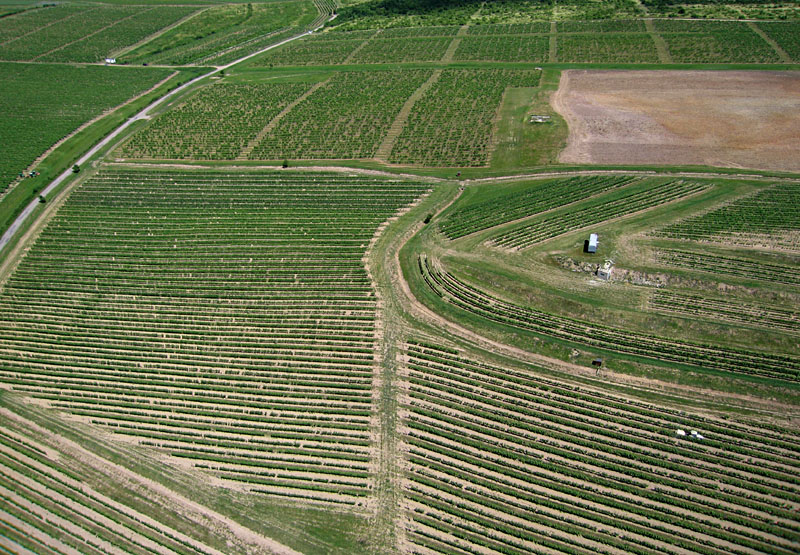 |
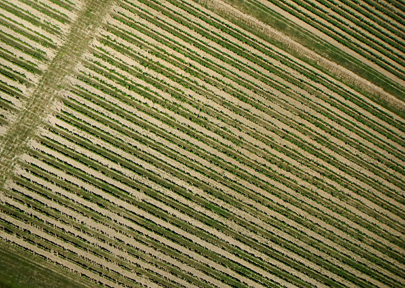
| Vertical shot (left) and ground view (right) showing alternate row scheme. Every other row is bare for tractors, and intervening rows have plant cover (clover and grass) for walking. Rows are spaced approximately 2 m apart, just wide enough for a small tractor to pass through. | 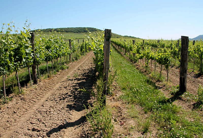 |
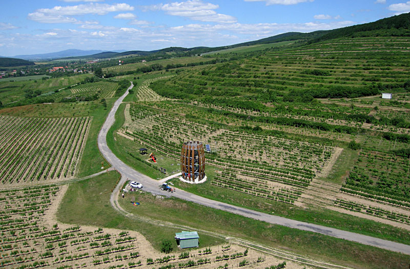
| Tokaj Viewing Tower overview (left) and close-up shot (right). The tower is a Swiss-Slovak project constructed in 2015 to resemble a traditional wine barrel. The top platform stands 12 above ground level, which allows panoramic views of surrounding hillside vineyards. | 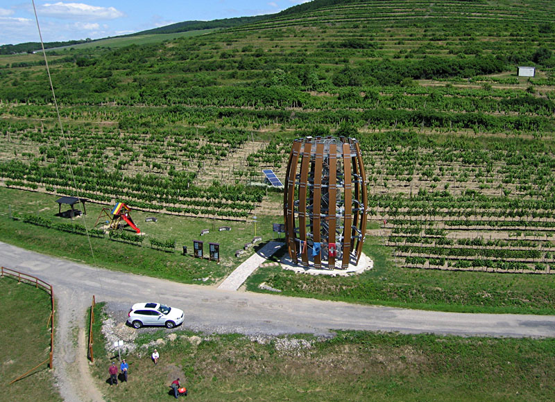
|
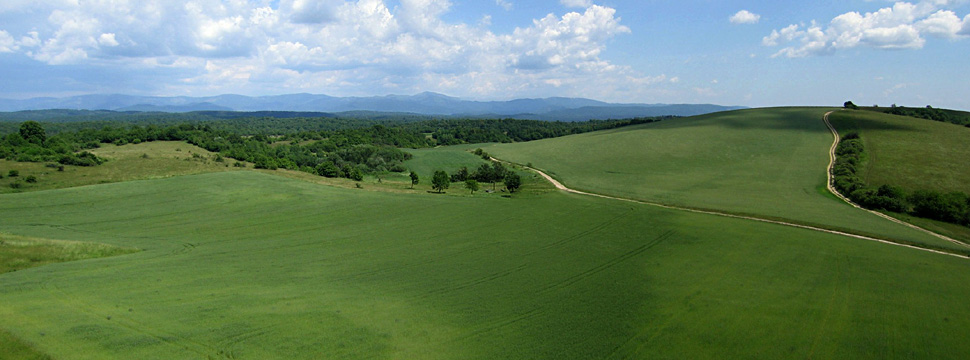 Slovenský Kras (karst) forms the ridge in the far background. Near Košice; assembled from two wide-angle shots. |
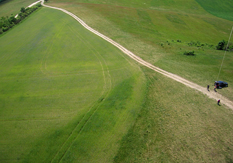
| Kite flyers working on a hill top beside a field of grain (left). View over large grain field (right). Note closely spaced rows of grain and distinct tracks left by sprayer. | 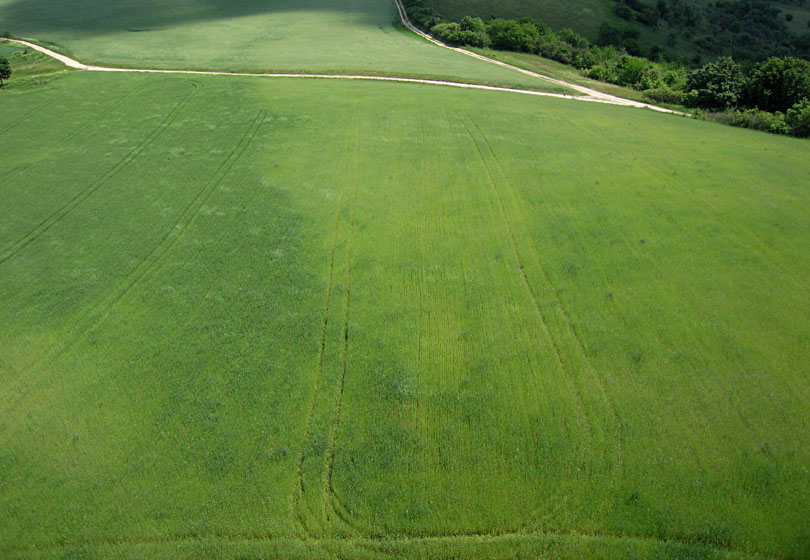 |

| Close-up view of grain field (left). Notice red and blue spots which are flowers of corn poppy (Papaver rhoeas) and cornflower (Cyanus segetum). Ground view (right) of flowers and grain. | 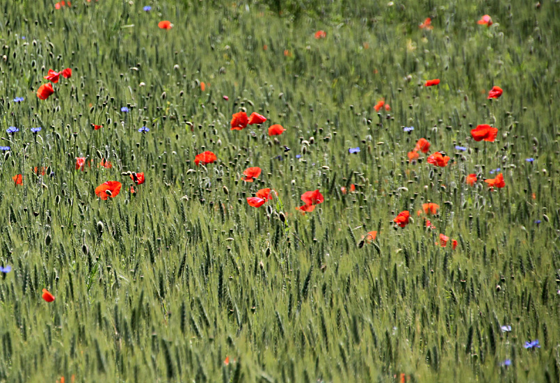
|
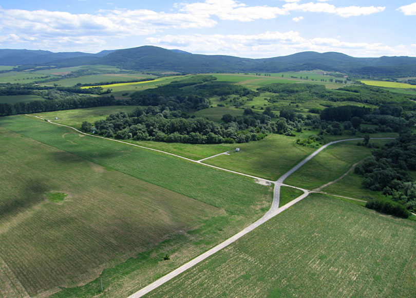
| Left: looking across the Hornád valley with Hungary in the background. Trees line the channel of the Hornád River, and small buildings are water wells. Right: view south toward Štrkovisko Kechnec, an artifical lake on the border with Hungary. Flood water flows into this lake via the channel at lower right. | 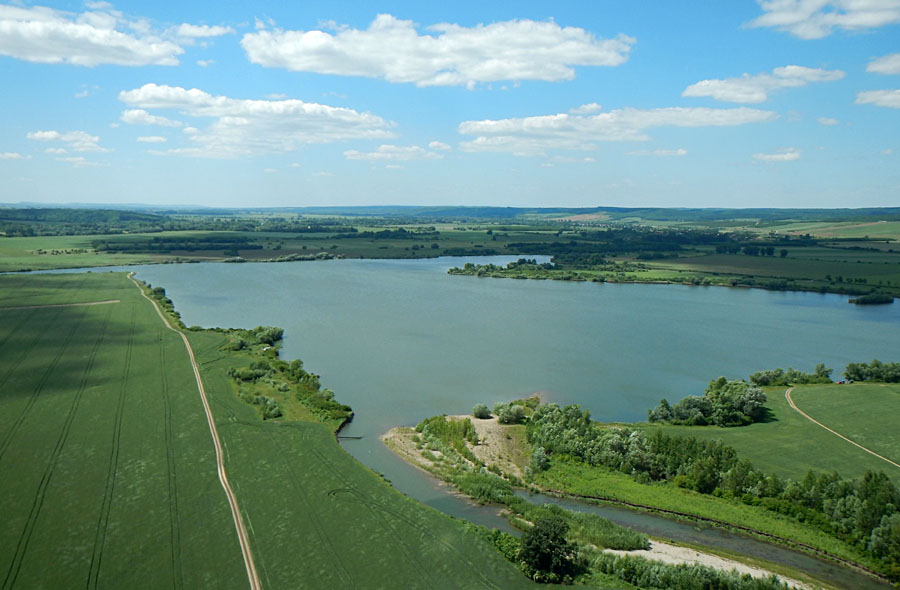 |

| Left: flood water follows two well-defined channels (C) across the bottomland, and the road acts as a small dam. Right: downstream from the road, deep gullies were eroded as water spilled over the road. Kite flyers near scene center. | 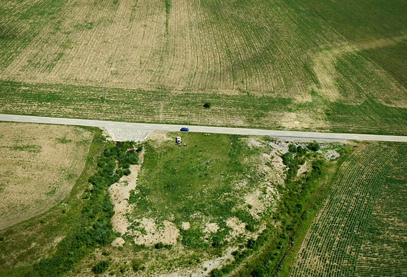 |
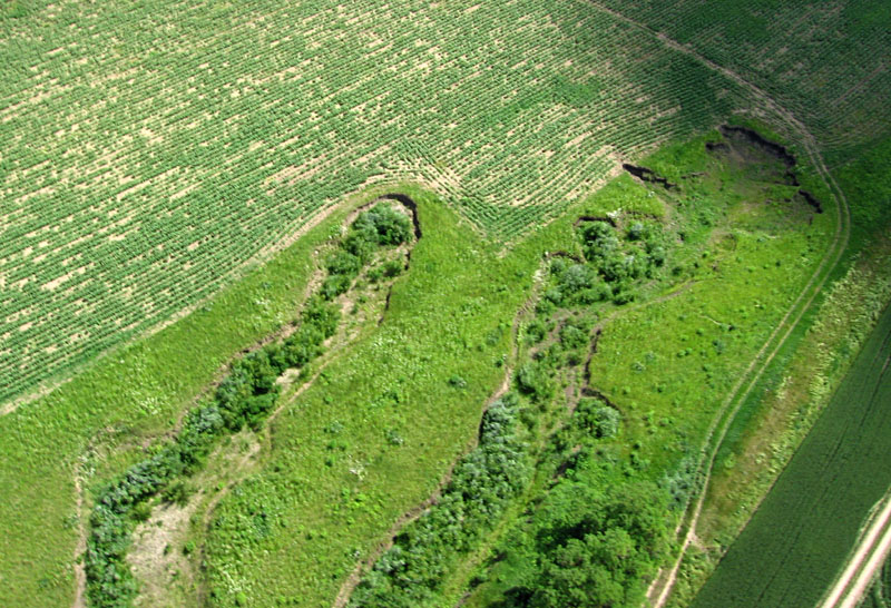
| Two views of small gullies that have formed within the past few years. Such gullies develop by rapid headward erosion across the tilled soil. These gullies did not exist in our 2007 KAP survey of this vicinity. | 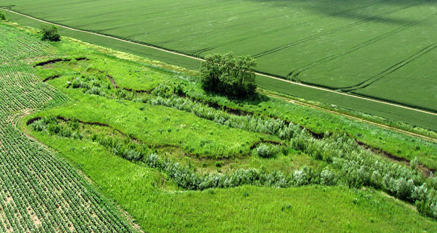
|
![]() Back to top.
Back to top.
Special thanks to TUKE students who assisted with KAP at several
sites: Igor Duriška, Marta Prekopová, and Barbora Zákršmidová.
![]()
All text and images © J.S. and S.W. Aber
![]() Return to KAP gallery.
Return to KAP gallery.
Last update: June 2016.