| J.S. and S.W. Aber |
|
| J.S. and S.W. Aber |
Lake Pueblo is the principal water storage reservoir in the Project. Its waters are used for irrigation, drinking and recreation, and it provides flood control to the Pueblo community. Following several years of drought conditions, water levels were quite low in the reservoir at the time of our visit in May 2003. However, significant late winter snowfall and spring rains have raised hope that Colorado's drought may have ended. In fact, drought turned into water surplus during the exceptionally wet year of 2015.
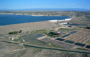
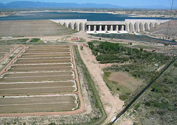
Lake Pueblo State Park was founded in 1975. It includes 7000 acres of land and 4500 acres of water rights leased by the state from the Bureau of Reclamation. The park is among Colorado's most popular destinations for water sports. Situated at the western edge of the High Plains, the location provides scenic constrasts between the open plains eastward and rugged mountains nearby. The site is dominated by Pueblo Dam—10,500 feet long and 200 feet high. A fish hatchery is located below the dam, and a wildlife-management area is set aside at the western (upstream) end of the park.
 |
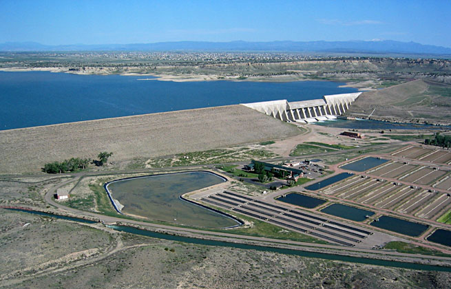
| Overview of Pueblo Dam with the fish hatchery to right and Lake Pueblo to left. Canal across the bottom of view is supplied by Lake Pueblo and is operated by the Bessemer Irrigating Ditch Co. The city in the background is Pueblo West. Pikes Peak is the snow-capped mountain on the horizon (to right). |
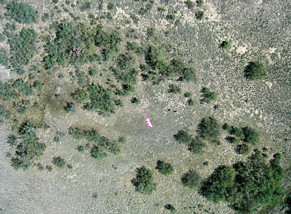
| View westward of the main control structure of Pueblo Dam. Note water shooting from outlet pipes at base of dam. Kite flyers are standing in lower right corner of scene. |
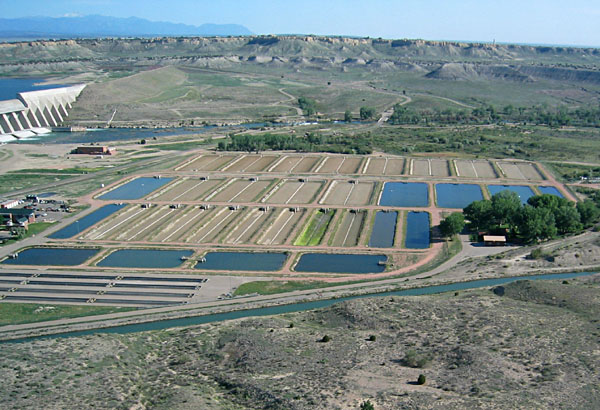
| Overview of the fish hatchery. A few ponds contain water, but most are dry in this scene. Picnic and fishing areas along the Arkansas River are situated behind the hatchery downstream from the dam. |
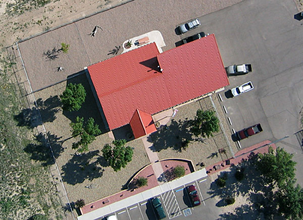
| Vertical view over the Bureau of Reclamation headquarters building, near Pueblo Dam. Building has a metal roof that simulates the appearance of red tile; surroundings are landscaped in southwestern adobe style. |
Most conventional methods for controlling saltcedar infestations are ineffective. Once established, Tamarisk is extremely tenacious and difficult to eradicate. Because of this growing problem, the Bureau of Reclamation is pursuing research on biological control of saltcedar. A leaf-eating beetle, imported from China, is a natural enemy of saltcedar. These beetles are being evaluated, under strict experimental protocols, at a site next to the Pueblo Dam. The authors were invited by Debra Eberts (BR researcher) to conduct kite aerial photography as a means to document the effectiveness of these beetles for defoliating and eventually killing saltcedar.
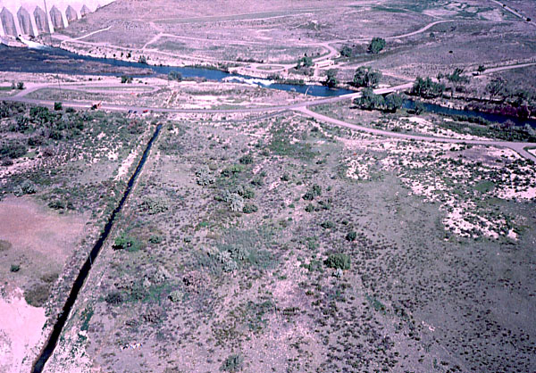
| Saltcedar biocontrol site in right foreground. Note scrubby vegetation with small clumps of trees. Dam is visible in upper left corner of view. Color-visible (left) and color-infrared (right) photographs. | 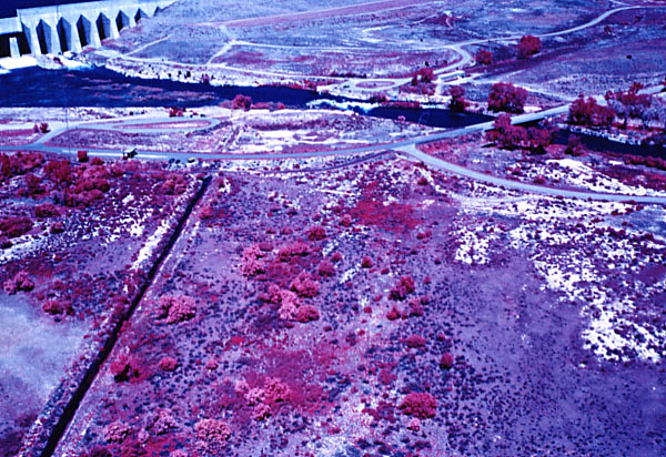
Saltcedar biocontrol site in foreground adjacent to picnic area. A clump of saltcedar is prominent in lower center of view (left photo). Color-visible (left) and color-infrared (right) photographs.
| |
| Vertical view in center of biocontrol test site with numerous saltcedar trees. The north arrow is 4 meters long; two people are standing to right of arrow. |