Presque Isle forms a natural harbor, which was quite significant for the American Navy during the War of 1812. Commodore Oliver Hazard Perry defeated the British fleet in the Battle of Lake Erie; a monument to him stands on the southern side of Presque Isle. Today, of course, the Great Lakes are peaceful, and Erie is a large city on the mainland side of the harbor. The entrance to the harbor is protected by a U.S. Coast Guard station, and most of Presque Isle is included in a popular state park.
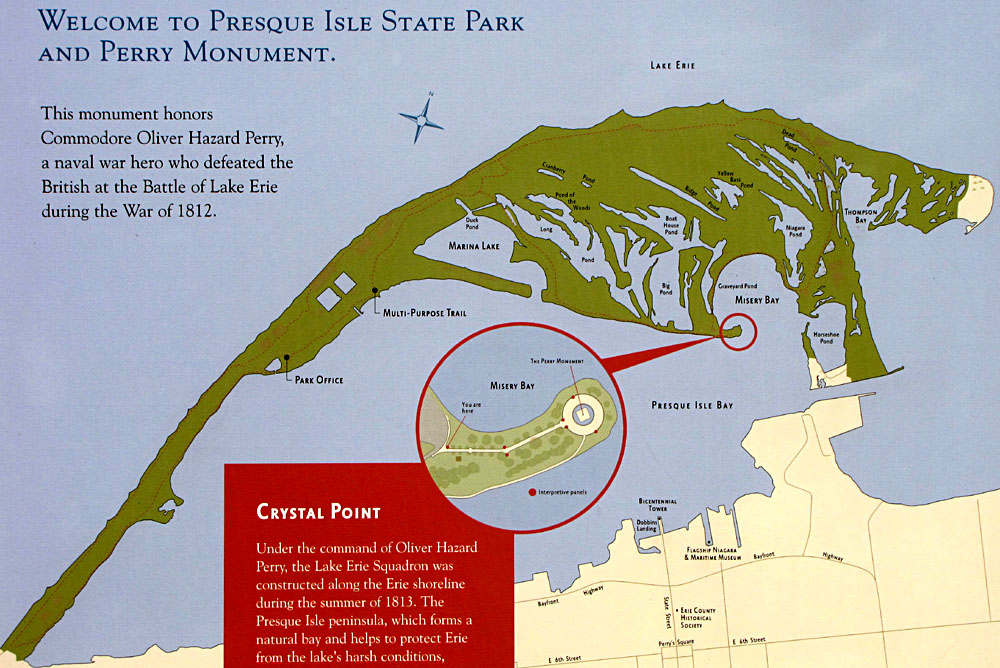
| Map of Presque Isle State Park and surroundings. Left: full map, right: enlarged eastern portion. KAP was conducted from the parking area at beach 11 marked by asterisk (*), CG = Coast Guard station. Map adapted from sign at Perry monument. | 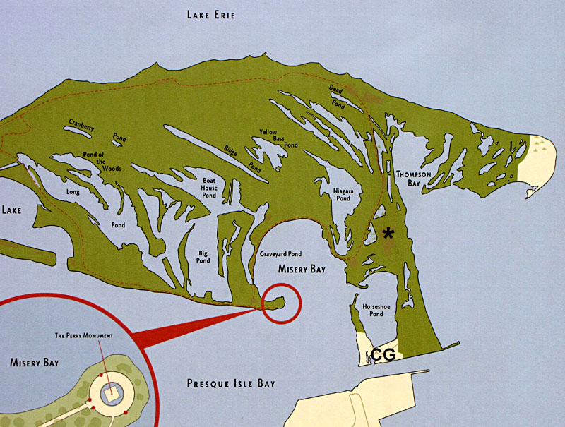
|
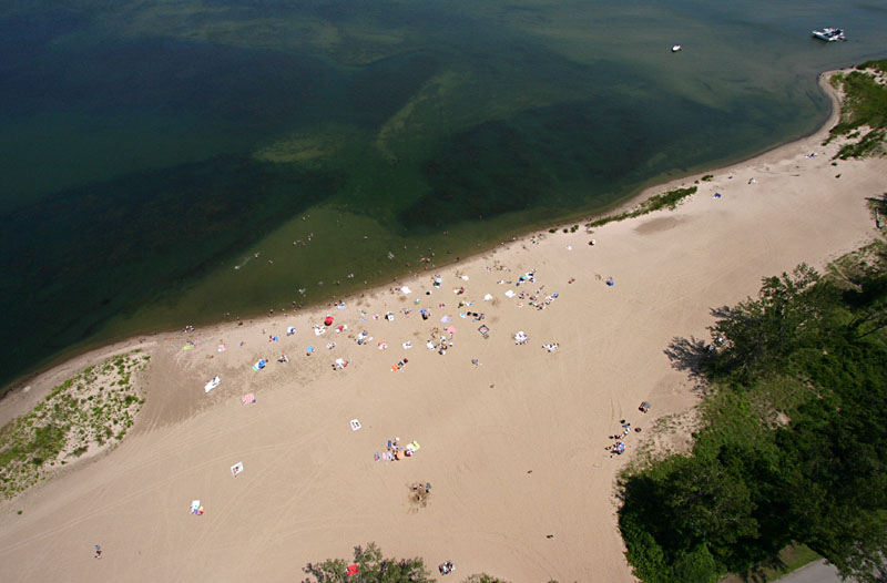
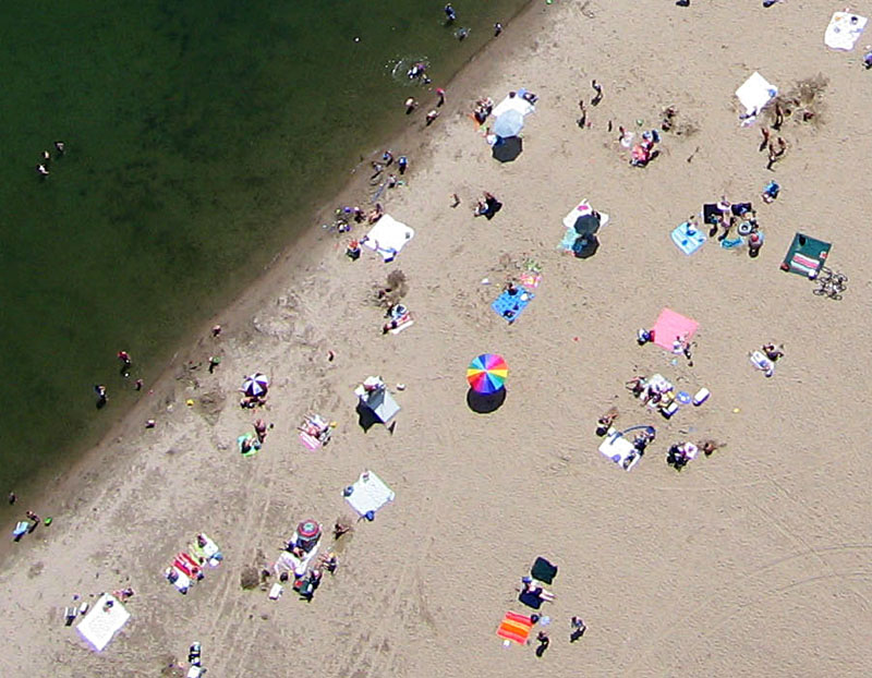
Using our large rokkaku we flew the Canon S70 (wide angle) and Canon Rebel (superwide-angle) camera rigs from a parking area at beach 11 on the eastern end of the island. Wind direction was stable from west-southwest to west, but strength was somewhat variable, at times almost too strong, and then diminishing to barely enough by the end of our session.
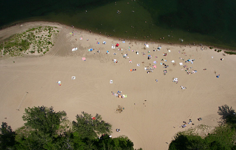
 from beach 11 at the eastern end of Presque Isle. |
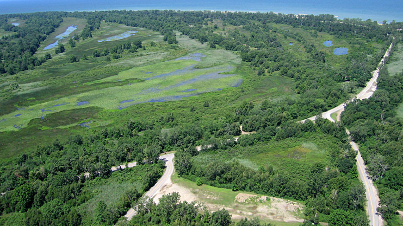
| Toward the west overlooking Niagara Pond. Former beach ridges are marked by trees and separated by swales that contain elongated ponds and marshes. |
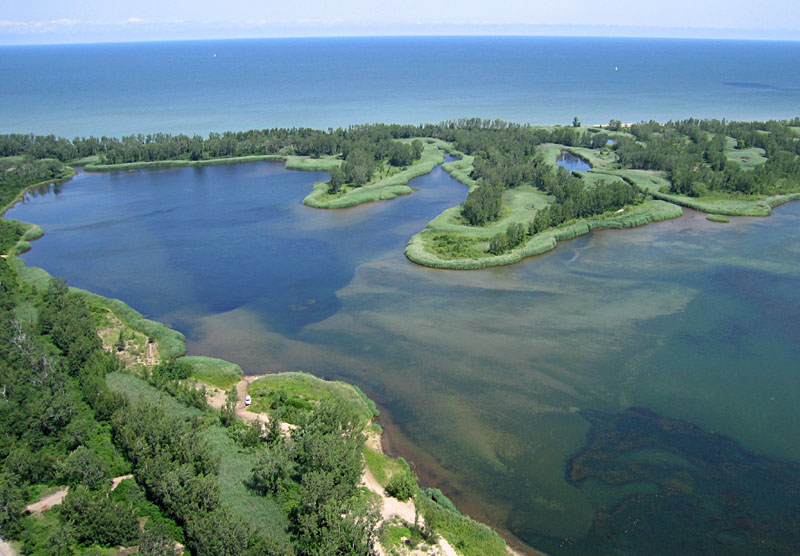
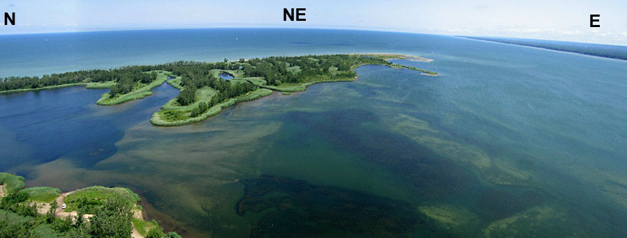
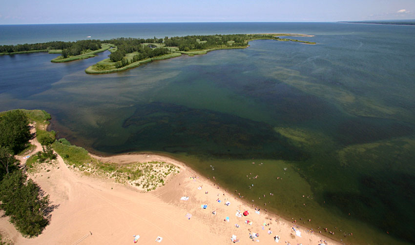
| View northward featuring Thompson Bay in the foreground and Lake Erie in the background. Sediment patterns (tan) and aquatic vegetation (dark green) are clearly visible in the bay. |
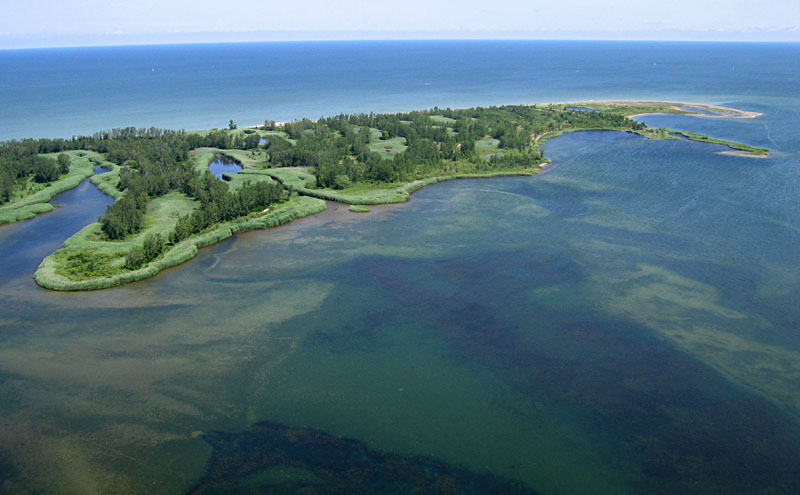
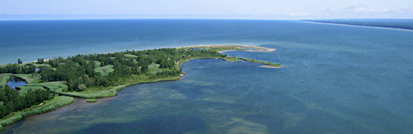
| Looking to the northeast, the easternmost tip of Presque Isle extends toward the right distance with Thompson Bay in the left foreground. |
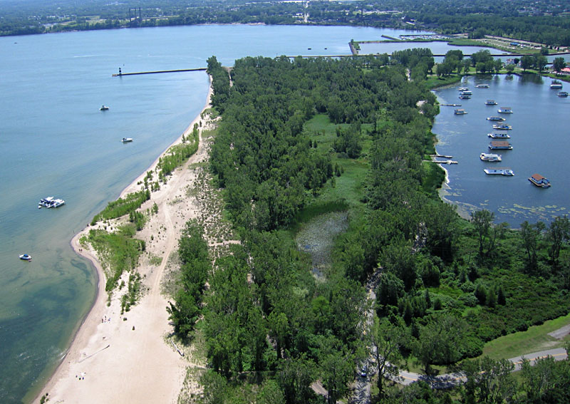
| View toward the southeast. The lighthouse to left is at the end of North Pier and marks the entrance to the harbor at Erie (out of view to right). Part of beach 11 can be seen in lower left corner. |
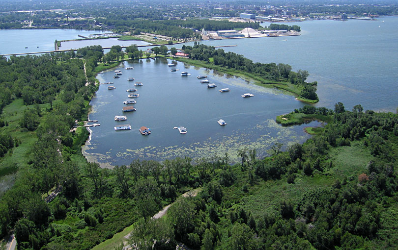
| Looking to the south over Horseshoe Pond. Anchored in the pond are several floating platforms with summer houses. Red buildings on the far side of the pond are part of the Coast Guard station, and the harbor of Erie appears in the far right background. |
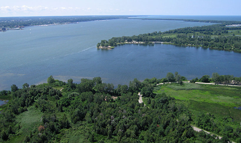
| View to the southwest across Misery Bay toward Presque Isle Bay. The Perry monument stands on the small peninsula near center of scene. In the background, a narrow strip of sand connects Presque Isle to the mainland. |
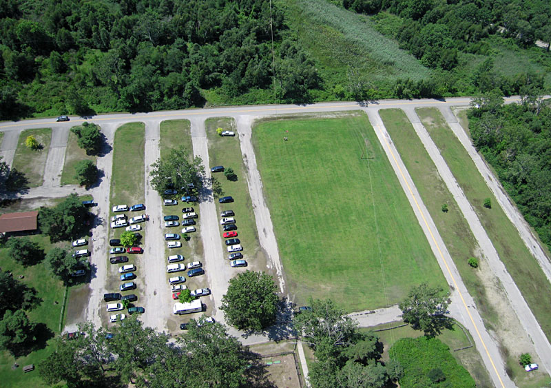
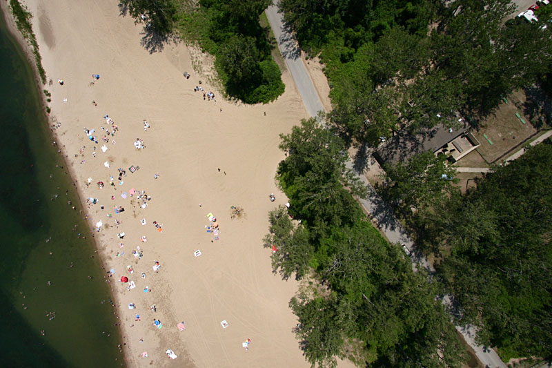
| Parking lot adjacent to beach 11. Kite flyers are standing in upper center of scene on a grassy terrace. |
| 
|