
| of Poland |
|
| of Poland |
During our KAPing trips, wind and weather conditions varied from near perfect to heavy cloud cover with strong wind. We flew a variety of kites including Sutton Flowforms (8, 16 and 30 sizes), a large delta-conyne kite, and a giant rokkaku. To take pictures we employed both the Olympus radio-controlled KAP rig and the manual KAP rig--see equipment. For transportation, we rented a small car. The following kite aerial photographs were taken in late September and early October, 1998 and in September, 2000. These kite aerial photographs represent, to the best of our knowledge, the first attempts to practice KAP in Poland (Aber and Galazka 2000). Click on the map below to see selected kite aerial photos.
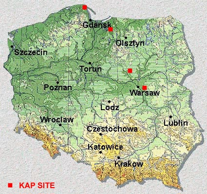
Map obtained from About Poland.
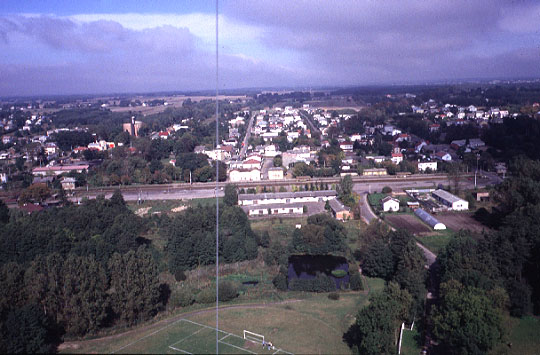
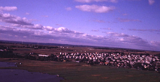
| High-oblique view over village of Mrozy, located near Minsk, about 40 km east of Warsaw. This view toward north shows the main railroad across scene center, which connects Warsaw to Moscow in Russia. Kite aerial photographers and spectators are visible at bottom center of scene at the end of a soccer field. Photo date 9/99, © J.S. Aber. |
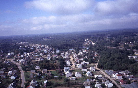
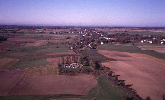
| View toward west over Mrozy, showing typical pattern of village layout, following the main roads, with forest in the background. Photo date 9/99, © J.S. Aber. |
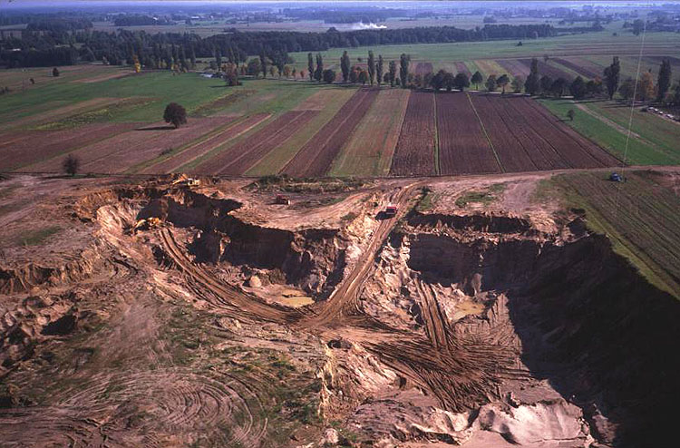
| Open-pit mine for sand and gravel aggregate at Kuflew, south of Mrozy. Excavators can be seen to the left, and a truck is coming for a load of sand near scene center. Kite flyers are visible on the far right. Photo date 9/00, © J.S. Aber. |
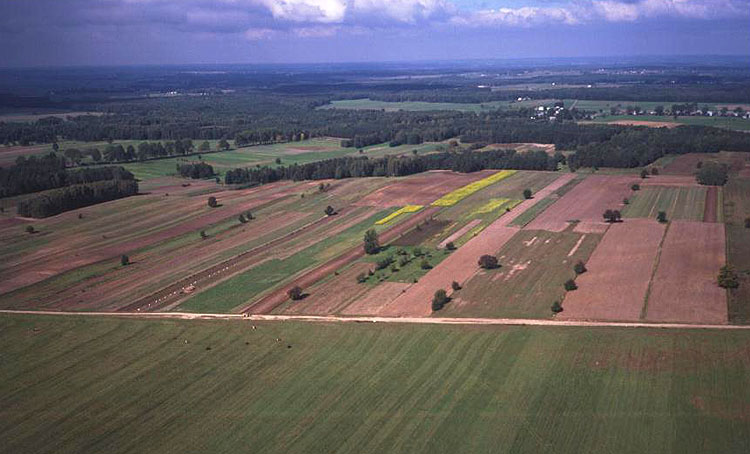
| Agricultural landscape at Seroczyn, south of Mrozy. Notice the contrast between the large field in foreground and narrow strips in the background. Winter wheat and rye crops are green at this time of year, and potatoes are being harvested--line of white bags in field to left. Photo date 9/00, © J.S. Aber. |
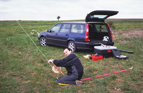
| Darek Galazka reels in a kite after a successful round of photography at Seroczyn. Photo date 9/00, © J.S. Aber. |
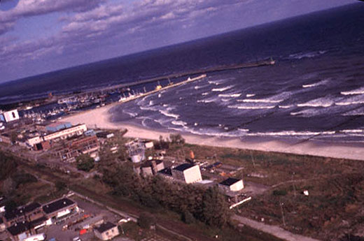
| Beach and harbor at Wladyslawowo on the Baltic Sea. The small fishing harbor blocks movement of sand along the beach, so an elaborate system of pumps and pipes is utilized to transfer sand around the harbor. Fragments of amber are often found on the beach, especially after storms. Photo date 9/99, © J.S. Aber. |
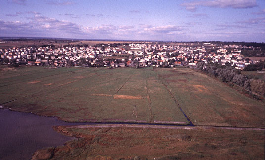
| Coastal marsh area behind the beach at Wladyslawowo. This land is drained for agricultural use. Part of the city is visible on higher ground behind the marsh. Photo date 9/99, © J.S. Aber. |
| View toward the southwest of Wladyslawowo. On the left horizon, two white towers are faintly visible. These towers are wind turbines--always a good sign for kite flying (see next image). Photo date 9/99, © J.S. Aber. |
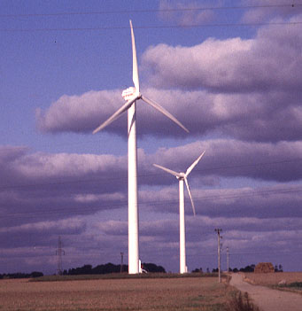
| Ground view of wind turbines at Swarzewo, south of Wladyslawowo. Such turbines represent a clean, renewable source of electrical energy and are widely employed in the southern Baltic region--Denmark, Sweden, Germany and Poland. Photo date 9/99, © J.S. Aber. |

| View along the Baltic coast showing the high cliff at Jastrzebia Góra in the background. This is the northernmost point of land in Poland. Photo date 9/99, © J.S. Aber. |
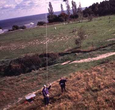
| The author (left) and Darek Galazka launch the KAP rig under very strong wind (25-30 mph) at Chlapowo, near Wladyslawowo on the Baltic coast. KAP equipment was transported to Poland in the Rubbermaid storage box seen to left. Photo date 9/99, © J.S. Aber. |
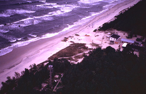
| Beach scene at Krynica Morska taken under heavy cloud cover. A small fishing harbor is visible with boats on the beach, where the kite flyers are located. An observation tower can be seen to lower left; the kite line came quite close to this structure at times. Photo date 9/99, © J.S. Aber. |

| Agricultural fields form a patchwork over the undulating glacial landscape of Elblag upland in northern Poland. Very few farmhouses are visible (see next caption). Photo date 10/99, © J.S. Aber. |
| Village of Milejewo surrounded by a mosaic of agricultural fields in the Elblag upland of northern Poland. Most farmers live in small villages like this example. Photo date 10/99, © J.S. Aber. |

| City of Mlawa appears in the background with a highway and railroad, and agricultural fields are visible in the foreground. Note long, narrow shape of fields, which is typical of rural land use in Poland. Kite flyers are standing at bottom of view. Photo date 10/99, © J.S. Aber. |

| Forest cover near Mlawa. The hilly landscape is an end moraine formed during glaciation. This view shows mainly deciduous forest, in which some trees display autumn colors. Forests are very important in Poland for recreational walking and collecting mushrooms. Photo date 10/99, © J.S. Aber. |
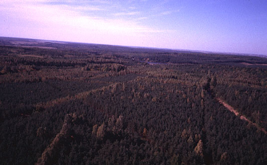
| Forest cover near Mlawa. The dark green patches are conifer forest consisting mostly of scotch pine, which are grown for commercial wood production. Lighter, yellow-green trees indicate deciduous forest. Photo date 10/99, © J.S. Aber. |
Return to KAP gallery.
Last update 19 Oct. 2000.