| Massachusetts James S. and Susan W. Aber |
|
| Massachusetts James S. and Susan W. Aber |
We found a small baseball field in Chilmark near Peaked Hill, which is one of the highest points on the island--just over 300 feet elevation. This portion of Martha's vineyard is a glacial end moraine that consists of a series of parallel ridges running NE-SW. The ridges are cored by bedrock blocks upthrust by glacier advance during the ice age. Our second KAP site was on the beach at Lobsterville on the northern side of Aquinnah.
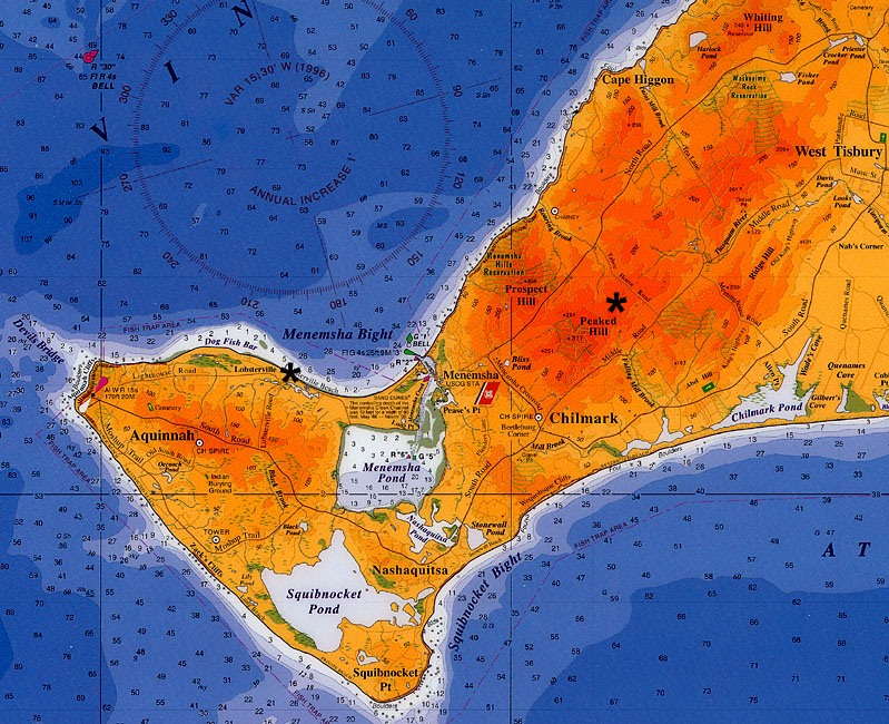 Map of the western portion of Martha's Vineyard. Two KAP sites are marked by asterisks (*). Map adapted from Channel Crossings Press (1999). | |
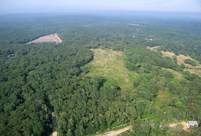
| View toward northeast. Former landfill site is visible in upper left corner. |
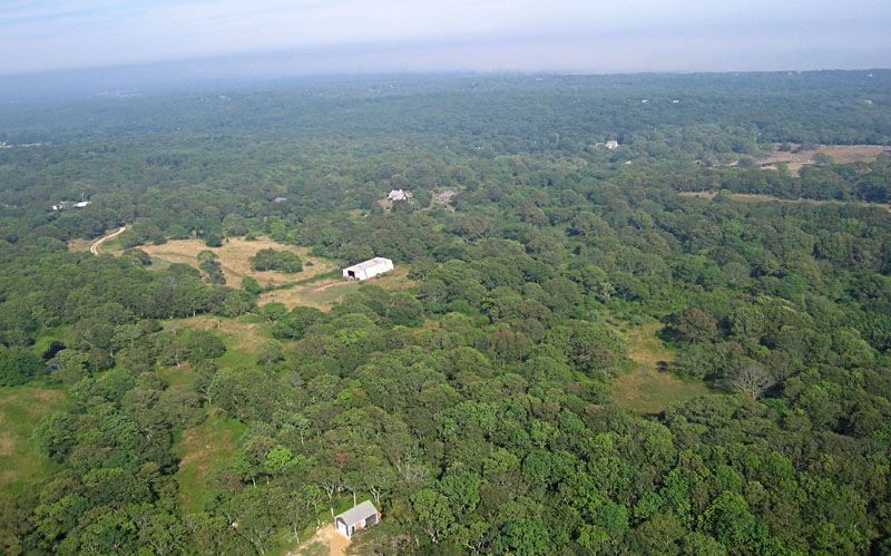
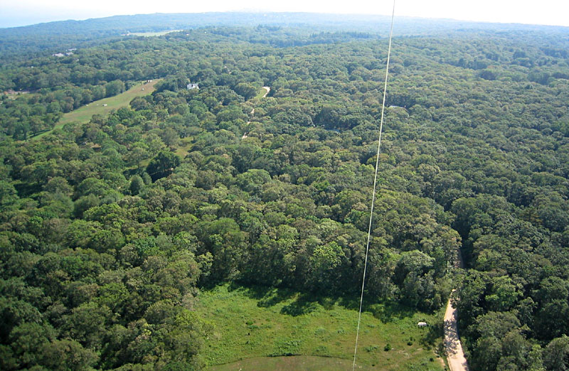
| View toward east. Patchwork of forest, cleared fields, farms, and country houses. |
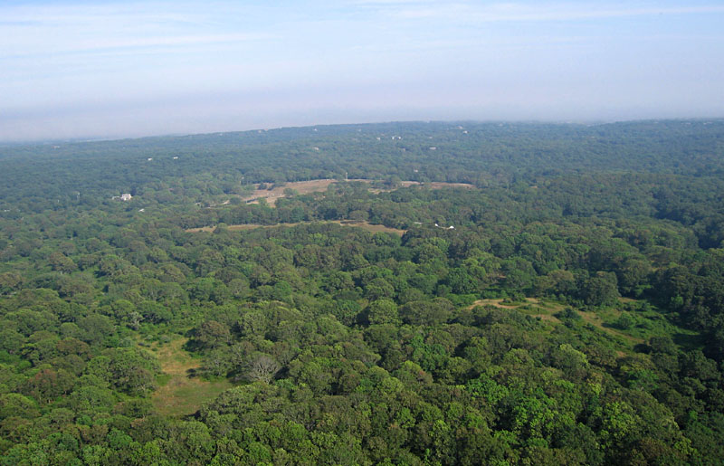
| View toward southeast showing heavily forested terrain of Chilmark vicinity. |
| View toward south. Coast and Atlantic Ocean are visible in the distance. |
| View toward southwest. Long clearings and roads follow NE-SW ridges in the landscape. |
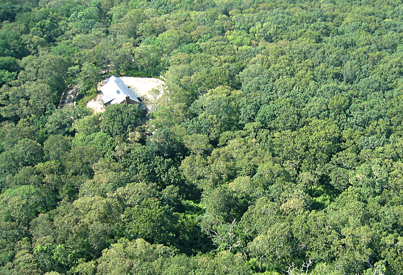
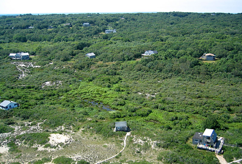
| A secluded house in the forest. |
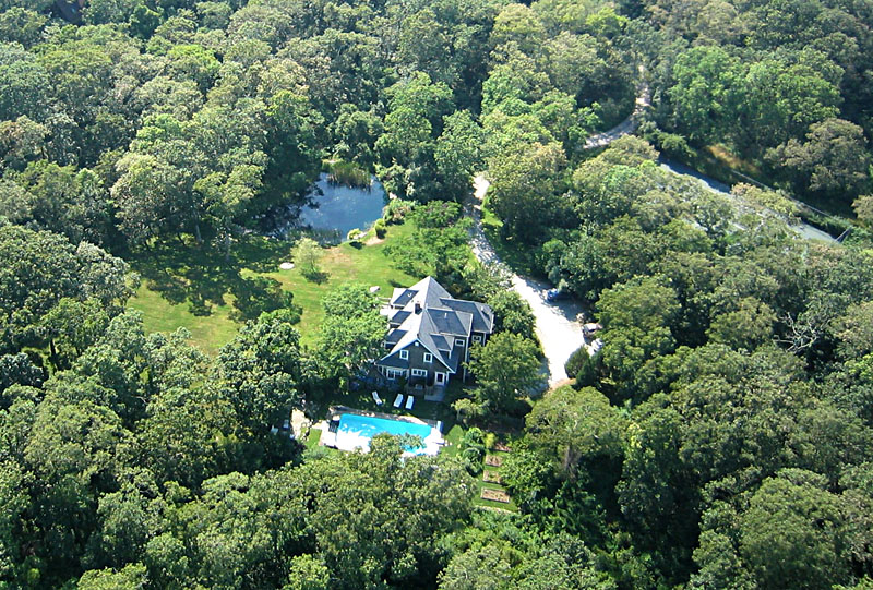
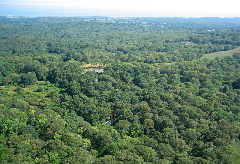
| Another secluded country estate. |
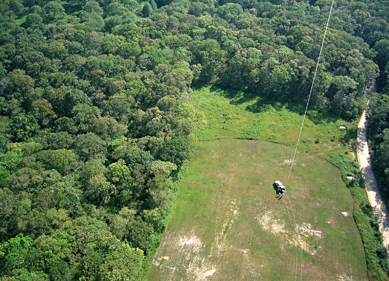
| Our flying site--a small clearing in the forest for a baseball field. |
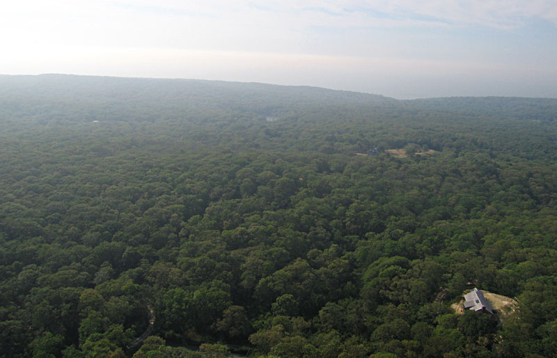
| Fog began to form in late afternoon, just as we completed our KAP session at Peaked Hill. |
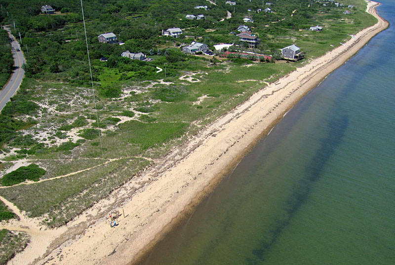
| KAP from the beach at Lobsterville, where there is a small public parking area. The arrow (>) marks an osprey nest on a pole. The ospreys largely ignored our kite. |
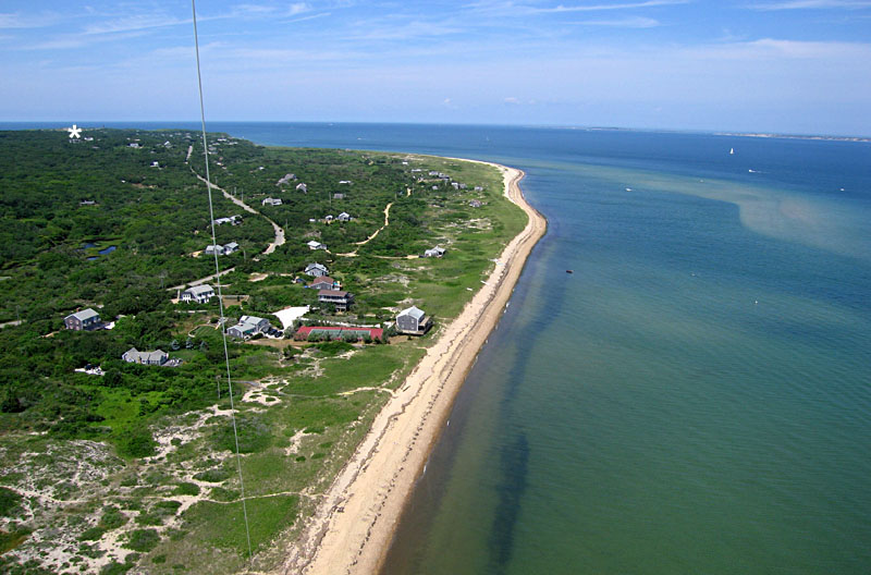
| View westward toward the end of Martha's Vineyard. The asterisk (*) marks the location of Aquinnah Cliffs on the northwestern tip of the island. |
| Summer cottages and vacation homes near the beach at Lobsterville. |
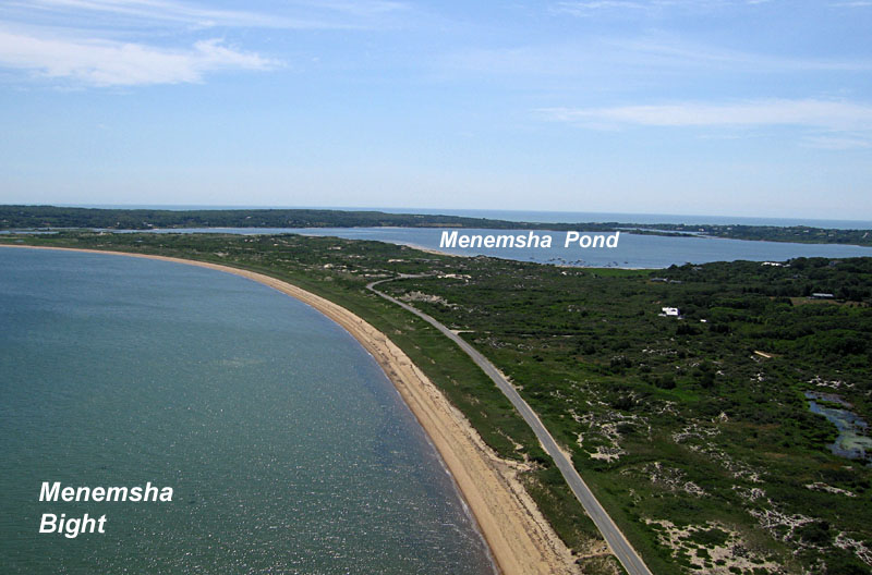
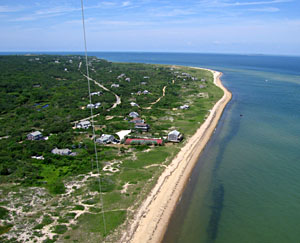
| View toward the southeast over Menemsha Bight and Menemsha Pond. The Atlantic Ocean is visible on the far horizon. |
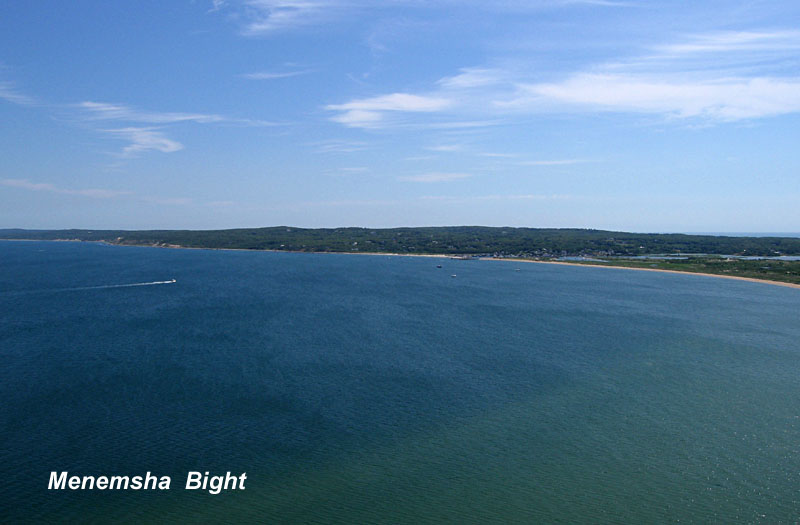
| View east toward the Chilmark region of the island. The harbor of Menemsha is situated just right of scene center. High forested ridges at center of view stand more than 300 feet (90 m) above sealevel. |
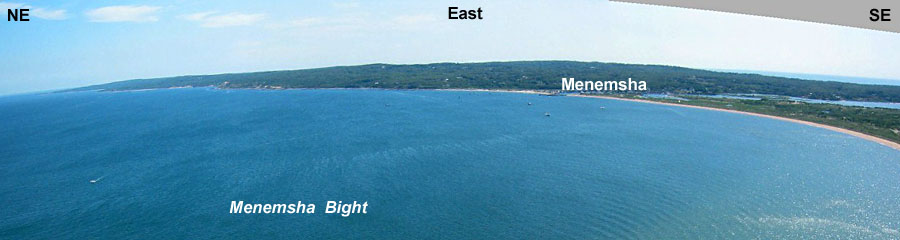 Panoramic view looking eastward over Menemsha Bight to the Chilmark portion of Martha's Vineyard. The image was assembled from two Canon digital Elph photos. | |
![]() Return to KAP gallery.
Return to KAP gallery.
Last update: Aug. 2005.