| Kansas City, Missouri James S. and Susan W. Aber |
|
| Kansas City, Missouri James S. and Susan W. Aber |
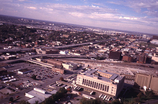
| View toward the northwest. The square building to lower right is the main post office. Elevated roadways and commercial activities dominate landuse in this part of the city. The Missouri and Kansas river valleys are visible in the distance. Photo date 10/98. |
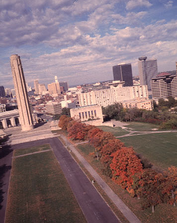
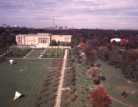
| Mall leading to the Liberty Memorial with downtown Kansas City visible in the background. The Liberty Memorial tower is 217 feet (66 m) tall and is one of the best known landmarks in the city. This is a rare (for me) portrait view. Photo date 10/98. |
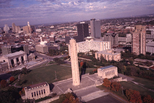
| Liberty Memorial complex in the foreground with downtown Kansas City visible in the background. The Liberty Memorial was built in the 1920s to celebrate the peace which followed World War I. Note a whisp of steam from the top of the tower, which symbolizes an eternal torch. Photo date 10/98. |
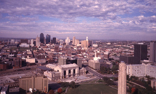
| Union Station, the former main train station is visible in lower center of view. The building is undergoing a complete renovation and will house a science and technology museum when completed. The top of the Liberty Memorial tower is visible to lower right, and the downtown skyline shows in the background. Photo date 10/98. |
| Liberty Memorial undergoing reconstruction. The pavement has been removed for replacement of support columns beneath the structure. Photo date 4/01. For post-recontruction views (2003), see architectural history of the Liberty Memorial. |

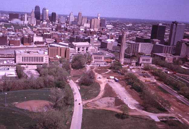
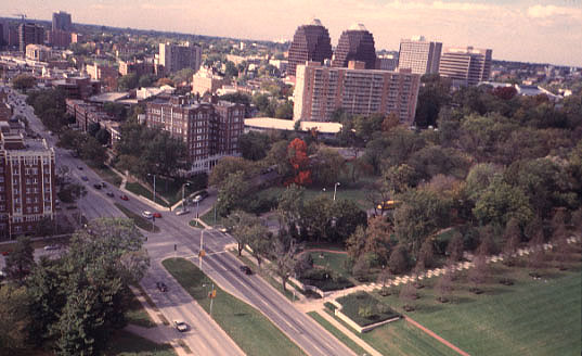
| Crown Center complex consists of a hotel, apartments, offices, shopping mall, and restaurants. This cluster of buildings is located near the Liberty Memorial and Union Station. Crown Center is the international headquarters of Hallmark Cards, Inc. Photo date 10/98. |
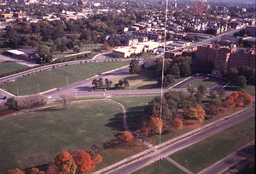
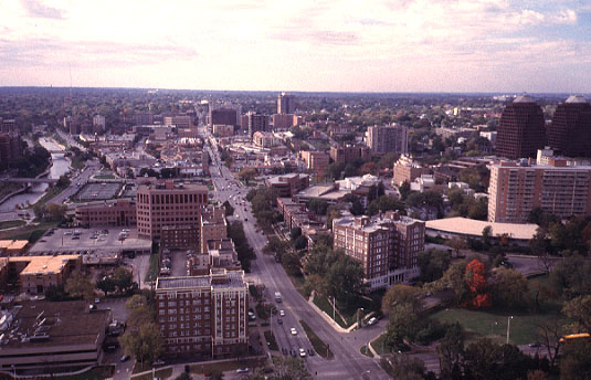
| View toward the east along 27th Street. Main Street runs across the lower portion of this scene. Part of Crown Center is visible to the left, and Union Cemetery is the tree-covered area to right (see next image). Photo date 4/01. |
| View toward the southeast from the Liberty Memorial mall. Large brick building to the right is the old St. Mary's hospital, now part of the Trinity Lutheran hospital complex. The old Union Cemetery is the treed area in the left background. Main Street extends southward in the upper right corner. Kite fliers are visible at bottom of view. Photo date 10/98. |
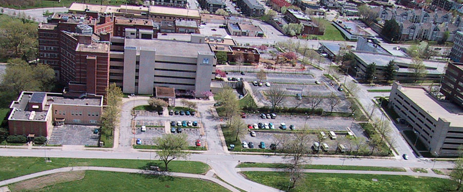
| Closeup view of the St. Mary's-Trinity Lutheran hospital complex, seen from the west side. Digital-camera image; photo date 4/01. |

| High-oblique view toward southeast with Trinity Lutheran hospital complex in the foreground. The landmark KCPT television tower (formerly KCMO-TV's) is located on east 31st Street. The tower was completed for service in 1955. Photo date 4/01. |
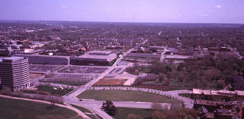
| Southward view along Broadway (street to left of scene center) with Penn Valley Park in the foreground. The complex of brick buildings in right center of view is Penn Valley Community College. This image was taken directly toward the mid-day sun and so has high contrast, many shadows, and sun glint. Photo date 4/01. |
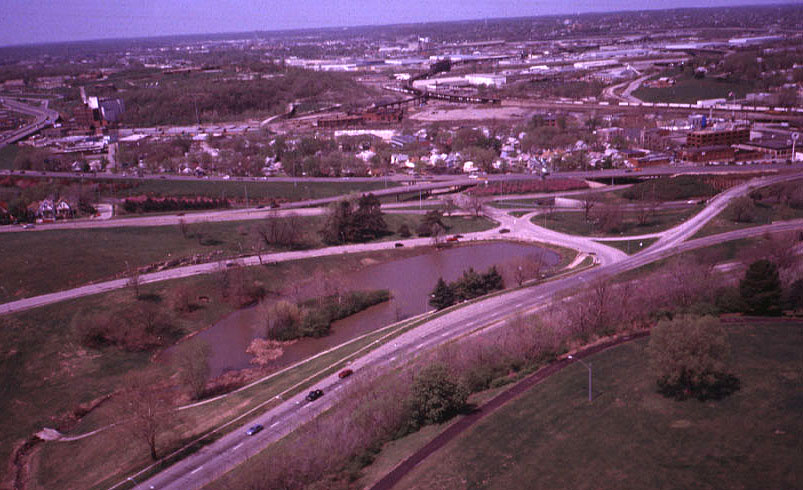
| View toward the northwest from Penn Valley Park. Three major roads enter the scene from the left: I-35 (upper left), Southwest Trafficway (left center), and Broadway (lower left). These roads merge in a complex intersection to the right. Kansas City, Kansas appears in the background. Photo date 4/01. |
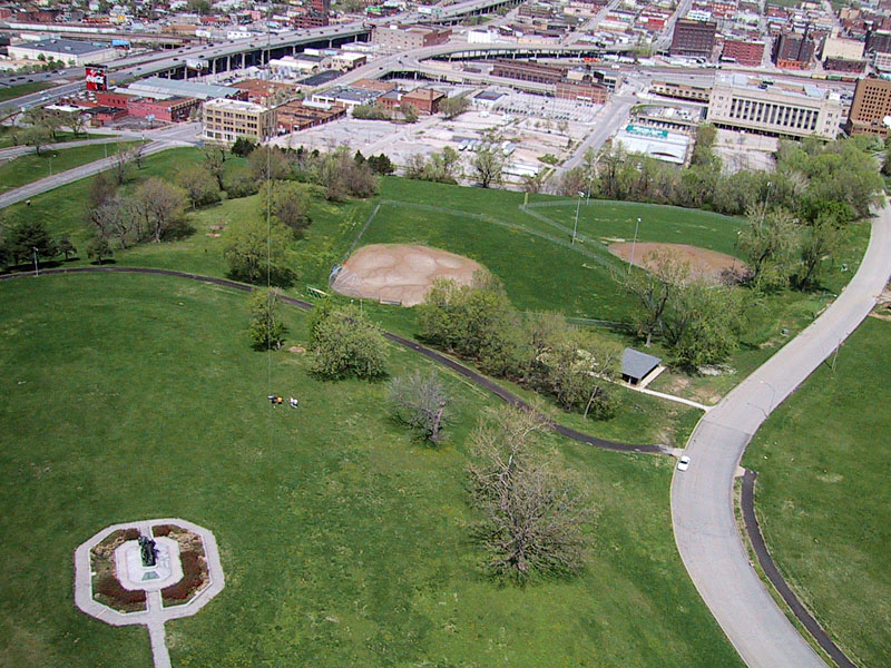
| Penn Valley Park and the Pioneer Mother statue with kite flyers. Main Post Office building can be seen in upper right corner; I-35 and Broadway cross the upper left corner of view. Digital-camera image; photo date 4/01. |

| Closeup, vertical view of the Pioneer Mother statue, which has been defaced with graffiti. Digital-camera image; photo date 4/01. |
| The Nelson-Atkins Museum of Art is a cultural icons near the Plaza district of Kansas City. The gallery has world-renowned collections of European and Oriental art. Seen here is part of the sculpture garden, in which monumental works are displayed outdoors. The skyline of downtown Kansas City is visible on the horizon, with the landmark television tower of station KCPT. Photo date 10/98. For more recent views, see Nelson-Atkins (2005). |
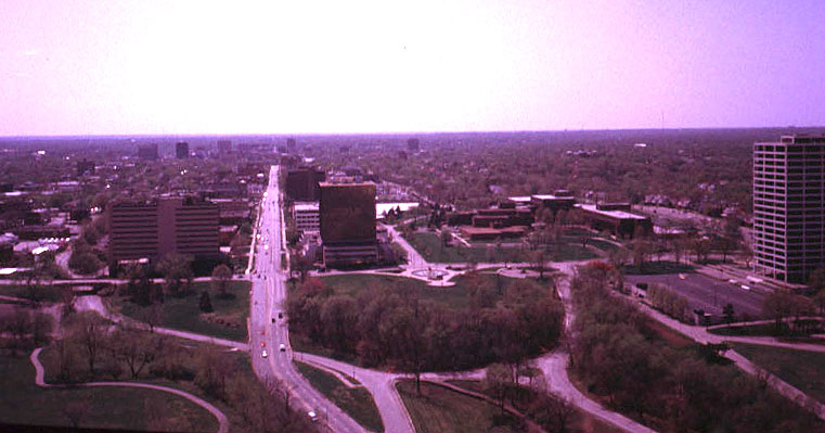
| View westward along 47th Street toward the Country Club Plaza district. Brush Creek is visible to far left side. This heavily urbanized drainage basin is subject to severe flash flooding. In September, 1977, 25 people died during a flood. More recently, on Oct. 3rd, 1998, 11 people were killed during another flash flood of Brush Creek. Photo date 10/98. |
| View toward the northwest, 47th Street on left side. Apartment buildings, hotels, and office towers cluster on the periphery of the Plaza district (in left background). Photo date 10/98. |
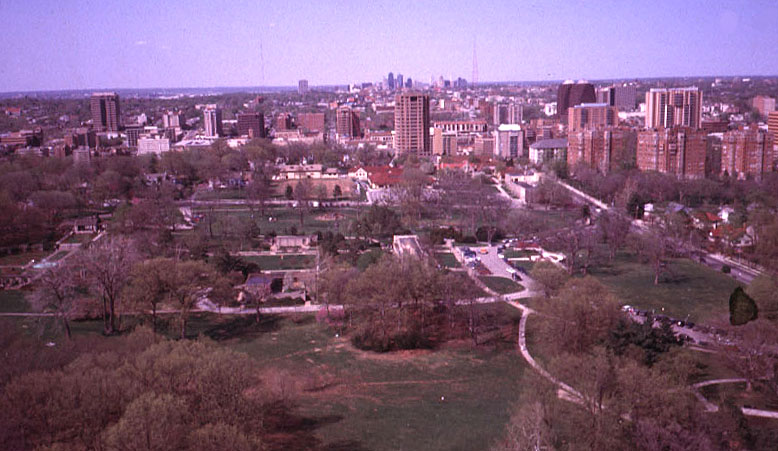
| View northward over Loose Park in the foreground with the Country Club Plaza in the middle distance and downtown skyscrapers on the horizon. The area of Loose Park was the site of the Battle of Westport during the Civil War. Later it became a private golf course and eventually a city park. Photo date 4/01. |

| The Rose Garden is the circular structure in the center of this view toward the northwest over Loose Park. The roses are not yet blooming in this early spring picture. Photo date 4/01. For detailed views, see rose garden. |
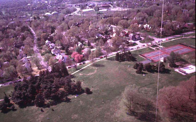
| View toward the west showing the tennis courts and wading pool (right) at Loose Park. Flowering trees are full of color in this early spring view. In the background, Ward Parkway and Johnson Drive can be seen. Photo date 4/01. |

| Low-oblique view of the Loose Park lake with Wornall Road across the top of scene. Compare late-spring vegetation in this view with the next image. Photo date 5/99. |
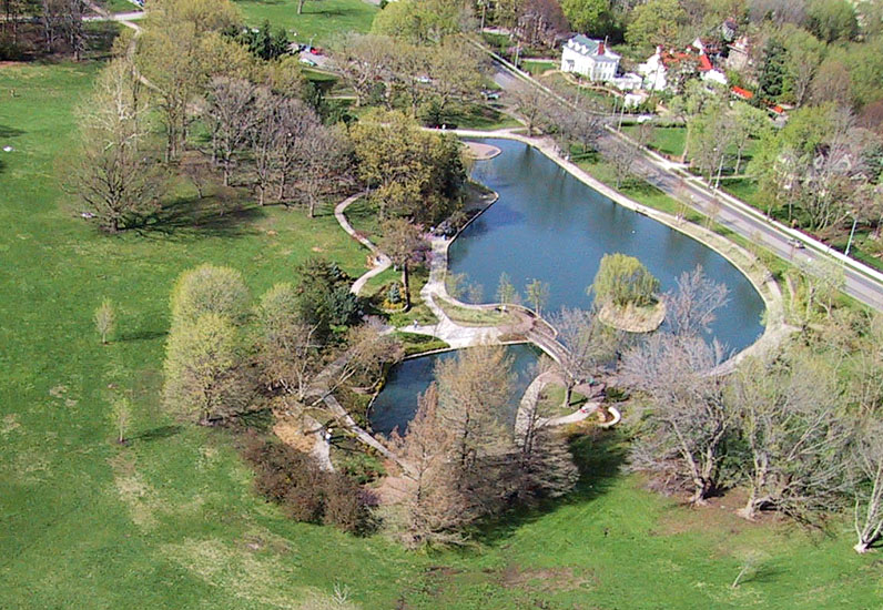
| Early spring view of the lake at Loose Park with Wornall Road across the upper right. Grass is green; deciduous trees have flowers (mostly green), but are largely bare of leaves. Digital-camera image; photo date 4/01. |
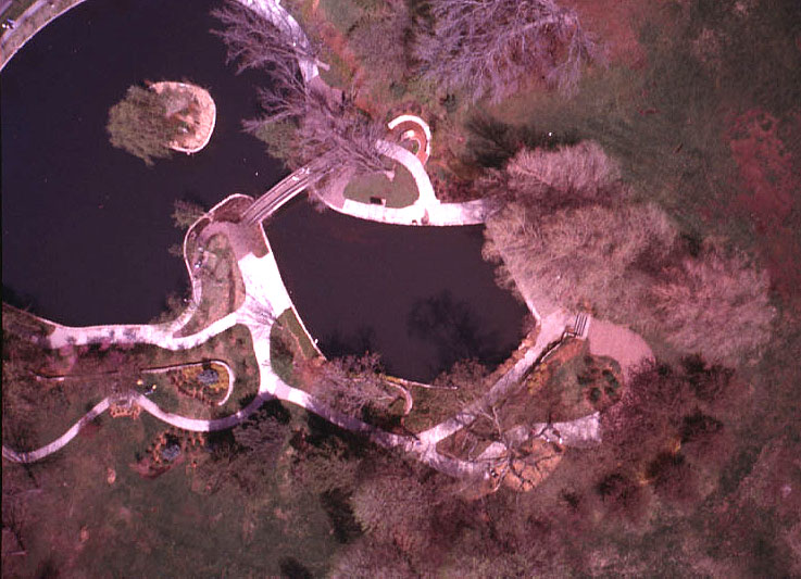
| Near-vertical view over the south end of the lake at Loose Park. Early spring scene in which grass is green, but deciduous trees are still mostly bare. Photo date 4/01. |
![]() Return to KAP gallery
or Great Plains KAP homepage.
Return to KAP gallery
or Great Plains KAP homepage.
All images © by the authors, J.S. and S.W. Aber (2005).