| Dam and Reservoir
Hodgeman County, Kansas
J.S. and S.W. Aber |
|
| Dam and Reservoir
Hodgeman County, Kansas
J.S. and S.W. Aber |
The authors have toured the surroundings before and have wanted to acquire KAP at this site for the past few years. Finally JSA was able to visit in mid-May '09 and conduct solo KAP under mostly clearly sky with a moderate breeze from the north. KAP took place at a small public viewing area on the northeastern corner of the construction site, so the kite carried toward the construction area. A small (11-foot) delta kite was used to lift the Canon S70 camera rig.
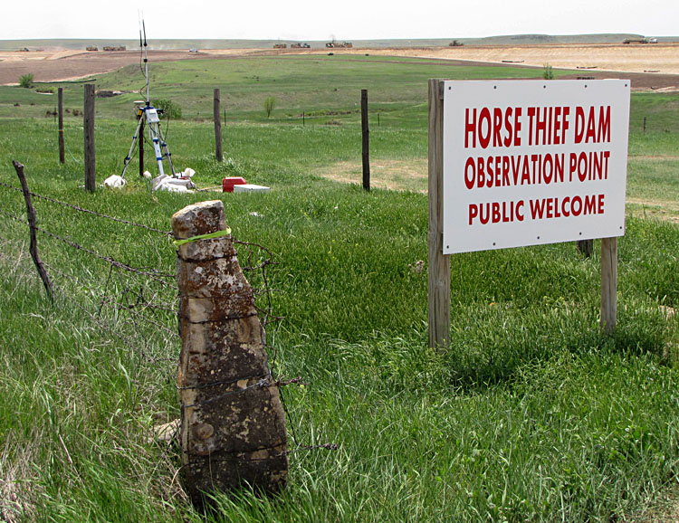
| A traditional stone fence post marks the public viewing area for construction of Horse Thief Canyon dam, which can be seen in the background. Also note the GPS survey station used for contruction measurements (detail to right). | 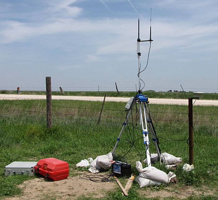
|
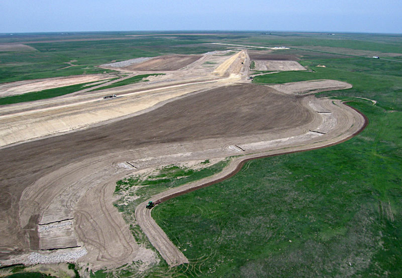
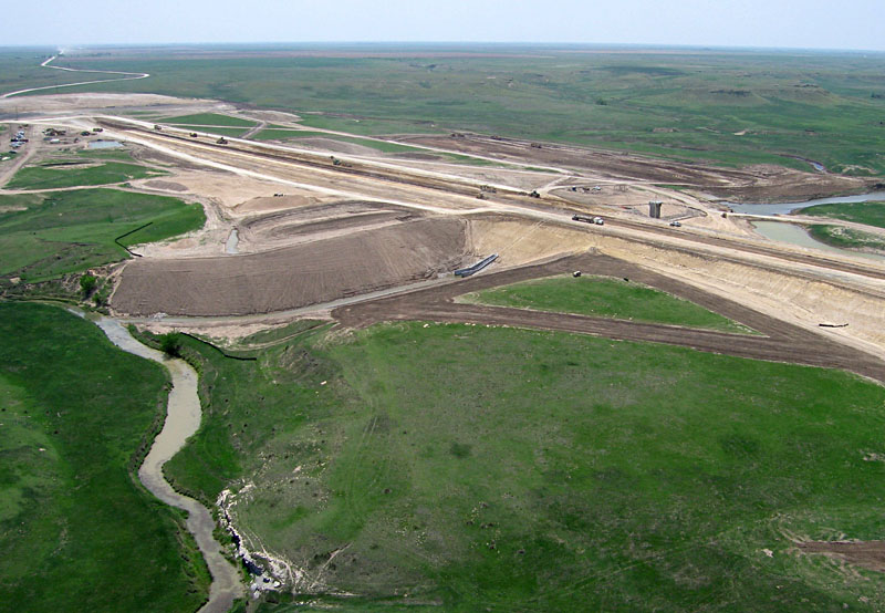
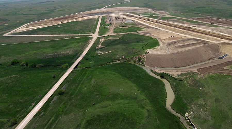
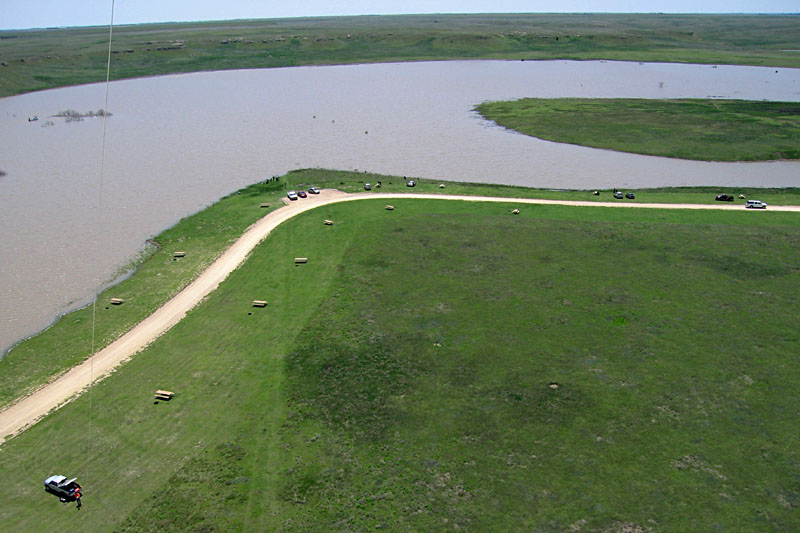
| Left: overview toward the northwest. The project management office can be seen in the far distance next the K-156 state highway. Right: view toward southwest. The outlet tower connects under the dam to a new outlet chute on the left side. | 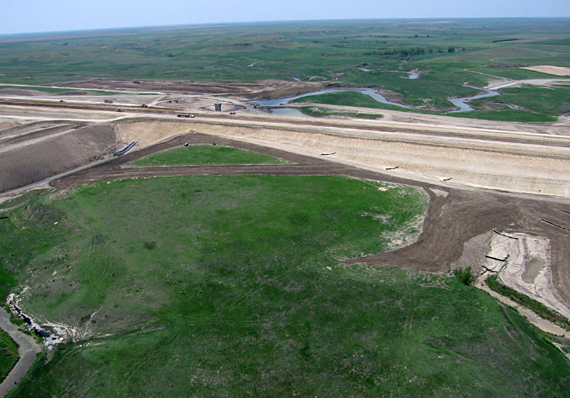 |
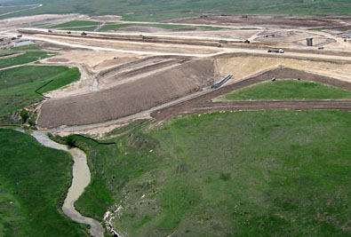
| Central dam construction. Overview (left) and close-up shot (right). The previous channel of Buckner Creek is now completely blocked by the dam. Buckner Creek can be seen in the background (behind dam), and the new outlet tower is visible behind the dam on left side. | 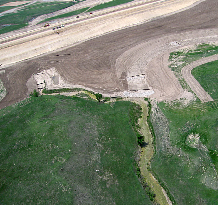 |
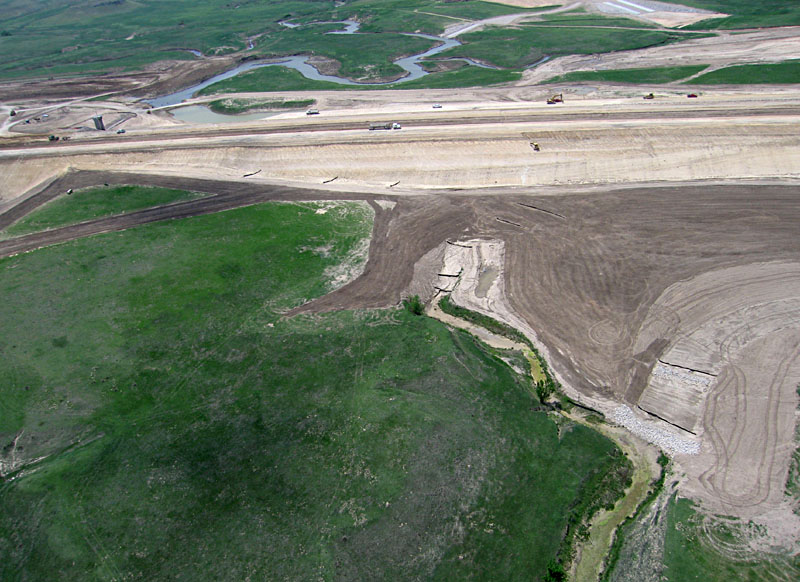
| Left: southern portion of the dam. Flow from the outlet chute connects to Buckner Creek channel on left side. Chalk bedrock is exposed along the old creek channel in lower left portion of scene. Right: view southeastward, looking downstream across Buckner Creek valley below the dam. | 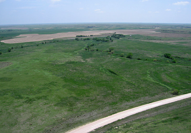
|
 Overview looking southward. The dam outlet appears on the right side. In the center distance is the emergency overflow spillway. The county road has been diverted around this spillway in the right background. May 2009.
| |
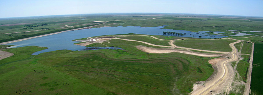 Panoramic view looking southeastward at scene center. The dam appears in the left background, and Buckner Creek feeds into the reservoir from the right background. The boat ramp area is under construction just left of scene center. Assembled from two wide-angle shots; May 2010. | |
The author (JSA) visited on May 31st and conducted solo KAP using two cameras, namely the radio-controlled Canon Elph and automatic Canon S70 rigs, lifted by a small rokkaku on a steady south breeze. Many visitors came by to view the full lake and watch the KAP.
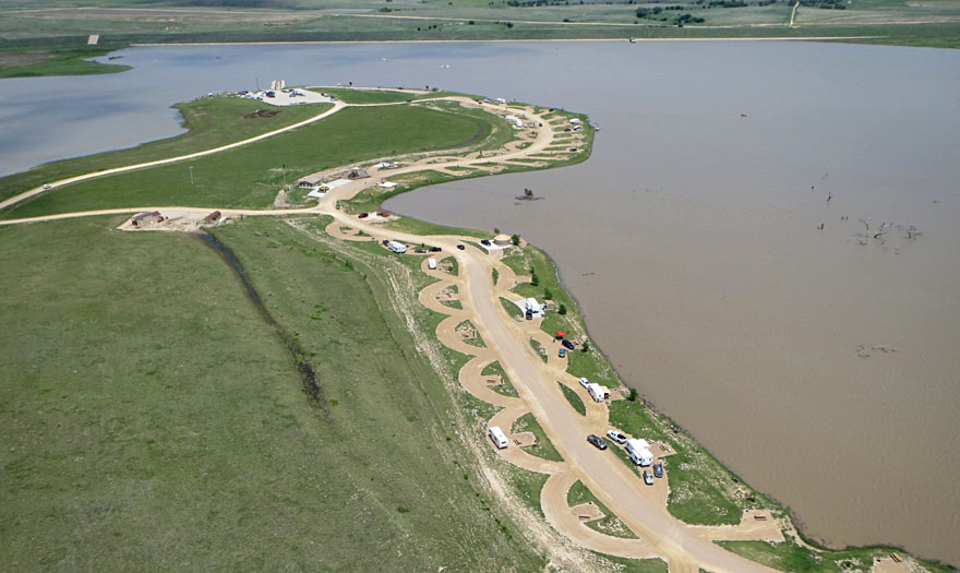
| Left: looking eastward toward the dam in the distance and camping area in the foreground. Right: View to north showing the access road on right and agricultural fields to left. | 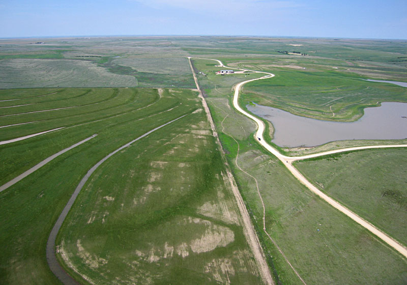 |
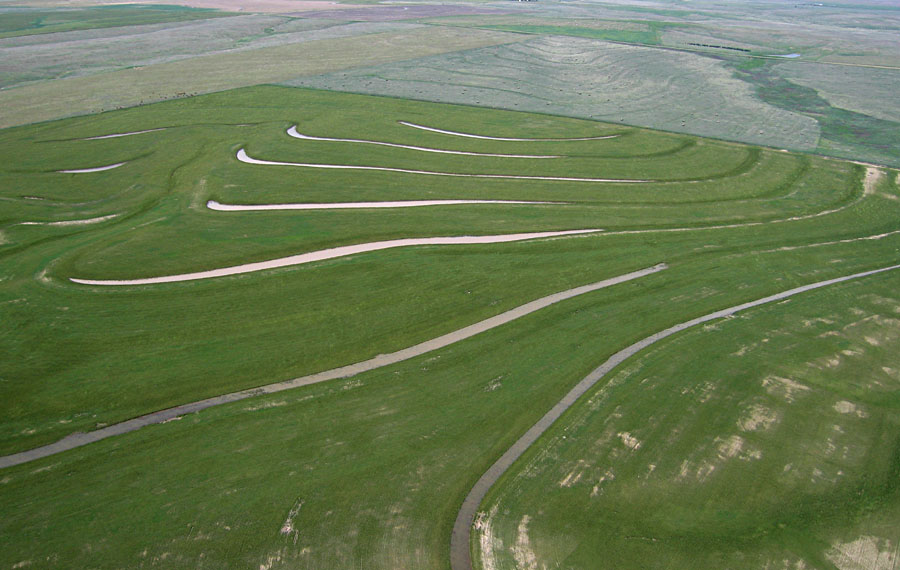
| Views toward northwest over a terraced field of winter wheat. Water fills the swales behind each terrace, a rare sight in western Kansas. | 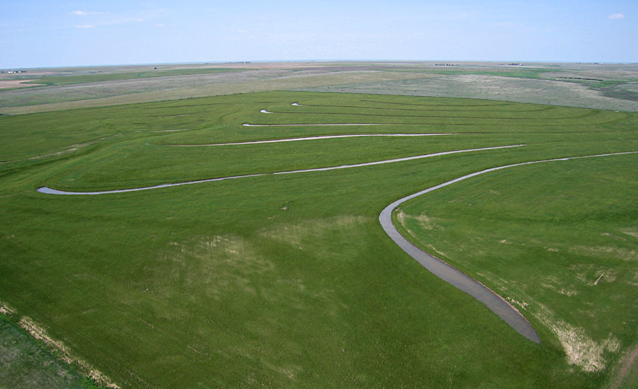 |
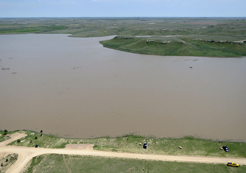
| Left: looking across the lake to prominent bluffs on the southern side. Right: view westward showing meandering Buckner Creek as it enters the lake from upstream. | 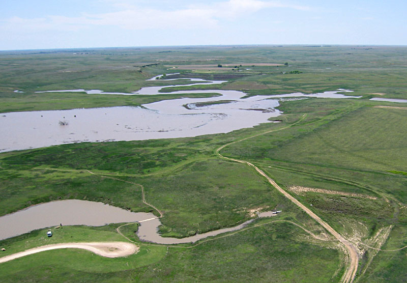 |
| Left: conducting kite aerial photography from the picnic area on the northern side of the lake. Right: testing the camera rig before launching with a self portrait (JSA). | 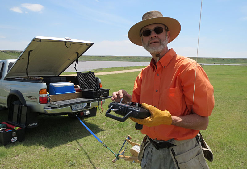
|
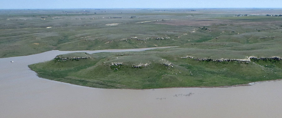 Close-up view of bluffs along the southern side of the lake basin. The ledges are formed by mortar beds at the base of the Ogallala Formation, which underlies the High Plains. | |
![]() Return to KAP home or gallery.
Return to KAP home or gallery.
All text and imagery © by J.S. Aber.
Last update May 2018.