Halstead, Kansas |
Halstead, Kansas |
Halstead is situated beside the Little Arkansas River on the floodplain. The city has a long history of flooding, of which the July 1993 flood was most severe. A levee/pump system was completed in the mid-1990s, which has protected the city from subsequent floods.
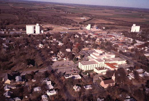
| Overview of Halstead toward the northeast. The large white building complex to right is the Hertzler Medical Clinic, and the "downtown" district is visible beyond the clinic buildings. Grain elevators are situated beside the Burlington Northern-Santa Fe railroad. Portions of the Little Arkansas River and levee can be seen just behind the grain elevators. Photo date 11/98; © J.S. Aber. |
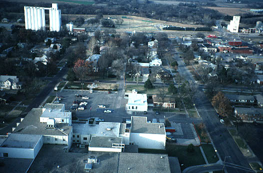
| Closeup view of the Hertzler Medical Clinic complex of buildings in the foreground. Photo date 11/96; © J.S. Aber. |
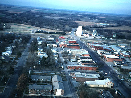
| Main Street "downtown" district is depicted on the right side. The brick buildings in lower left corner are the "inn" which serves visitors to the Hertzler Medical Clinic. Photo date 11/96; © J.S. Aber. |

| View over the southeastern portion of Halstead, showing the city's water tower. Water is derived from the Equus Beds aquifer which underlies the surrounding region. Photo date 11/98; © J.S. Aber. |
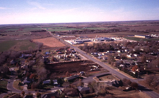
| View toward the west along 6th Street, which continues as a rural road in the distance. New suburban development and industries can be seen. Photo date 11/98; © J.S. Aber. |
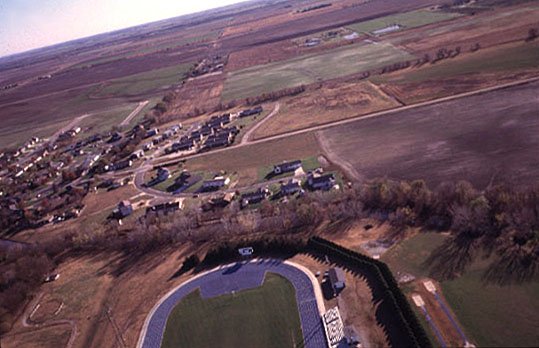
| Southern side of Halstead with a portion of the high school athletic field and new homes in the background. A drainage slough runs between the athletic field and the homes. This channel marks an old path of the Little Arkansas River. Photo date 11/98; © J.S. Aber. |
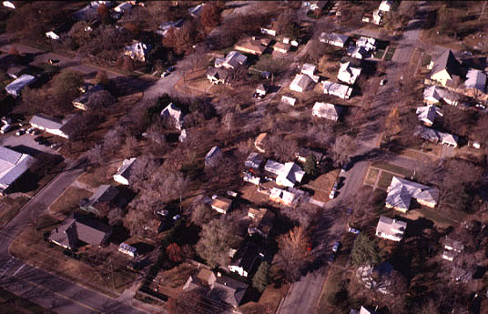
| High-oblique view over residential district just north of 6th Street. This scene depicts typical "midwestern" city development based on a grid plan. Photo date 11/98; © J.S. Aber. |
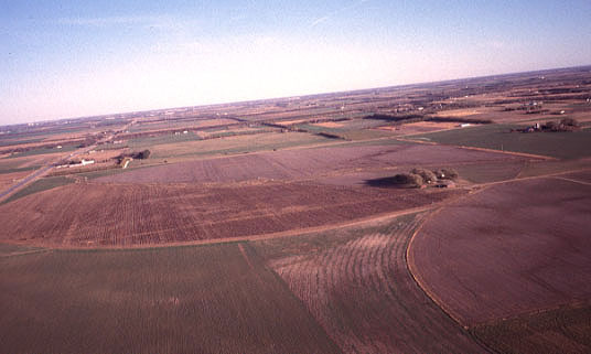
| Agricultural landscape north of Halstead. The large circular fields are developed for center-pivot irrigation systems. The water is pumped from the underlying Equus Beds aquifer. Corn, milo (sorghum), and soybeans are the main crops grown with irrigation during the summer; winter wheat (green) is growing in the non-irrigated fields in this late autumn image. Photo date 11/98; © J.S. Aber. |
| Halstead cemetery with U.S. highway 50 in the background. This view shows the older portion of the cemetery, in which large trees are present and tombstones stand upright. Photo date 11/98; © J.S. Aber. |
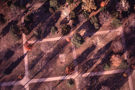
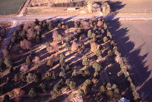
| Vertical view over Halstead cemetery. The upper half depicts the older portion of the cemetery with many trees and upright tombstones. The lower half shows the newer section, in which there are few trees and tombstones are laid flat, level with the ground (note lack of shadows). Photo date 11/98; © J.S. Aber. |
More information on Kansas groundwater management districts--GMD.