|
Northeastern
J.S. and S.W. Aber |
| Introduction | Blimp setup |
| Airphotos | References |
|
|
Northeastern
J.S. and S.W. Aber |
| Introduction | Blimp setup |
| Airphotos | References |
Introduction to gilsonite
Gilsonite is a naturally occurring type of asphalt found primarily in the Uinta Basin of northeastern Utah. It was discovered in the mid-nineteenth century and promoted commercially by Samuel H. Gilson. The name "gilsonite" is a registered trademark of the American Gilsonite Company (AGC 2013). It is also known as asphaltite, uintahite, or asphaltum (Ziegler 2010). Gilsonite was mined in the late 1800s for various applications: waterproofing wood, insulating wire cable, and varnish.
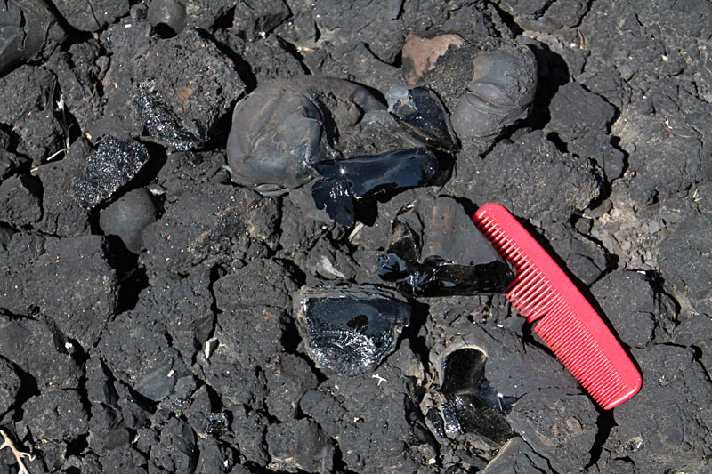
Gilsonite clumps display dark brown or gray to black color. The natural asphalt is quite brittle and soft (Mohs hardness = 2). Freshly broken surfaces are shiny like obsidian (volcanic glass).

| Two modern gilsonite mines remain in operation. Left: American Gilsonite Company at Bonanza, Utah. Right: Ziegler Chemical and Mineral Corporation at Little Bonanza, Utah. | 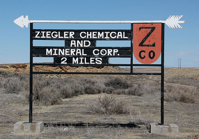 |
| Beautifully restored 1914 Ford Model T displayed in the Automobile Museum at Gjern, Denmark. |
Gilsonite veins are found primarily within the Uinta Formation (upper Eocene; USGS 2013a) that consists of poorly consolidated sandstone and mudstone deposited from erosion of the Uinta Mountains to the north. Oil shale (kerogen) is located underneath in the Green River Formation, which is lower/middle Eocene, approx. 50 million years old (Cushman 2006; USGS 2013b). Subsequent uplift and deformation of the region led to fracturing of the Uinta Formation, perhaps aided by high fluid pressure in the Green River Formation (Monson and Parnell 1992), and hydrocarbon fluids migrated upward to fill the fractures (Tetting 1984). Volatile compounds later escaped leaving behind the solid residue of gilsonite.
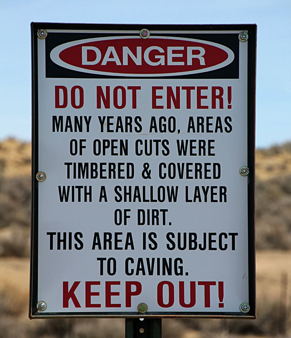
Over the years, many gilsonite veins have been mined out. Open trenches, old equipment, and derelict buildings are scattered across the landscape. Left: mine trenches are fenced with warning signs. Right: close-up view looking into a mine trench; photo courtesy of Rick Moran.
|  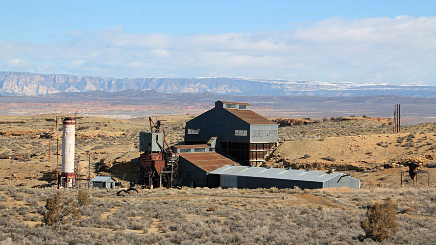
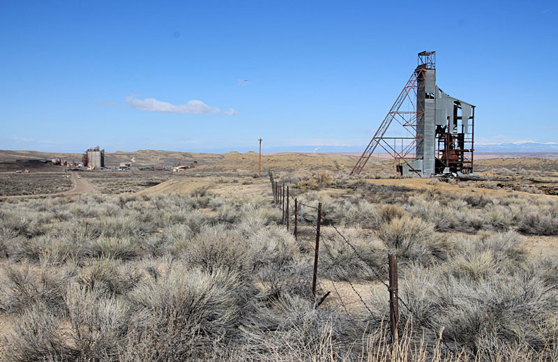
Abandoned gilsonite mine facilities. Left: processing plant next to our blimp launch site. Right: mine hoist on a gilsonite vein with the American Gilsonite plant in the left background.
| 
|
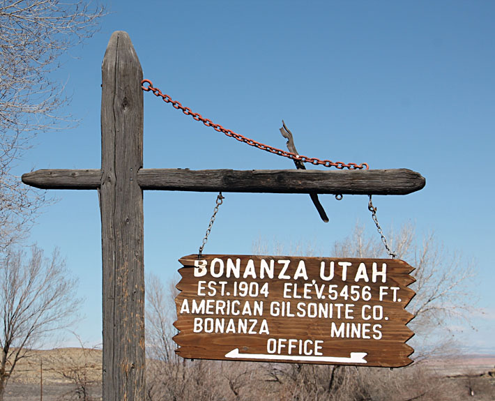
| Sign with elevation at entrance to the American Gilsonite Co. mine at Bonanza, Utah. Our blimp aerial photography site was about four miles to the east, near Cowboy Canyon. |
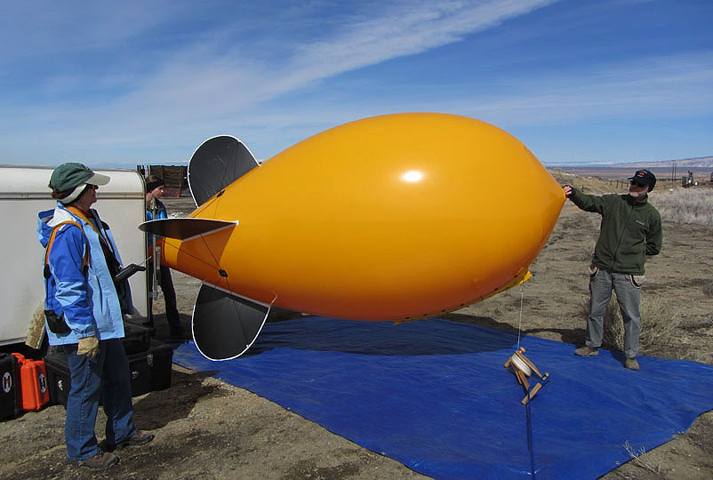
| Left: inflating the gold-and-black blimp, which is highly visible in flight. These colors represent Emporia State University. Right: "stingers up" demonstrating the new ESU hand signal next to the blimp's "stinger" tail. | 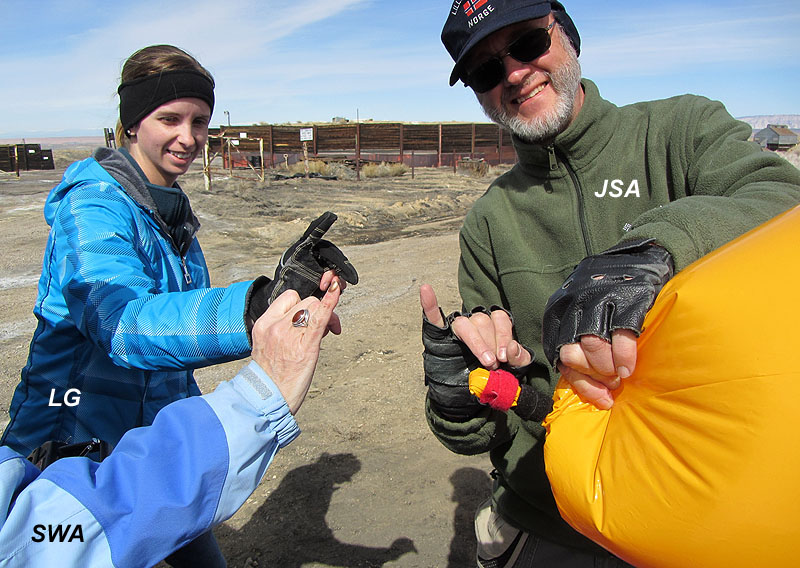
|
| Left: self-portrait taken with the Canon Elph camera rig before the antenna broke. Right: broken antenna that fell to the ground from the tangled Canon Elph camera rig. |  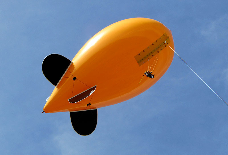
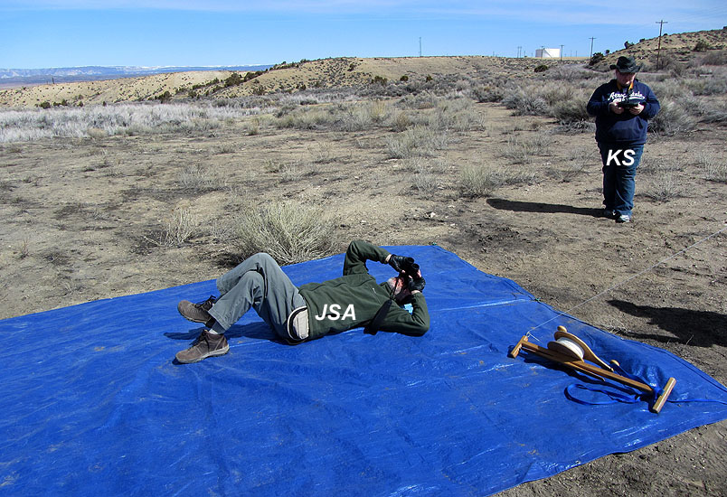
Left: helium blimp in flight with the Canon S70 camera rig suspended from the keel. Right: watching the blimp and camera with binoculars while Katie Simmons operated the radio control to aim the camera and take pictures.
| 
|
The following aerial pictures were acquired with the Canon S70
camera from a height range of 400-500 feet above the ground.
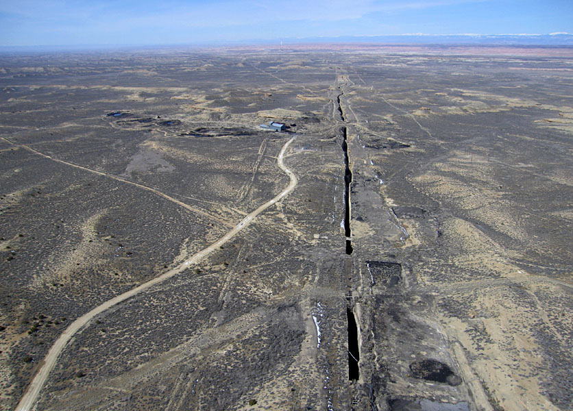
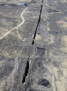
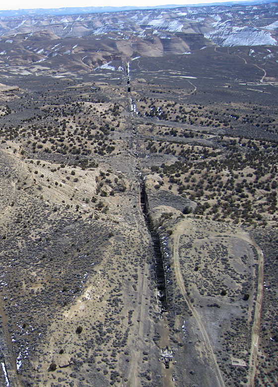
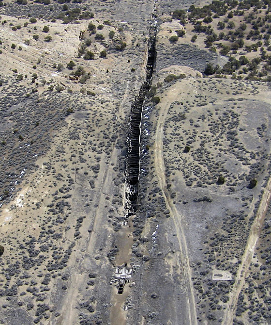
| Left: overview toward the west-northwest with the Wasatch Mountains on the far horizon. The mine trench extends for several miles into the distance. Right: closer view of the mine trench with partial timber-and-soil covering. | 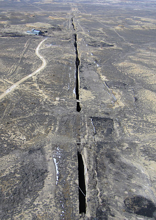 |
Left: overview toward the east-southeast of the same mine trench, which extends for several miles into the distance. Right: closer view of the mine trench and timber framework with partial soil covering.
|  |
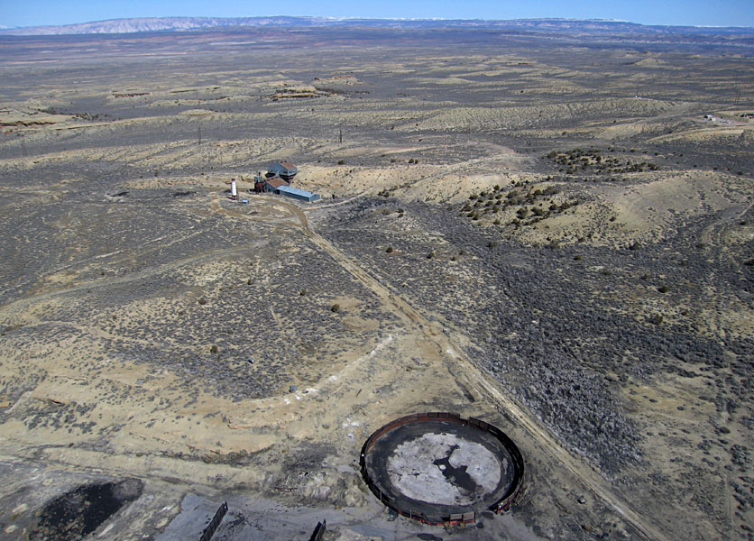
| Overview toward the north with a circular gilsonite storage bunker in the foreground, an old processing plant in the middle distance, and the Uinta Mountains on the far horizon. |
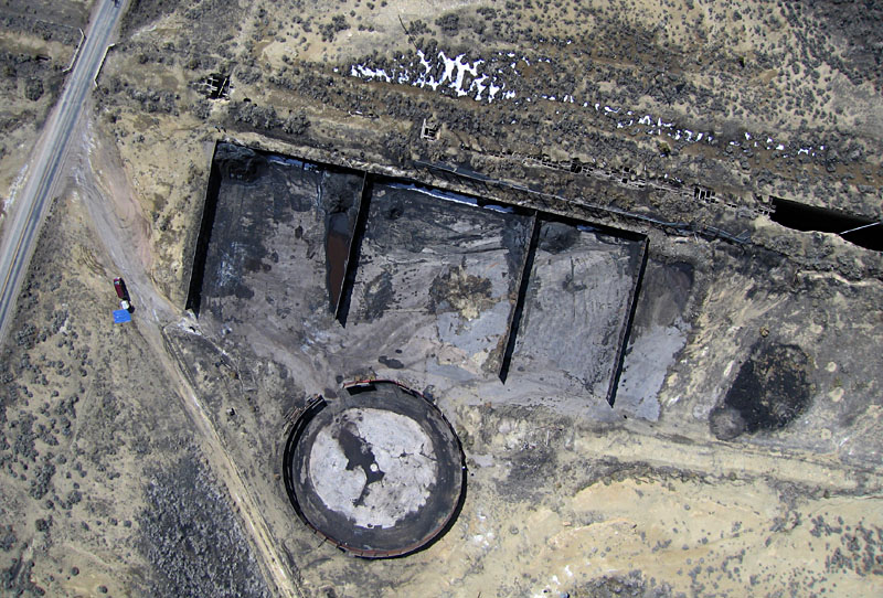
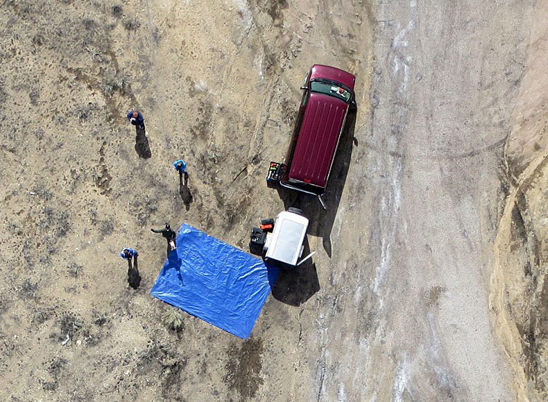
| Left: rectangular and circular storage bunkers for gilsonite next to the mine trench. Vehicle, trailer, and blue tarp for inflating blimp to left side. Right: looking straight down into old mine trench with partial timber-and-soil cover. The trench is approx. 25 feet wide. | 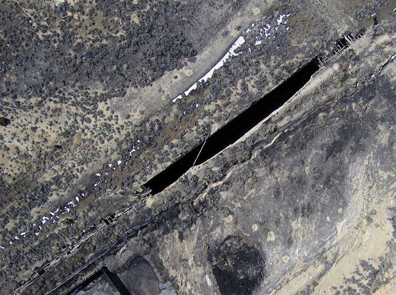 |
References
![]() Related sites
Related sites
![]() Return to KAP home or gallery.
Return to KAP home or gallery.
All text and imagery © by J.S. and S.W. Aber.
Last update June 2013.