| J.S. and S.W. Aber |
|
| J.S. and S.W. Aber |
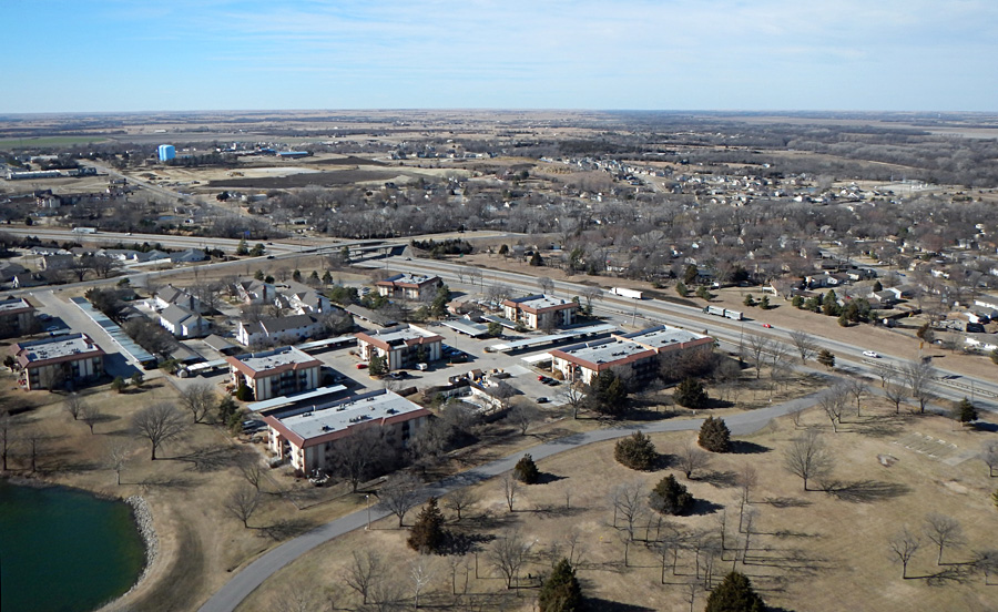
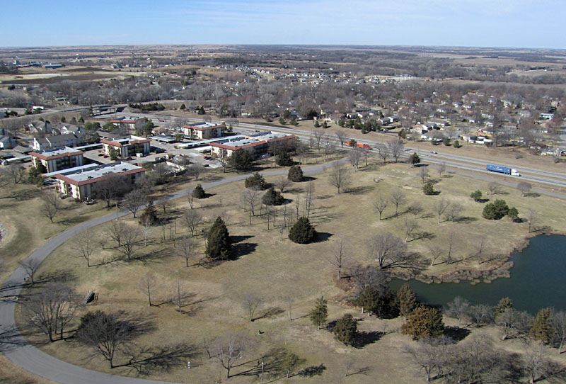
| Overviews. Left: looking toward the northwest. The city water treatment plant is marked by the blue water tanks in the left distance. This is the highest point in the city. Right: view toward the southeast. Maplewood Cemetery occupies the middle distance of this scene. | 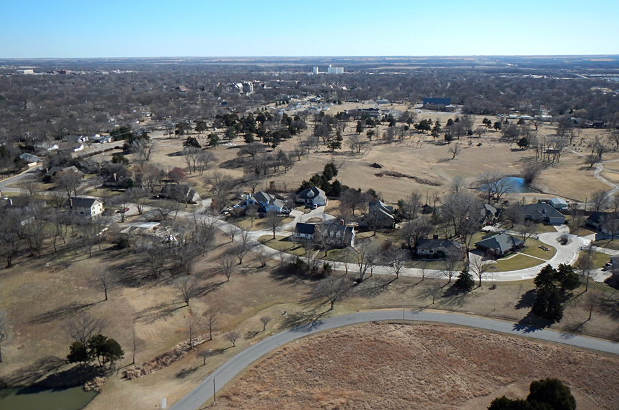 |
| Jones Park hosts a disc golf course that meanders around the area. These views cover portions of the course, for which trees and ponds form numerous obstacles. Looking toward the northwest (left) and northeast (right). | 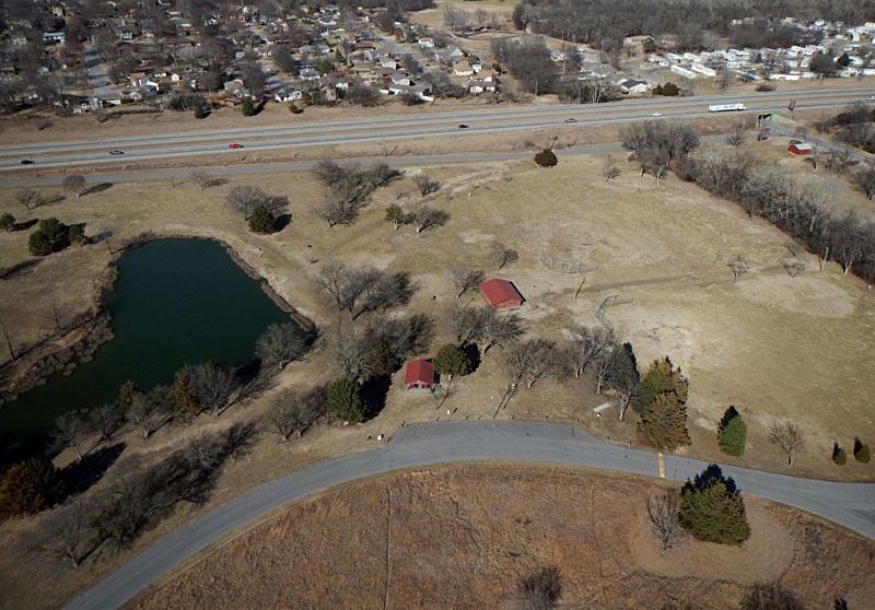 |

| Close-up shots of the flagpole and sculpture on the central hill (left) and some people having a picnic between large cedar trees (right). Note disc golf tees (concrete pads) and baskets. These winter shots were taken just before prairie grass was burned in late February. | 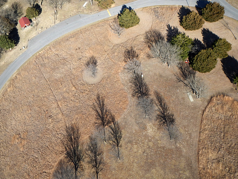
|
 Assembled from three overlapping images. |
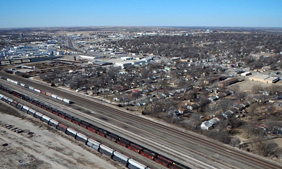
| Overviews looking toward the northwest (left) and east (right) with the BNSF Railway switching yard in the foreground and city beyond. | 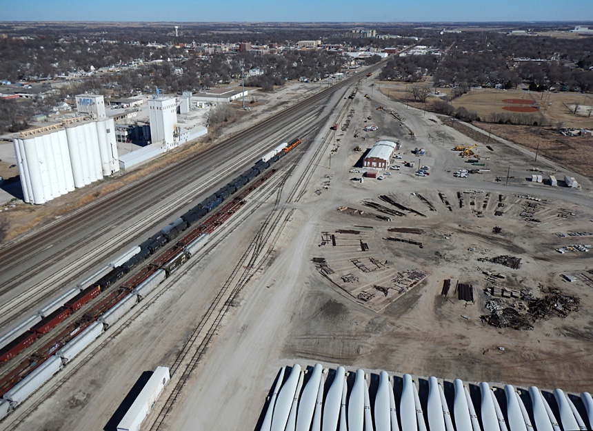 |
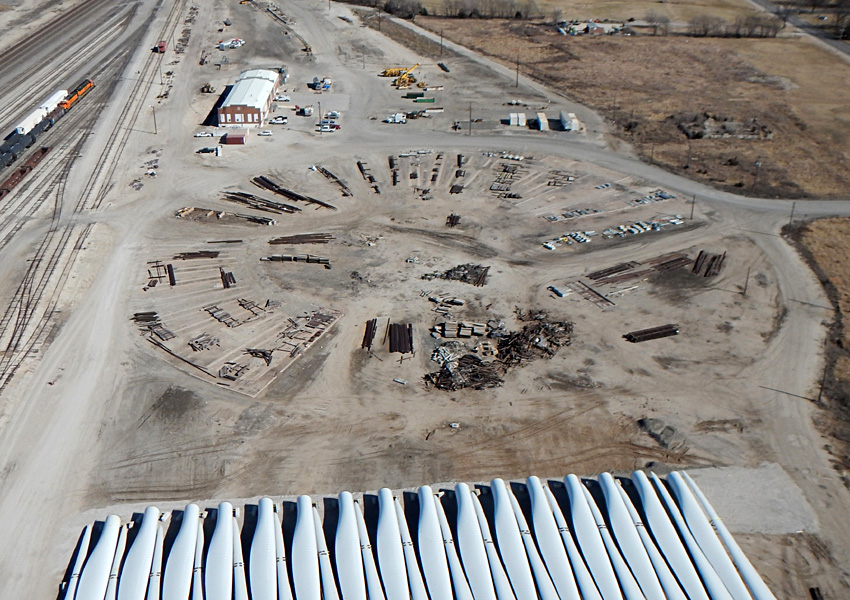
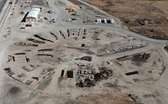
| Left: close-up view of the former roundhouse that was used to service and repair steam locomotives. It was built in 1926-28 and torn down in 1983, but the foundation remains. It spanned 200° and had 30 stalls accessed by a turntable at the center. Right: airphoto from the mid-1940s showing the roundhouse. | 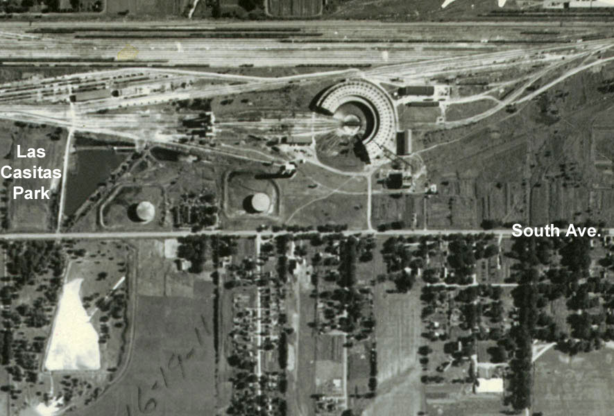 |
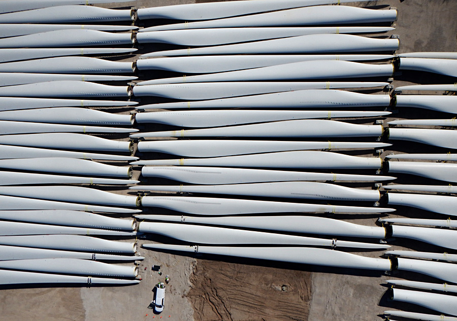
| Vertical shots of wind-turbine blades stored temporarily in the BNSF Railway depot. Horizontal and diagonal displays; service truck for scale is about 20 feet (~6 m) long. | 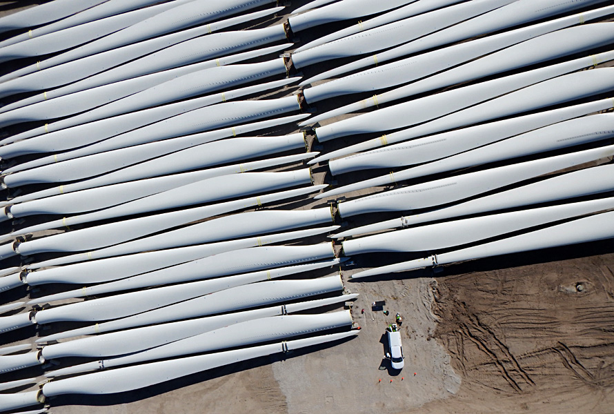
|
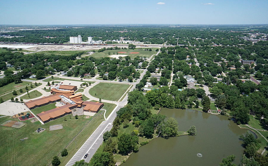
| Overviews from Peter Pan Park. Left: looking straight northward. Riverside elementary school appears on the left side. Right: view toward northeast. Downtown buildings appear in the center distance. | 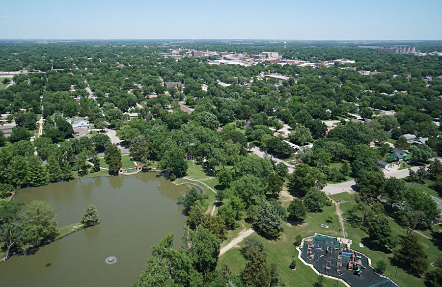 |
| Overviews from Peter Pan Park. Left: looking eastward. Bunge oilseed processing plant in left background. Right: view toward southeast showing the Emporia Zoo, Kansas highway 99, the Cottonwood River, and its floodplain. | 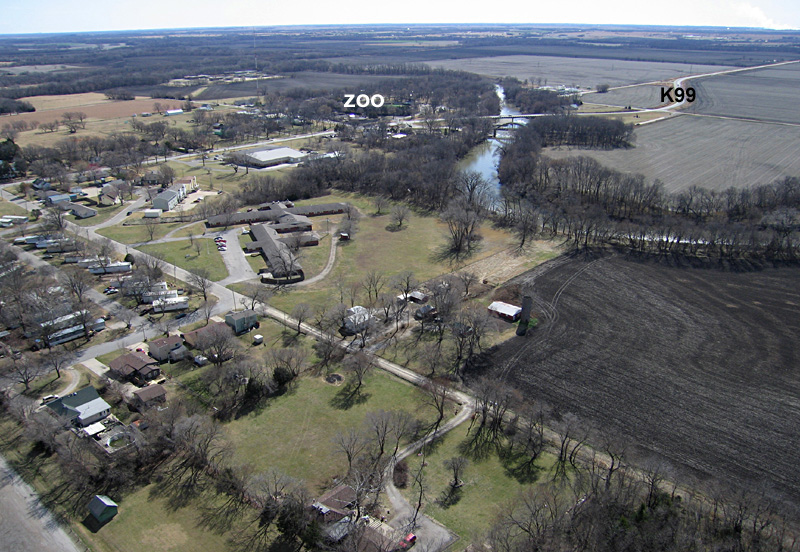 |
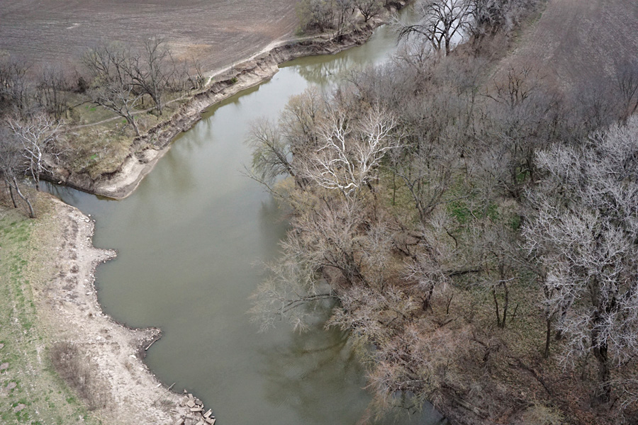
| Cottonwood River low-oblique (left) and close-up vertical (right) winter views. The tree with white bark is sycamore, which often grows on floodplains and beside stream channels in eastern Kansas. | 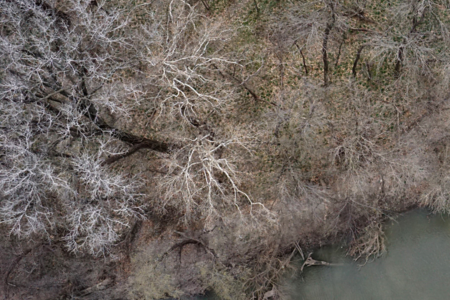 |

| The disc golf course at Peter Pan Park is quite popular. These winter (left) and spring (right) views show the pond, numerous trees, playground equipment, and other obstacles on the course. Many discs end up in the pond! | 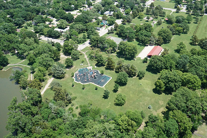
|
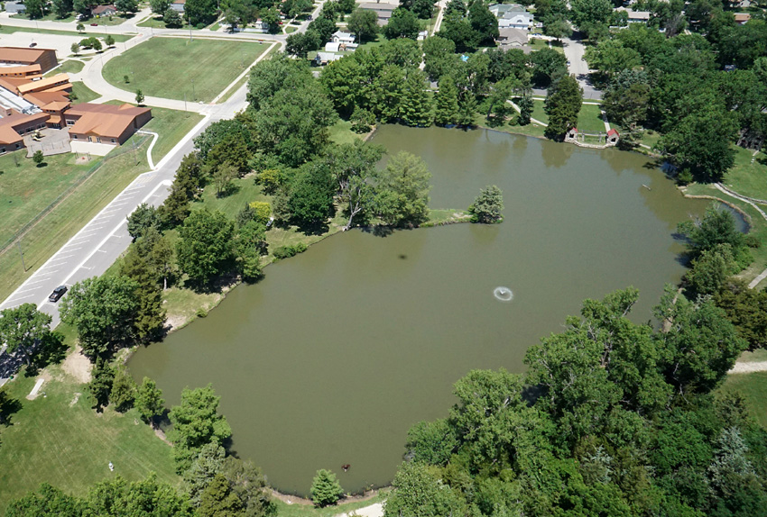
| Normal color (left) and color-infrared (right) images of the pond. The color-infrared camera is sensitive to blue, green, and near-infrared; the latter is portrayed as red in the image. Active vegetation appears bright orange, and water bodies are dark blue. Shadow of kite appears on the pond near center of each image. | 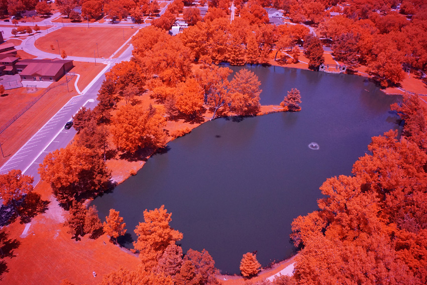 |
| Normal color (left) and color-infrared (right) images looking toward the west. The color-infrared camera is sensitive to blue, green, and near-infrared; the latter is portrayed as red in the image. Active vegetation appears bright orange, and water bodies are dark blue. Cottonwood River on left side. | 
|
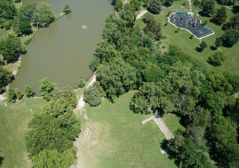
| Left: amphitheater is located in a natural depression directly south of the pond, lower right portion of view. Right: vertical shot of the amphitheater. The grassy stage area is marked (*), and spectators sit in the grassy semicircular area at scene center. | 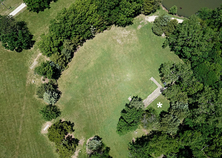 |
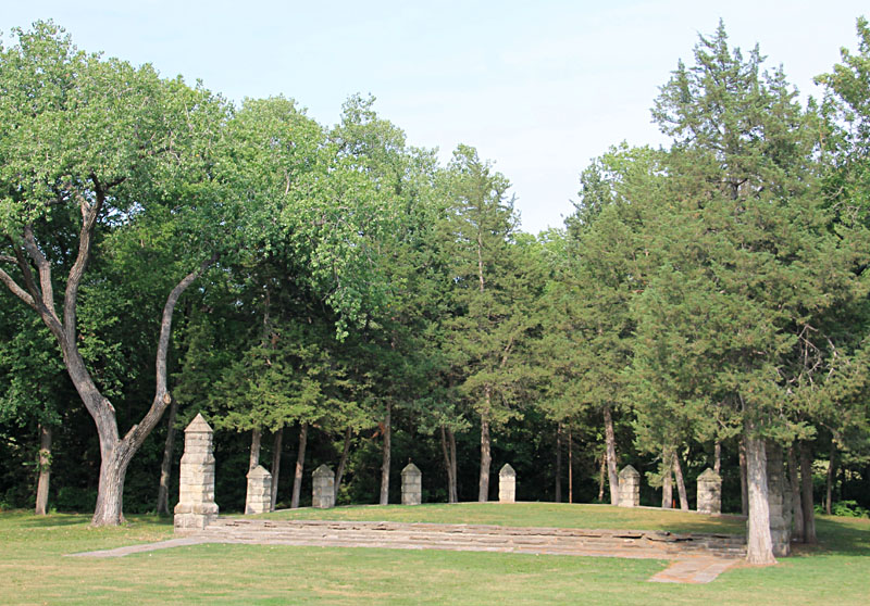
| Ground views of the amphitheater. Left: the steps in front of the stage are 75 feet across and made of cut slabs of limestone. Right: ESU's A Cappella Choir performs a public concert, April 2018. | 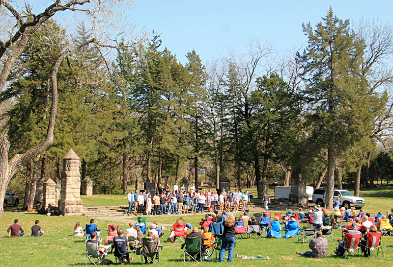
|
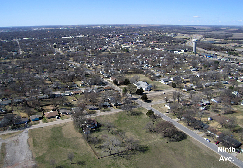
| Overviews from Whittier Park, also known as Sertoma Park. Left: looking toward the northwest. Ninth Avenue crosses the scene, and the water tower on 12th Avenue appears in the right background. Right: view toward the southeast. Sixth Avenue runs across the center of the scene. | 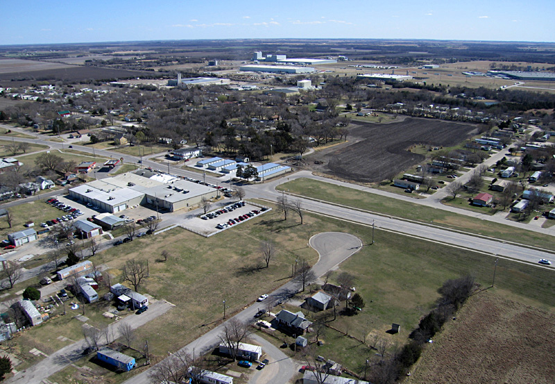 |
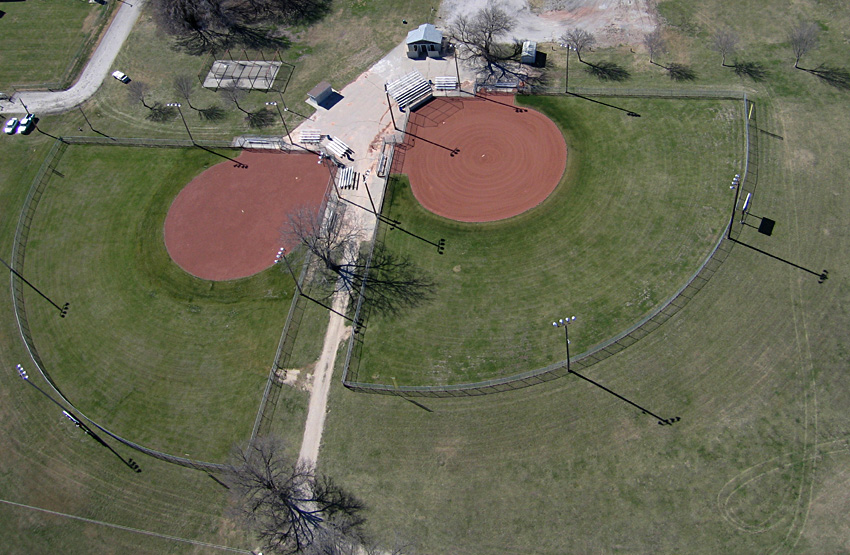
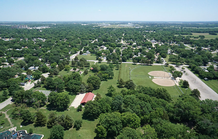
| Baseball is the major sports attraction in this park. Sertoma baseball diamonds 2 and 3 (left) and the Kiwanis T-ball complex (right). The railroad on right is the BNSF Railway route to Topeka. | 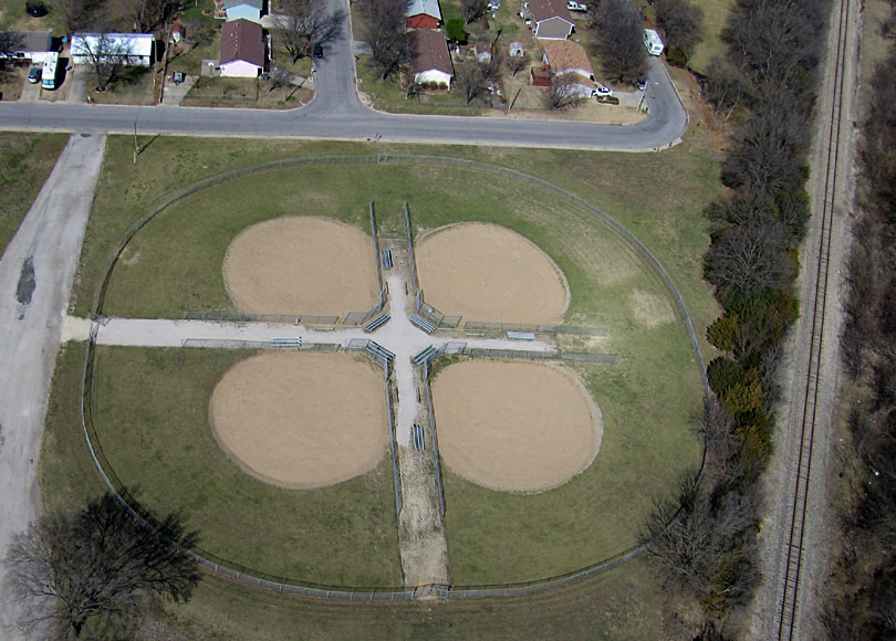 |
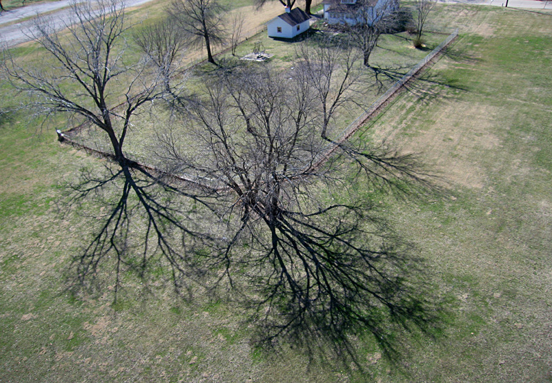
| Close-up shot of distinctive shadows cast by bare deciduous trees in the late winter. |
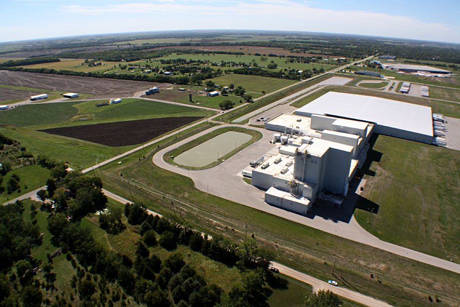
| Superwide-angle shots looking toward the southwest (left) and northwest (right). Industrial Park III in the foreground. The large building (left) is the Hill's Pet Nutrition plant. | 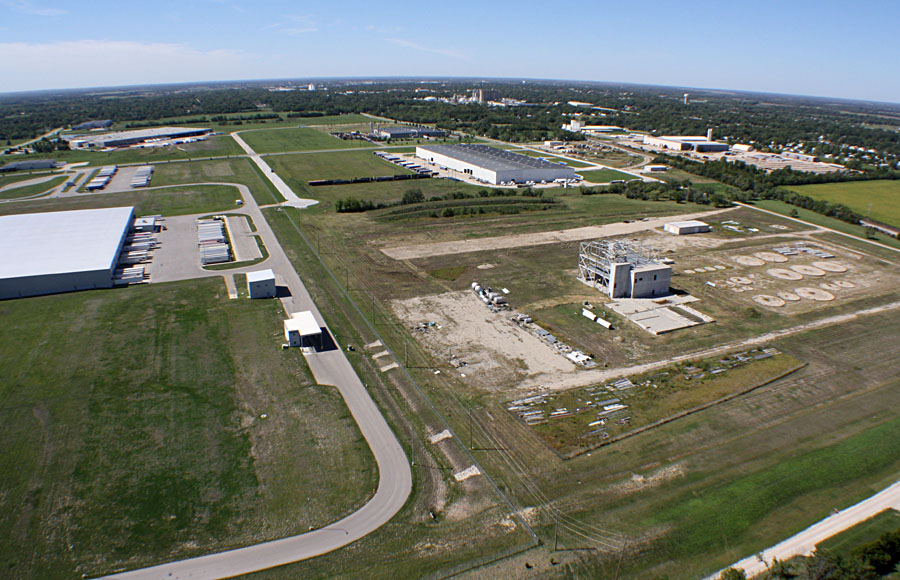 |
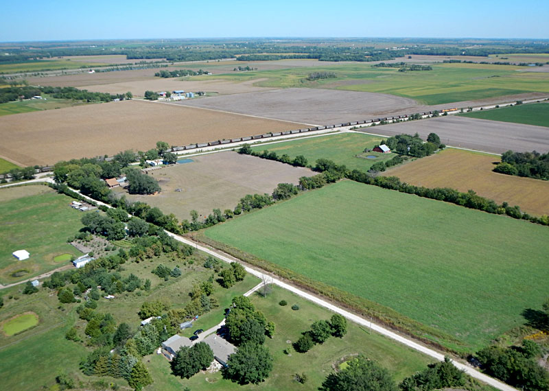
| Left: view toward the northeast showing a coal train on the BNSF Railway mainline route to Kansas City. Right: nearly the whole cemetery appears in this view. Kite flyers standing on right side. | 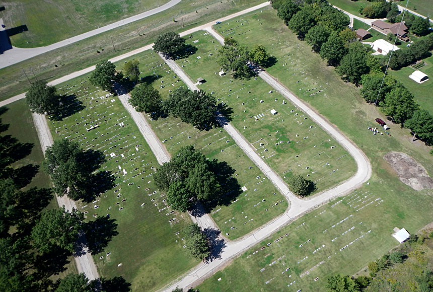 |
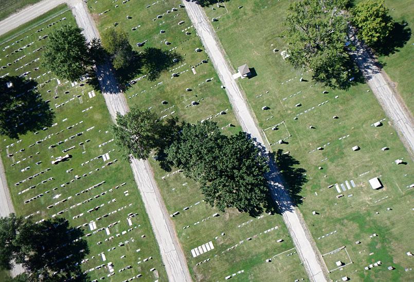
| Near-vertical shots from high (left) and low (right) positions show arrangement of tomestones, grave markers, and other monuments. Faint mowing patterns are visible in the well-maintained lawn. | 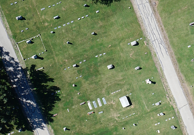
|
![]()
![]() Return to airphoto gallery
or Great Plains airphoto homepage.
Return to airphoto gallery
or Great Plains airphoto homepage.
All text and images © by the authors (2018).