
| J.S. and S.W. Aber |
|
| J.S. and S.W. Aber |
Permanent stone buildings were constructed during the next two years from locally available sandstone. Lt. George A. Hesselberger was in charge of this project which employed 60 tempsters and 200 mules to haul the stone (Fort Dodge 2014). Many of these buildings still remain in various states of repair. However, the Arkansas River that once flowed full is now dry most years.
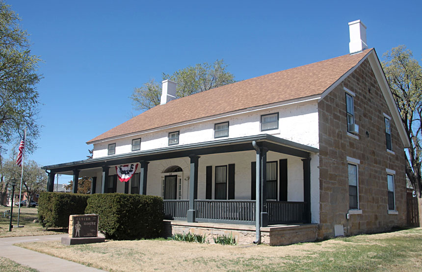
| Fort Dodge state historical site and Kansas Soldiers Home. Left: Custer House, the residence for officers, constructed of Dakota sandstone. Right: dry channel of the Arkansas River immediately south of Fort Dodge. Vegetation shows evidence of a recent fire. | 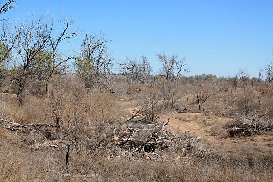
|
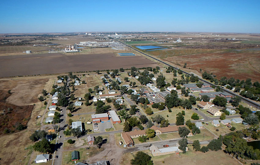
| View westward (left) with Fort Dodge in the foreground and Dodge City in the background. Closer view of Fort Dodge (right). Parade ground near scene center and a small pond on right side. Custer House marked with a white asterisk (*) to right of parade ground. | 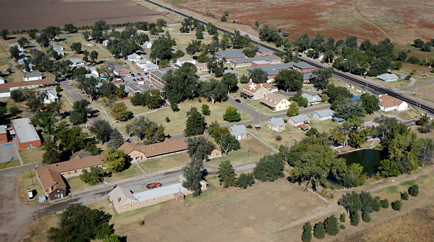 |
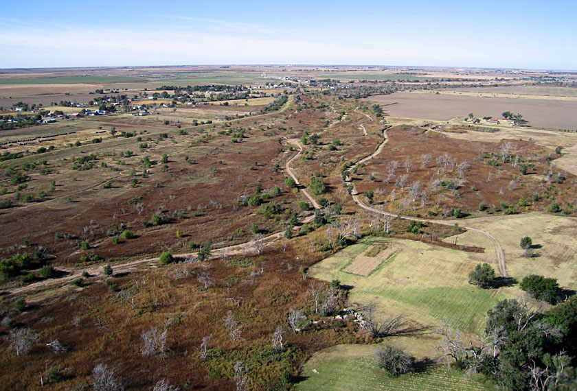
| Looking toward the southwest (left) upstream along the dry channel of the Arkansas River, which flows behind Fort Dodge. Dead trees are evidence of a recent fire. Blimp aerial photography (right) from a mowed field adjacent to the fort and river. | 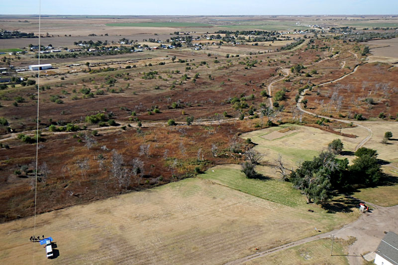 |
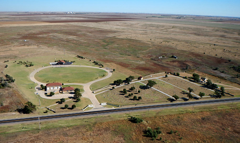
| High-oblique (left) and low-oblique (right) views to the northeast across US highway 400 toward the Kansas Veterans Cemetery. New portion of cemetery to left; older portion to right. | 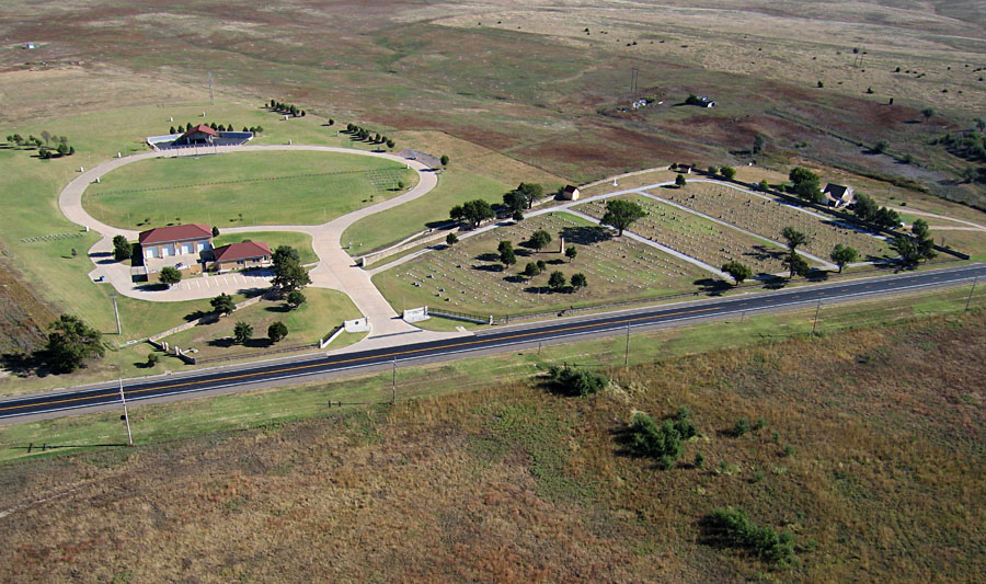
|
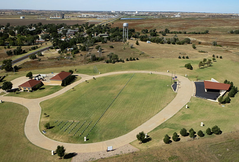
| High-oblique (left) and low-oblique (right) views over the new portion of the cemetery with the Fort Dodge water tower behind. Note the perfect alignment of identical tombstones. | 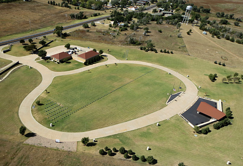 |
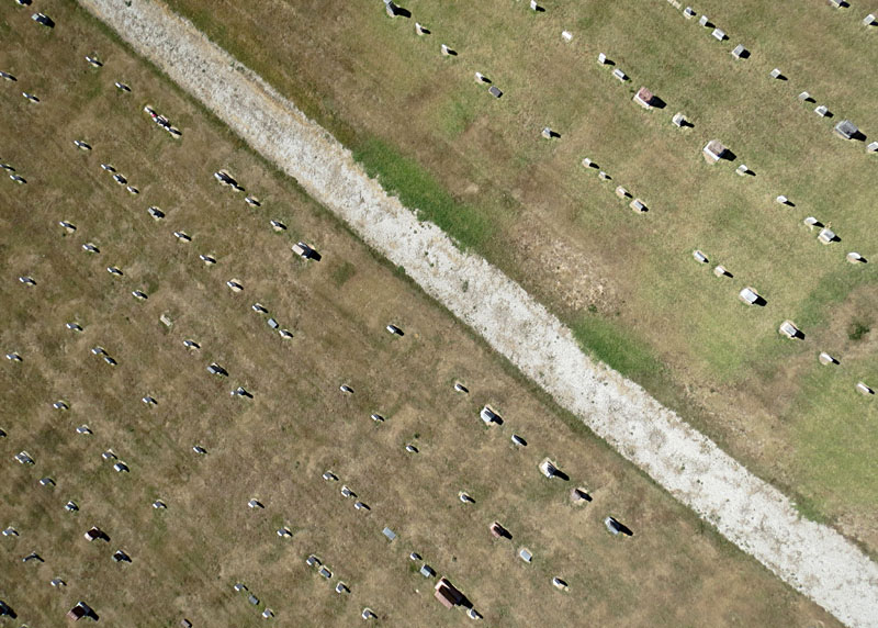
| Vertical shots over tombstones in the older section of the cemetery. These grave markers display considerable variation in size, shape, and type of stone. Note extreme relief displacement; stones appear to lean away from photo center. | 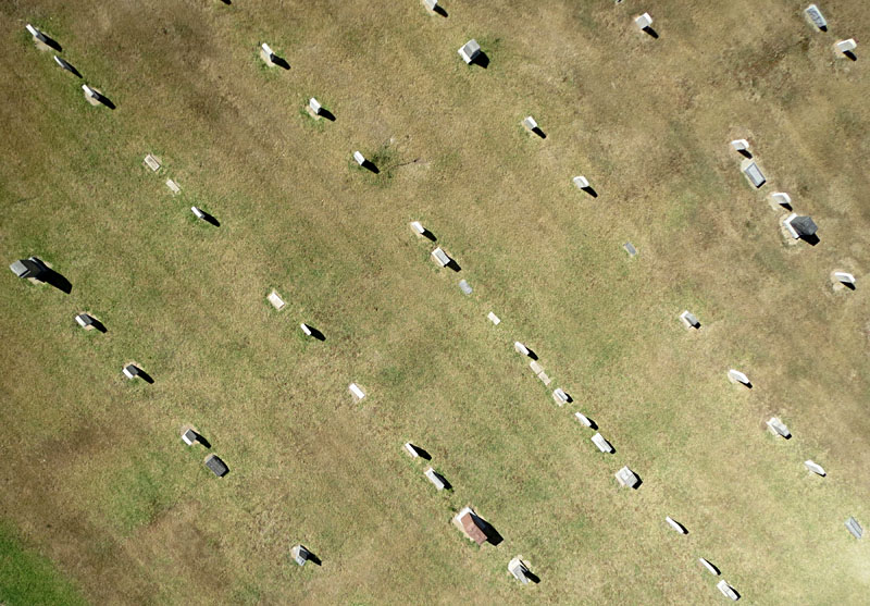 |
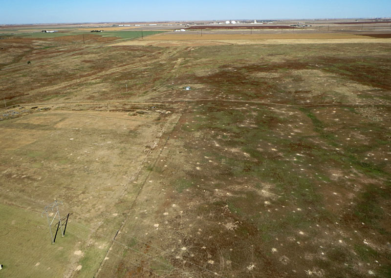
| A prairie dog town (left) extends northward from the cemetery. Light spots are burrow entrances; note power poles and lines in lower left. Closer shot (right) shows prairie dog burrows up to the edge of the cemetery (lower center of scene). | 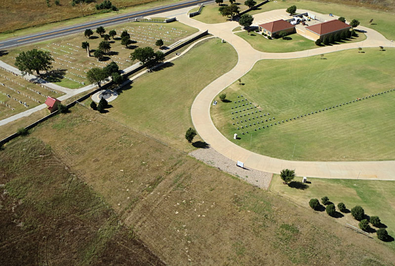
|
Return to airphoto gallery
or Great Plains airphoto homepage.
All text and images © by the authors (2016).