| and Kansas Turnpike James S. Aber |
|
| and Kansas Turnpike James S. Aber |
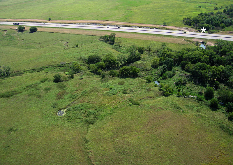
The Coughlen Natural Area has been modified by human activity in the past. Broad, shallow excavations expose weathered shale, linear furrows resemble bulldozer tracks, a small ridge forms a terrace, and the spring is dug out as a circular pool. When these changes were made is unknown. The spring pool forms a perennial water supply, but the purpose of other modifications is uncertain. Although restored prairie covers the site now, signs of these older features remain conspicuous.
I visited the Coughlen site in late August under relatively mild weather conditions. Mid-day temperature was in the mid-80s with sunny sky and a moderate breeze from the south-southeast. Launch site was the open prairie in the northern portion of the natural area downwind from trees along the stream. The large rokkaku kite was utilized to lift the Canon S70 autoKAP rig as well as the Nikon GPS radio-controlled rig. Both camera rigs worked flawlessly. Wind and sky cooperated until the end of the session when cloud cover moved over the region and wind speed increased.
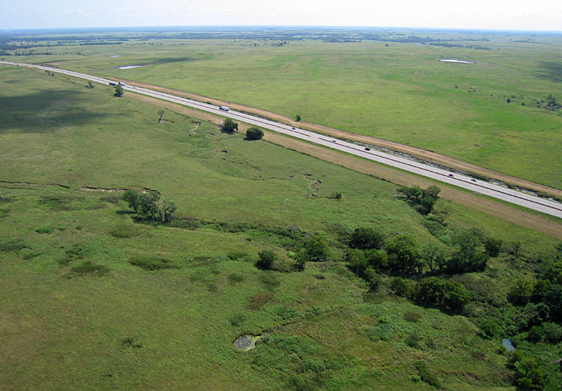
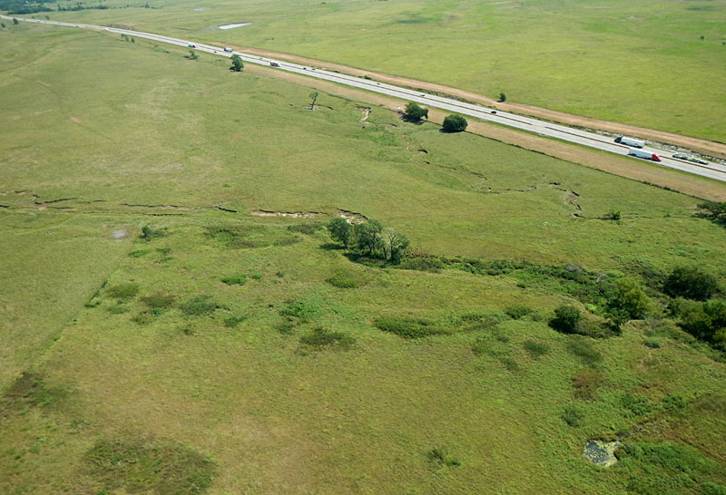
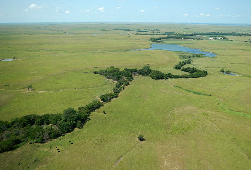
| Overview of the Coughlen Natural Area. Looking toward the northeast (left) the natural area is in the foreground and the Kansas Turnpike behind. View southward with the natural area in the left foreground (right). A county road bridges over the turnpike in the background, and a small stream marked by trees crosses the southern end of the natural area. Asterisk (*) marks the launch site for kite aerial photography. | 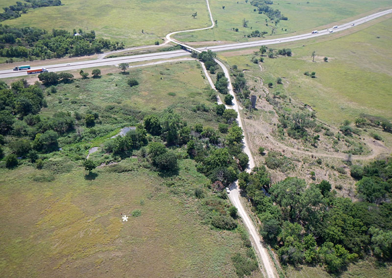 |
| Close-up shots. Left: Coughlen prairie area in foreground, and cattle grazing in pasture across the road. Right: restored prairie portion of Coughlen area: a) spring pool, b) terrace-like ridge, c) excavated zone with linear tracks. | 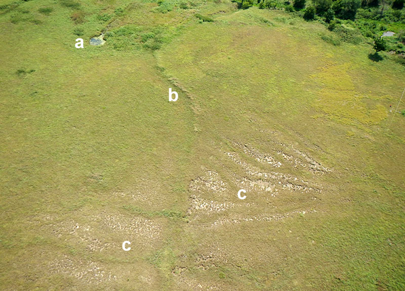 |
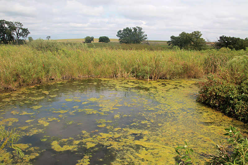
| Ground views of Coughlen Natural Area. Left: spring with cattails, watercress, algae, and other wetland vegetation. Right: excavated zone displays bare patches of weathered shale, and a small bank (b) in the background marks the limit of excavation. | 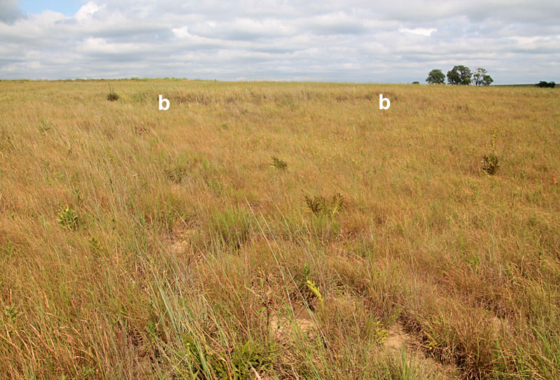 |
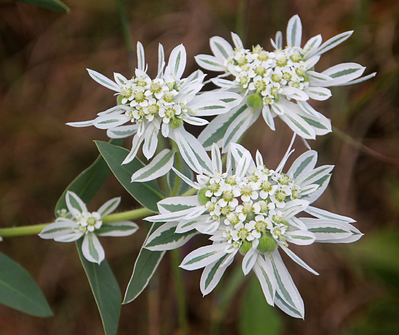
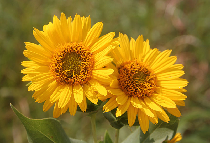
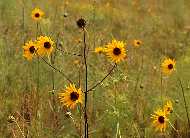
| The restored prairie displayed a variety of grasses, forbs, and wildflowers in bloom, including snow-on-the-mountain (left, Euphorbia marginata, KWG), ashy sunflower (center, Helianthus mollis, KWG), and willow-leaf sunflower (right, Helianthus salicifolius, KWG). Flower identifications by M. Sundberg. |
| Looking toward the northeast with Coughlen area in the foreground and Kansas Turnpike behind (left). The asterisk (*) marks the site of the flash flood, culvert, and fatality. Ground view of the flooding site on the Kansas Turpike (right). Temporary lake formed on the east (right) side, and Coughlen Natural Area is on the opposite side. | 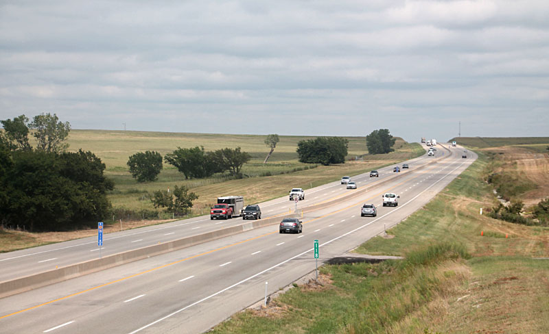 |
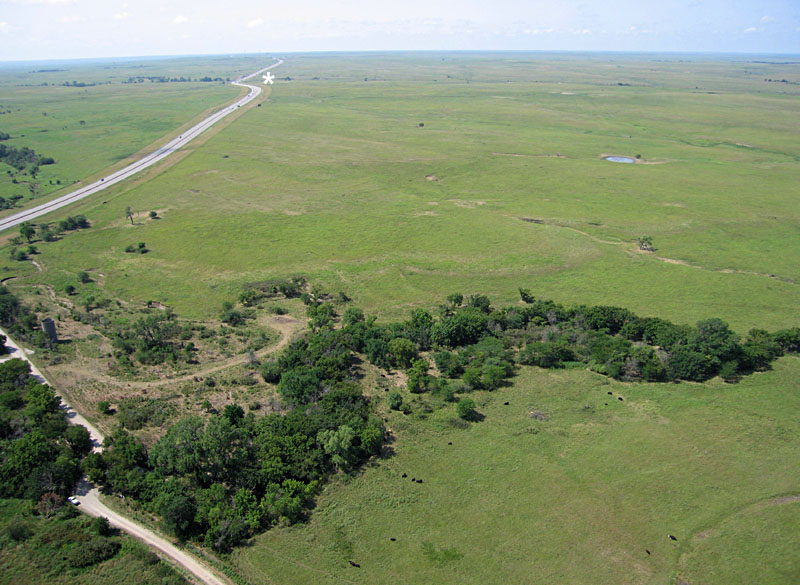
| Views looking downstream (left) and upstream (right). Trees mark the course of the unnamed stream that experienced flash flooding on July 10, 2015. Asterisk (*) indicates the culvert where the fatality took place. | 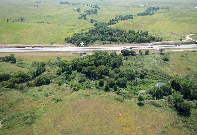
|
| Looking along the Kansas Turnpike toward the southwest. Asterisk (*) marks the site of the 2003 flash-flood tragedy near mile marker 116. Seven vehicles were washed off the roadway by Jacobs Creek, and bodies of two victims were recovered two miles downstream (to the right). |
Text and images © J.S. and S.W. Aber