| James S. and Susan W. Aber |
|
| James S. and Susan W. Aber |
Beginning in 2002, we have acquired airphotos over various portions of the Nature Conservancy land in Cheyenne Bottoms, as part of a project to document management and climate impact on wetland conditions. During this period, the bottoms has varied from completely dry, drought status to flooded meadows and pools. Much of the marsh cattails died during drought, and the dead thickets have been removed in places by mowing and burning. The demise of cattails has led to open marshes, which are favored by migrating shorebirds.
We have conducted kite and blimp aerial photography at several sites--see index map below. Most photos have been acquired at site B, the main marsh complex known as Clearwater Pool. Kites are generally utilized when wind exceeds 10 mph (15 km/h), and the helium blimp is used when winds are light or calm. We have employed nearly all combinations of cameras, lens, filters and film types as well as digital cameras. The following examples demonstrate the variety of wetland conditions within the Nature Conservancy land at Cheyenne Bottoms.
Ikonos satellite image for Nature Conservancy airphoto sites
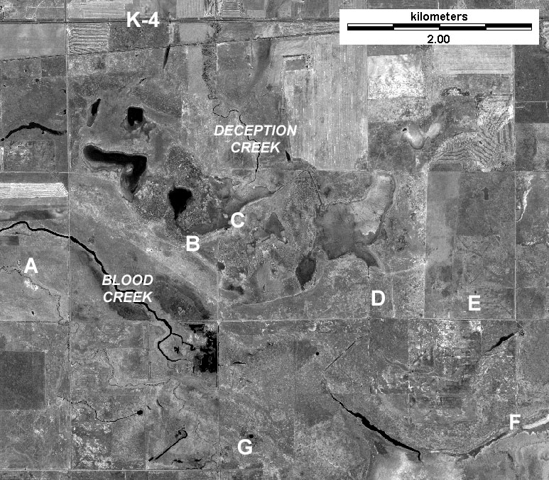
A - Nature Conservancy headquarters.
B - South side main marsh complex.
C - North side main marsh complex.
D - Plunge pool and drainage ditch.
E - Test pothole study field.
F - Edge of state wildlife area.
G - South section--oil field.
Fisheye views of Cheyenne Bottoms.
Site A
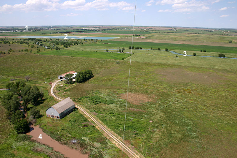
| Northwestward view over Nature Conservancy barn, shop, and headquarters. 1 - City of Hoisington, 2 - sewage treatment lagoons, 3 - Blood Creek, 4 Shop Creek. Shop Creek is a distributary channel of Blood Creek. August 2004. |
| View southeastward with Blood Creek visible to upper left and Shop Creek in the lower right corner. The state wildlife area can be seen in the distance. August 2004. |
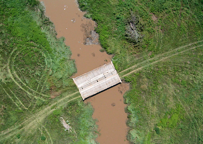
| Vertical view of wooden bridge over Shop Creek with distinctive vehicle tracks leading to and from the bridge. August 2004. |
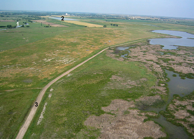
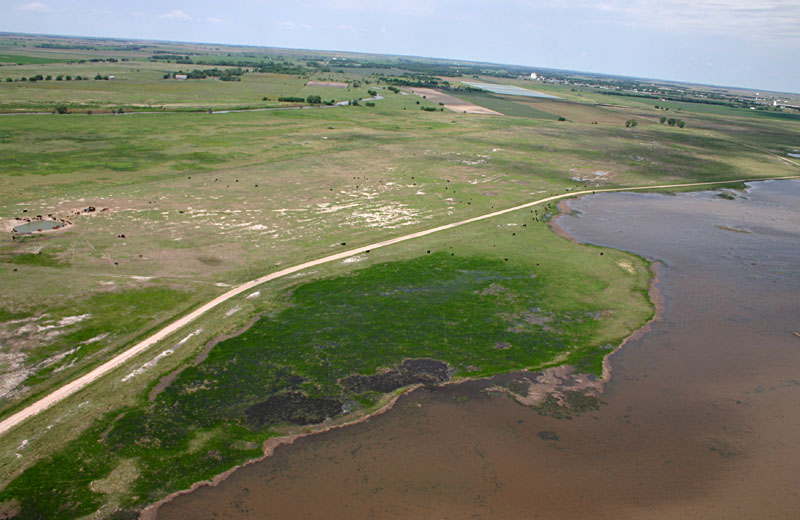
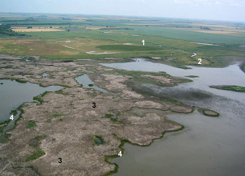
| View toward the northwest with the city of Hoisington on the horizon. 1 - distributary channel of Blood Creek, 2 - sewage treatment plant for Hoisington, 3 - access road to Nature Conservancy land. Clearwater pool is located to right (north) of road. June 2003. |
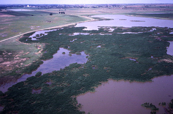
| View toward northwest over the large lake/marsh complex in northern portion of Nature Conservancy land. City of Hoisington in background. Note thick cattail beds in scene center. May 2002. |
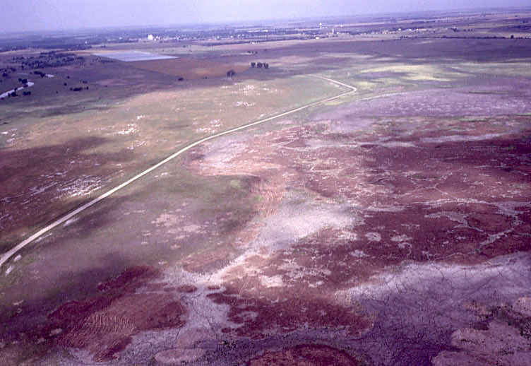
| Overview of dry Clearwater Pool with Hoisington in the background. Reddish-brown areas represent cattail thickets that were burned to remove dead thatch. Compare with image above. May 2004. |
| View toward west. This scene has undergone a remarkable transformation since 2002--compare with images above. Cattail thickets are gone and spike rush has filled in a mud flat (bright green). July 2004. |
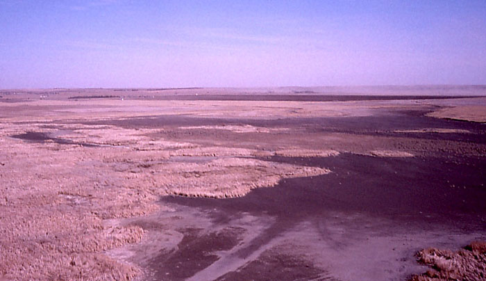
| View toward northeast over mostly dry cattail beds and mudflats. Note dust blowing in the right distance. Compare with picture of Deception Creek delta below taken one week later. March 2003. |
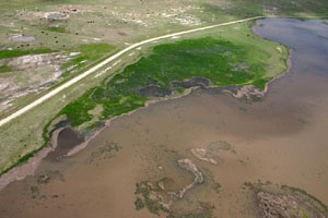
| Oblique view toward the north, late March, 2003, following heavy rain and runoff. Deception Creek is visible in top center. Note extremely muddy water in the marsh around the small delta, where the creek flows into the marsh. |
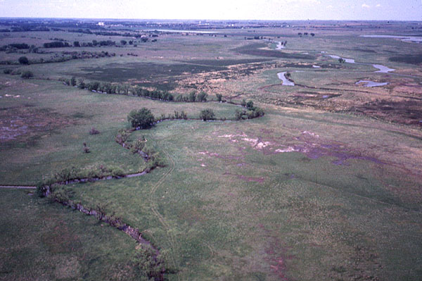
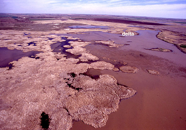
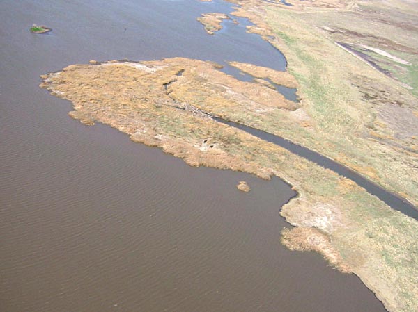
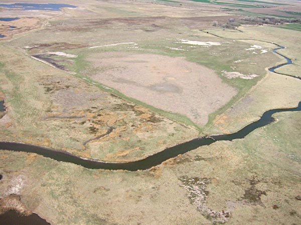
| View toward north over Clearwater pool. 1 - Deception Creek, 2 - delta of Deception Creek, 3 - dead cattails, 4 - live cattails. Large portions of the cattail beds were killed during the drought of 2002; cattails survived only along the fringes of the beds. June 2003. |
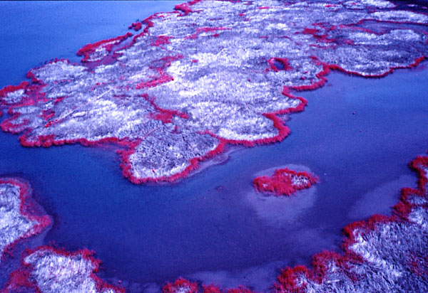
| Color-infrared overview of cattail beds, most of which died during drought of last year. Cattails are growing actively only in a narrow (red) fringe between the dead beds (pale cyan) and open water (dark blue). Compare with image above. June 2003. |
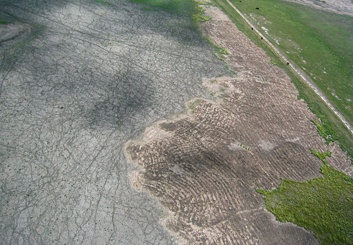
| Close-up view of dry mud flat (left) and mowed cattail bed (right center). Numerous lines crossing the mud flat are cattle tracks. May 2004. |
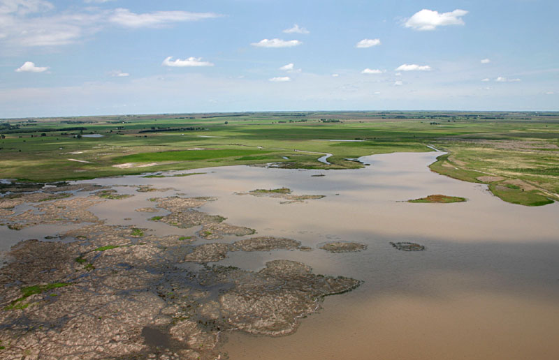
| View toward the northeast with full water in Clearwater Pool marsh following repeated rains in June. Deception Creek delta in center background, and dead cattail thicket in left foreground. July 2004. |
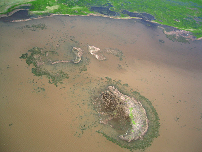
| Close-up view of tiny, crescent-shaped islands within the marsh. This area was formerly covered by cattail thicket, of which only small remnants remain. July 2004. |
| View toward the southeast over the central portion of the Nature Conservancy land. Hay mowing is a management technique for wet meadows, as depicted in the foreground. April 2002. |
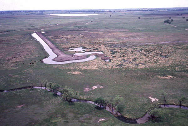
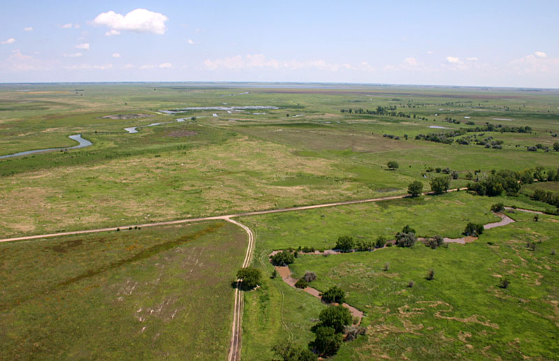
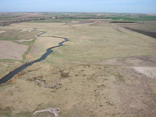 Series of overlapping pictures in the northern portion of the Nature Conservancy land. Views toward the northwest and north showing Deception Creek and its delta in the lake/marsh complex. Agricultural fields are visible in the background, and a fence has collected debris where it crosses Deception Creek. The creek is the main source for surface inflow in this portion of the wetland. April 2002. | |
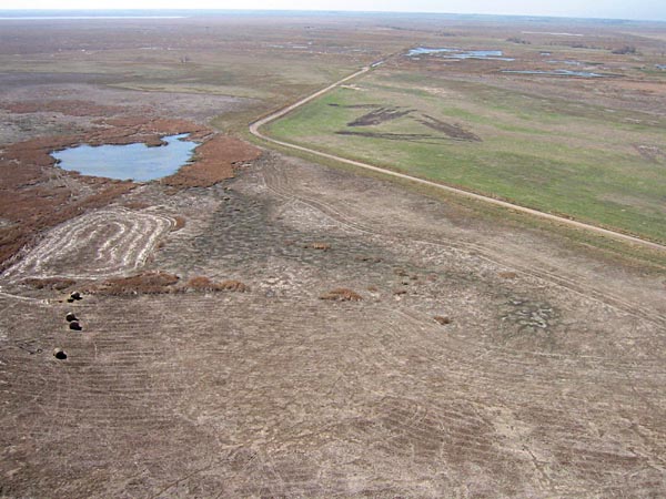
| View northward over lower marsh and artificial outlet that leads to a plunge pool in lower left corner of view. The marsh is dry and partly covered with vegetation. May 2004. | ||||
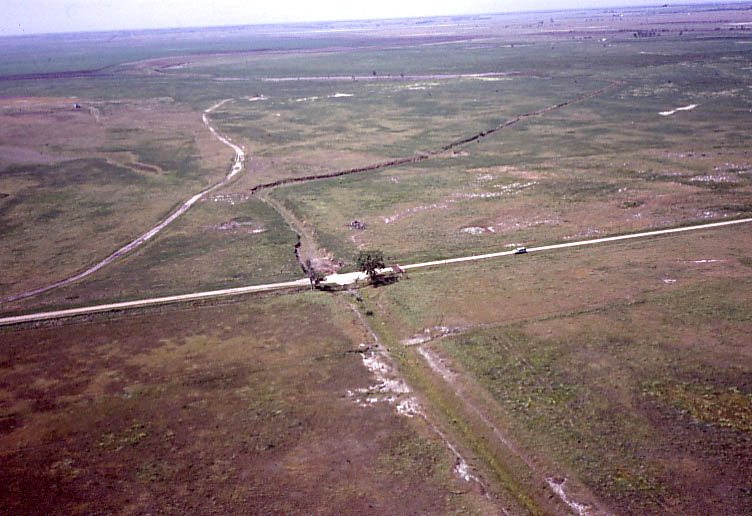
| View southward with drainage ditch running under the county road. The ditch serves in part to divert water flow around oil wells in the left background. May 2004.
Site G
|