| Nevada and California
J.S. and S.W. Aber |
| Sand Mountain | Wind surfing |
| Tehachapi wind farm | Related sites |
Introduction
In May 2012, we took a two-week tour through Nevada and California for multiple professional and academic purposes. During this long trip, we were able to conduct kite aerial photography at three sites, one in Nevada and two in California. Wind is the common theme at all three sites: wind-blown sand, kite surfing, and wind energy. We took pictures with our Canon SD600 and S70 camera rigs and flew rokkaku or delta kites at all sites. We were assisted at Foster City by Marco Allain, who gained his first experience with KAP. The following pictures illustrate our results.
Sand Mountain, Nevada
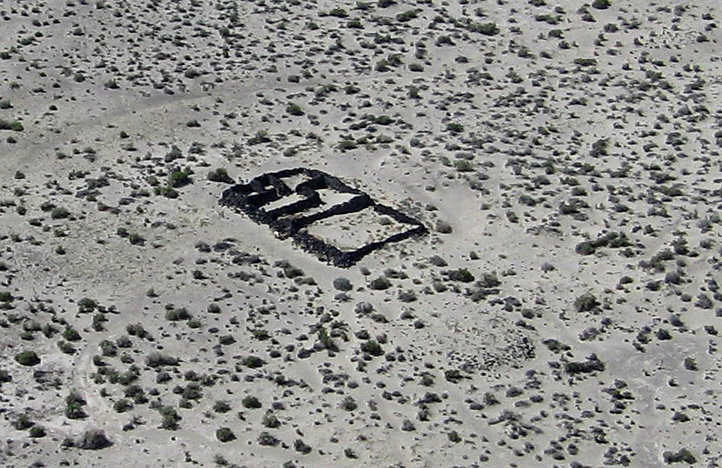
In route to California, we stopped near Fallon, Nevada at the Sand Mountain Recreation Area, U.S. Bureau of Land Management. This site is located just off U.S. highway 50 and includes a massive sand dune blown up from the Carson Sink as well as the remains of a Pony Express station. 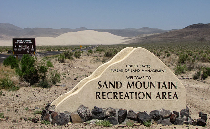
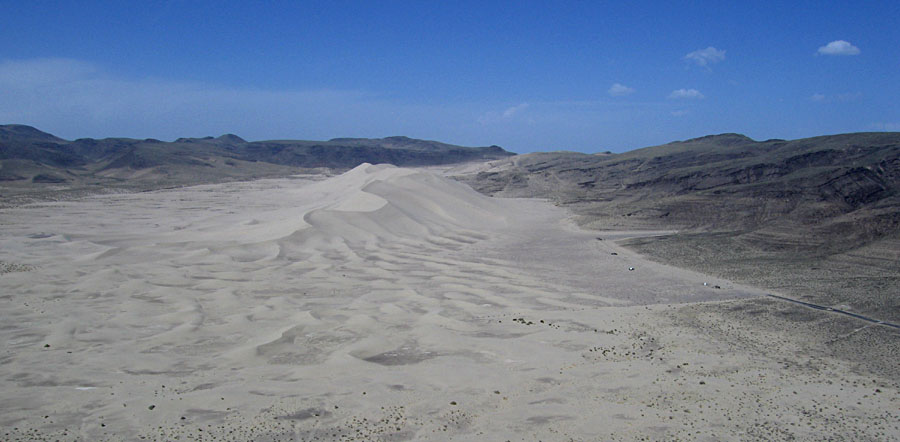
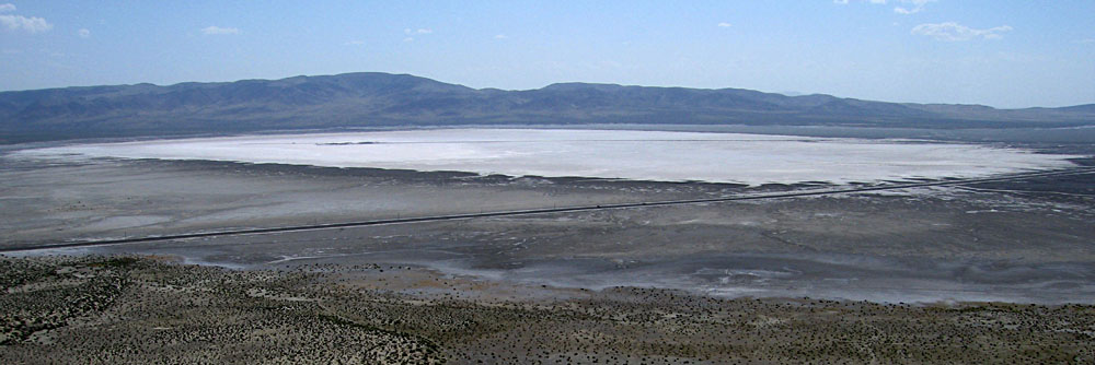
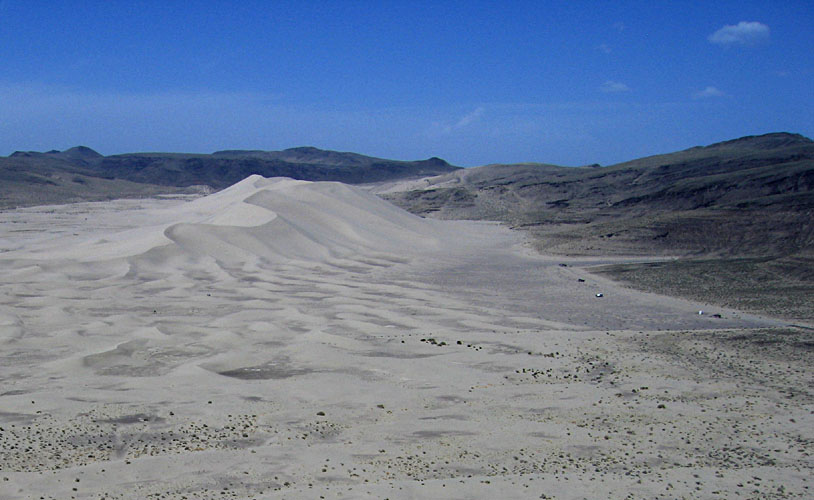
Left: closer view of the massive sand dune; vehicles on right side are large RVs. Right: kite flyers (SWA & JSA) operating from a small parking area. Pony Express station near scene center with part of the Carson Sink in the left background.
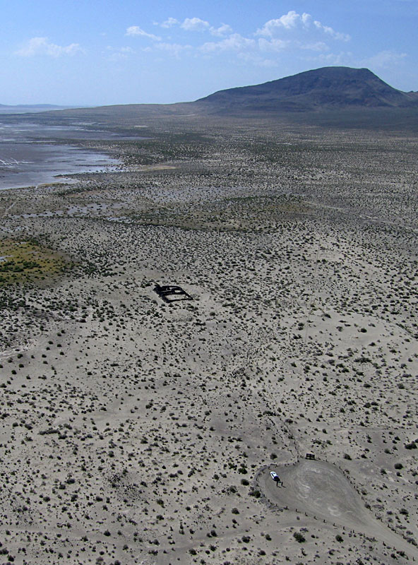
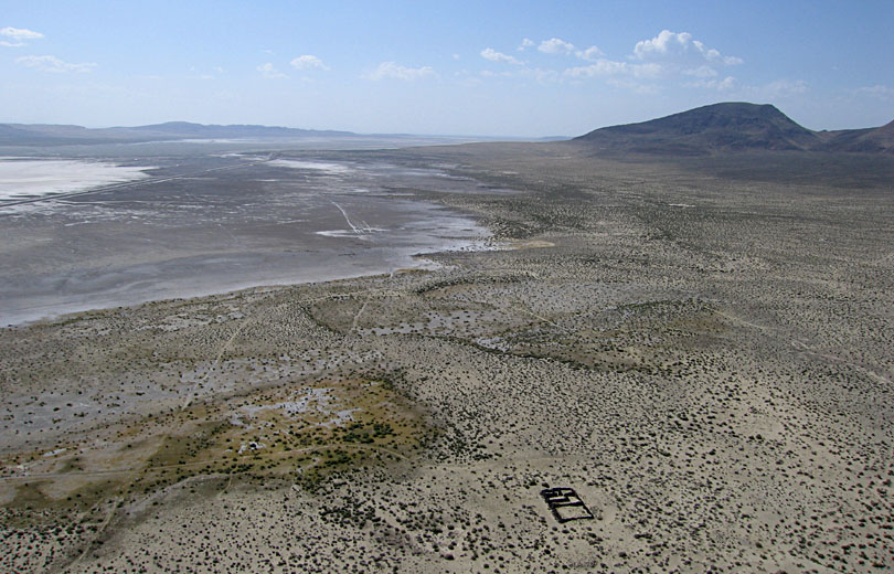
Pony Express station. Left: overview with the station ruins in lower right and Carson Sink in left background. Right: close-up shot of the station walls made of dark basalt stones that contrast with the light sand surface.
Foster City and San Mateo Bridge, California
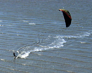
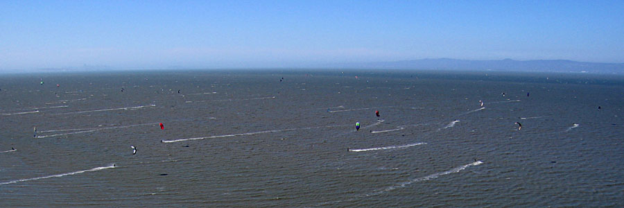
We visited a wind-surfing beach in Foster City on the western side of San Francisco Bay near the San Mateo Bridge. The sky was exceptionally clear with a brisk breeze coming from the northwest. The beach was crowded with wind surfers on Saturday afternoon, so we had to set up some distance away in a brushy area to avoid hindering the wind surfing activity. This was our second visit to this site—see California 2006.
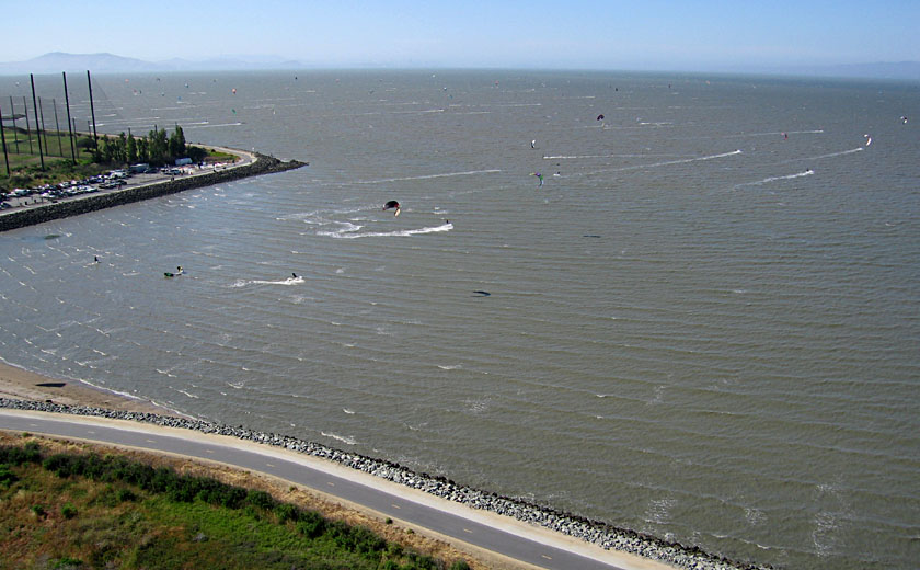
| Left: overview of wind-surfing beach; each of the wakes represents a wind surfer on the bay. The cage to left is a practice golf enclosure. Right: looking toward the San Mateo Bridge with buildings of Foster City to right. | 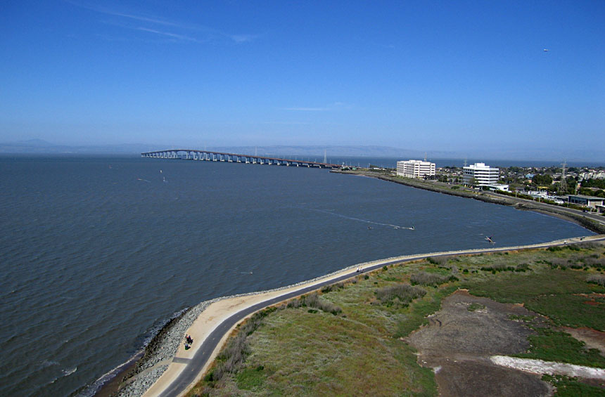 |
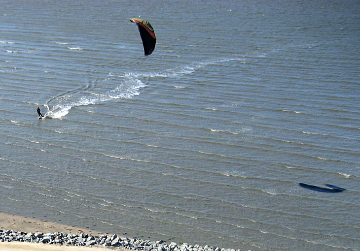
| Left: close-up shot of wind surfer coming into shore; note shadow of kite to right. Right: kite flyers M. Allain (right) and JSA in a brushy meadow next to the beach. | 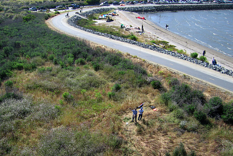 |
 |
| urban features.  |
Tehachapi Wind Farm, California
Our western venture concluded with successful kite aerial photography at the Tehachapi Wind Farm, located in the pass between the southern end of the Sierra Nevada Mountains and the Tehachapi Mountains. The wind farm and most surrounding land are private with restricted access. A few public roads and the Pacific Crest Hiking Trail cross the area of the wind farm. In order to obtain a broad overview of the locale, we found a small cemetery about five miles (8 km) away. We conducted KAP at an elevation of ~4000 feet, and the crest of the wind farm is around 4800 feet.
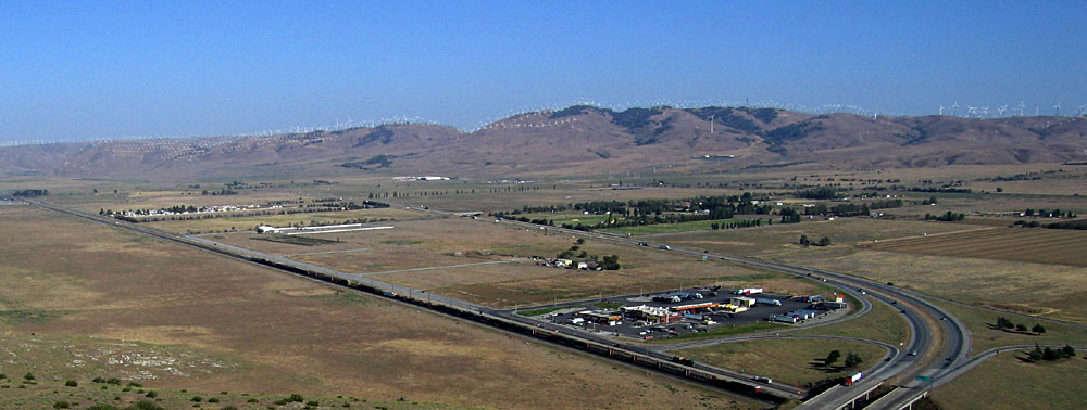 From a distance of 5 miles, hundreds of wind turbines appear as tiny white dots on the horizon at Tehachapi Pass. Highway 58 and a BNSF train are visible in the foreground. | |
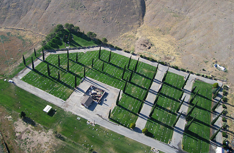
| Left: Tehachapi East Side Cemetery, from where we did KAP. A well-irrigated cemetery with tombstones set flush with the ground; kite flyers (JSA & SWA) on left edge. Left: nearby limestone quarry for raw material to make concrete. | 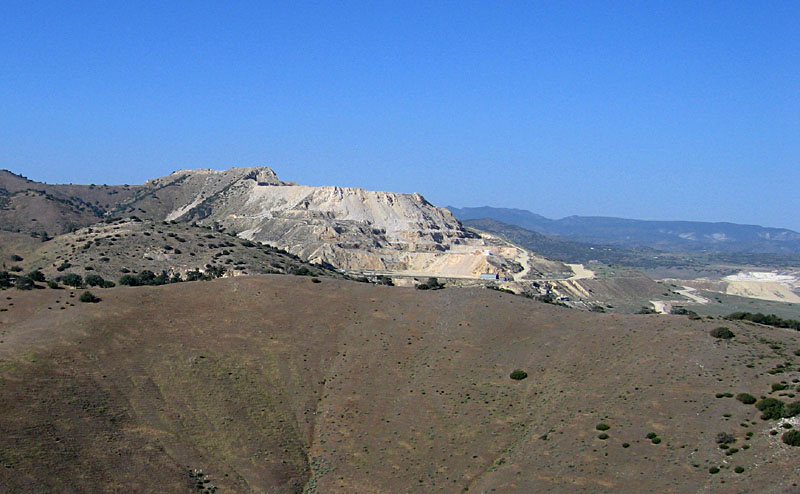
|
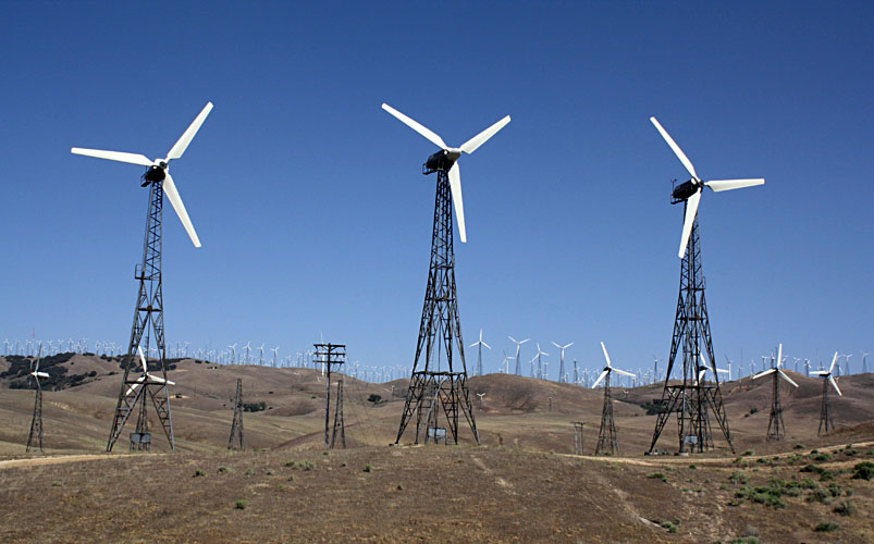
| Crest of the wind farm. Left: most turbines are mounted on truss towers, so only the white blades are visible in the aerial panorama. These are older, small wind turbines. Right: benchmark at Oak Creek Pass, near the crest of the wind farm. | 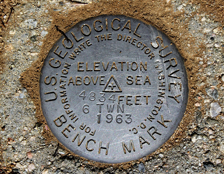 |
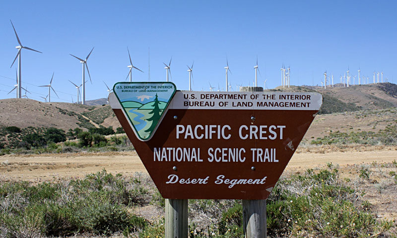
| Eastern side of the wind farm. Left: trail sign with large turbines in the background. Right: modern, large Vestas wind turbines. | 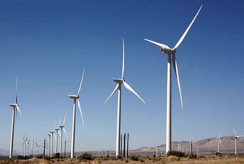 |
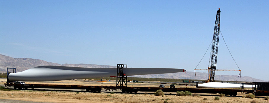 special railway cars at nearby Mojave. |
![]() Related sites
Related sites
![]()
![]() Return to airphoto gallery.
Return to airphoto gallery.
All text and imagery © by the authors.
Last update May 2012.