
|
J.S. and S.W. Aber |
|
|
J.S. and S.W. Aber |
We took pictures with our Canon SD600 and S70 camera rigs and flew a large rokkaku at all sites. Normally we fly our kites with a tail, but upon the advice of experienced kapper, Chris Benton, we removed the tail for light wind conditions. And the wind was light throughout the conference. Many participants had difficulty finding suitable breeze to lift their camera rigs, but we were lucky to get our cameras in the air at four sites. The following pictures illustrate our results.
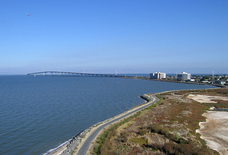
| View southeastward over the bicycle/walking trail with San Mateo Bridge in the background. Notice passenger airplane in upper left corner; it was on an approach path to the San Francisco airport. |
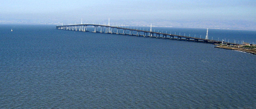
| Closer view of the San Mateo Bridge. The eastern side of San Francisco Bay is barely visible through the hazy smog. Notice towers for power lines beside the bridge. |
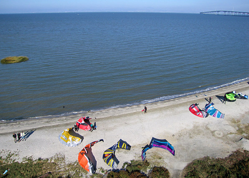
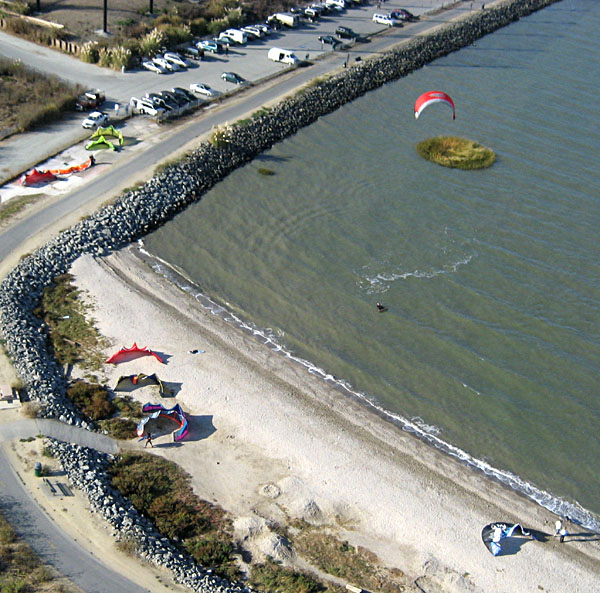
| Kite surfing on San Francisco Bay. Kites ready to go on a small beach at Foster City with the San Mateo Bridge in the right background. View eastward from the southwestern margin of San Francisco Bay. |
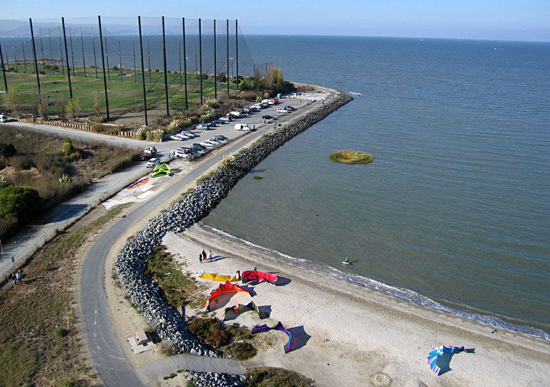
| Kite surfing beach and parking area. A golf course is surrounded by a tall fence in the left background. Kite flyers are standing at lower left edge of scene. |
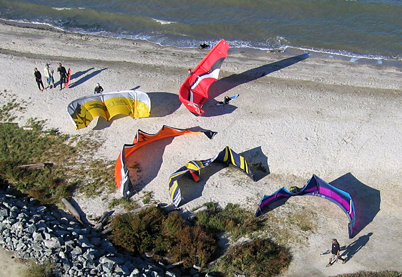
| Closeup view of kites and people on beach. Notice the dog lying in the water at top center of scene. |
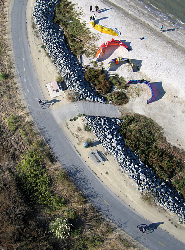
| Bicycles, kites and people--a study in shadows. |
| Left: approaching the beach. 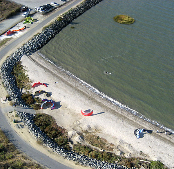
|
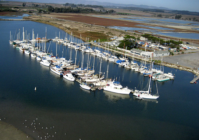
| Marina in the lagoon at Moss Landing State Beach with estuary wetlands in the background. |
| Lagoon and marina at Moss Landing. Tracks on sand to lower left were created by harbor seals sliding into the water. White birds are sea gulls. |

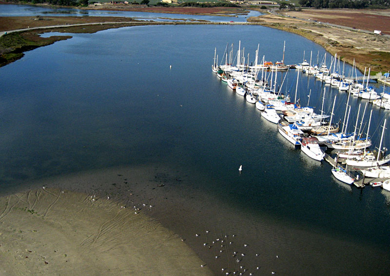
| Lagoon in foreground and Elkhorn Slough in background. The red crane is used to lift small boats out of the water. California state highway 1 crosses the middle of the scene. |
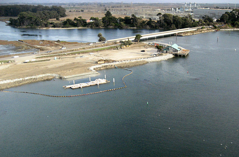
| California state highway 1 bridge crossing Elkhorn Slough channel at Moss Landing. |
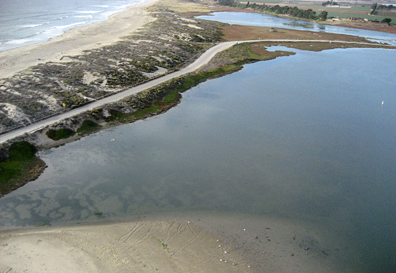
| Quiet lagoon (foreground) is separated from the open sea of Monterey Bay (left background) by a narrow strip of beach and sand dunes. |
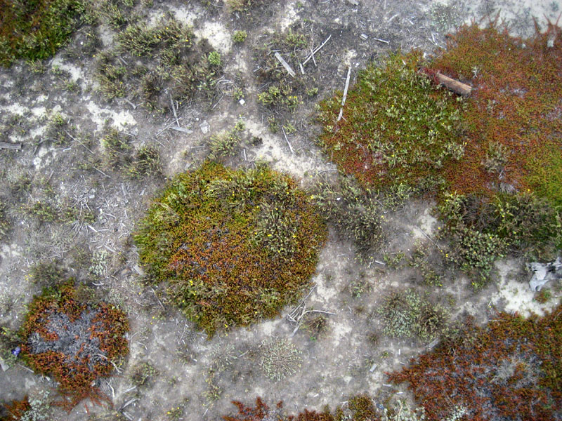
| Vertical view of vegetation and drift wood on sand dunes next to lagoon at Moss Landing State Beach. |
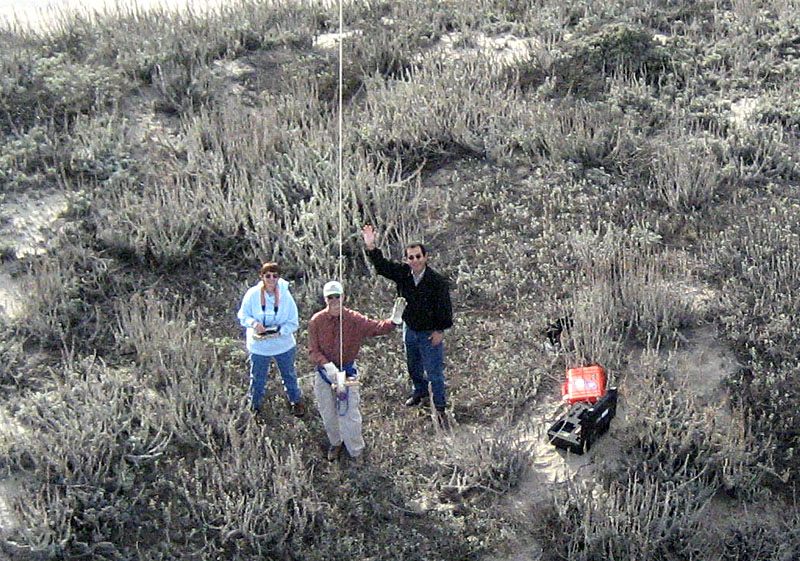
| Kite aerial photographers (from left): Susie Aber, Jim Aber, and Manuel Saavedra. |
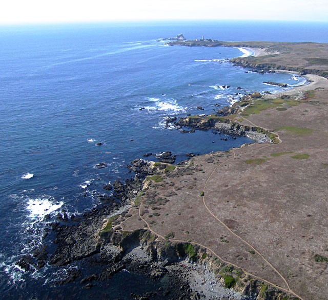
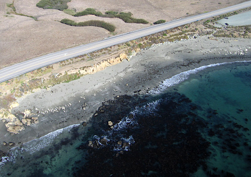
| View northward toward Point Piedras Blancas with the lighthouse visible in the distance. In this vicinity, the coast consists of a relatively low and broad terrace. |
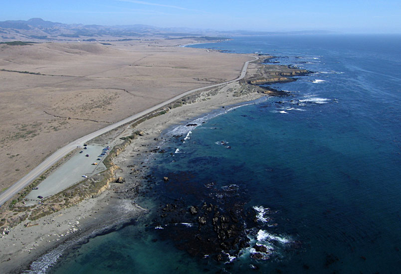
| View southward including the main beaches for elephant seals and a parking area for visitors to view the seals. |
| Elephant seals on the beach near Point Piedras Blancas. Scores of juvenile seals are resting on the beach; most are 6 to 8 feet long. Most are turned sideways or upside down exposing their light-colored bellies. |
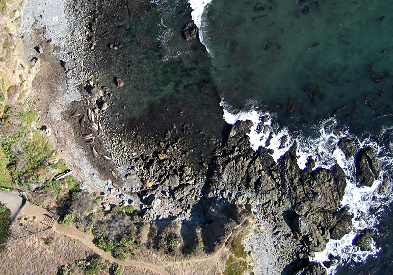
| Vertical view of elephant seals resting on a bed of seaweed (left) on a bouldery beach next to jagged rock outcrops. |
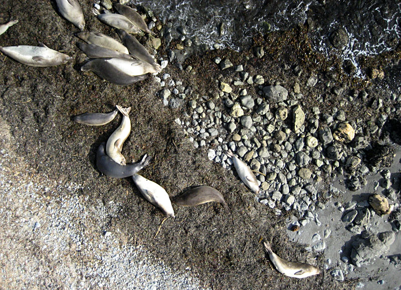
| Closeup vertical view of elephant seals on the beach. Most are sleeping on a bank of seaweed, and they were hardly aware of our presence nearby. |
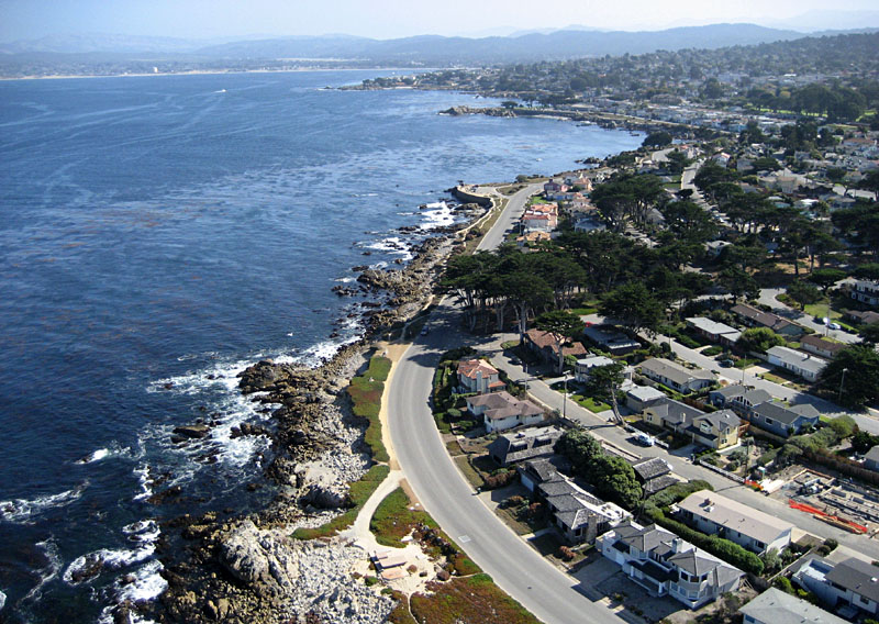
| View toward the southeast. Residential housing in the right foreground and downtown Pacific Grove in the right background; Monterey Bay to the left. |
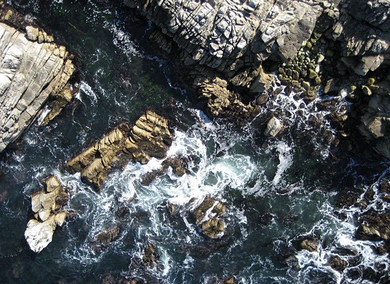
| Closeup vertical view of rocky shore at Point Pinos, Pacific Grove. Waves break among fractured granite knobs and loose boulders. |
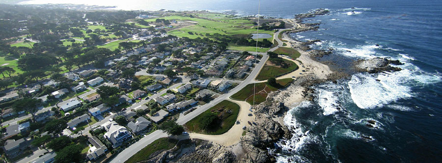
| View toward Point Pinos. Pacific Grove Municipal Golf Links in center background. Kite line extends down to a small parking area, where we flew from granite knobs. Two wide-angle images were stitched together to create this panoramic view. |
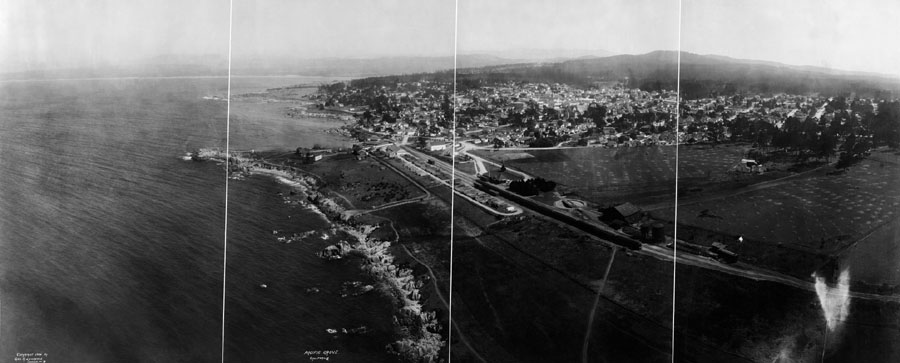
| Panoramic kite aerial photograph of Pacific Grove made by George Lawrence in 1906. View from Otter Point looking toward southeast. Image restoration by Peter Nurkse (2006). |
We attempted to recreate Lawrence's panoramic view using modern kite aerial photography techniques. With a large rokkaku kite (sans tail) we lifted our Canon S70 camera rig from a position near Point Pinos. Because the city has grown substantially since Lawrence's time, we had to move outward (along the shore) to capture the cityscape. Nonetheless, we achieved a similar height and direction of view. Two wide-angle images were stitched together to make the following picture.
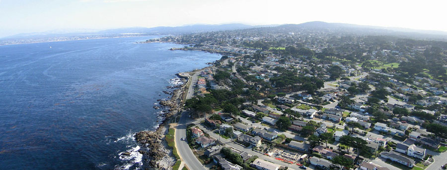
| Panoramic kite aerial photograph of Pacific Grove, Oct. 31, 2006. This image was selected as the Best KAPiCA Photo taken during the conference. Judging was done by Michael Melford, a photographer for the National Geographic, and we received a handsome KAPiCA Kup award. | 
|
![]() Return to airphoto gallery.
Return to airphoto gallery.
All text and imagery © by the authors.
Last update Nov. 2006.