The KAPiCA02 (Kite Aerial Photography in CAlifornia) conference took place at Pacific Grove in early November, 2002, organized by Brooks Leffler and Peter Bults. The following images were acquired during the conference. All images © by the authors.
|
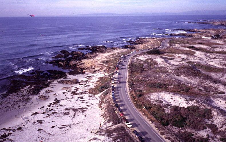
| View northward along the Pacific coast at Asilomar State Beach. Other kites are flying to left. The name Asilomar is derived from Spanish, meaning a santuary by the sea. |
|
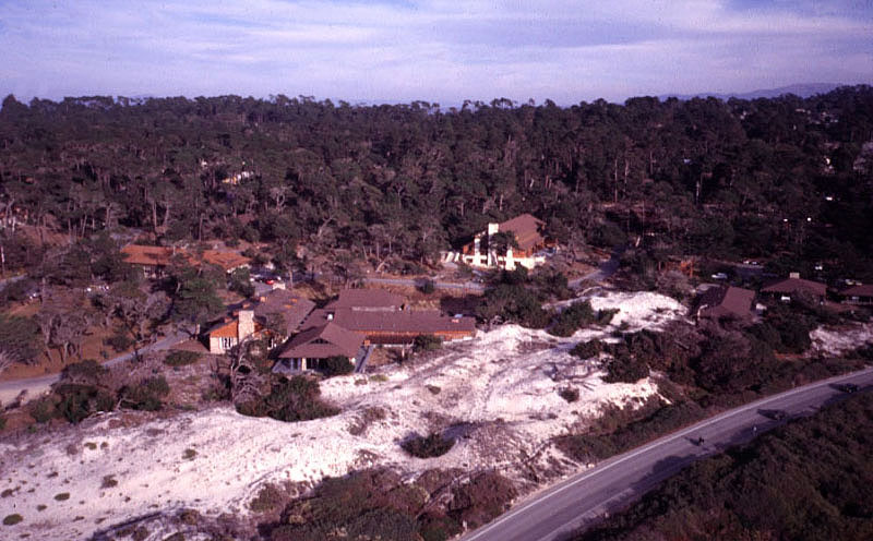
| View of the Asilomar State Park conference grounds behind sand dunes. KAPiCA conference was held at this beautiful facility. Asilomar was founded as a YWCA summer camp. |
|
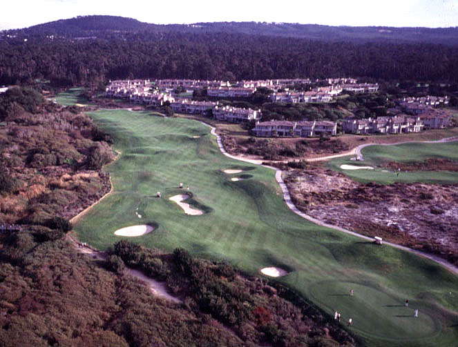
| View over the Spanish Bay Golf Resort and Pebble Beach immediately south of Asilomar. |
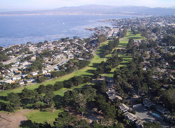
| View eastward with Pacific Grove in the foreground and the southern end of Monterery Bay in the background. |
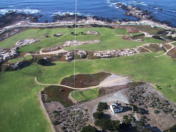
| Point Pinos lighthouse (lower right) surrounded by the Pacific Grove Municipal Golf Links. Rocky shore of the Pacific coast appears beyond the golf course. |
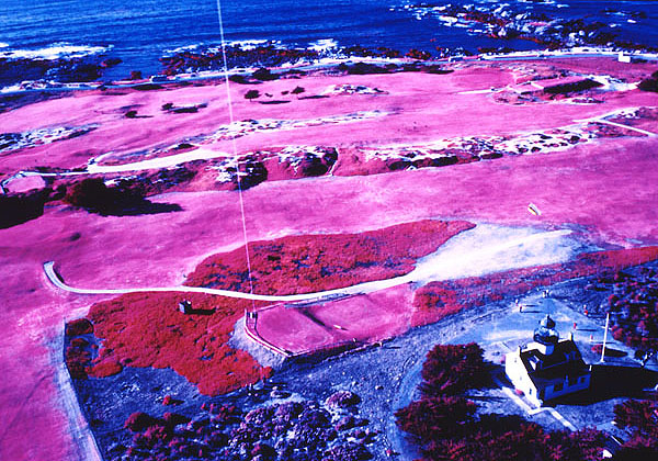
| Color-infrared image over the Pacific Grove Municipal Golf Links adjacent to the Point Pinos lighthouse. Note bright red-pink color of vegetation on the irrigated golf course. Compare with image above. |
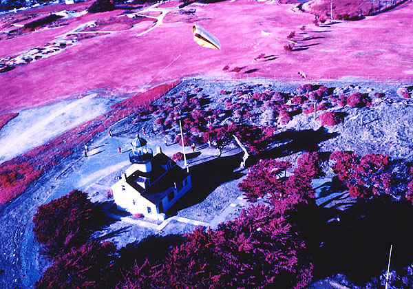
| Color-infrared image of the Point Pinos lighthouse. Note kites flying above the lighthouse. Compare with image below. |
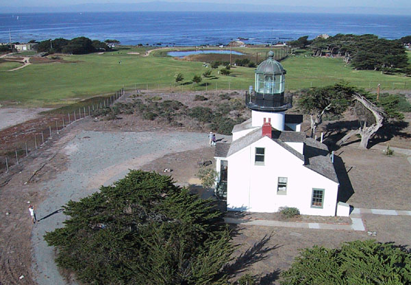
| Closeup view of the Point Pinos lighthouse, which marks the southern entrance of Monterey Bay. This lighthouse, built in 1853, is the oldest continually active lighthouse on the Pacific coast of the United States. |
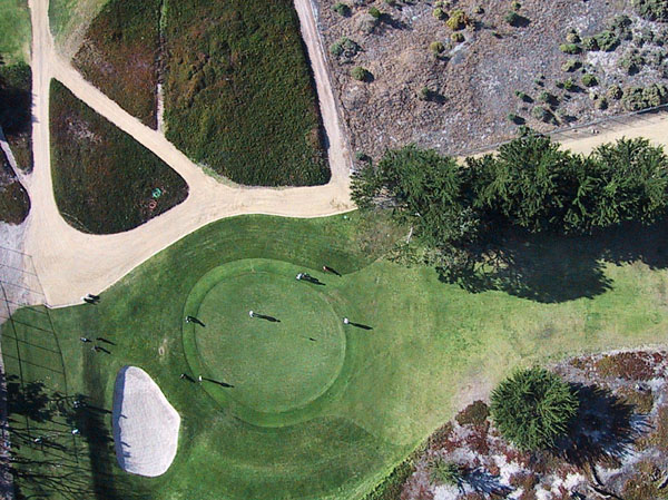
| Vertical view over the Pacific Grove Municipal Golf Links next to the Point Pinos lighthouse. |
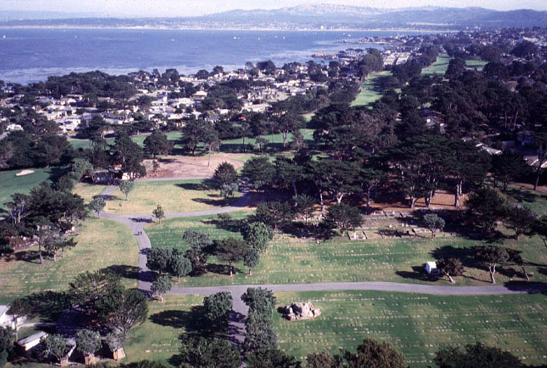
| Pacific Grove cemetery in the foreground and the southern end of Monterery Bay in the background. Normal color picture--compare with next image. |
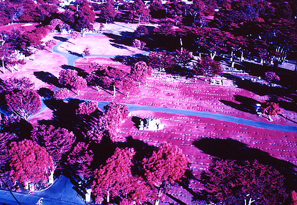
| Color-infrared view of the Pacific Grove cemetery. Note dark, sharply defined shadows that enhance the appearance of flat headstones. |

| Low-oblique view across the Elkhorn Slough in late afternoon sun. The estuarine reserve is located next to Moss Landing, near the center of Monterey Bay. Note the intricate pattern of vegetation and channels in the marsh. |
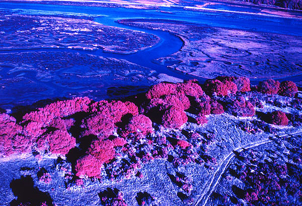
| Color-infrared image showing deciduous trees (bright pink) in foreground and Elkhorn Slough in background. Note relatively dark colors of the marsh compared to bright pink deciduous trees. |

| Closeup color-infrared view of Elkhorn Slough estuarine marsh. Compare with first image in normal-color format. |