| Spring River, Kansas J.S. and S.W. Aber |
|
| Spring River, Kansas J.S. and S.W. Aber |
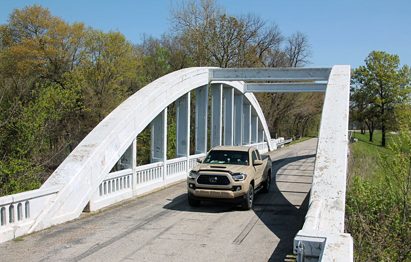
| Rainbow-curve bridge on Route 66 over Brush Creek, a tributary of the Spring River, approximately 3 miles north of Baxter Springs. Constructed in 1923, it is the only remaining Marsh Arch Bridge on Route 66. Original two-way, the bridge is now one-way; the width between arches is only 19 feet. |
Baxter Springs is located on the historic military road that connected Fort Leavenworth (KS) to Fort Gibson (OK). These forts were established in the 1820s, and Fort Scott (KS) was added in 1842. The functions of these forts were to keep the peace between Indian Nations, to aid in Indian removals from the eastern United States, and to protect western trails and settlers.
Baxter Springs was the site of Fort Blair, a small garrison built during the Civil War to guard the military road and western frontier. It saw little action until October 4, 1863, when William Quantrill and about 400 Rebel guerillas attacked. Greatly outnumbered Union forces fought off Quantrill's band, who then moved southward along the Spring River.
A northeasterly breeze at 8-12 mph was just enough to lift our large rokkaku, and we flew both our Nikon GPS radio-controlled rig and the Sony Alpha autoKAP rig. Sunny sky when we arrived gave way gradually during the afternoon to high, thin clouds and then mostly cloudy conditions during our KAP session. This had the effects of soft lighting and vague shadows on the ground, which are evident in some of the images.

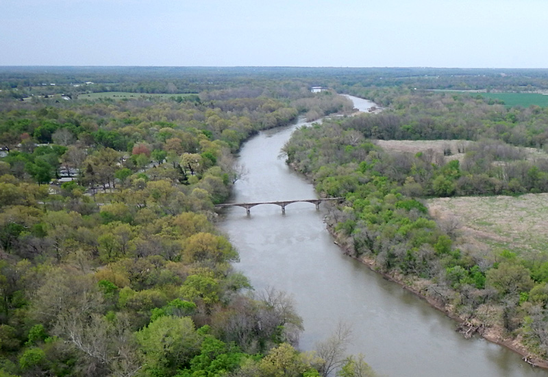
| Left: view northward over the Spring River with an abandoned railroad bridge. Right: closer view with kite flyers at bottom next to a curious circular pattern in the grass. | 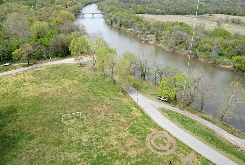 |
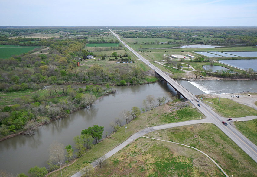
| Views toward the east (left) and southeast (right) over the Spring River and US 166 highway. River flow from left to right. Note the low-water dam just below the highway bridge and pools of the water-treatment facility behind the river. | 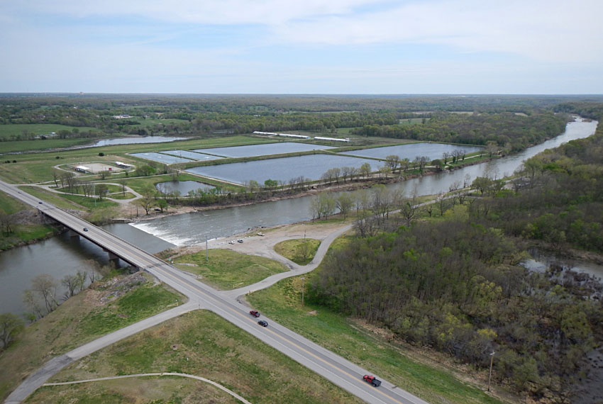 |
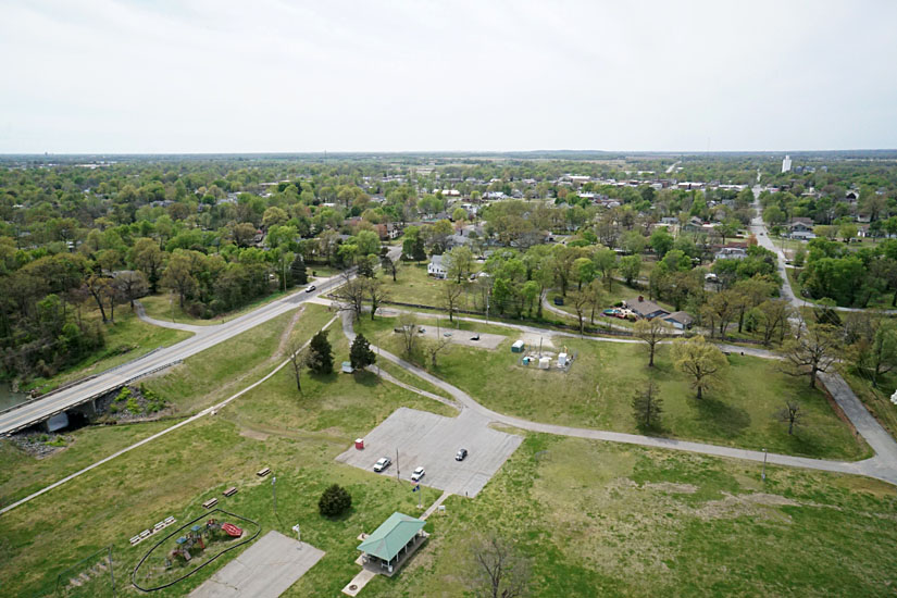
| Views toward the southwest (left) and northwest (right) with the Kiwanis Park in the foreground and city of Baxter Springs on higher ground behind. | 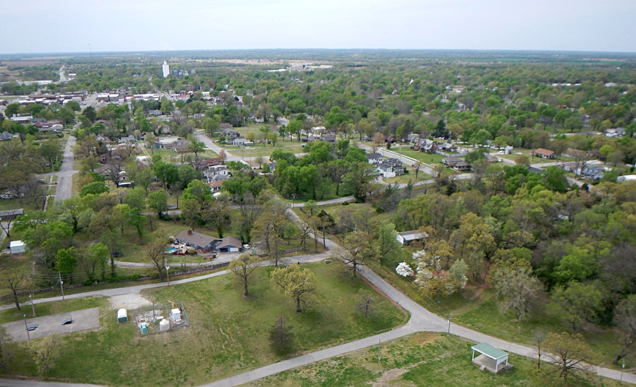
|