| James S. and Susan W. Aber |
| Introduction & history | Kite aerial photography |
| Geology & topography | Water supply & quality |
| Wetland environments | References |
|
| James S. and Susan W. Aber |
| Introduction & history | Kite aerial photography |
| Geology & topography | Water supply & quality |
| Wetland environments | References |
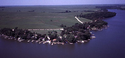
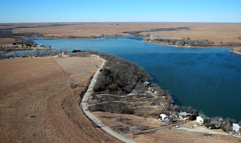
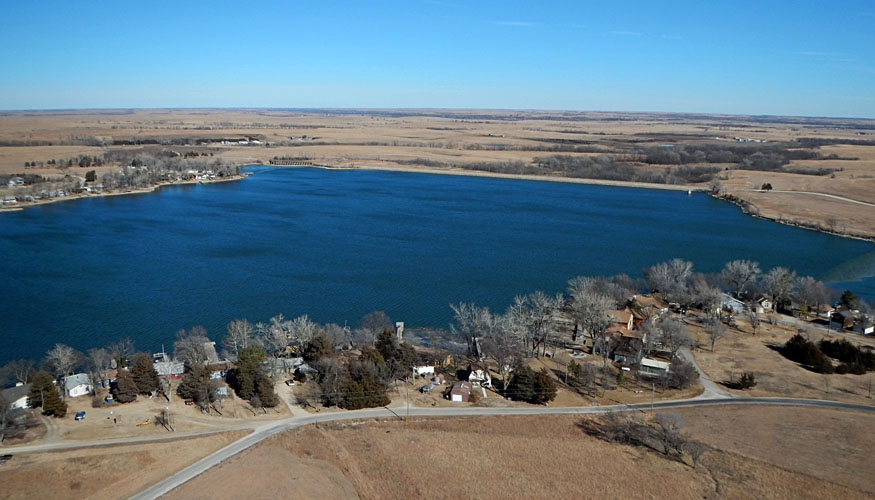
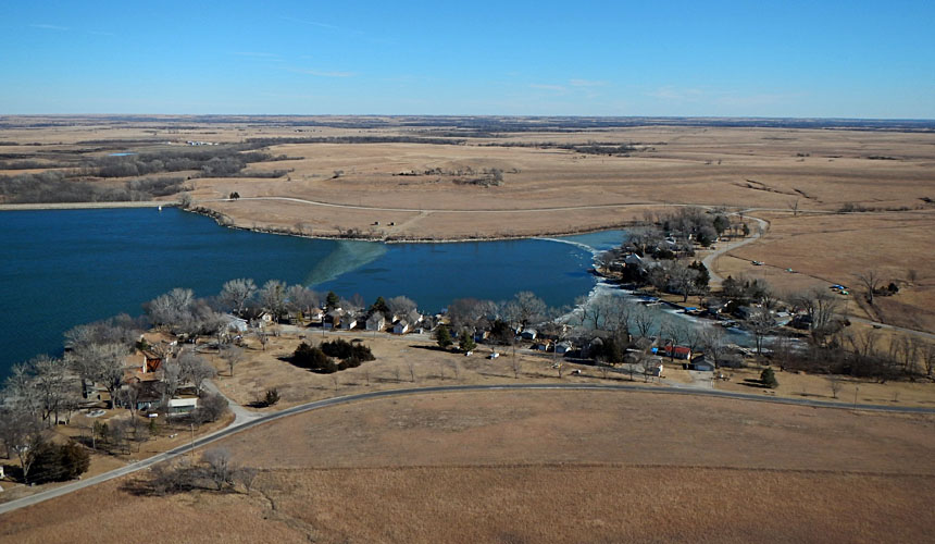
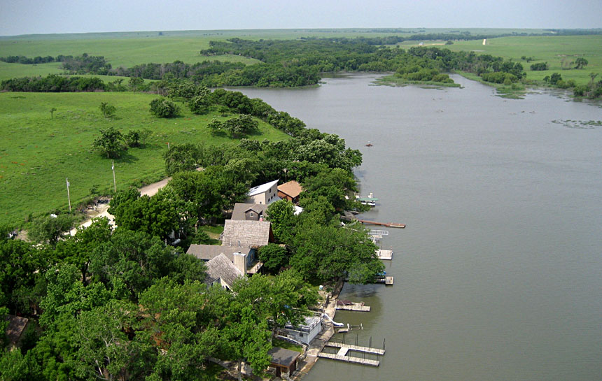
During the nineteenth century, this location was part of the Kansa Indian Reservation, and they frequently camped beside the creek. The remaining Kansa people relocated in 1873 into Indian Territory (Oklahoma). The name Kahola means "by the living waters," which refers to many clear springs that feed the creek and lake (Kahola 1940-41). The dam was completed in 1937, and total cost of the project was $242,000 (Kahola 1940-41). The spillway weir dam has an elevation of 1269 feet, and the lake covers approximately 400 acres (~160 ha) when full. In the past, the lake served as a reserve water supply for the city of Emporia (Aber 1990).
 and south bluffs in the background. Adapted from Kahola (1940-41). 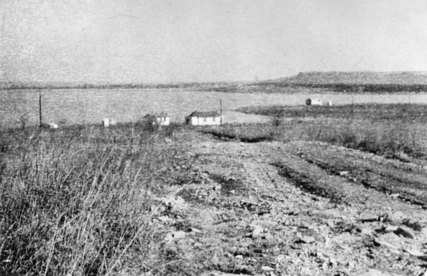 looking toward the northeast. Courtesy of D. Montgomery. |
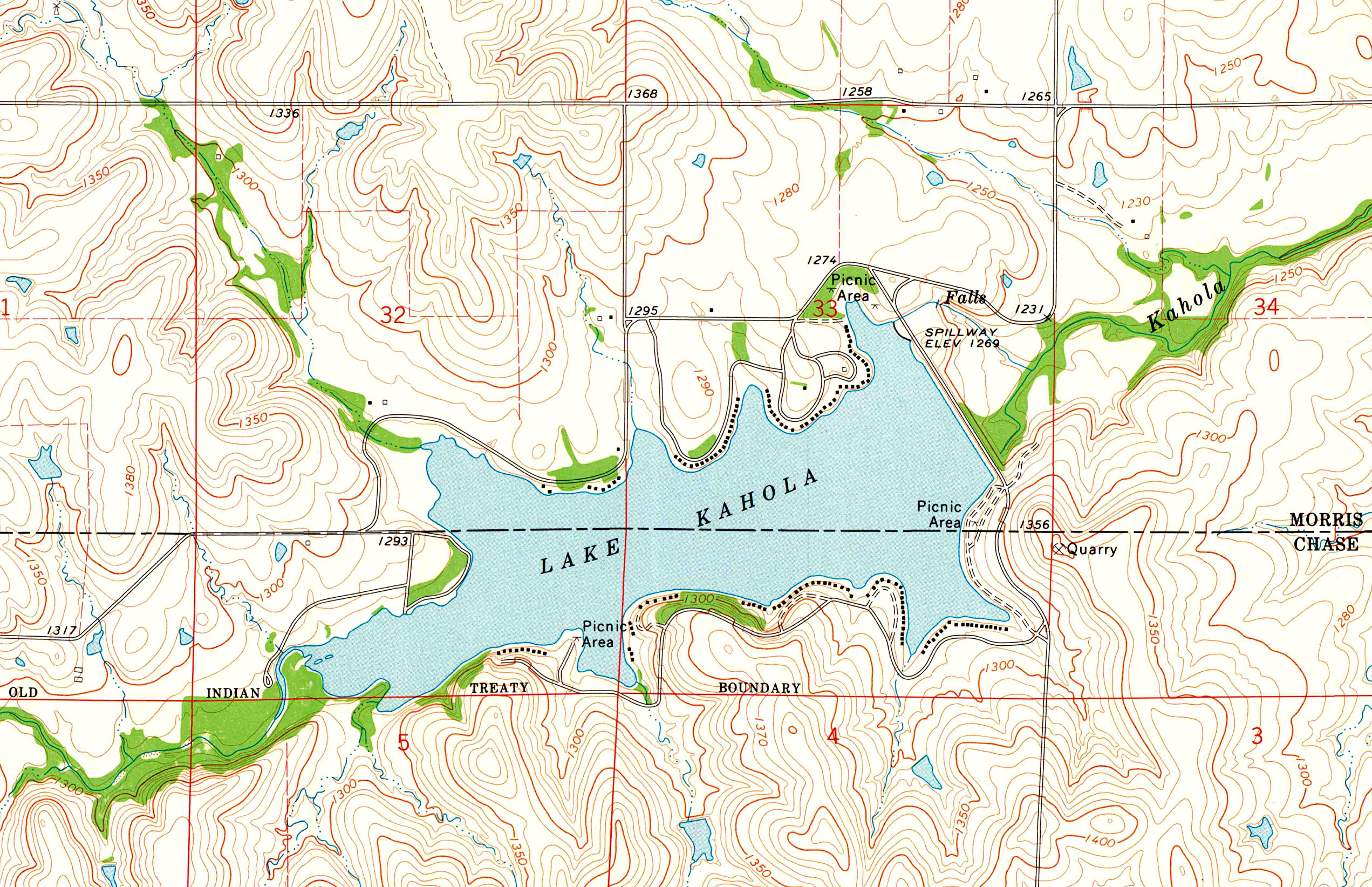
| Lake Kahola straddles the Chase-Morris county line, and an old Indian treaty boundary runs across the southern edge of the lake. Portion of the Lake Kahola, Kansas 7.5-minute topographic map (1972). Map obtained from USGS Store. |
![]() Return to top.
Return to top.
   |
Recognizing these issues, the cabin owners association began an effort in 2000 to place permanent survey markers at the corners of all building lots in the park. To supplement the ground-based survey markers and lot measurements, large-scale airphotos were selected as the tool for documenting lake-shore development and lot boundaries. We conducted vertical kite aerial photography during the winter, leaf-off period in order to obtain views with minimal obstruction from trees (Aber and Aber 2003). Lot boundary markers were identified with additional ground survey.
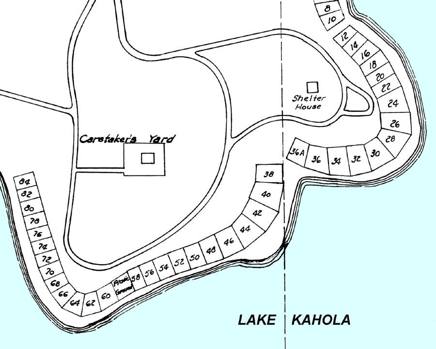
| Left: portion of the original plat of Lake Kahola cabin lots; a highly schematic diagram that lacks any georeferencing (date unknown). Right: actual lot boundaries marked by red dots annotated on a vertical kite aerial photograph. Adapted from Aber et al. (2010). | 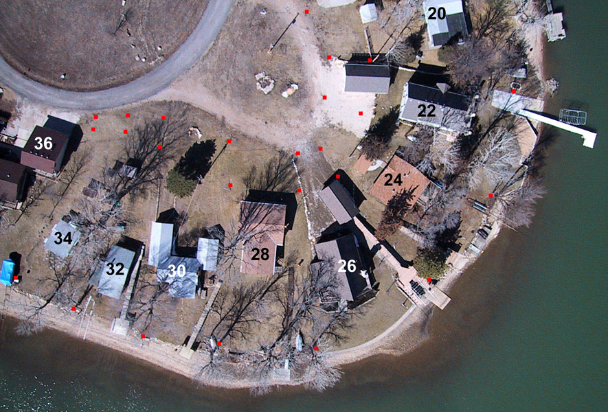
|
![]() Kahola Lake 2002 aerial survey.
Kahola Lake 2002 aerial survey.
![]() Return to top.
Return to top.
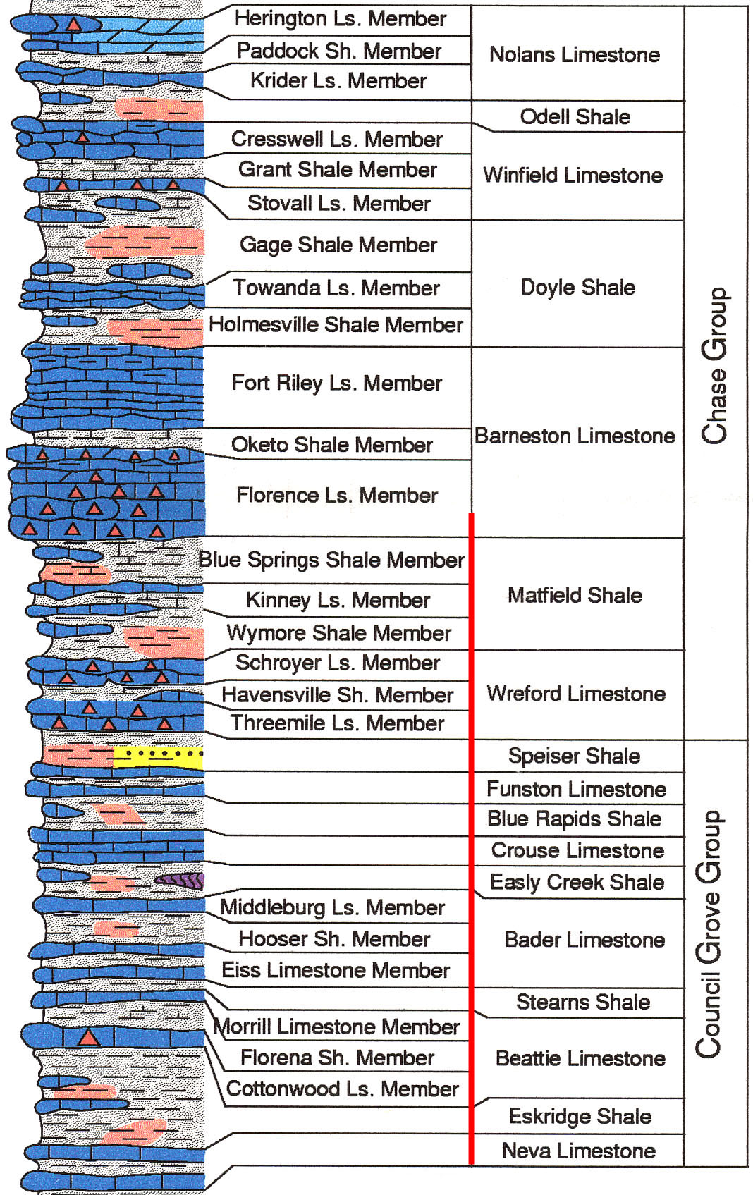
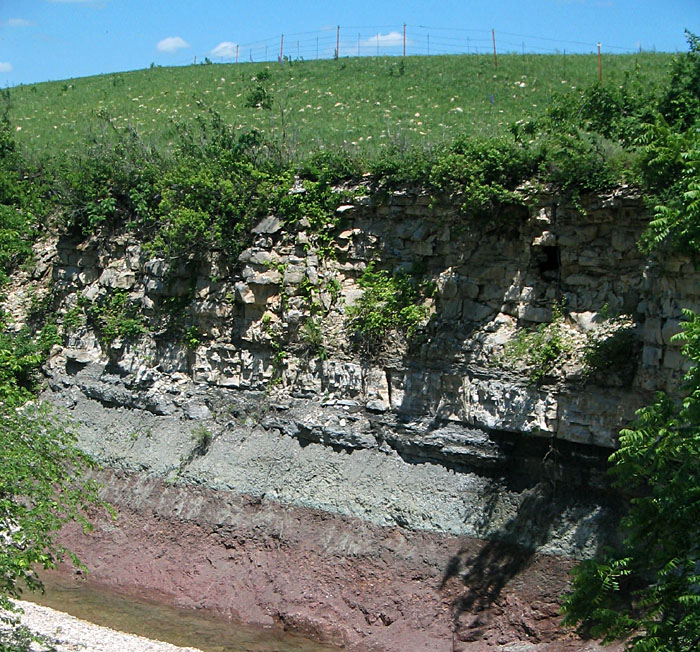
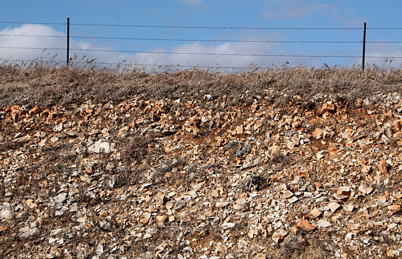
| Flint Hills bedrock stratigraphy (left). The strata in the Lake Kahola vicinity are indicated by the red line and range from the Neva Limestone (in spillway) to the lower Florence Limestone (on highest hill tops). The Wreford and Florence limestones are particularly thick and contain much chert (flint) as nodules and beds (red triangles).
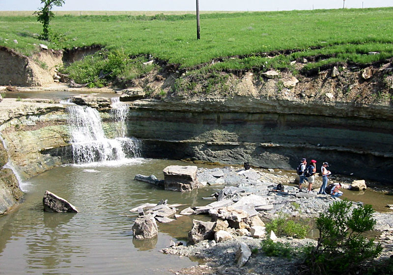 Eskridge Shale and water fall in lake spillway
|
![]() Return to top.
Return to top.
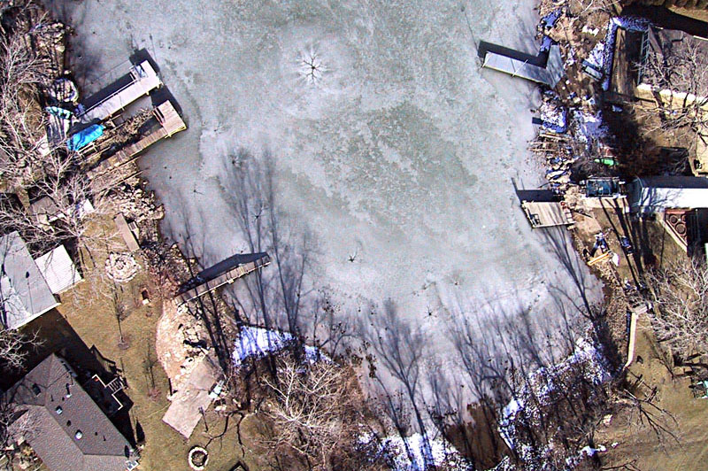
| Left: vertical shot of ice in a small cove on southeastern side of lake. The circular ice patterns with concentric rings and radial cracks result from irregular ice freezing. Right: hundreds of mallards (Anas platyrhynchos) resting on the edge of ice toward the western side of the lake. | 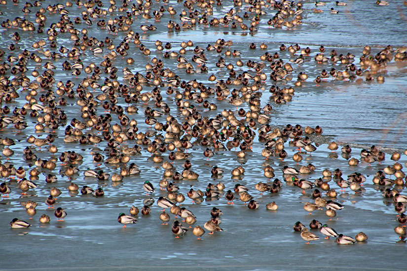
|
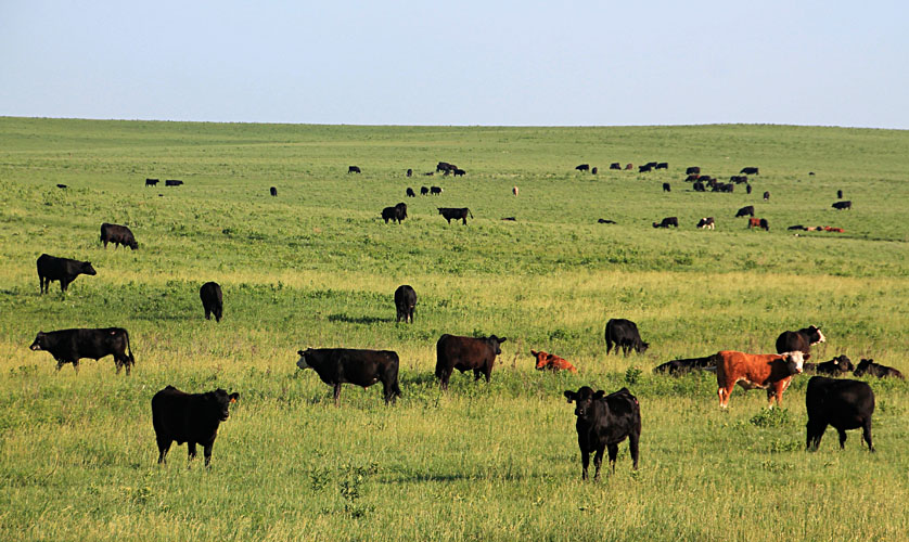
| Left: typical prairie scene with cattle grazing on lush tallgrass adjacent to Lake Kahola. Right: zebra mussel warning sign placed at the entrance to the lake for the July 4th holiday. | 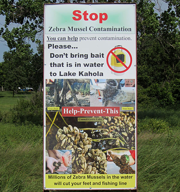
|
| Left: looking toward the southwestern end of the lake where Kahola Creek enters. The path of the creek is marked by trees in the background in this spring view. Right: upstream from the lake on Kahola Creek seen from canoe. | 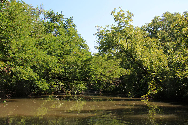
|
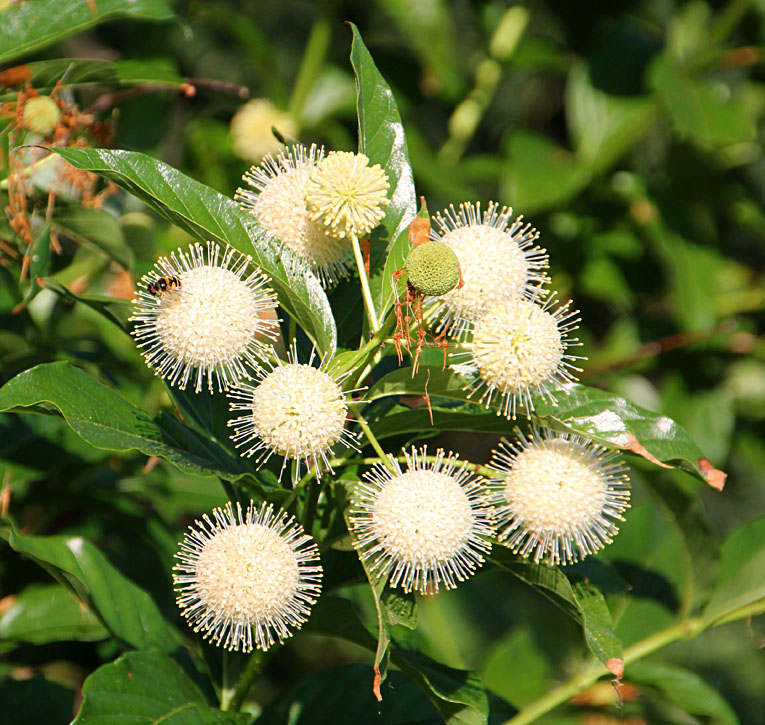
| Buttonbush (Cephalanthus occidentalis) is a deciduous bush or small tree that grows along the rocky south bluff and western shoreline of the lake. It has dazzling white flower clusters in June and July that attract many insects including bees (left) and the red admiral (Vanessa atalanta) butterfly (right). | 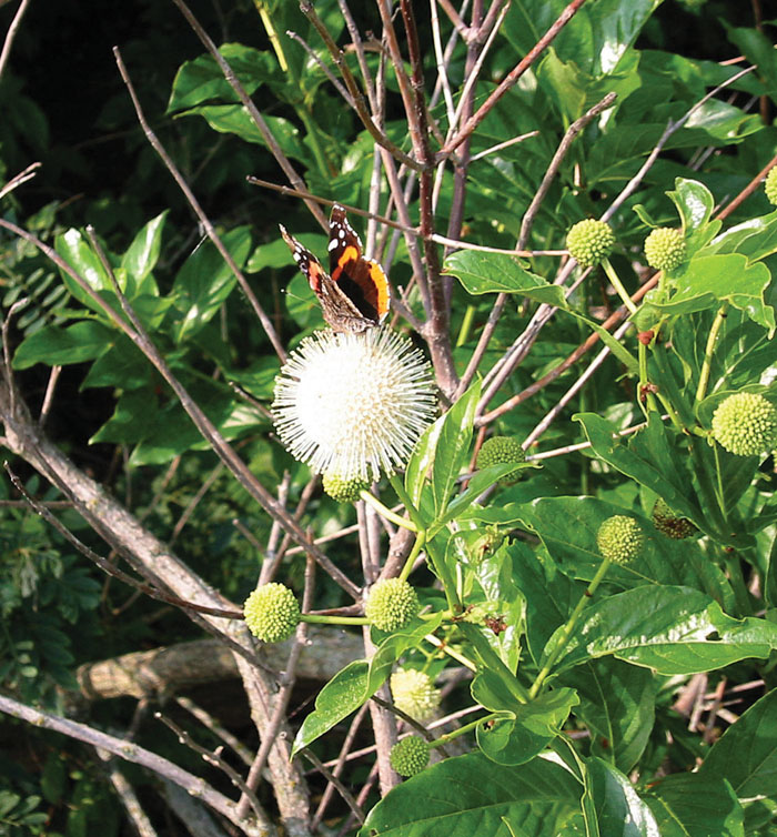 |
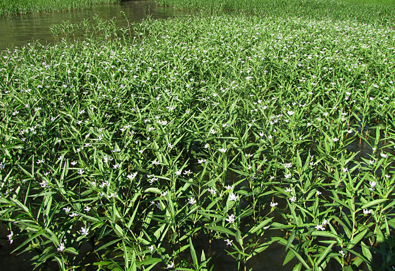
| Water willow (Justicia americana) grows in shallow water along the rocky south bluff and western margin of the lake. It has narrow, willow-shaped leaves, for which the plant is named (left). The small, orchidlike, white flowers attract bees and other insects (right). | 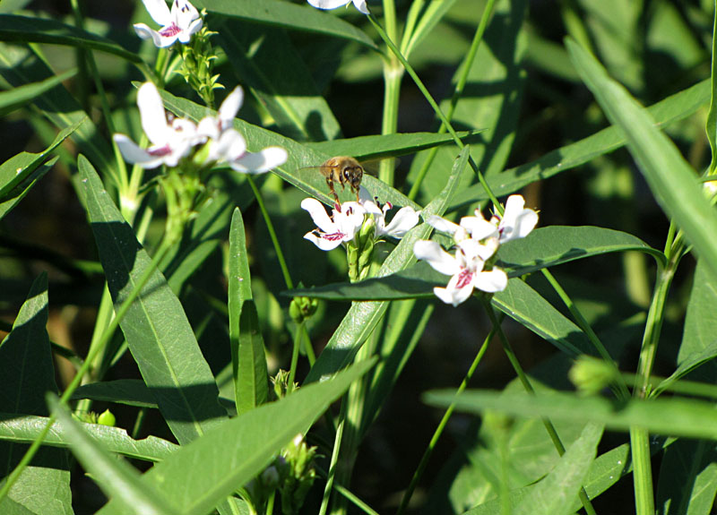 |
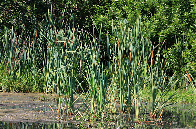
| Cattail (Typha sp.) to left and arrowhead (Sagittaria sp.) to right are among the most common and recognizable emergent wetland plants around the world. Both are common along the margins of the delta and Kahola Creek inlet to the lake. | 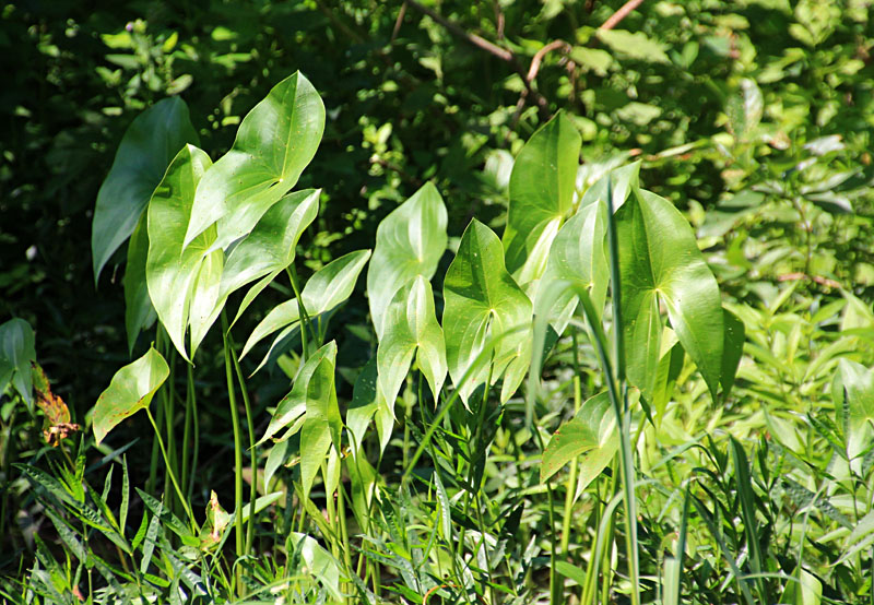 |
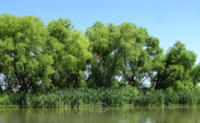
| Left: large willow (Salix L.) trees behind cattails along the delta margin. Right: small butterfly feeds on pale flowers of pink smartweed (Polygonum bicorne) beside the creek inlet to the lake. | 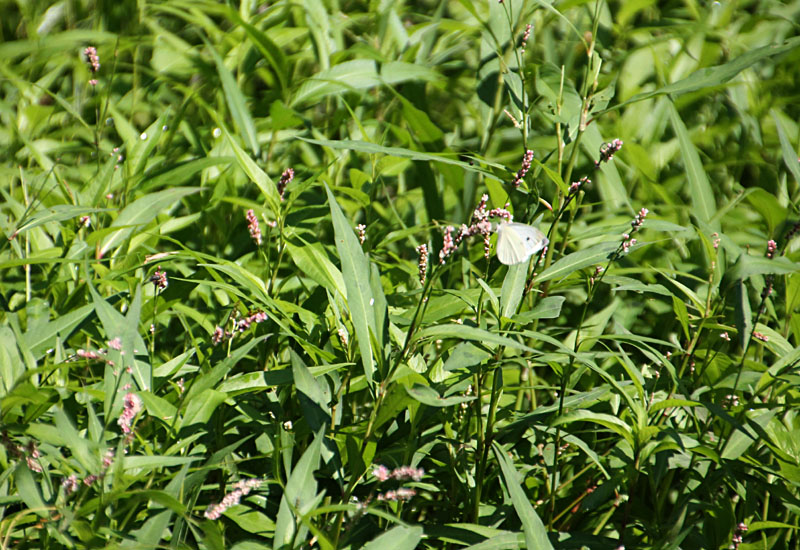 |
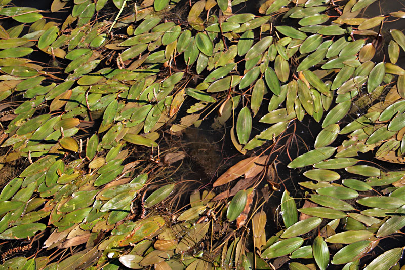
| American pondweed (Potamogeton nodosus) is a floating-leaved variety of the large pondweed genus. Pondweeds are among the most important food plants for waterfowl (Whitley et al. 1999). Elongated leaves (4-6 inches long) cover the water surface (left), and small flower stalks rise above the surface (right). | 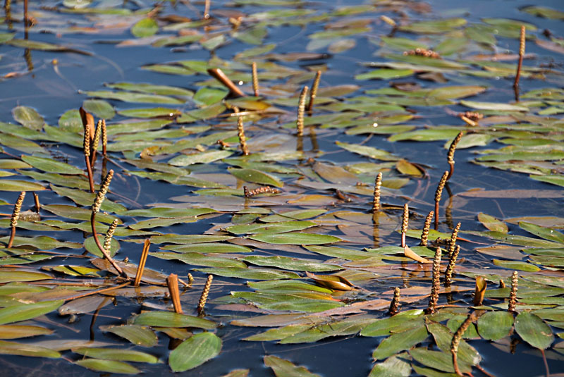 |
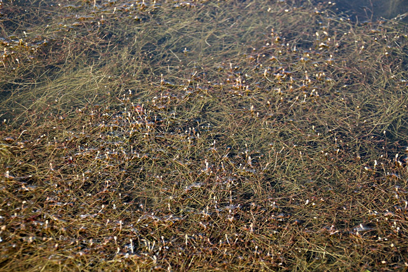
| Left: submerged pondweed (Potamogeton L.) sends tiny flower stalks barely above the surface. Right: water milfoil (Myriophyllum heterophyllum) prefers cool, slow-moving, slightly alkaline water with high calcium content (Whitley et al. 1999), as in the delta at the southwestern end of the lake. | 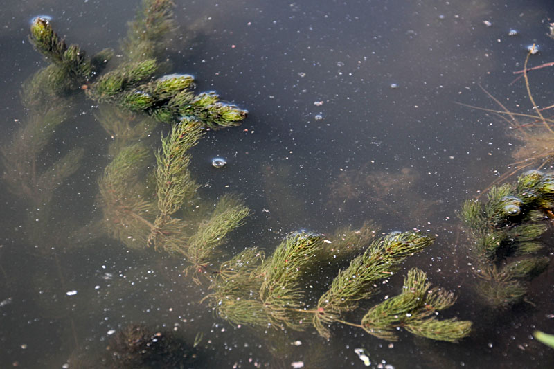 |
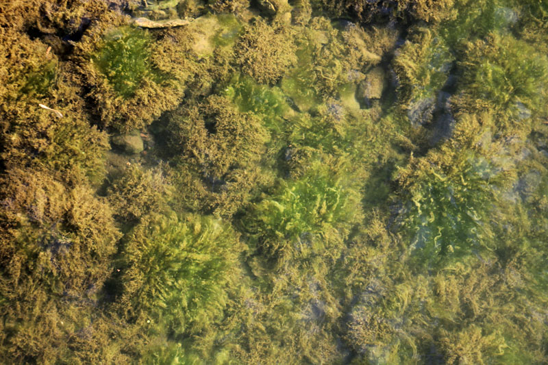
| Algae are primary producers and food sources in many aquatic environments. Algae are present at Lake Kahola on shallow rocky substrates (left) and floating on the surface (right). The amount of algae is generally limited, however, by cool water temperature and low levels of nutrients from the grassland drainage basin. | 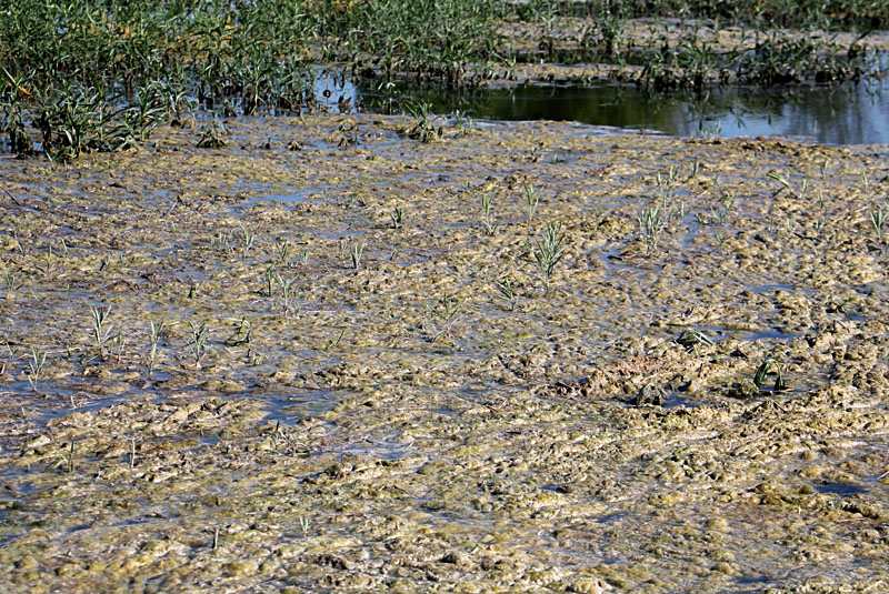
|
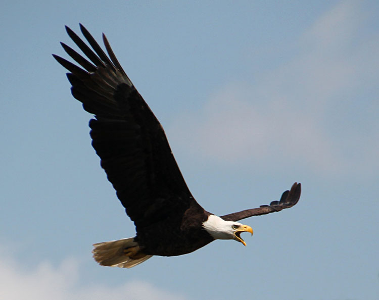
| Left: bald eagles (Haliaeetus leucocephalus) nest in large trees next to the lake. Right: individual American coot (Fulica americana) slowly cruises along in search of aquatic vegetation to eat. Coots often feed with and are mistaken for ducks, but coots are not ducks. | 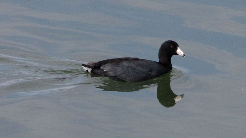 |
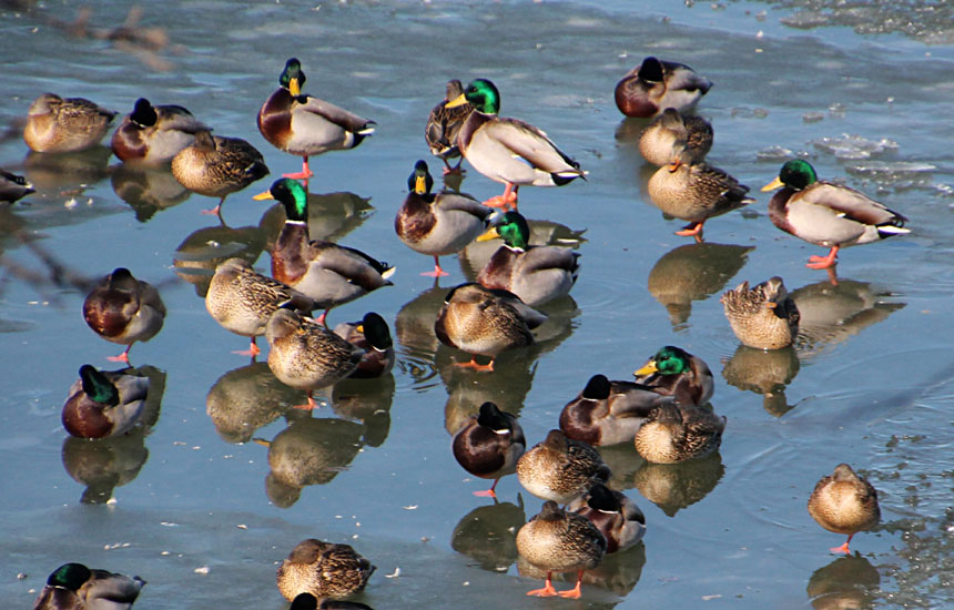
| Left: mallards (Anas platyrhynchos) appear occasionally in large numbers during migration. Seen here resting on ice. Right: longear sunfish (Lepomis megalotis) displays brilliant orange and turquoise colors. This male is quite possibly guarding a nest in the gravel bottom of Kahola Creek. | 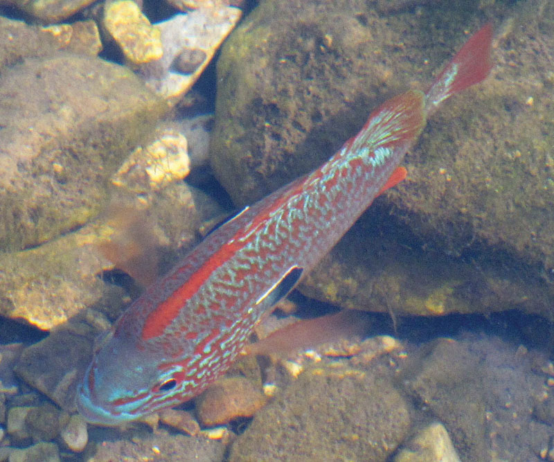 |
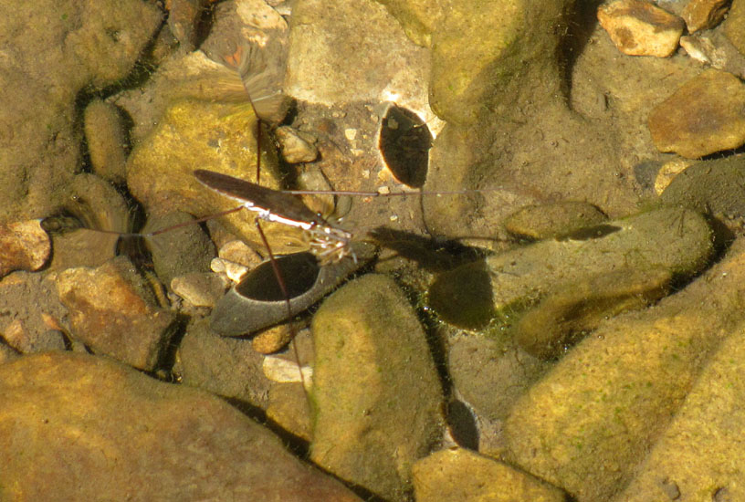
| Left: water strider (Aquarius remigis) on a shallow clear stream. Distortions on water show where the legs have depressed the surface tension and refracted sunlight creating the dark spots on gravel bed. Right: whirligig beetles (family Gyrinidae) move rapidly in large groups half in and half out of the water. | 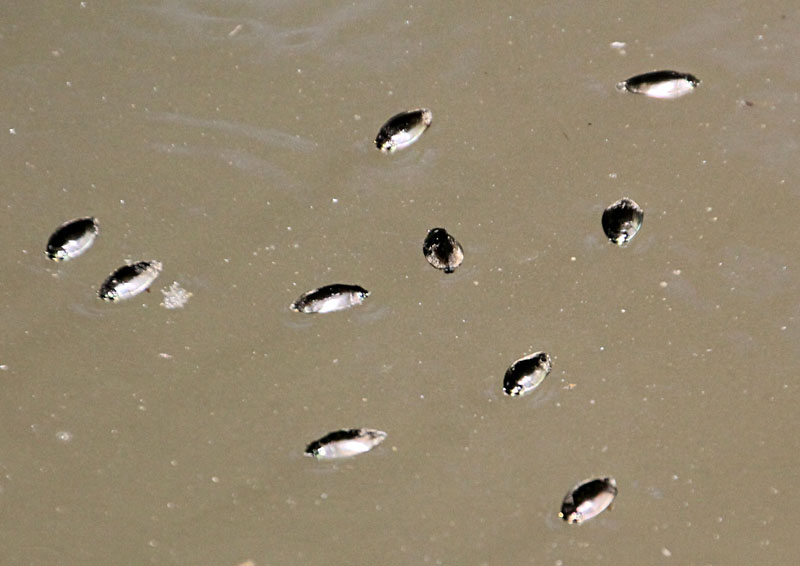 |
![]() Return to top.
Return to top.
References
![]() Return to Geospectra.net or Great Plains aerial photography.
Return to Geospectra.net or Great Plains aerial photography.
All text and images © J.S. and S.W. Aber
Last update 2017.