|
Scott County, Kansas
J.S. and S.W. Aber |
|
|
Scott County, Kansas
J.S. and S.W. Aber |

| Satellite image of Dry Lake vicinity, on the High Plains of west-central Kansas. Active crops (mostly winter wheat) appear bright green, and fallow fields are pink and maroon colors. The checkerboard pattern reflects alternate-year cropping. This image dataset was acquired on May 16, 2007, just two days before our initial observations at Dry Lake. Landsat false-color image based on visible, near-infrared, and mid-infrared bands. Dataset obtained from USGS Glovis; image processing by JSA. |
| 2007 | 2008 | 2009 | 2010 | 2011 |
| 2012 | 2013 | 2014 | 2015 |
![]()
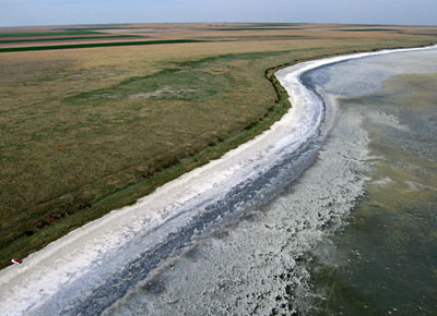
| Overviews toward northeast (left) and southwest (right). Lake is completely full of water following heavy winter snow and spring rain runoff. Sun glint highlights wind-driven wave patterns on the water. Waves are eroding sediment from the shore and shallow lake floor. Note small overturned boat for scale. | 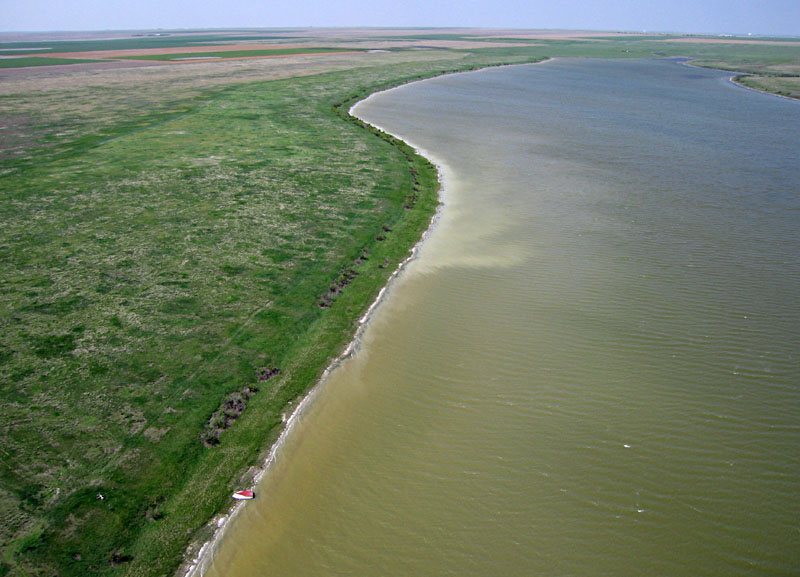 |
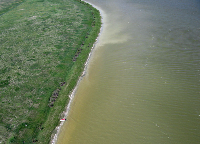
| Left: closer view of southern shore with small boat. Salt cedar bushes grow along bank that marks the edge of the lake basin. Right: ground crew, from left: Cheryl Unruh, JSA, SWA, and Dave Leiker. | 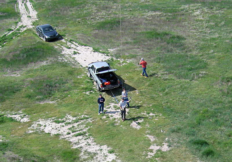
|
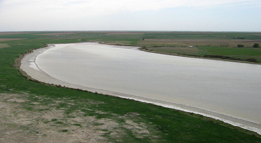
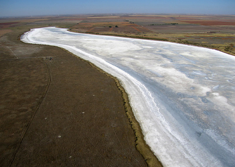
| Overviews toward northeast (left) and southwest (right). Most water of previous year has evaporated. A moist mud flat occupies the center of the basin with a salt flat around the margin. A series of descending shorelines can be seen in the pattern of salt accumulation. | 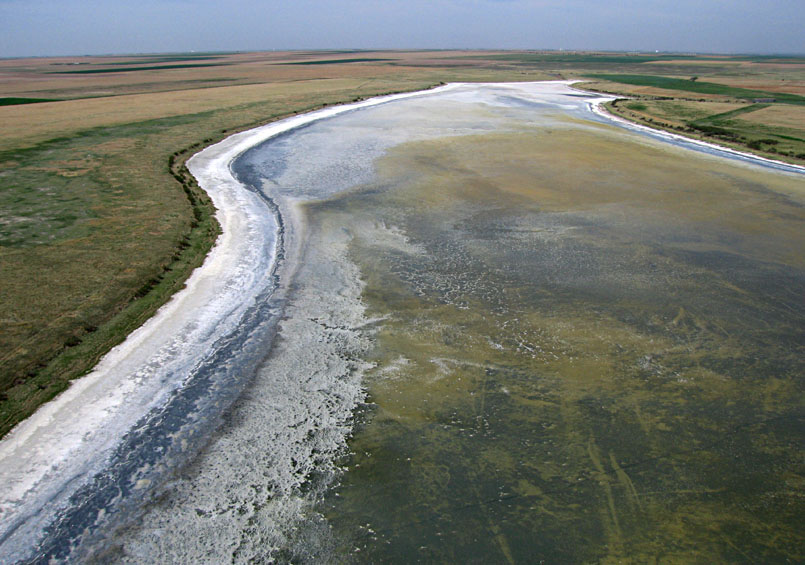 |
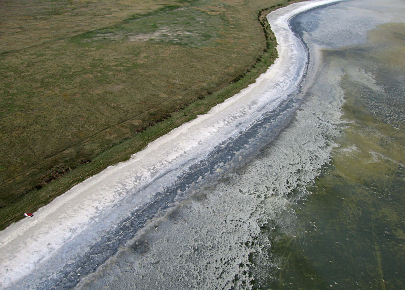
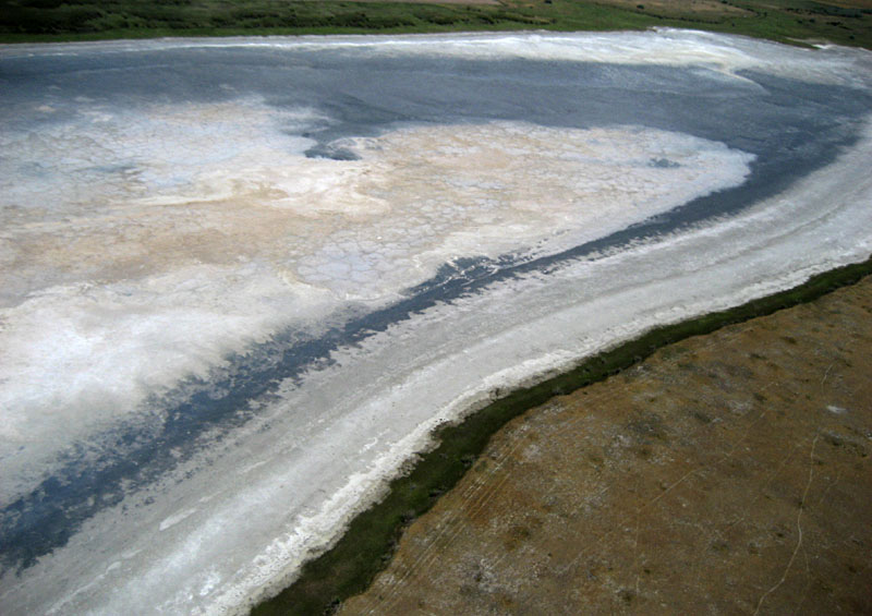
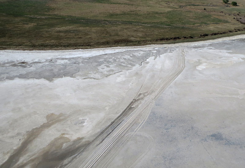
| Closer views of the southern margin of the dry lake basin. Distinctive zones and patterns are visible in the salt and mud. This salt has a definite "table salt" taste. The mud and salt flats are quite wet; impossible to walk far from the vegetated edge without sinking into the saturated soil. | 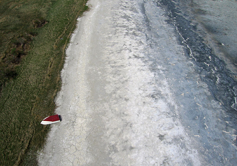 |

| Ground crew (JSA & SWA) conducting KAP from the southern side of Dry Lake with the small boat in the same spot as the previous year. |
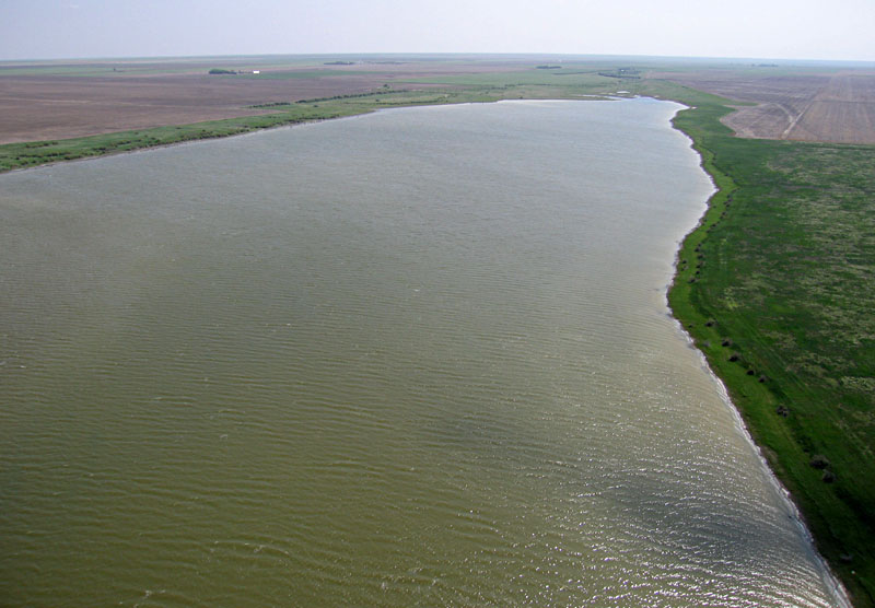
| Looking toward the west (left) and southwest (right) under partly cloudy sky. Water fills most of the basin except for a narrow mud flat around the edge. The late afternoon sun reflecting from the water surface helps to define the boundary between water and wet mud flat. | 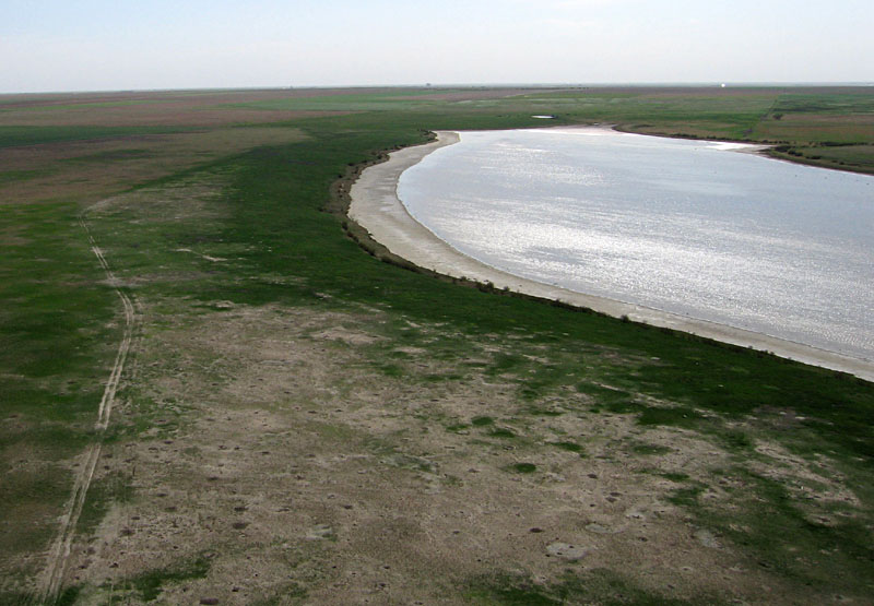 |
| Left: overview toward the northeast. A narrow fringe of wet mud and salt surrounds open water in the lake. Streaks on water indicate wind at 20-30 mph. Right: hard crash in pasture south of lake. Tilt servo gear broken, antenna pulled off radio receiver, and titanium frame bent. The result of solo KAP under difficult conditions, but the camera survived and the rig could be repaired. | 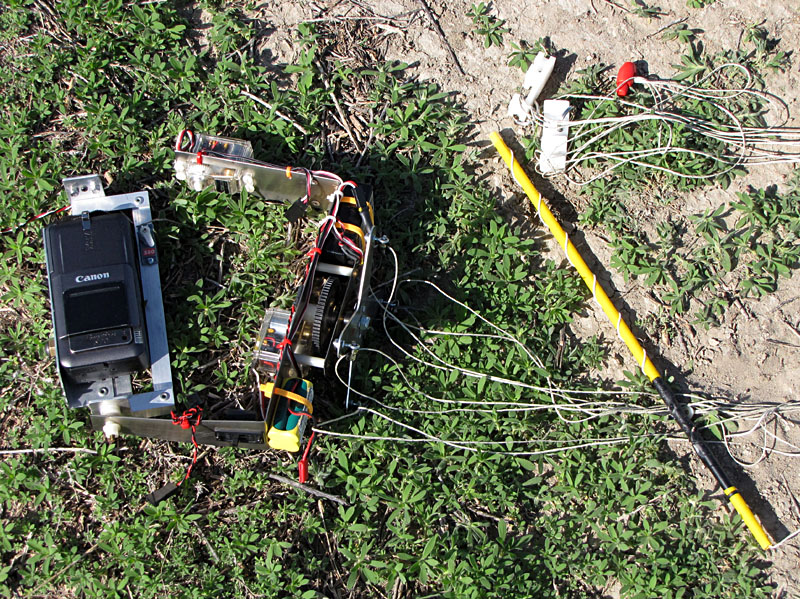 |

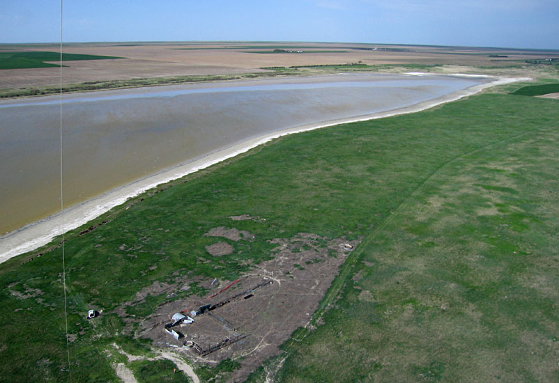
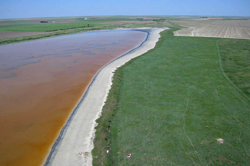
| Overviews looking toward the northeast (left) and southwest (right). Lake is partly full of orange-brown water, and a dry mud flat surrounds the shoreline. Shortgrass prairie is exceptionally green following a wet spring. | 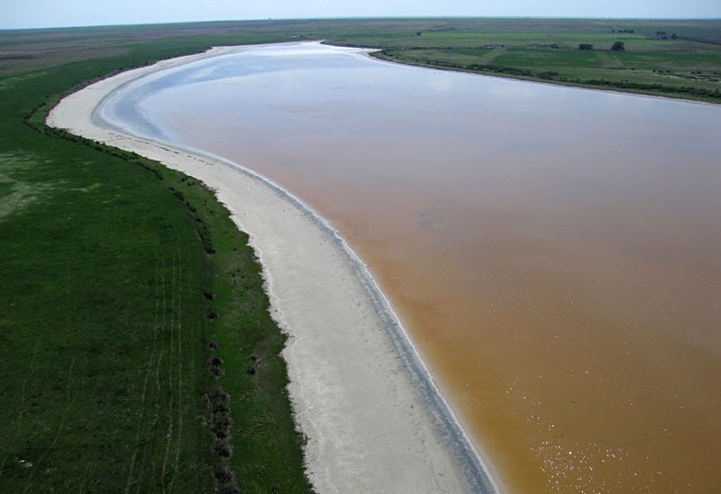 |
| Eastward view over the southern margin of Dry Lake. The red boat seen on the shore in previous years (above) has been moved up onto the prairie (bottom center). |
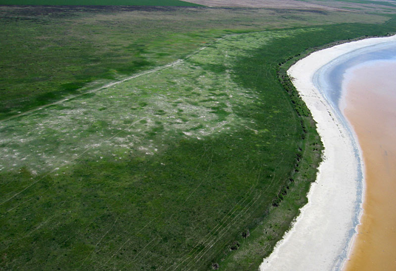
| The spotty, pale-green zone in left-center of this scene is a prairie dog town, now protected behind an electric fence. |
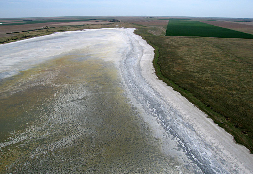
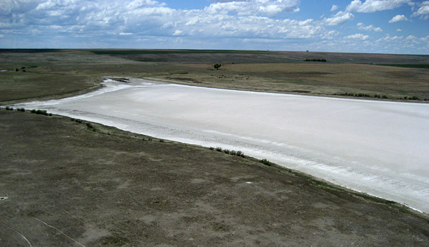
| Lake is completely dried out with a heavy salt crust well out into the basin. Left: overview from eastern end looking toward the west. Right: view over the western end. | 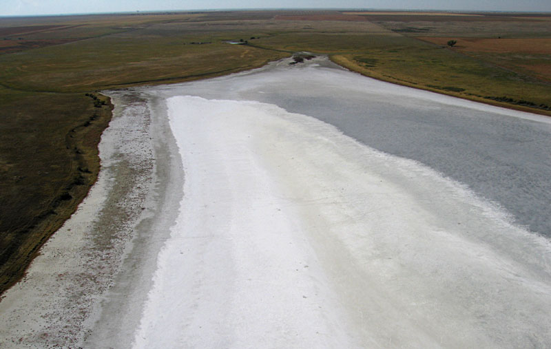 |
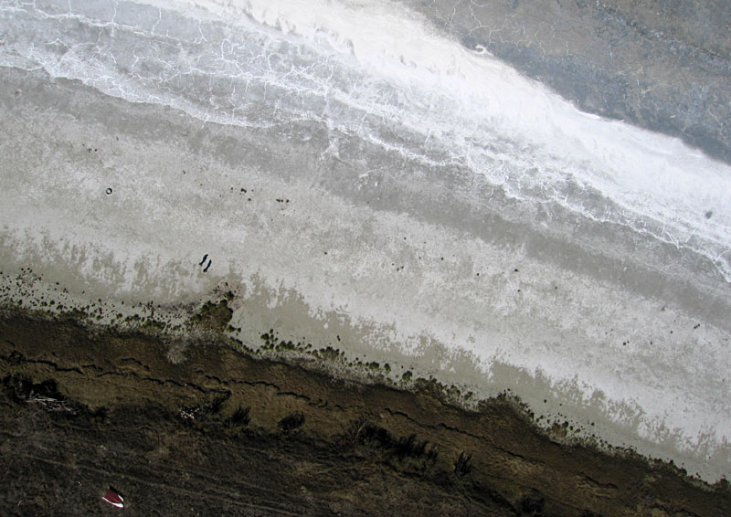
| Closeup vertical shot over the southern margin showing distinctive patterns in the salt and mud surface of the dry lake floor. Two people are standing left of center, and the red boat can be seen on the lower left edge. |
 Panoramic overview from the eastern end looking westward. Lake remains dry, but most surface salt is gone and mud is quite soft. Saline water is just a few inches below the surface and tastes like sea water. | |
| Left: western end of Dry Lake basin. Notice how brown the surrounding prairie grass is compared with May of previous year. Right: view across the center of Dry Lake with green winter wheat fields in the background. Lake floor conditions are similar to May 2008. | 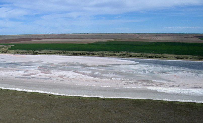 |
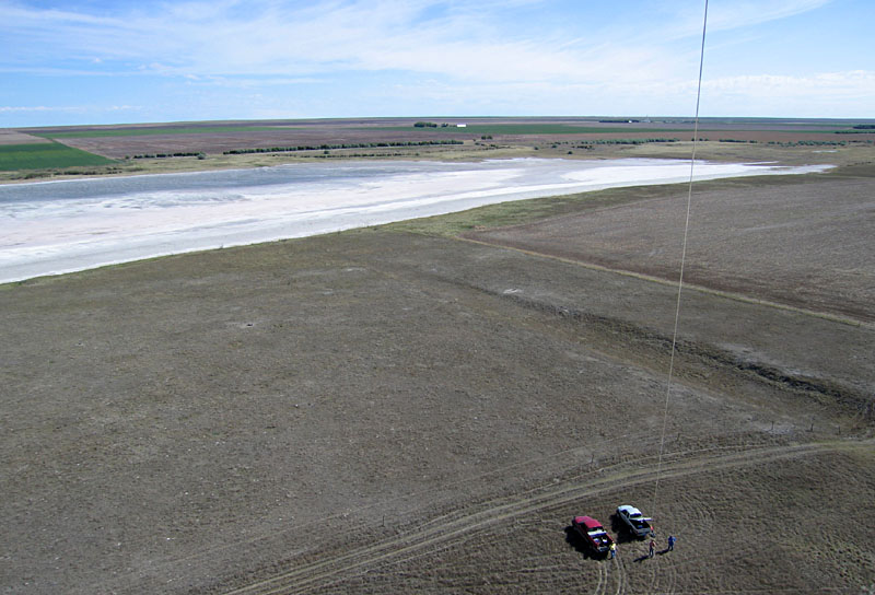
| Kite flyers in open prairie south of the lake basin near the eastern end. |
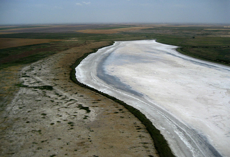
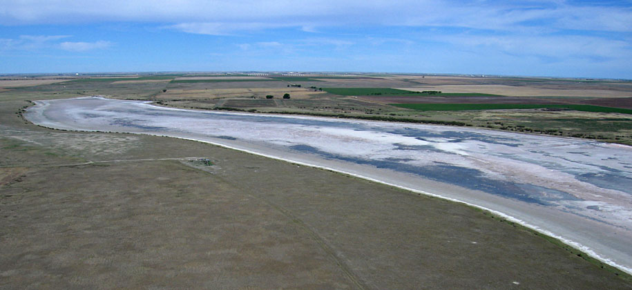
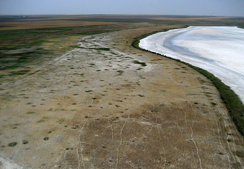
| The lake basin remains completely dried out with a salt-covered mud flat. Left: Looking toward the southwestern end of the lake basin. Right: the northeastern end of the lake basin. | 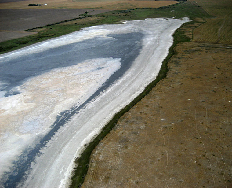 |
| Close-up shots of the lake basin. Left: intricate patterns in salt accumulation along the shore and the center. Right: green strip of vegetation along margin of basin. Old tire at bottom edge gives scale. | 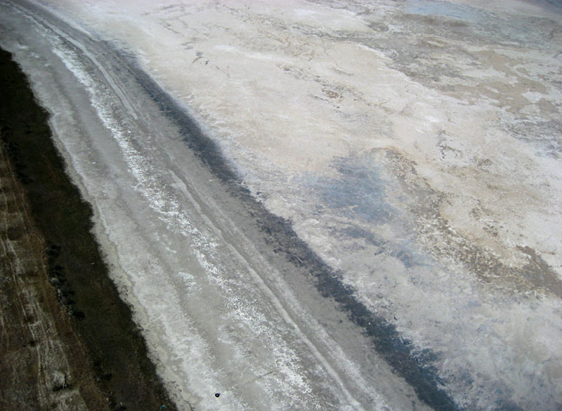 |
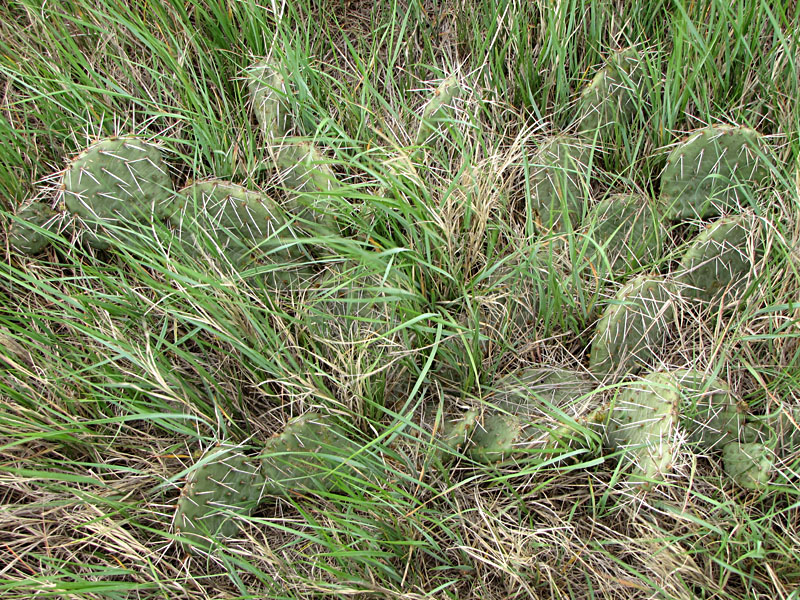
| Left: prairie dog town south of the lake basin has expanded over the past couple of years. Right: golden winter wheat field ready for harvest south of the lake basin. The mottled pattern in prairie to lower left is typical of wind-blown silt (loess) that forms the topsoil of the High Plains. | 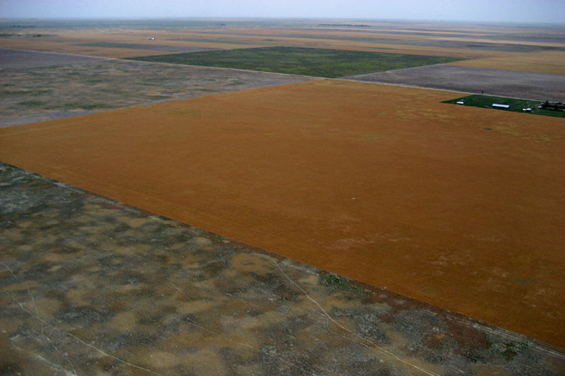 |

| Left: overview from the western end looking toward northeast showing nearly the whole lake basin, which is completely dry. Right: view eastward with the prairie dog town along the southern edge of the lake. | 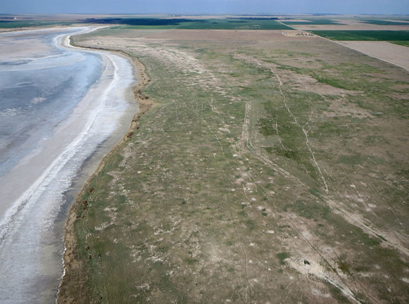 |
| Left: close-up shot of the western end with vehicle tracks across the dry lake floor. Right: looking westward showing the prairie dog town, which has expanded considerably over the past few years. Sun glint reveals a puddle of water in an inlet creek. | 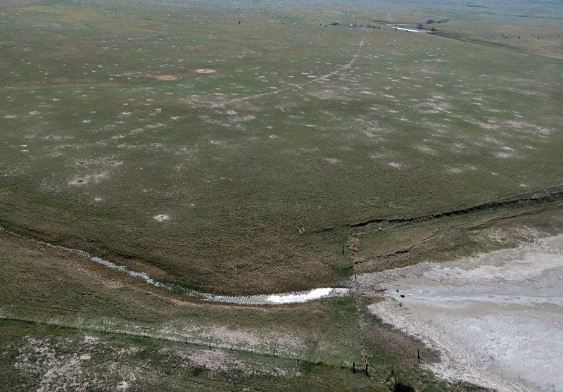 |

| Overviews looking toward the northeast (left) and northwest (right). This is the first time the lake has held water since 2010. Repeated heavy summer rains replenished soil moisture, filled small puddles and ponds, and generated sufficient runoff to refill the lake basin partially. | 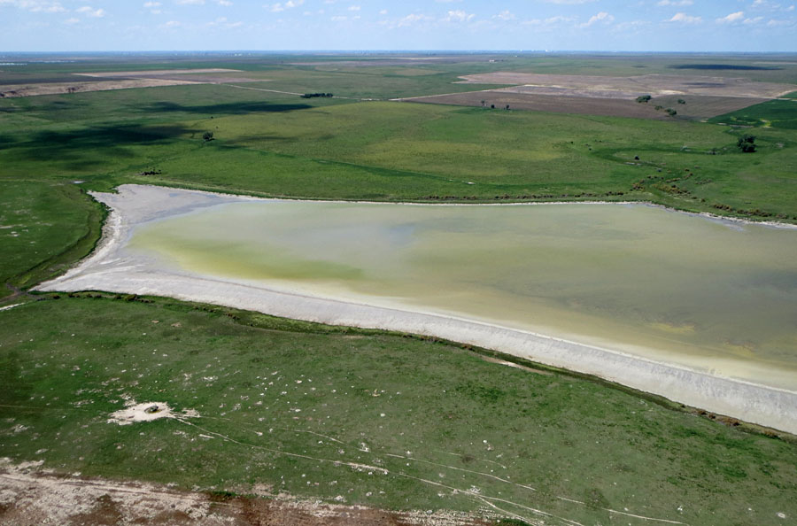 |

| Left: view to north with kite flyers at lower center in a prairie dog town. Right: water body in center of lake displays a distinctive yellowish-green color, presumably caused by algae and drowned weedy vegetation. | 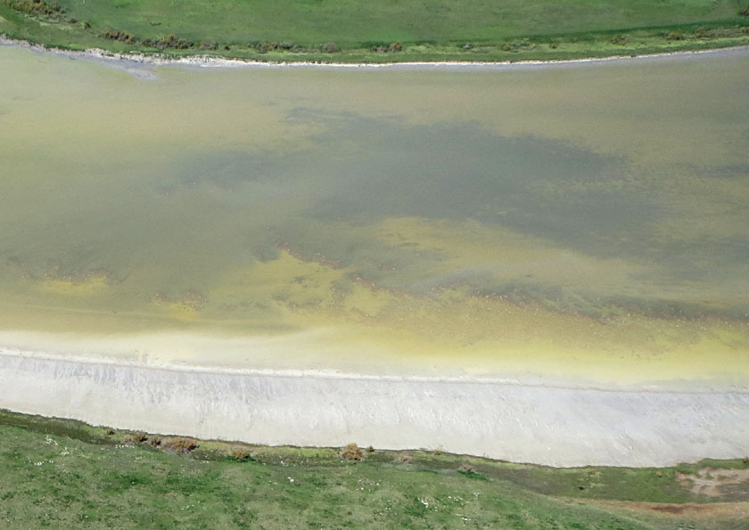 |
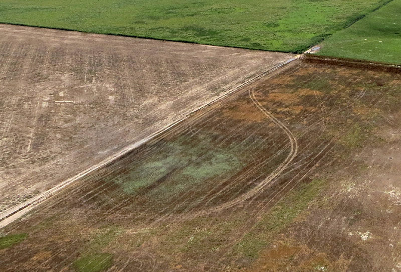
| Left: our normal access road (lower left) was blocked by mud in a small playa depression (scene center); we had to deviate across the fallow field. Right: extensive prairie dog town is evident in the fallow field; kite flyers in upper left corner. | 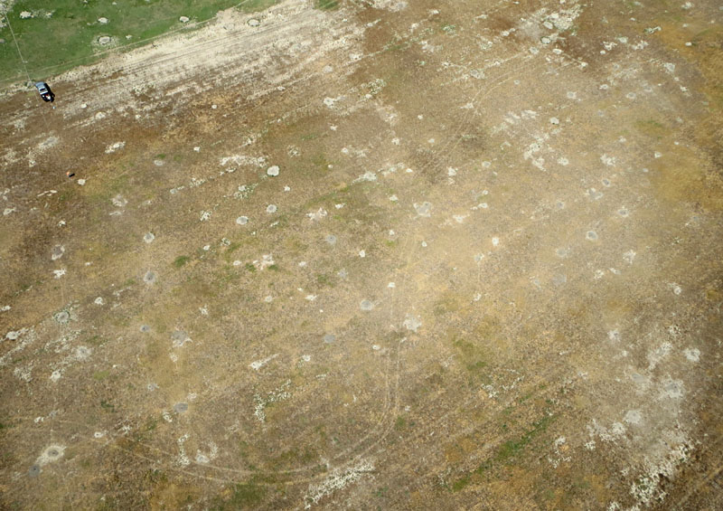 |
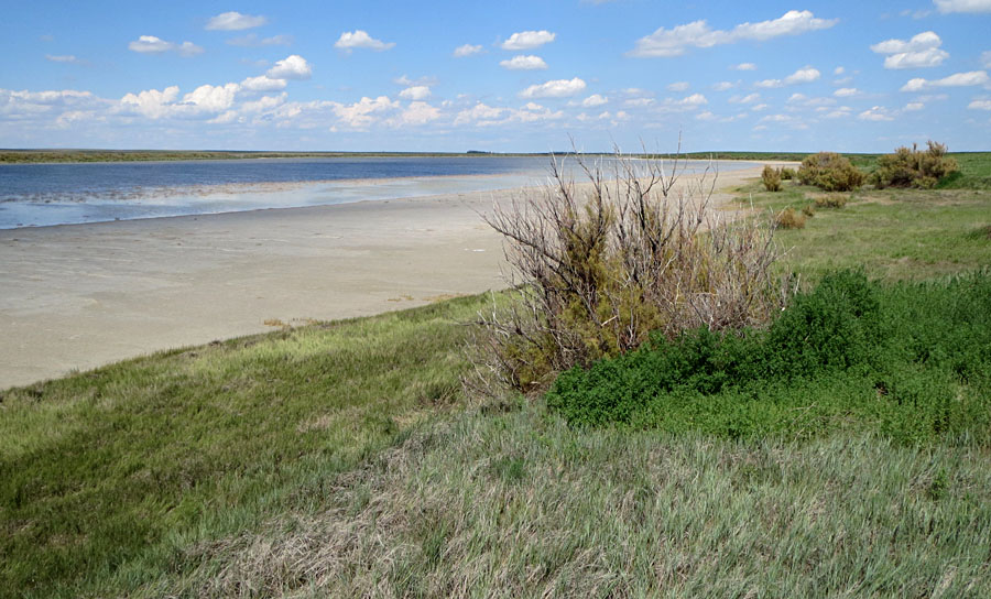
| Ground views. Left: extensive mud flat marks the southern margin of the lake, and saltcedar (Tamarix ramosissima) bushes occupy the terrace along the edge of the basin. Right: cattle grazing in a water-filled playa near Dry Lake, a rare sight on the High Plains. | 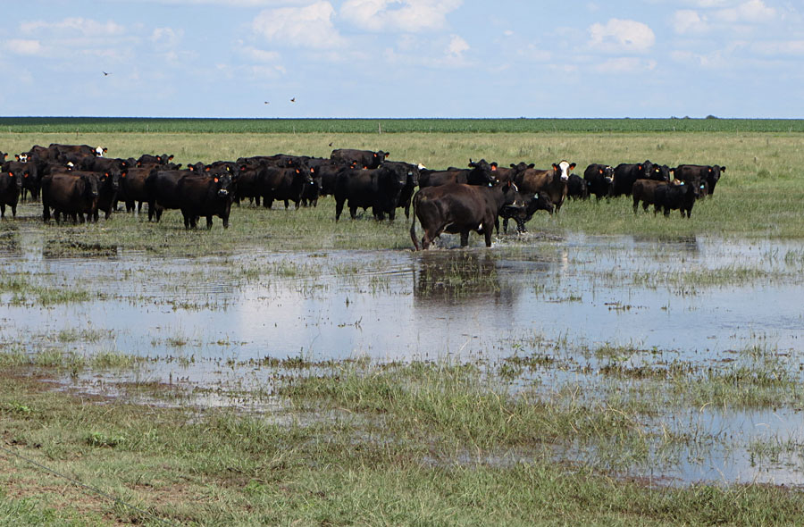 |
| Overviews looking from the western end toward the northeast. The lake is completely full following repeated spring rains. Water has not been this abundant since the high stand of 2007, when our annual observations began. | 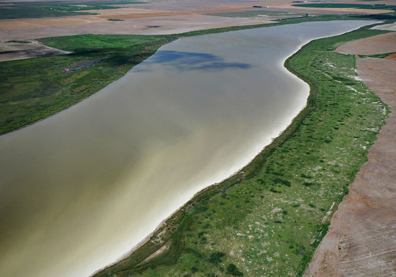 |
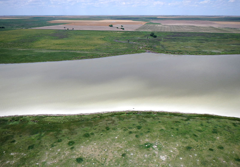
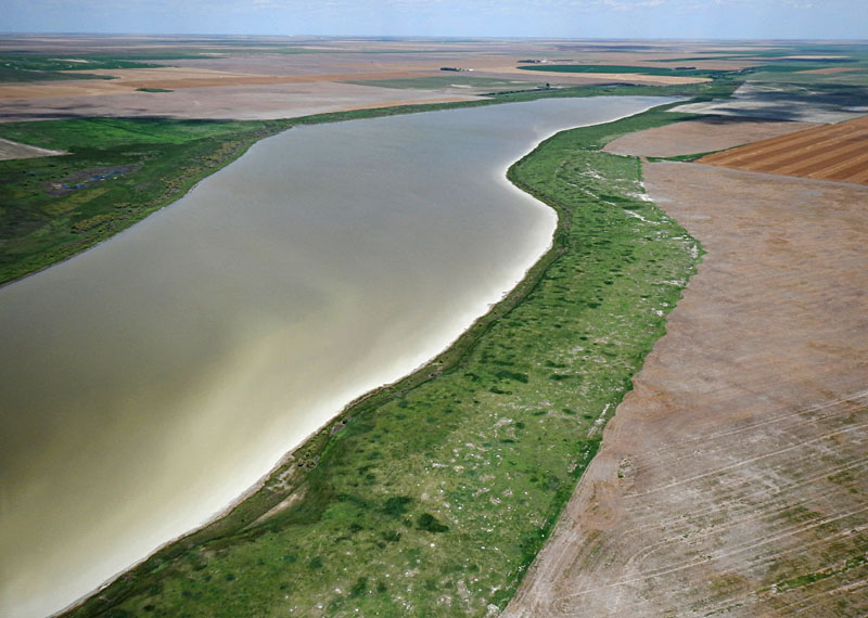
| Views toward the north (left) and northwest (right). The milky water color reflects suspended sediment stirred up from the shallow lake floor by wind-driven waves. | 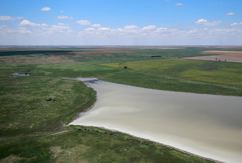 |
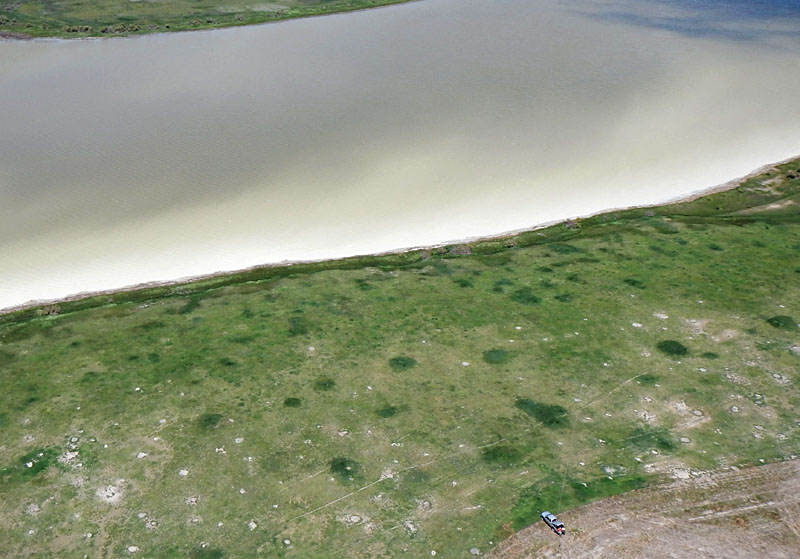
| Left: authors conducting KAP next to the prairie-dog town on the southern side of the lake. Right: Swainson's hawk (Buteo swainsoni), which flew all the way from Argentina to breed here. It was cruising for prey over the prairie-dog town and along the lake shore. | 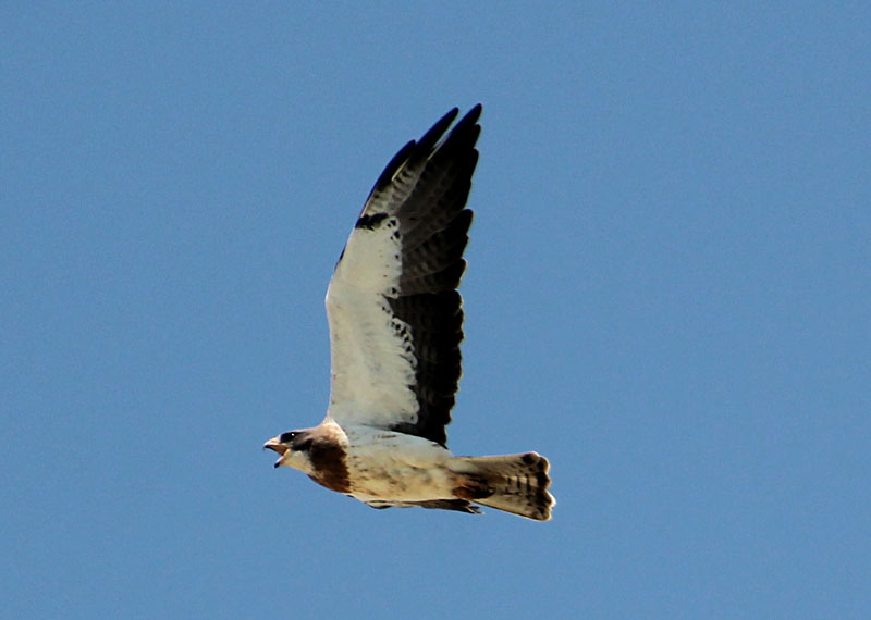 |

| Left: small playa depression on the upland south of Dry Lake. Our normal access road was under water, and we had to deviate around the playa. Right: wheat harvest was fully underway during our visit. | 
|
![]()
Thanks to local landowners for permission to conduct aerial photography.

 |
![]() Return to KAP home or gallery.
Return to KAP home or gallery.
All text and imagery © by the authors.
Last update July 2015.