|
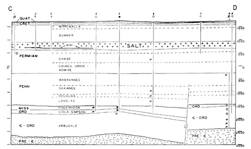
| Figure 2. Stratigraphic cross-section of rock layers near Lyons, Kansas. Distance is feet above or below mean sea level, which is shown as zero. This image was scanned and taken from Walters, 1978, p. 6. See the Kansas Geologic Survey website www.kgs.ku.edu/Hydro/Hutch/GeneralGeology/index.html. |