| National Historical Site North Dakota |
| Introduction | Landsat images |
| Knife River | Kite aerial photos |
|
| National Historical Site North Dakota |
| Introduction | Landsat images |
| Knife River | Kite aerial photos |
The Corps of Discovery arrived in this vicinity in October 1804, built a small wooden fort in November, and remained until April 1805. The Corps benefitted greatly from good relations with the Hidatsa and Mandan Indians. Lewis and Clark exchanged trade goods, including metal battle axes turned out by John Shields, for food and knowledge. The early 19th century was cold; it was the Little Ice Age, and the winter in North Dakota was exceptionally chilly by modern standards (Ambrose 1996). According to Clark's journal (Bergon 1989):
In spite of extremely cold temperature, the Corps spent a largely peaceful and rewarding interval in this locale. They accompanied Indians on buffalo hunts, made and repaired equipment, pursued Indian-U.S. diplomacy, and remained active throughout the winter. They would experience quite different conditions during the winter at Fort Clatsop on the Pacific coast the next year.

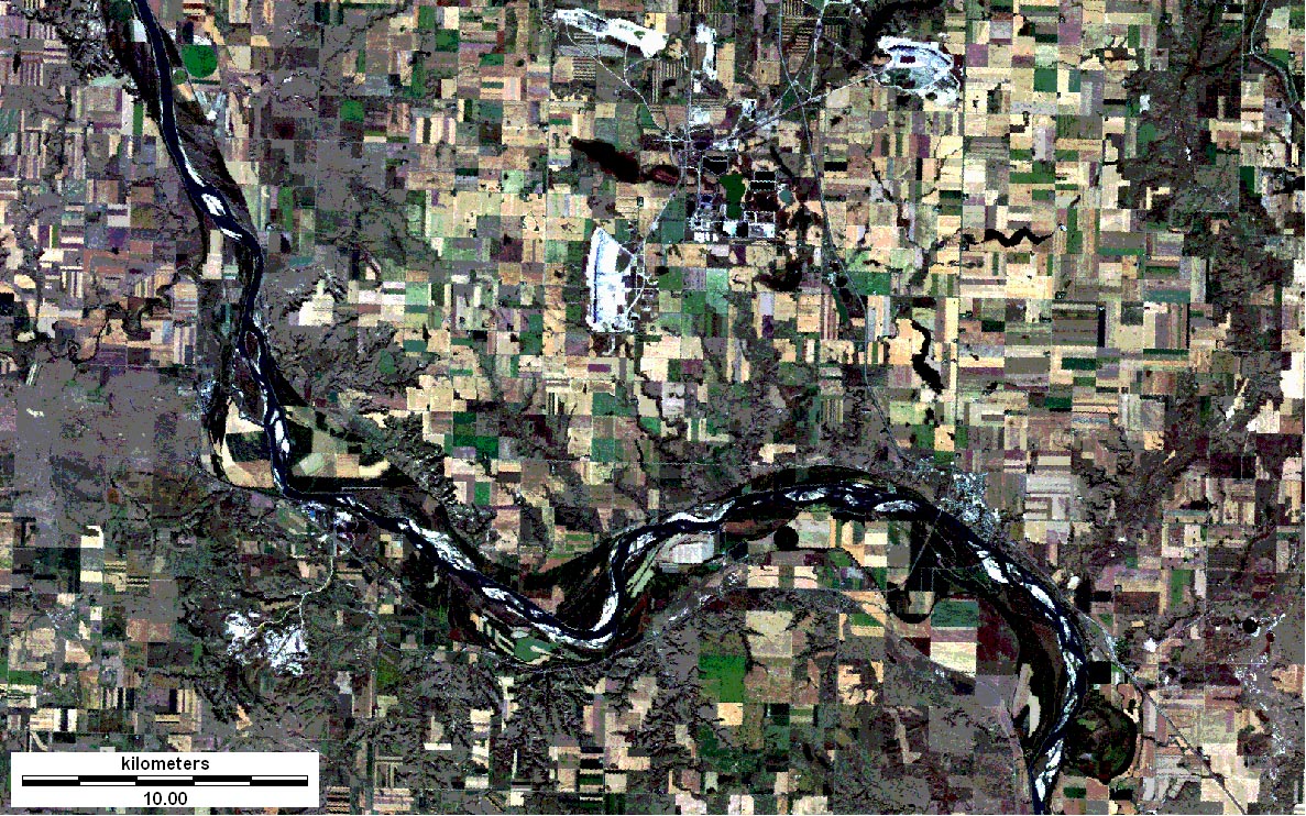
| Landsat TM 257 special false-color composite. This image includes visible and mid-infrared bands in a combination that creates a naturalistic view of the landscape. Active vegetation appears in green and yellow-green colors. Bare and fallow ground is tan to white, and water bodies are black. 1 - Lewis and Clark National Historic Trail--reconstructed Fort Mandan replica, 2 - Fort Clark State Historical Site, 3 - approximate location of original Fort Mandan (based on Ronda 1984, p. 68), 4 - Knife River Indian Villages NHS. |
| Landsat TM 123 natural-color composite. This composite consists of blue, green, and red bands depicted in a fashion similar to normal vision. Active vegetation is green and olive colors. Fallow fields, bare ground and coal mines are light tan to white. Water bodies are black. This image has high contrast and is relatively dark compared to the previous example. |
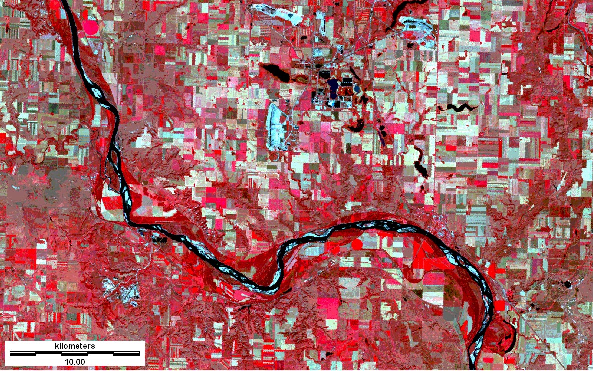
| Landsat TM 234 standard false-color composite. This combination includes visible and near-infrared bands in a manner that resemble color-infrared photographs. Active vegetation appears in bright pink and red colors. Such images have long been used for camouflage detection, as only natural vegetation shows red and pink. |
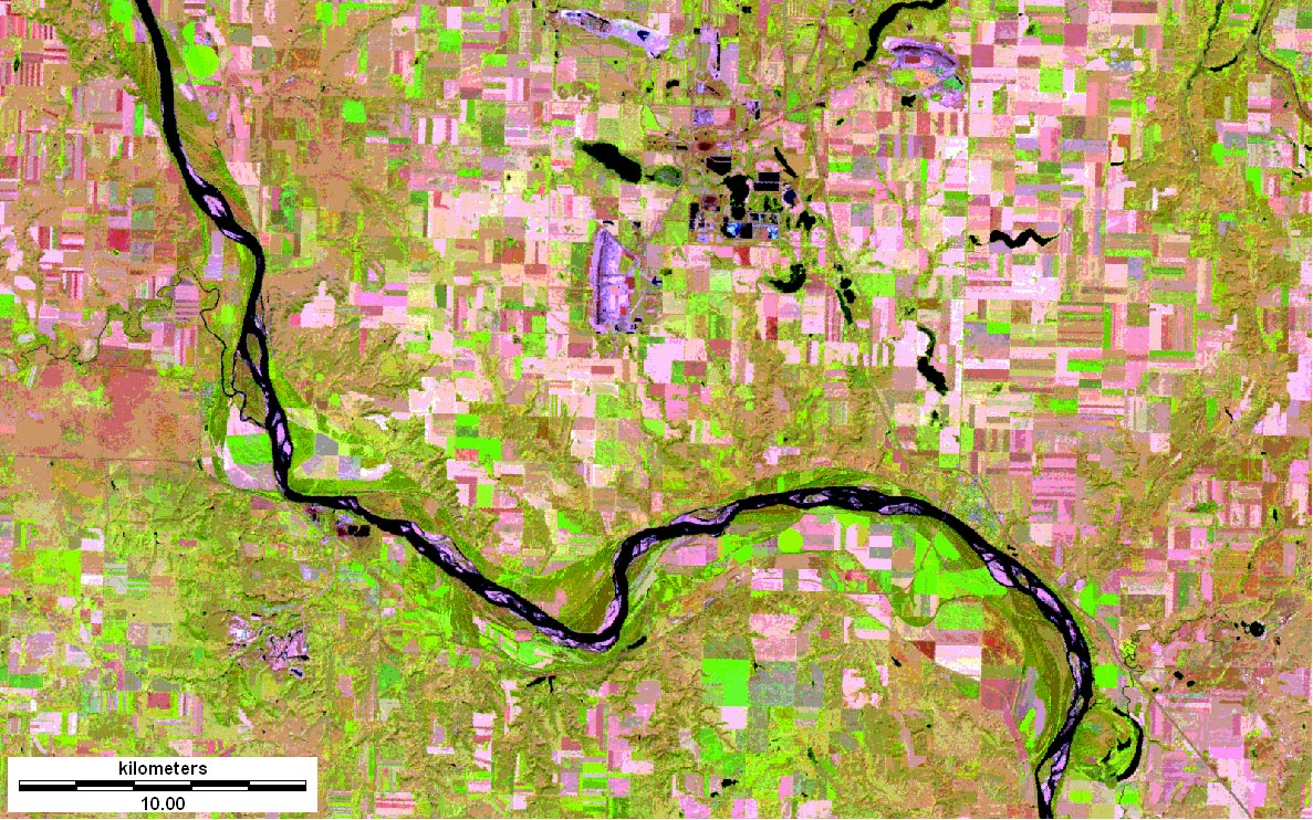
| Landsat TM 345 special false-color composite. This image incorporates one band each of visible, near-infrared and mid-infrared radiation. Active vegetation is green and yellow green, bare ground and fallow fields are pink and red, water bodies are black. The Falkirk Coal Mine appears as three purple patches in upper center of scene; another smaller coal mine is located in the southwesten corner of the scene. |
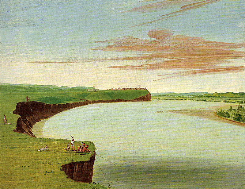
| Distant view of the Mandan village beside the Knife River. The village was situated on a terrace that stood above flood level. George Catlin, 1832, oil. |
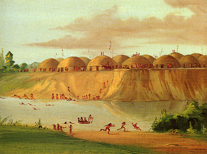
| Hidatsa village on the Knife River. Earth lodges were the summer dwellings for Hidatsa and Mandan peoples. Bull-boats made of buffalo hide were used to cross the river. George Catlin, 1832, oil. |
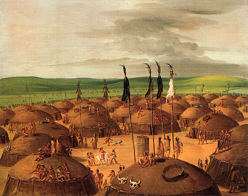
| Bird's-eye view of the Mandan village. Notice the arrangement of earth lodges around the village center, which is marked by a barrel-shaped object known as the "Big Canoe." George Catlin, 1837-39, oil. |
Local Indians served as middlemen in a far-flung trading regime that included copper from the Great Lakes, Catlinite (pipestone) from Minnesota, obsidian from Yellowstone, and Dentalium shells from the Pacific coast. With the arrival of European traders in the 18th century, new items entered the trading network: furs, guns, and metal.
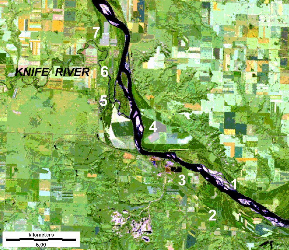
| Closeup view of Knife River Indian Villages vicinity. Notice the broad valley at the junction of the Knife and Missouri rivers. Both rivers have flooded repeatedly and meandered back and forth across the valley, leading to great changes within the valley system during the past two centuries. Today much of the upland area is utilized for agriculture (rectangular fields). Landsat TM 257 special false-color composite, 15 Sept. 2000. 1 - approximate location of original Fort Mandan, 2 - Fort Clark State Historical Site, 3 - Mandan village (Matootonha, Sheheke), 4 - Mandan village (Rooptahee, Black Cat), 5 - Awaxawi Hidatsa village (Mahawha, Tatuckcopinreha), 6 - Awatixa Hidatsa village (Metaharta, Black Moccasin), 7 - Big Hidatsa village (Menetarra, Le Borgne). Knife River Indian Villages NHS includes sites 6 and 7. Based largely on Ronda (1984, p. 68). |
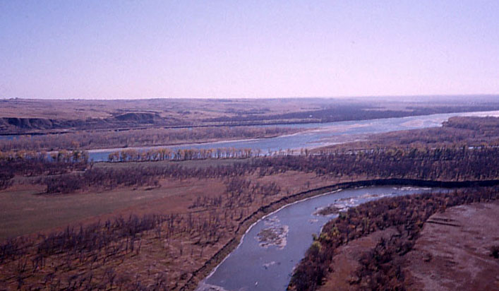
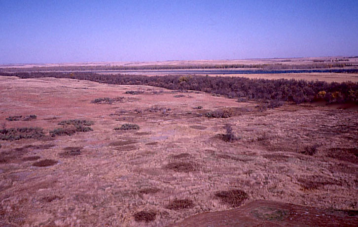
| View toward the southeast with Knife River in the foreground and Missouri River in the background. Knife River Indian Village NHS is in near portion of the scene. |
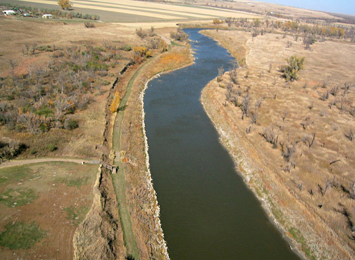
| View northward along the Knife River. Part of the Awatixa Village site on near left side of scene. |
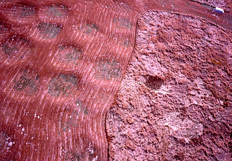
| View southward over the Awatixa Village site. Mowed portions in foreground and background. Circular vegetation patterns indicate many dozens of earth-lodge remains in the unmowed middle portion. |
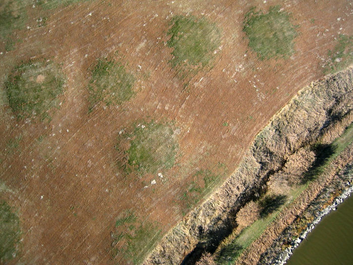
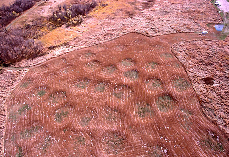
| Vertical shot of earth lodge remains at Awatixa Village. Green circles, about 30 feet across, mark floors of former lodges. A distinctive mowing pattern crosses the lodge remains, and small white patches are animal burrows (gophers and squirrels). Erosion by the Knife River (lower right) has removed part of this village site. |
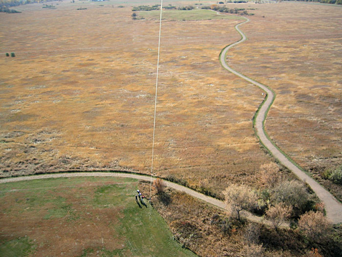
| Superwide-angle view of the Big Hidatsa Village site showing several dozen earth-lodge remains in the mowed portion. Kite flyers are standing in upper right corner of the scene. |
| Oblique view of mowed (left) and unmowed (right) portions of the Big Hidatsa Village. The small, light patches in the mowed section are burrows made by gophers and squirrels. Kite flyers are standing in upper right corner of the scene. |
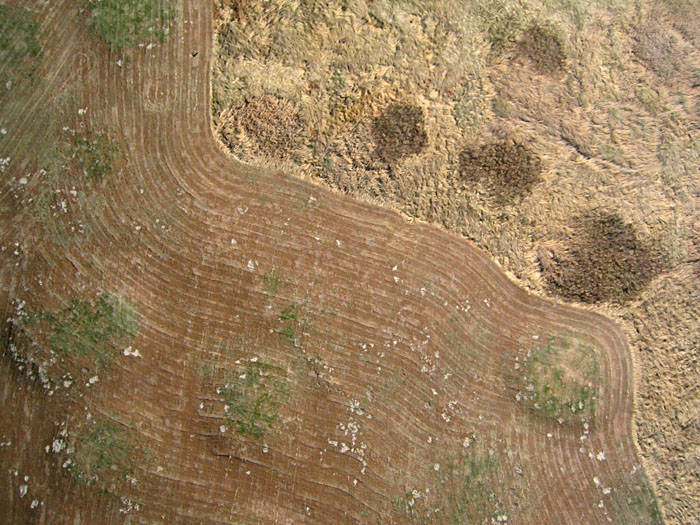
| Closeup, vertical shot of mowed and unmowed portions of the Big Hidatsa Village site. Earth-lodge remnants are depicted clearly in both portions. |
| Northeastward view over unmowed portion of Big Hidatsa Village with Missouri River in the background. Former earth lodges are revealed by vegetation patterns. Brushy growth fills circular depressions in the prairie landscape. |
All text and images © J.S. Aber.
Last update: April 2004.