| Kite Aerial Photography James S. Aber |
|
| Kite Aerial Photography James S. Aber |
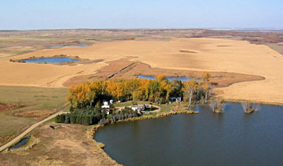
Our primary location was the vicinity of Devils Lake in the northeastern portion of the state. Devils Lake occupies a series of large basins that were scooped out during Ice Age glaciation. To the south are a series of hills built of the material shoved out of the basins. These landscape features are textbook examples of the "hill-hole pair" glacial landform. Similar features are found nearby at Devils Lake Mountain and in central North Dakota at Dogden Butte.
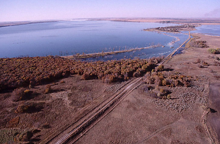
For the past decade, Devils Lake has experienced a dramatic rise in water level within the enclosed drainage basin. A 20-foot increase in lake level has caused considerable economic hardship as farmland, roads, buildings and other valuable development have been submerged. In 1999, Devils Lake reached a level that allows drainage into nearby Stump Lake--see Devils Lake 10-year record. When we took aerial photographs in October, the lake stood at 1446.5 feet elevation, approximately one foot below its peak elevation during May-July '03.
| Devils Lake Mountain seen from the northwestern side. Superwide-angle image taken with a 19-mm lens on 35-mm Kodachrome film. Nearly all of the ice-shoved hill (background) and source basin (lake) are visible. |
| Devils Lake Mountain seen from the northwestern side. Standard, oblique view showing central portion of the hill and source basin. The crest of the hill stands more than 150 feet above the lake in foreground. |
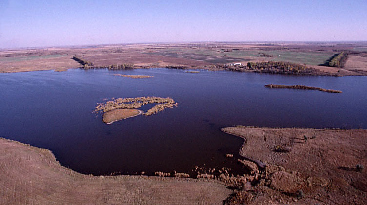
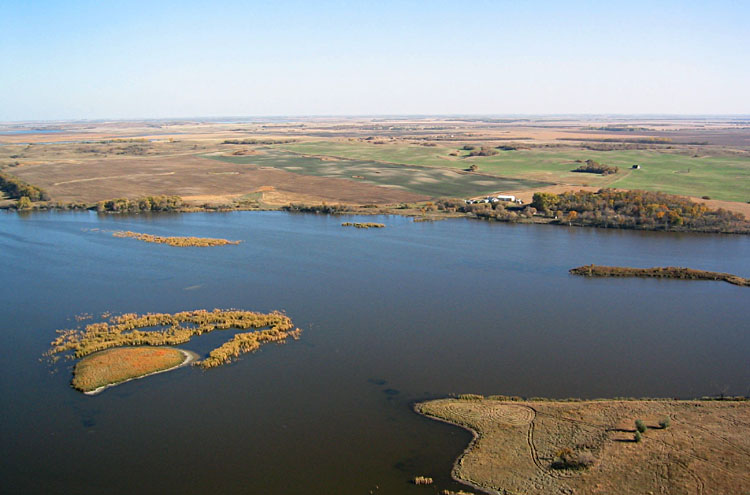
| Superwide-angle view toward the northwest over East Devils Lake. This lake has risen substantially during the past decade with major consequences--flooding of the lake margin and expansion of the lake area. |
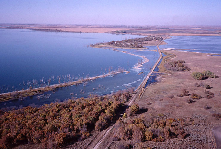
| View toward the north over the eastern margin of East Devils Lake. Note the old shoreline with dead trees now submerged. A rural road remains barely passable, just above water level. |
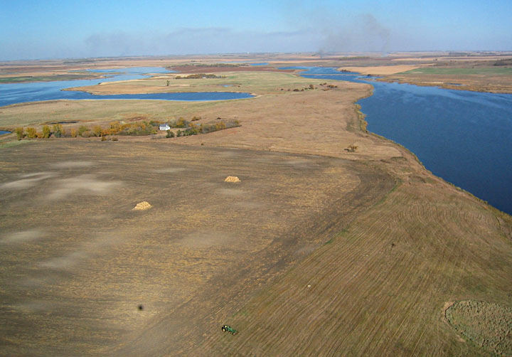
| Agricultural scene with mowed fields, tractor, and hay bales. The dark spot in lower left portion is shadow of the blimp. Smoke from prairie burning fills the sky in the distance. |
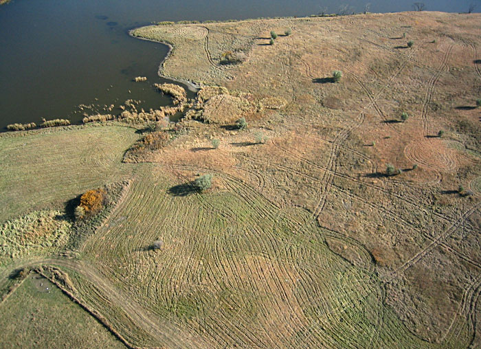
| Closeup view of mowing patterns in hay meadow. |
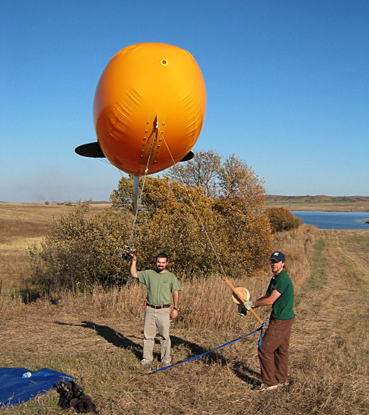
| Ground view of Billy Jacobson (left) and Shawn Salley handling the helium blimp. The blimp, seen front-on in this view, is 13 feet (4 m) long and lifts the same camera rigs used for kite aerial photography. |
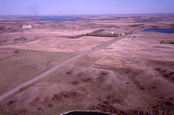
| View toward the northwest of ice-shoved hilly terrain with Devils Lake in the far background. Devils Heart Butte (DHB) is the conical hill in upper left portion of view. |
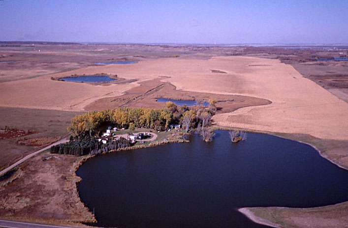
| Northward view with shallow spillway channel marked by small lakes in foreground. Sullys Hill is on the left horizon, and Devils Lake can be seen in the far background. |
| Dogden Butte, a large ice-shoved ridge complex in central North Dakota. View toward the northeast. The hill is marked by prairie grass in contrast to agricultural fields on adjacent lower terrain. The butte reaches an elevation of 2298 feet, more than 200 feet above the surroundings. |