
Today Fort Leavenworth is home to the U.S. Army's Command and General Staff College and the National Simulation Center. Military officers from all service branches receive advanced training in warfare tactics and battle simulation. Military officers are trained from many other countries around the world as well. The U.S. Disciplinary Barracks (prison) is also located at Ft. Leavenworth. The military reservation includes substantial forest, both in the Missouri valley bottomland and on upland bedrock ridges. The bottomland was innundated during the great flood of 1993.
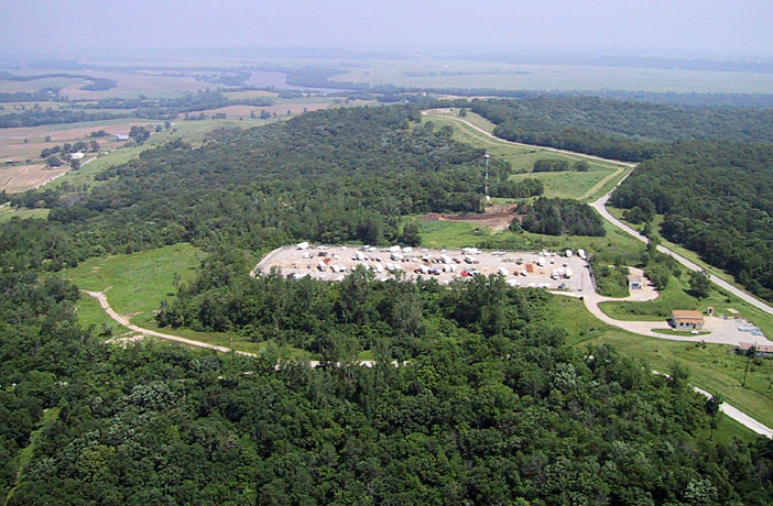
An old missile-launching site is located on the bedrock ridge in this part of the fort. It was a Nike-Hercules anti-aircraft missle battery--the launching area, to be specific, with remains of the three elevators used to bring the missiles to the surface for launch. The building between the berms was the warhead building, where both nuclear and conventional warheads were serviced and assembled. This information provided by Tom Coleman (tompaulcoleman@sbcglobal.net), who served in the U.S. Army as a missile technician.
|
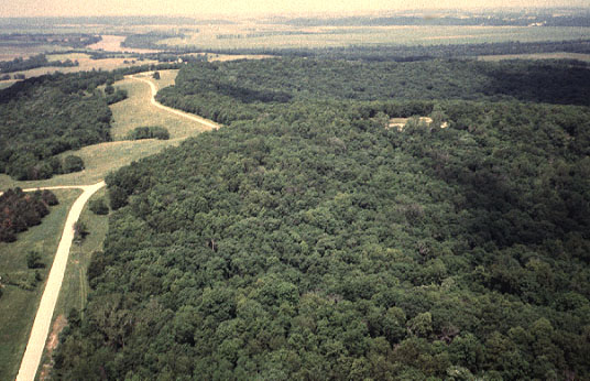
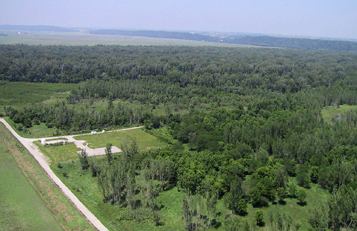
| View northward along bedrock ridge on west side of Ft. Leavenworth. The mixed deciduous forest consists of various oaks, walnut, hickory, and other hardwood trees. This mature forest has a rough canopy. Some cloud shadows can be seen in this late spring view. Photo date 5/98; © J.S. Aber. |
|
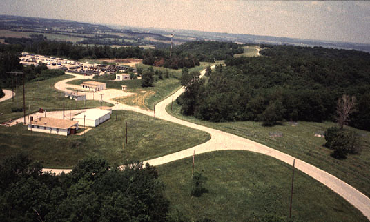
| Another view to the north shows the old missile base to the left (west) of the road at Bell Point. A road to lower left (visible through trees) leads to the Hunt Lodge (see below). Digital image date 6/01, © J.S. Aber. |
|
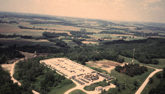
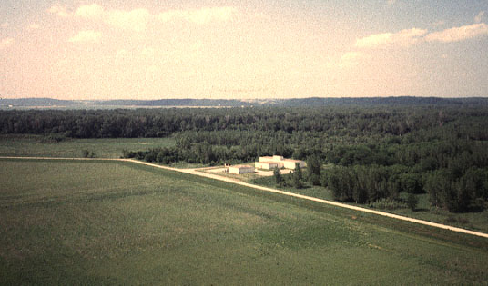
| An old missile range located at Bell Point, west side of Ft. Leavenworth. The missile range has been deactivited, and the complex is utilized now mainly for commumications and storage. Photo date 5/98; © J.S. Aber. |
|
| Storage compound at old missile range. Army trucks are parked at the near end. Private boats and recreational vehicles occupy the remainder of the concrete pad. Photo date 5/98; © J.S. Aber. |
|
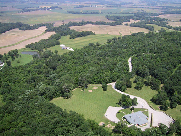
| The Hunt Lodge (lower right) is located on the western forested slope of the bedrock ridge in western Fort Leavenworth. The lodge is used for various meetings, meals, and recreational functions. Private farmland is visible in the background to the northwest. Digital image date 6/01, © J.S. Aber. |
|
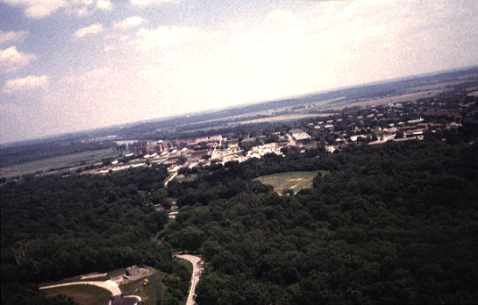
| Overview toward east from forested ridge on west side of Ft. Leavenworth. The main fort complex is visible in middle distance with the Missouri River and bottomland in the background. Photo date 5/98; © J.S. Aber. |
|
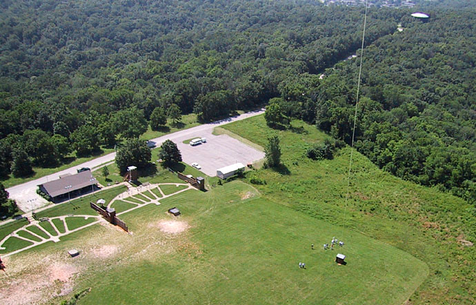
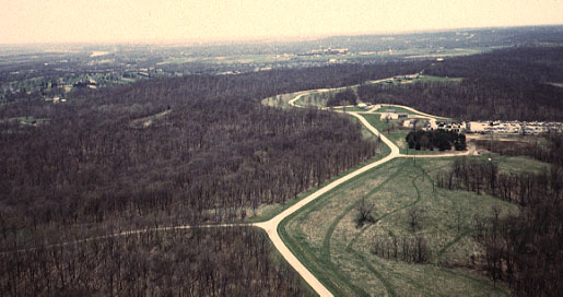
| View south over bedrock ridge on west side of Ft. Leavenworth. KAPers are standing next to the ridge-crest road, "Sheridan Drive," and a skeet-shooting range is visible in the right background. Photo date 5/98; © J.S. Aber. |
|
| Closeup view of the skeet-shooting range. Kite flyers are standing on the mowed range in the right foreground, and a water tank is visible in the right background. The range was not open for shooting this day! Digital image date 6/01, © J.S. Aber. |
|
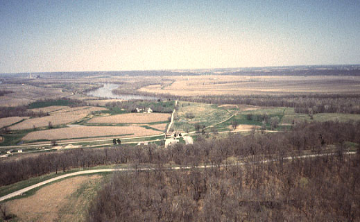
| Early spring view toward north from Hancock Hill, Ft. Leavenworth. Missouri River and valley bottomland are visible in distance. The Missouri valley at this point is only about two miles wide; it is restricted by resistant limestone bedrock in the bluffs. Photo date 4/98; © J.S. Aber. |
|
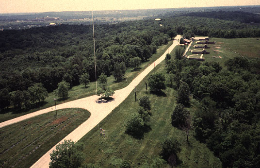
| High-oblique view toward south from Hancock Hill, Ft. Leavenworth. Road runs along the crest of the bedrock ridge with forest on either side. An old missile range is visible to the right. Trees are leafless, but grass is green in this early April view. Photo date 4/98; © J.S. Aber. |
|
| Vertical view over forest near Hancock Hill, Ft. Leavenworth. Leafless trees and their shadows create a distinctive scene in the early April photograph. The forest displays very little green understory. Photo date 4/98; © J.S. Aber. |
| Missouri valley bottomland in vicinity of Sherman Army Airfield, Ft. Leavenworth. The road, which follows a levee, is named "Chief Joseph Loop" after the Nez Percé Indian chief. The forest in the background consists mainly of young cottonwood, willow, pecan, and other softwood trees. Photo date 5/98; © J.S. Aber. |
| View over the bottomland forest of fast-growing softwood trees. Notice the building visible in the image above is no longer present in this scene. Digital image date 6/01, © J.S. Aber. |
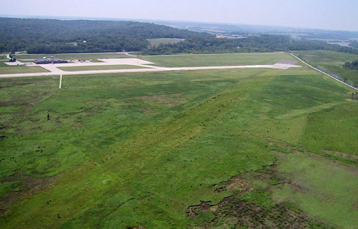
| View toward the Sherman Army Airfield in background. A diagonal strip runs across the scene from lower left to upper right. This is an old, now-abandonned, cinder airstrip. Vegetation has covered the old airstrip, but it is still quite visible. Digital image date 6/01, © J.S. Aber. |
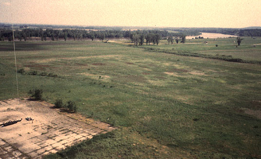
| Bottomland view toward south, Sherman Army Airfield, Ft. Leavenworth. KAPers are located on the concrete pad to left. This pad is at the end of an old cinder-covered runway, and the Missouri River can be seen in the right background. This region was completely submerged during the July, 1993 flood. Photo date 5/98; © J.S. Aber. |