| Mississippi and Louisiana J.S. and S.W. Aber and Marco Giardino |
|
| Mississippi and Louisiana J.S. and S.W. Aber and Marco Giardino |
Mulatto Bayou is an archaeological site that was occuppied by native Americans during the interval 1200 B.C. until historical times. Located beside the Pearl River delta, abundant natural resources, namely shellfish, were available close by. Most impressive is an earthwork of considerable proportion. A long earth wall and perimeter moat, presumably built as defensive structures, are well preserved although overgrown with deciduous forest today. The wall and moat were constructed during the period 600 B.C. to A.D. 300. Next door is Port Bienville, an industrial park connected to the Intercoastal Waterway.
Our final KAP site, after leaving NASA Stennis, was a visit to Grand Isle, a barrier island on the coast of Louisiana. Grand Isle is the only barrier island accessible via highway in Louisiana, and it has a long history of agricultural, recreational, and industrial development. First colonized by the Spanish in the 1700s, the island was shifting sand without any tree cover. French Creole settlers took over in the 1800s with agriculture and fishing. Gradually woodland vegetation became established on the dune sands—oaks and oleander. Salty meadows, marshes and lagoons occupy the lower terrain. The island remained relatively inaccessible until offshore oil production began in the late 1940s. Electricity and telephones arrived in the 1960s along with a recreational boom. Major hurricanes impacted the island in 1893 and 1965, and again in 2005 (after our visit).
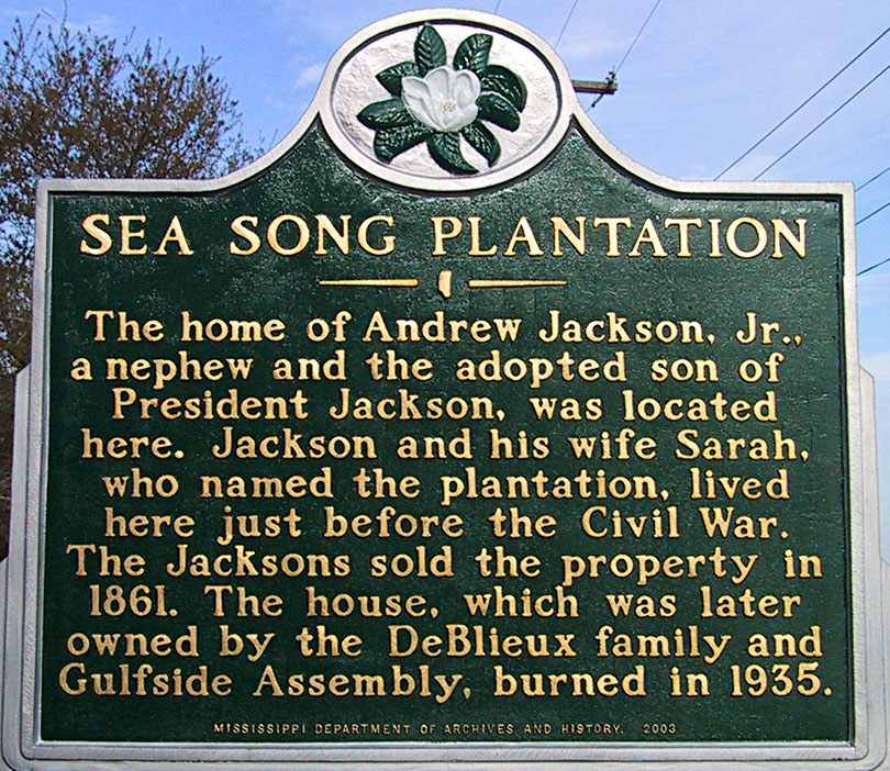
| Sea Song Plantation, MS | |
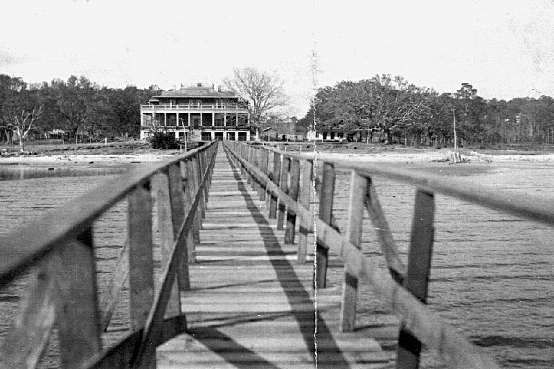
| Ground photos ca. 1904 of the Sea Song Plantation when it was owned by the DeBlieux family. | 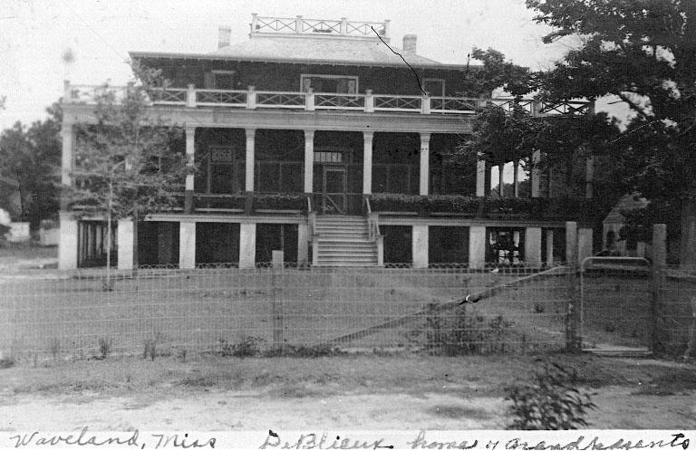 |
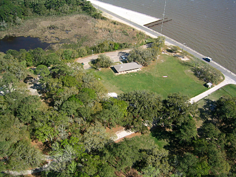
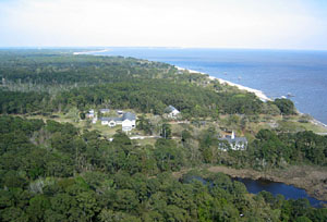
| Overview of Sea Song Plantation historical site. The grassy quadrangle is presumably where the main house and outbuildings were located. |
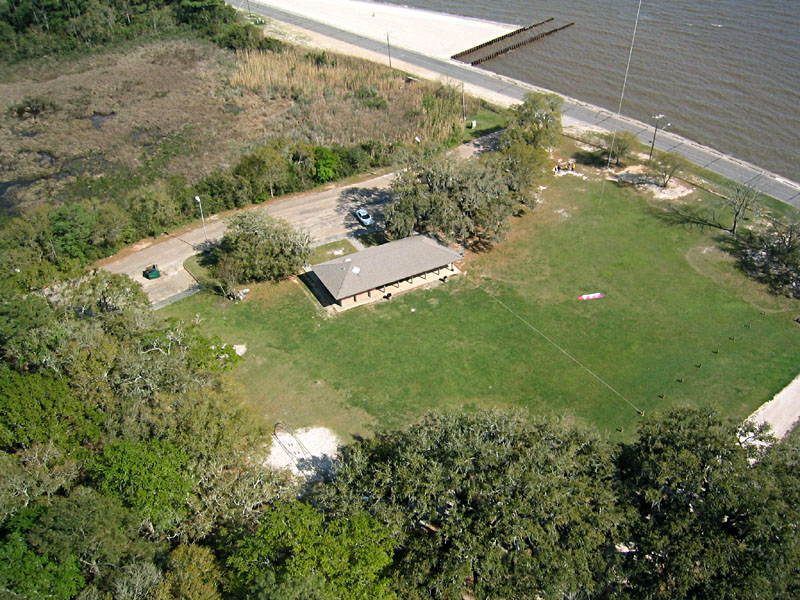
| Closeup oblique view of building site. Note color patterns in grass cover that may correspond to former building locations. Beware of fire ants here! |
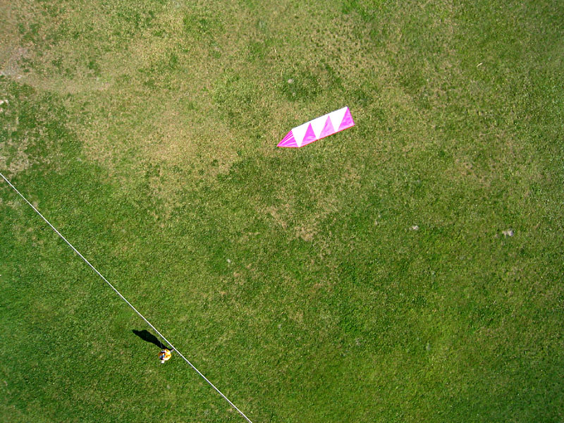
| Vertical view reveals a square pattern (around arrow) of unknown significance; it may represent some type of former building structure. North arrow is 4 meters (13 feet) long. |
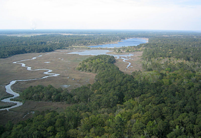
| Overview toward north showing inland forest and tidal estuary adjacent to Sea Song Plantation. The estuary is dammed to form a reservoir in the background. |
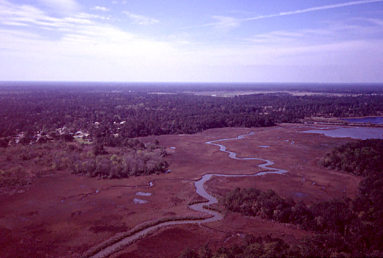
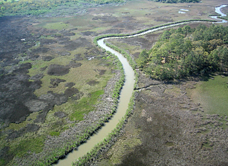
| Meandering stream/tidal channel in wetland adjacent to Sea Song Plantation. Part of Buccaneer State Park can be seen in left background. |
| Closeup view of wetland tidal marsh adjacent to Sea Song Plantation. At this time of year, forest trees (on drier ground) have begun to green up, but wetland marsh is still largely dormant. |
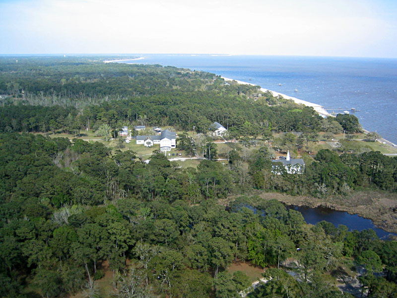
| View eastward along the Gulf coast from Sea Song Plantation. At scene center is the Gulfside Assembly, and Bay St. Louis is in the far background. |
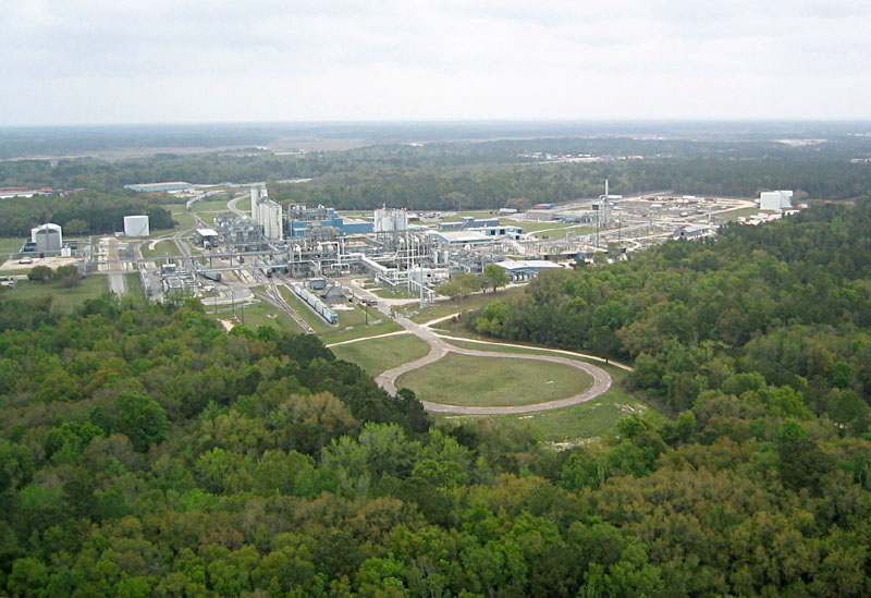
| Overview of Port Bienville industrial park, Mulatto Bayou, Mississippi. |
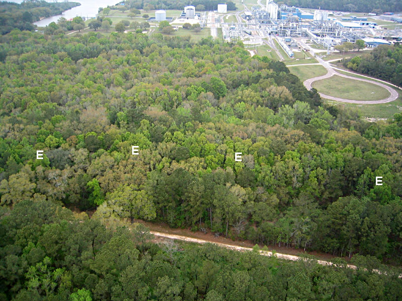
| Portion of the prehistoric earthwork next to Port Bienville industrial park. The earthen wall is hidden, but it supports trees that green up early in the spring. They appear as the brighter green stripe (E) across the scene. The earthwork continues to the right in next view. |
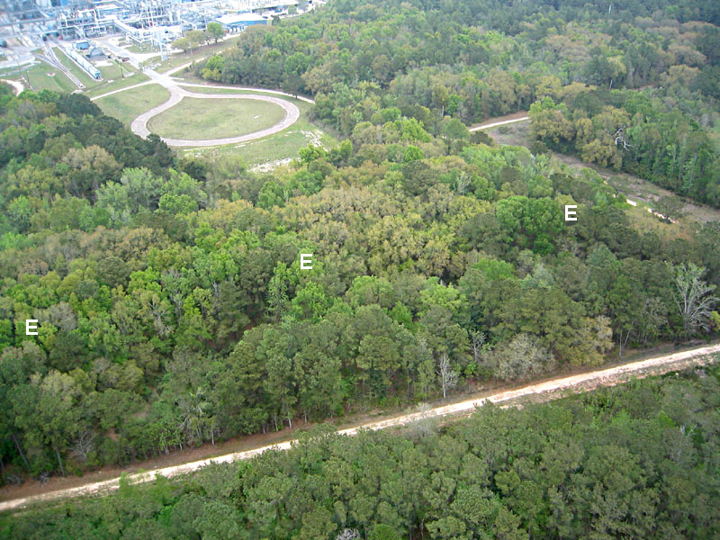
| Portion of the prehistoric earthwork next to Port Bienville industrial park. The earthen wall is hidden, but it supports trees that green up early in the spring. They appear as the brighter green stripe (E) across the scene. The earthwork extends to the left in previous view. |
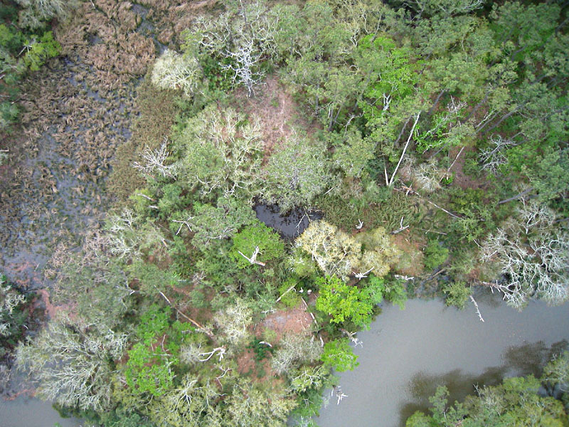
| Vertical view of coastal swamp at Mulatto Bayou archaeologic site. Trees have just begun to green up in this early spring view. Notice relief displacement of trees (side views) toward edges of scene. |
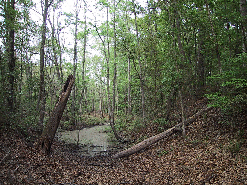
| Ground views of earthwork moat (left) and wall (right) under heavy forest canopy at Mulatto Bayou. | 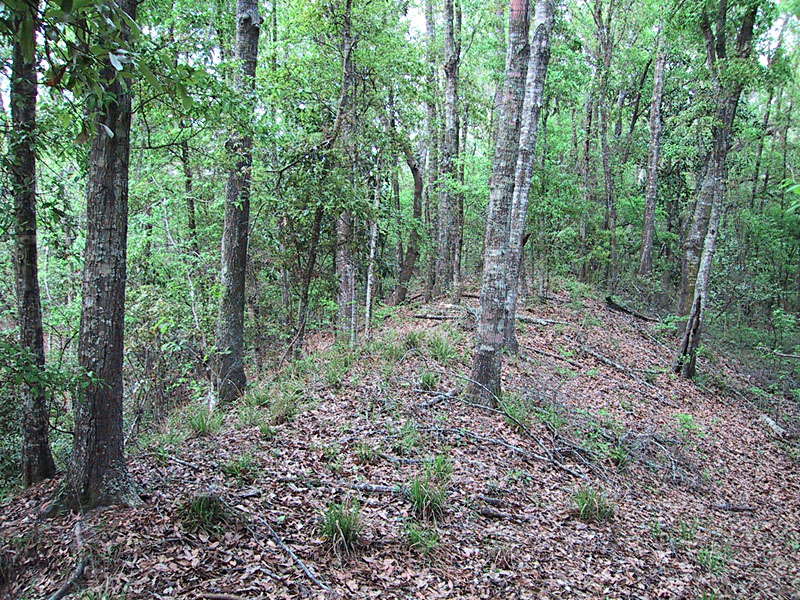 |
| View westward from Grand Isle State Park along the length of the barrier island. The Gulf of Mexico is visible in the left background, and Caminada Bay appears in the right background. Part of a gated recreational community appears in right foreground, behind which is an oil terminal. |
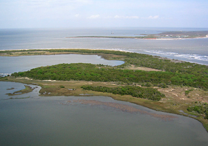
| View eastward over Grand Isle State Park toward the end of the island. The foreground is a salt-water lagoon. An inlet separates Grand Isle from the next barrier island visible in distance. |
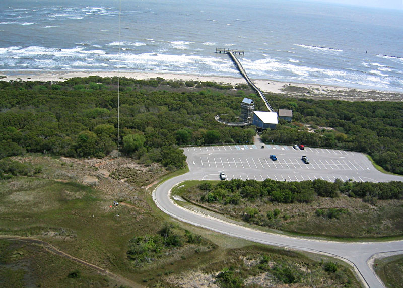
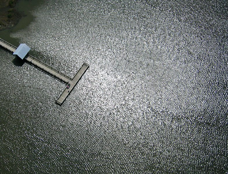
| Visitors center at Grand Isle State Park with an observation tower and boardwalk across the beach to a fishing pier. Kite flyers are standing on left side of view at the edge of a salt meadow. Oak and oleander woods cover the dune ridge between the beach and meadow. |
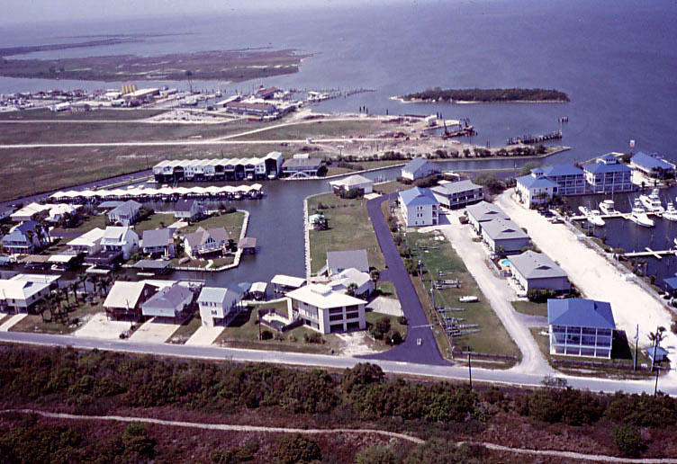
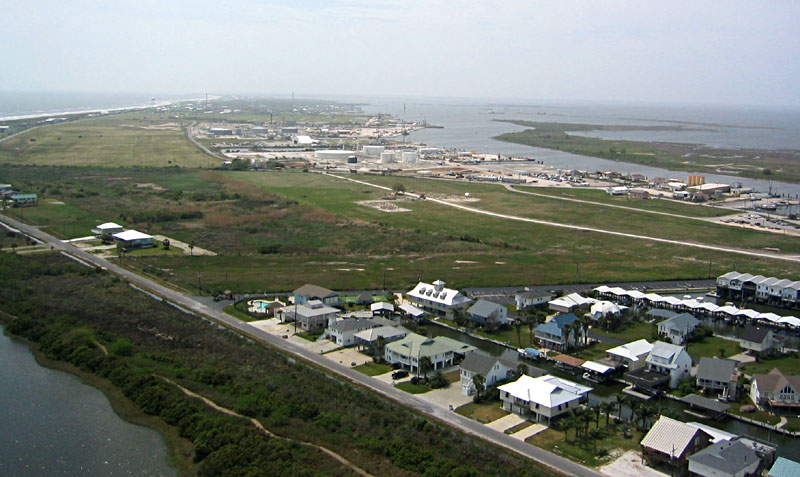
| View over gated recreational community next to Grand Isle State Park. Canals provide water access for each property to Caminada Bay in the background. A portion of an oil terminal also can be seen in the left background. |
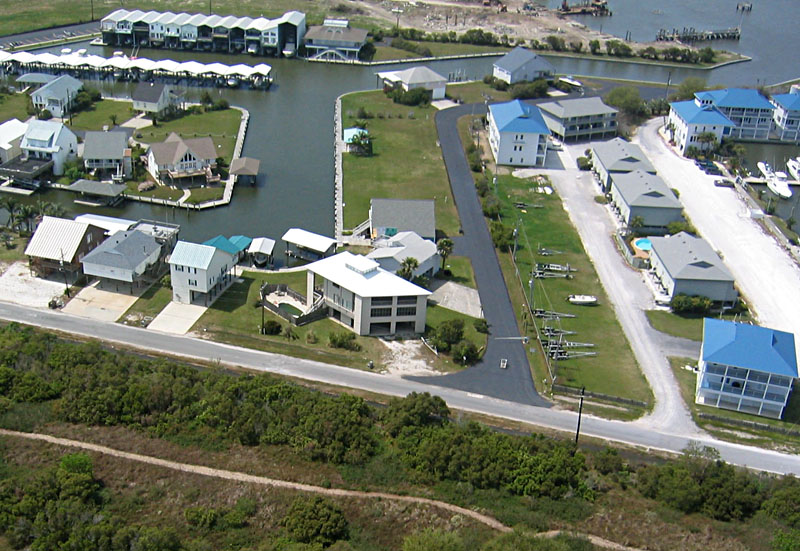
| Closeup view of gated recreational complex next to Grand Isle State Park. Notice the tall boathouses and palm trees. Most structures are built on stilts to minimize wave damage during storms. |
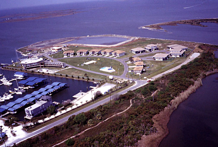
| View toward northeast over U.S. Coast Guard station adjacent to gated recreational boat harbor at the eastern end of Grand Isle. |
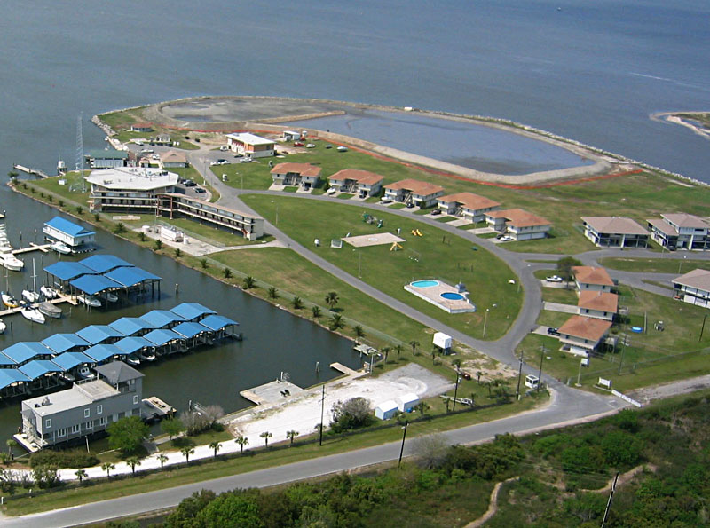
| Closeup view of U.S. Coast Guard station. Notice distinctive curved layout of station housing. |
| Sun glint from surface of saltwater lagoon. Waves on water produce an interesting pattern of intersecting ripples. |

|
|