| Relocation Center
Granada, Colorado J.S. and S.W. Aber |
| Introduction | KAP 2007 |
| KAP 2018 | References |
|
| Relocation Center
Granada, Colorado J.S. and S.W. Aber |
| Introduction | KAP 2007 |
| KAP 2018 | References |
Amache was the smallest of ten such centers built across the western United States run by the War Relocation Authority (McCoy 2018). Amache was in operation from August 1942 until October 1945. It reached a capacity of more than 7500 evacuees in October 1942 (Amache.org Timeline 2017), two-thirds of whom were American citizens. At this time, it was the tenth largest city in Colorado. In all, more than 10,000 Japanese-Americans were incarcerated there, as people came and went. Today Amache is a ghost town.
When the relocation center was first established, there was confusion between the center and the nearby town of Granada, so the name Amache was chosen for the relocation center post office. Amache was the daughter of Onichee (Lone Bear), a Cheyenne chief (M. Tonai, pers. comm.). She married John C. Prowers, the Indian Agent for the Upper Arkansas Agency and for whom the county is named, Prowers County (McCoy 2018). Her father was killed subsequently in the Sand Creek Massacre, which took place about 40 miles to the north in 1864.
Amache is located on chalky uplands next to the Arkansas River valley close to the city of Granada. This is semi-arid High Plains country, which must have looked bleak to those who were forced to move here from the west coast. Most of the buildings were wood-frame structures erected on concrete foundations. The living quarters were arranged in blocks that contained 12 barracks, constructed with minimal walls and roofs, heated with coal-burning stoves, and floored with concrete or bricks set in dirt (Amache NPS 2004). The barracks had no furnitureóconditions were primitive.
The center farms produced abundant food each year, and surplus food was sent to other relocation centers. Nearly 10,000 acres were farmed of which almost 6000 were irrigated in the Arkansas valley. In 1943, the value of agricultural produce was $190,000 (interpretative sign at site). But the residents still had to eat army-style meals in large mess halls. Cooking supposedly was prohibited in the barracks, but archaeologic remains suggest that cooking did take place (McCoy 2018). In spite of such restrictions, the residents were able to create highly productive vegetable gardens and beautiful flower displays, and they planted many trees.
The center was a small city with a hospital, post office, elementary and high schools, and stores. But, the center was surrounded with a barbed-wire fence, and guard towers were equiped with machine gunsóthe Japanese-Americans were virtual prisoners. Nonetheless, many young men volunteered to serve in the U.S. Army during the war, and they gained a reputation for their heroic efforts. Others were allowed to leave during the war for higher education, jobs, or to resettle in the U.S. interior or east, but the west coast was off limits until the end of the war.
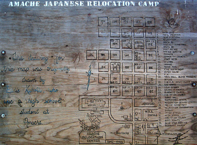
| Left: sketch map of Amache Relocation Center at the main entrance to the protected site. Locations given in photos below are keyed to this diagram, which is also reproduced in McCoy (2018). Note map shows south toward top. Right: prickly pear cactus in full bloom at Amache for Memorial Day 2007. | 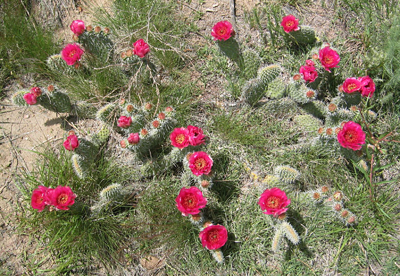
|
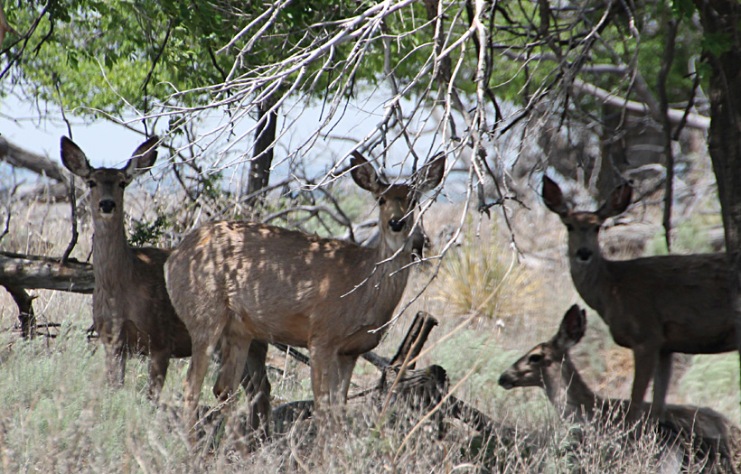
May 2018 differed in several ways from our previous visit. 2018 was a drought year, which showed in the vegetation and dusty conditions. Cattle no longer graze the area, so brush had grown up, which provides good habitat for a herd of mule deer and other wildlife. The reconstructed buildings are all located in the southeastern corner of the site, so that's where we set up for KAP.
The National Park Service announced early in 2024 that Amache National Historic Site has been added to the national park system. President Biden had already signed the necessary legislation to include Amache in the national parks, and citizens of nearby Granada acquired and donated the land to set up the historic site. Go to Amache NPS.
KAP visit in 2007
For several years we had driven by Amache on U.S. highway 50, on trips between Colorado and Kansas, and we have thought many times about conducting kite aerial photography (KAP). Finally we had good weather conditions for Memorial Day weekend 2007. On a brisk southeasterly breeze we flew our large rokkaku and took pictures with the Canon S70 camera rig. Elevation is approximately 3600-3650 feet, almost the lowest point in Colorado. Following an exceptionally snowy winter and wet spring, wildflowers were blooming in profusion, which made working at this site particularly enjoyable. Still we had to watch our step to avoid yucca and cactus spines.
![]() KAP oblique views
KAP oblique views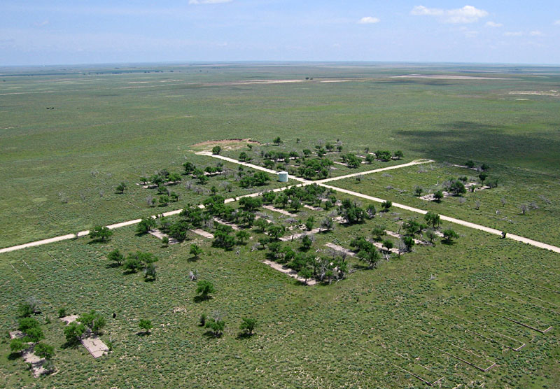
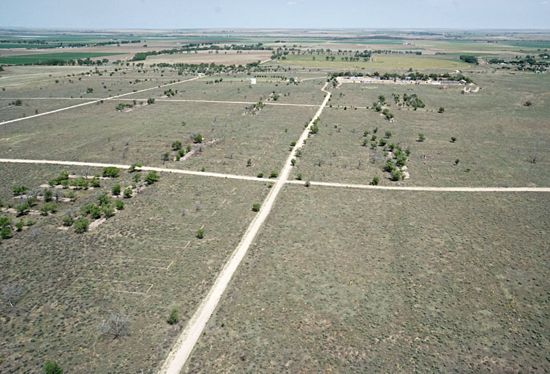
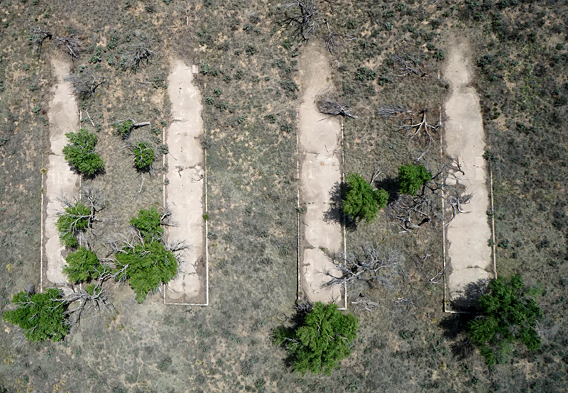
Left: overview from the middle of Amache (near the high school) looking toward the southeast. Trees have grown up around numerous building foundations. Right: view eastward on the south side showing the southeastern portion of the center. Blocks 11G (left) and 12G (right) are in the foreground.
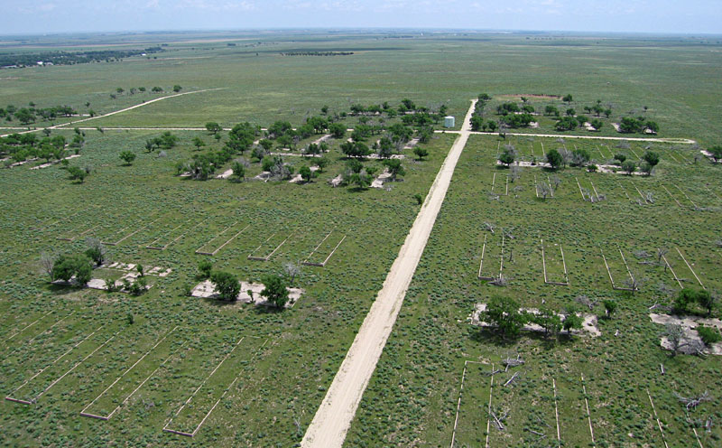
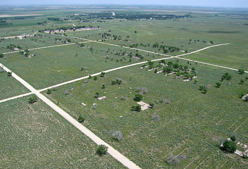
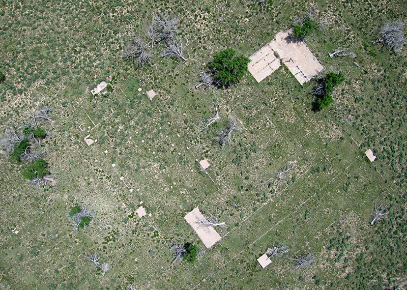
Left: overview toward the northeast. Ruins of the high school are in the center foreground, and the city of Granada can be seen in the distant background. Right: closer view toward the northeast. The buildings in left background were part of the hospital complex according to the sketch map (above).
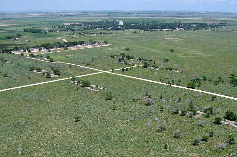
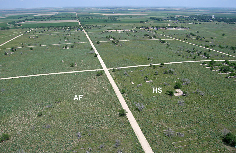
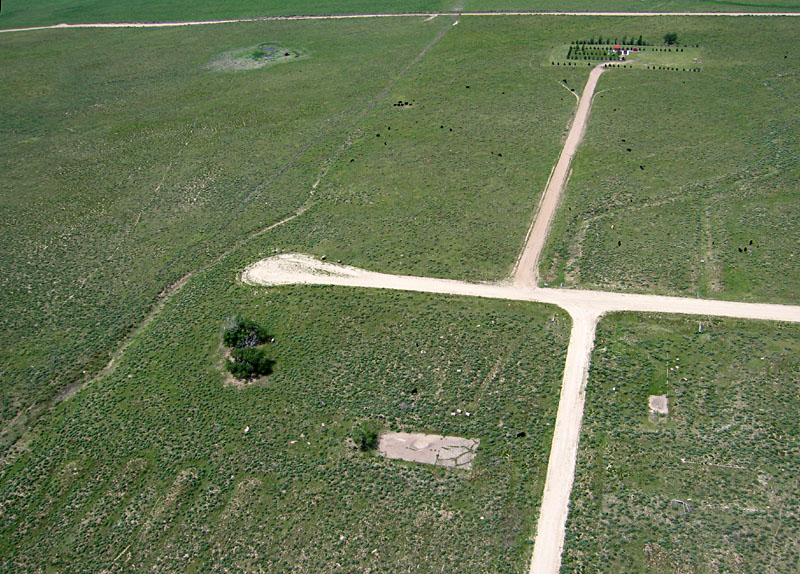
Left: northward overview. The high school (HS) and athletic field (AF) can be seen in the foreground, and crop fields occupy the Arkansas River valley in the far background. The co-op stores were located directly north (behind) the athletic field. Right: close-up view of the co-op stores site in the foreground.
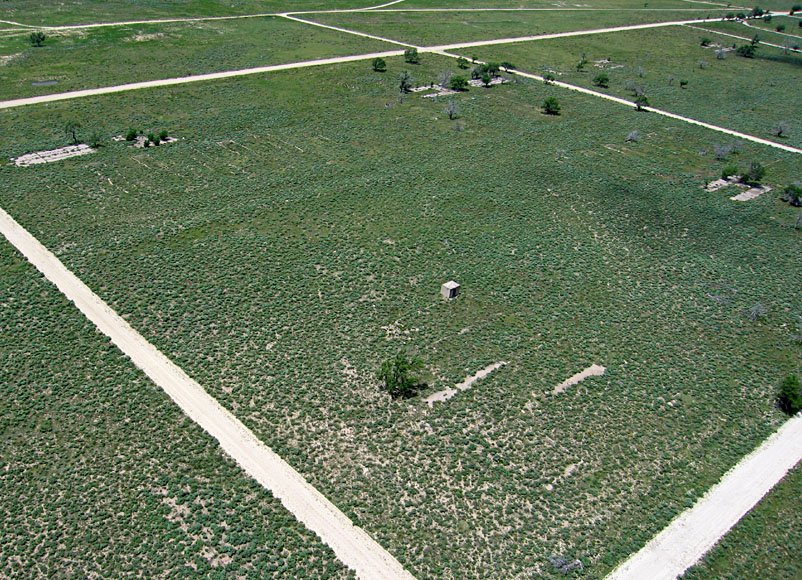
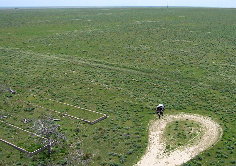
Left: view westward along the southern margin of the center. Block 12E in left foreground, and the cemetery in right background. Cattle are grazing in the pasture in front of the cemetery. Right: authors conducting KAP from the southern margin of the center area, next to block 12G (left), which contained the Buddhist Church.
![]() KAP vertical views
KAP vertical views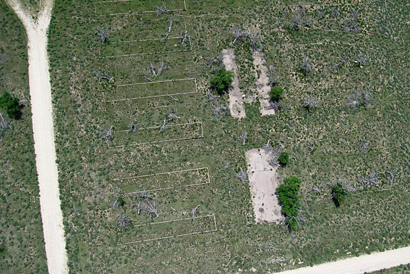
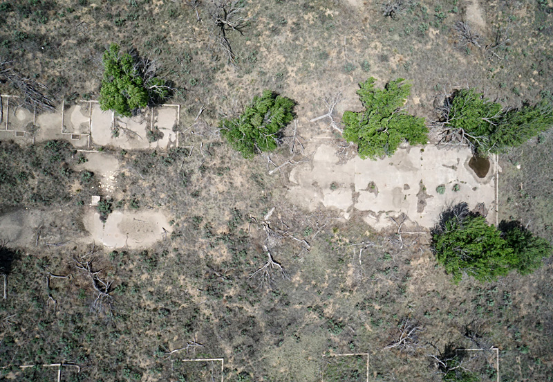
Each block followed a standard layout with 12 rectangular barracks, six on the east side and six on the west side. In the center was a large mess hall plus an H-shaped building for laundry, bath, and latrines (Amache NPS 2004). Detail showing foundations remaining in block 12F (left) and in block 12G (right).
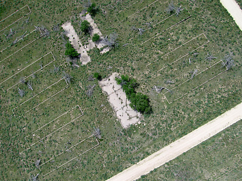
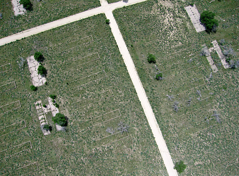
Left: detail showing foundations remaining in blocks 11G (left) and 11E (right). Right: foundations of Amache High School. Construction of the high school-auditorium complex cost $136,886, the most expensive building project in Prowers County at that time (Amache NPS 2004).
KAP visit in 2018
Amache was designated as a National Historic Landmark in 2006, and much interest and activity have focused on the site since our first KAP visit in 2007. The water tower, a guard tower, and a barracks building have been reconstructed. Archaeologic and preservation projects are underway, and the Amache Preservation Society operates a small museum and research center in Granada nearby. In late May 2018, we again visited Amache and conducted KAP. On a strong southeasterly wind, we launched a small delta kite and utilized the Canon S70 autoKAP rig as well as a new, radio-controlled Sony a6000 camera rig.
![]() KAP oblique and vertical views
KAP oblique and vertical views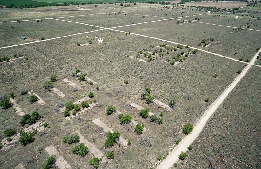
Left: overview looking toward the northwest. Asterisk (*) shows location of the former high school (see above). Right: looking northward. The structures in the right background represent the hospital complex. Block 10H in left foreground, but there were no structures in the right foreground (block 10K).
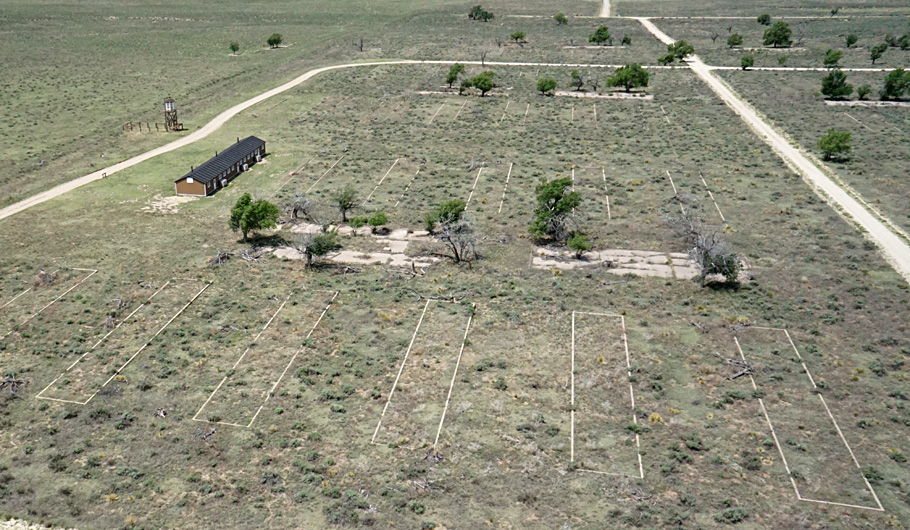
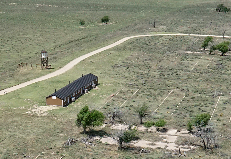
Westward view over block 12G in the foreground (left). Reconstructed barracks and guard tower in upper left. Closer view of the reconstructed barracks and guard tower (right).
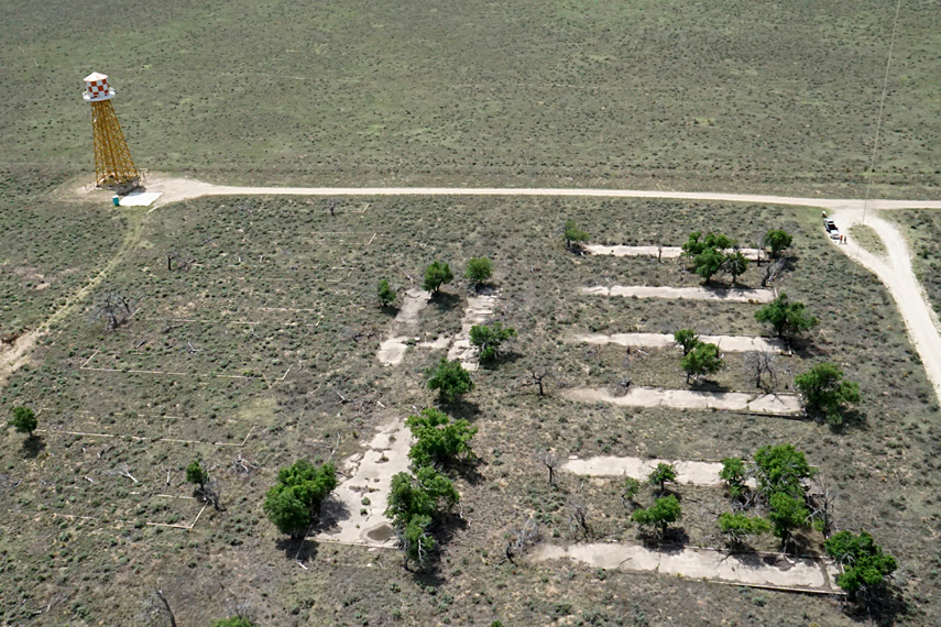
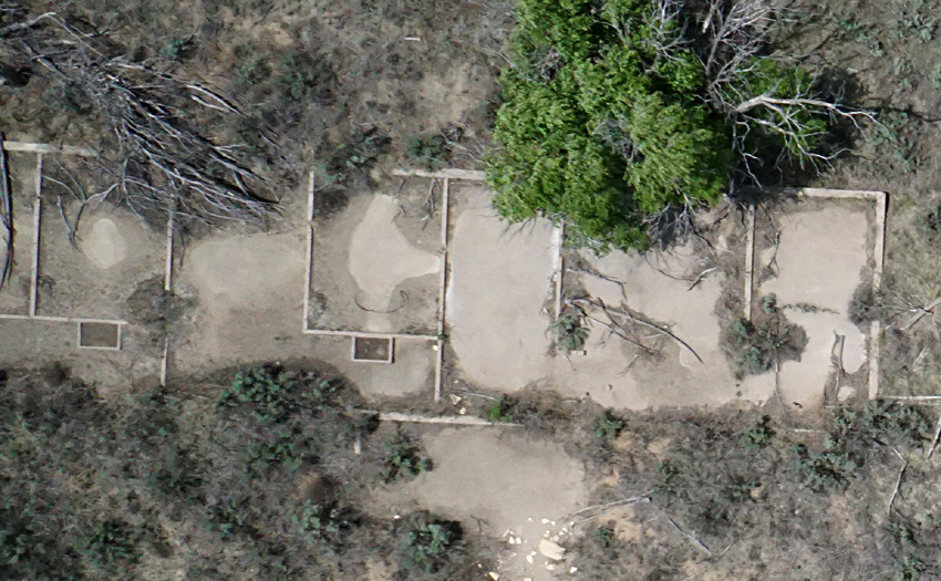
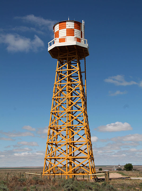
Block 12K and reconstructed water tower (left). Six barracks on right have concrete floors; six on left do not. Vertical view of four barracks foundations with concrete floors in block 12K (right). Each building measured 20x120 feet and was divided into six living quarters of slightly different sizes (Amache NPS 2004).
Left: vertical shot of the mess hall on right and laundry/bath house on left in block 12K. The mess halls measured 40x100 feet (Amache NPS 2004). Right: close-up vertical view showing a portion of the laundry/bath house in block 12K.
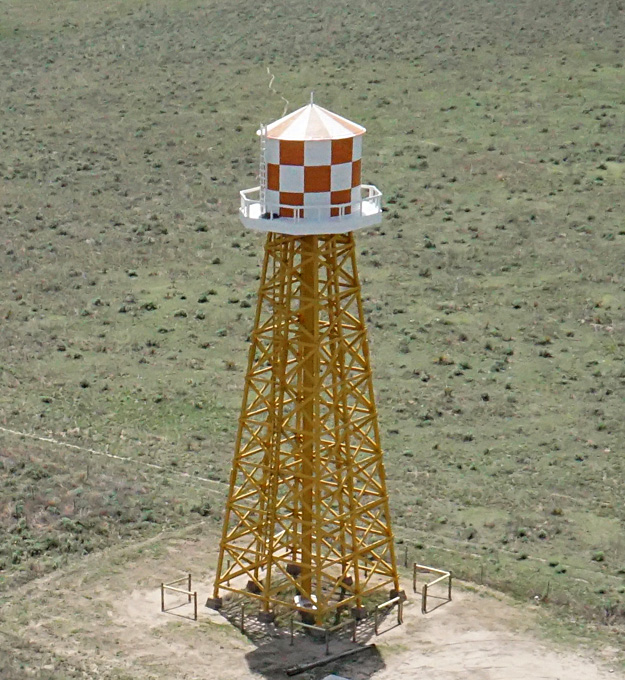
Close-up view of the reconstructed water tower. Water was provided by four 800-foot-deep wells and stored in a 200,000-gallon tank. From there, chlorinated water was pumped into the tower, which held 25,000 gallons. The original tower stood 72 feet tall.
![]() Ground photographs
Ground photographs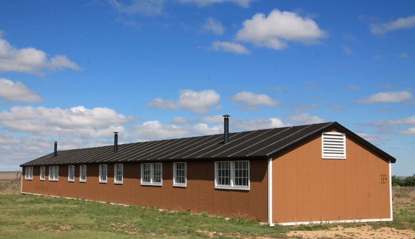
Left: reconstructed barracks building (block 12H, bldg. 7) sits on an original foundation, but construction materials are not the same as original. Right: herd of mule deer (Odocoileus hemionus) rests in the shade.
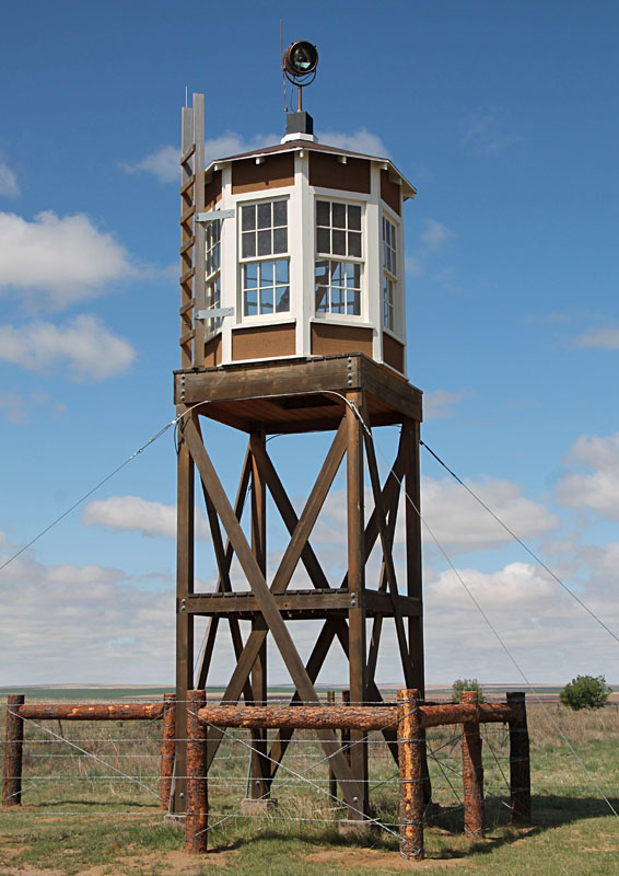
Reconstructed guard tower (left) and water tower (right). The water tower is situated topographically on the highest point of the site (approx. 3660 feet elevation) in order to distribute water by gravity flow throughout the center.
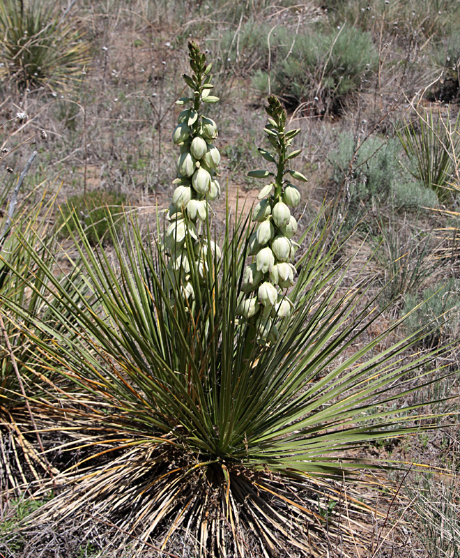
Wild yucca grows everywhere in the site and was in full bloom for our visit. Beware of needle-sharp leaves!
![]()
References
![]() Related sites
Related sites
![]() Return to KAP gallery.
Return to KAP gallery.
Last update: February 2024.