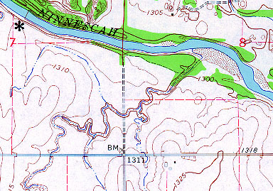
The reservation consists of approximately two ¼ sections--SE¼ sec. 7 and SW¼ sec. 8, T29S, R3W, which are separated by a now-abandoned rural road. The black asterisk marks location of the research station adjacent to the Ninnescah River. Taken from Afton Lake, Kansas, USGS 7½-minute quadrangle. Contour interval = 5 feet; scale 1:24,000.